Multipitch Atlas

Spelling need not be exact.

Gorges Profondes

La Rouvière · Gorges de l'Ardèche · France

Read the cautionsBail with caveats

A short, varied six-pitch route that you reach by abseiling from the rim of the Ardèche gorge and climb back out to the road. Grey walls and crack systems on rough limestone, sustained but never desperate, with superb views over the river. A good first 'abseil-in' multipitch, though the grades feel stiff and the route is vegetated.

On the last pitch of Gorges Profondes, with the Ardèche river belowPhoto: zahl · CC BY-NC-ND 3.0

Photo

Hardest pitch
6a+
Pitches
6
Length
140 m
Approach
5 min
Aspect
W
West-facing
Rope
2×50 m
abseil approach
Rock
limestone
Season
Mar to Jun, Sep to Nov
Bolting confidence
High
Last verified
October 2026 · Compiled from published sources
Read before you go

Well bolted again after the 2009 vandalism, but the abseil approach has a known rope-jam spot and easy-to-confuse lines, and retreat from the base ledge is awkward.

Overview

Gorges Profondes climbs the west-facing wall below the La Rouvière belvedere in the Ardèche gorge, in six pitches and 140 m. You abseil in from chained anchors at the rim to a ledge, then climb back up a fine grey wall, crack systems and a steep, technical 6a+ wall on pitch 5. Climbers describe it as varied, homogeneous and on good, abrasive rock, one of the more accessible multipitch routes in the gorge. The site is little frequented, so aromatic plants grow back in the cracks; parties clean them on the way down. The pitches can be linked into three with a 50 m rope, using only the abseil belays.

Worth knowing

  • Link the pitches into three long pitches with a 50 m rope and 14 to 16 quickdraws, using only the abseil belays.
  • Clean out plants from the cracks as you abseil in: the climb back out is more pleasant.
  • Parties take about 2 to 4 hours on the route, plus the abseils; a half day is usually enough.
  • Zoolook is a parallel route nearby and some parties combine its lower pitches with the top of Gorges Profondes.

Pitch by pitch

No topo we can show. See: Yadugaz07 – Escalade à la Rouvière.

Pitches of Gorges Profondes
PitchGradeNotes
P16a+A fine grey wall, harder than it looks and steep, especially when cold, then cracks.
P26aArea of multiple cracks.
P35cCrack system. The belay at the top (R3) is hard to find; several parties missed it and linked pitches 3 and 4.
P45bMore cracks, with some earthy and vegetated sections.
P56a+Steep, technical wall on good but spaced holds, passing right of a small cave. The best pitch.
P65bEasier and pleasant, on good holds to the top of the cliff by the road.

Approach

To the parking

Drive the gorges road (D290) from Vallon-Pont-d'Arc towards Saint-Martin-d'Ardèche and park at the La Rouvière belvedere, just past the Cirque de la Madeleine. This is not the place called La Rouvière between Vallon and Chames on the IGN map. One 2025 party came by train to Pierrelatte and cycled to the belvedere.

On foot · about 5 min

From the belvedere car park walk about 200 m back along the road towards Vallon (upstream) to a cairn by a road sign. A path heads due west to the cliff edge; follow the edge right for 30 to 40 m to a tree and the chained abseil anchor, slightly hidden next to an unlinked two-bolt anchor that is easier to see from the path (that one leads down Kat). Three abseils of about 40 to 45 m on chains reach the ledge at the foot of the route. A party in 2023 reached the ledge on foot from the riverside path instead, through dense brambles and scrub, and does not recommend it.

Map of the walk-in

Coordinates · crag

44.33367, 4.51491

Point from camptocamp waypoint 43241 (La Rouvière)

For your phone or watch

Download GPX

Contains the route point.

Points from published sources, not surveyed.

Descent

No descent: the route finishes at the top of the cliff near the road, a few minutes from the belvedere car park.

Bailing off the route

Bail with caveats

Because you abseil in, the abseil line (three chained anchors) is right there, and you can climb or prusik back up it. Retreat downwards is the problem: the yadugaz07 topo calls retreat from the route very delicate, and the base ledge only connects to the river path through steep scrub. In practice, be sure you can climb the route before you pull your ropes.

Retreat from
From the abseil anchors on the route; from the base ledge only by a long bushwhack down to the riverside path.
Point of no return
Pulling the ropes after the last abseil: from then on the normal way out is up the route.
Carry
Two 50 m ropes; prusiks or ascenders to climb back up a jammed rope.
Basis
Part stated, part inferredThe retreat warning is from yadugaz07 and the riverside access from a 2023 outing; the point of no return is inferred.

In an emergency · France

112Emergency; sends PGHM or CRS mountain rescue

  • 17Gendarmerie and police

Position of the crag

44.33367, 4.51491

Marks the crag, not the route: give route and pitch.

Say what happened, how many are hurt, and where you are. Checked October 2026 (source).

Hazards

  • Rope jams on the first abseil: in April 2026 a party could not pull their ropes because of cracks just below the anchor and had to climb 40 m back up the rope.
  • Easy to take the wrong abseil line (into Kat or another route): look for the chained anchor near the tree, not the unlinked two-bolt anchor on the terrace. On the Kat line the second abseil must swing left to the next anchor above an overhang.
  • Vegetation in the cracks, especially in spring, including common rue (Ruta graveolens), whose sap causes burns on skin in sunlight; a climber was burned in April 2026.
  • Retreat from the route is described as very delicate by the yadugaz07 topo: once you are on the ledge the way out is up the route or a long scramble through scrub to the river path.
  • Hangers were stripped in 2009; parties since 2012 report the bolting complete, but check as you go and note the hard-to-find R3.
  • Red ants on the flakes of pitch 1 in late summer (2017 report).

Gear

14 quickdraws; 16 if you link pitches. Two 50 m ropes for the three 45 m abseils (parties managed with 2×40 m, just). Helmet.

Checklist

Quickdraws
14
Rope
2×50 m (abseil approach)
Helmet
One each
Abseil device and prusik
For abseiling

Conditions

Reader reports

No reports yet.

Report a problem with this route

Say what and where. Reports are checked before they appear; no name or email is stored.

Bolts and history

Bolting
Bolted in 2000 with chained belays used for the abseil approach; 14 quickdraws. In March 2009 hangers were stripped from pitches 2 and 3, and were still missing in August 2010, but camptocamp says the bolting was later revised and completed and parties from 2012 to 2023 report all bolts in place and the equipment excellent. The intermediate belay R3 is hard to find (one party in 2016 said it no longer exists), and a 2016 party noted one bolt missing on easy ground in the last pitch.
History
Equipped in 2000 by Fred Jabot and Mathieu Nicolas. Hangers were removed from pitches 2 and 3 by unknown people in March 2009; the bolting was later revised and completed, and parties report it complete from 2012 onwards.
Guidebook
'L'escalade en Ardèche' (local guidebook); yadugaz07.com online topo.

Where sources disagree

  • Grades: an October 2026 party found the grading stiff ('Ardèche' grades) and pitch 4 much harder than pitch 1 although both are listed as 6a+ in their paper topo; camptocamp lists pitch 4 as 5b. The camptocamp and yadugaz07 grades are used here.
  • Abseil length: 3×45 m on camptocamp and yadugaz07; a 2016 party measured nearer 40 m and parties in 2022 and 2023 managed with 2×40 m ropes.
  • Belay R3: a 2016 party said it no longer exists; parties in 2017 and 2026 simply did not find it.
  • Bolting: yadugaz07 visitor comments from 2009 and 2010 report missing hangers on pitches 2 and 3; camptocamp's text says the equipment was revised and completed, and outings from 2012 onwards report all bolts in place.

Sources

Around 6a+ · about 6 pitches

Similar elsewhere

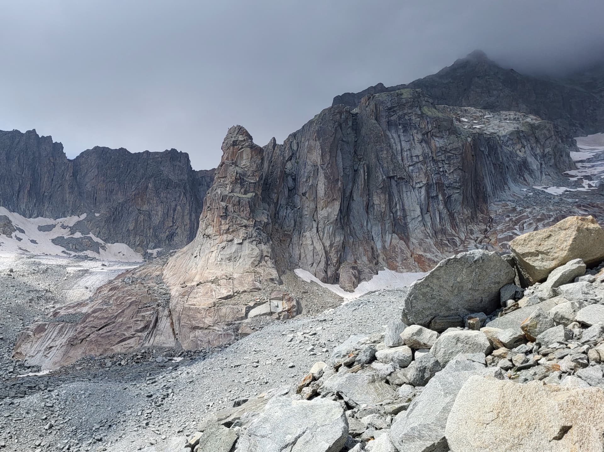
The Hannibalturm, a granite tower standing in front of the walls of the Gross Bielenhorn above the Sidelen glacier.

Switzerland · Furka

Conquest of Paradise

The classic of the Hannibalturm: six short, wandering pitches of slab, quartz veins, cracks and a 6a+ slab crux on perfect high-mountain granite at 2800 m. A bench and a bus-stop sign wait on the summit. Very popular, so expect company.

6a+6 pitches180 m

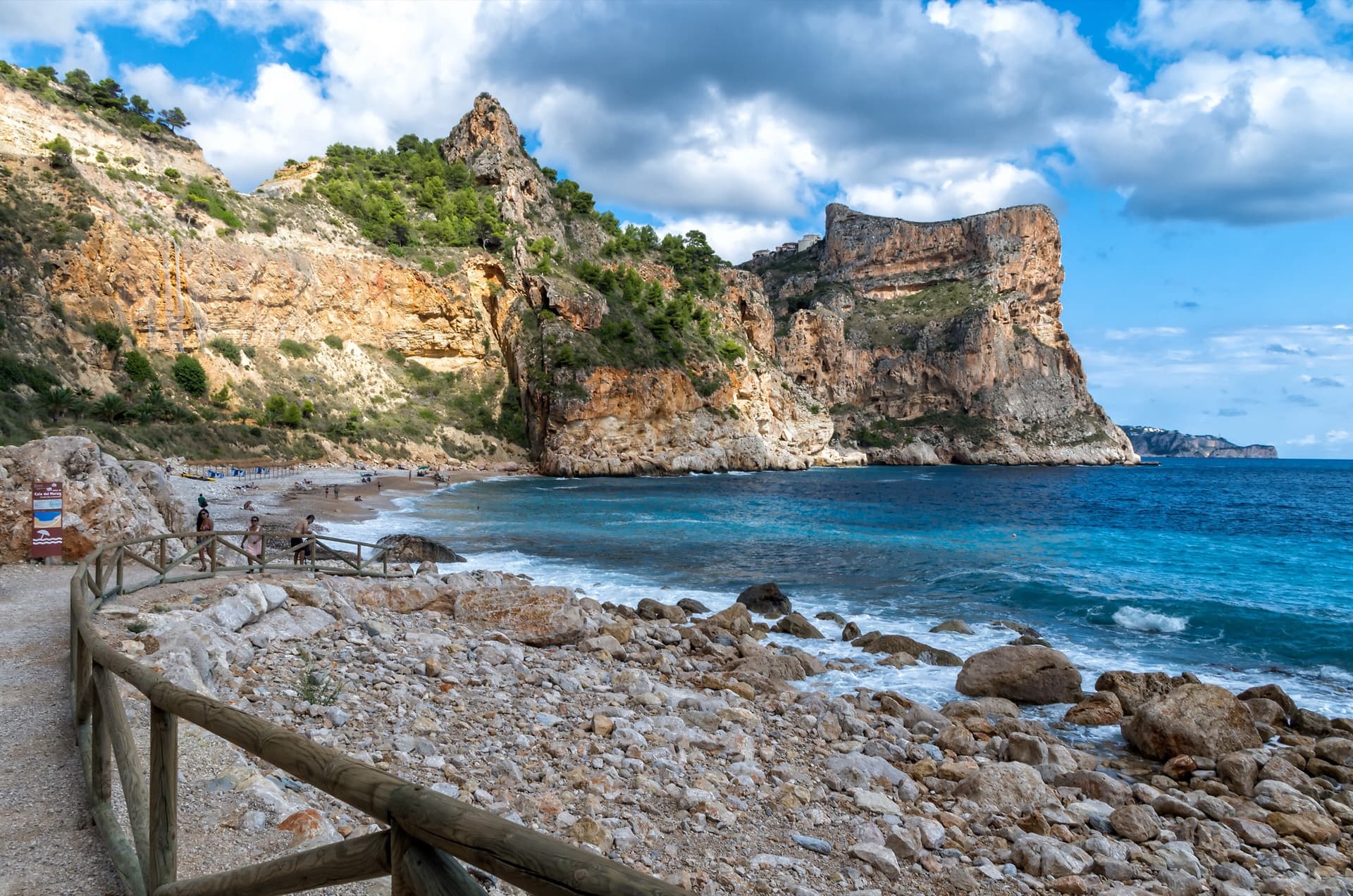
The flat-topped sea cliff of Morro Falquí closing the south end of Cala del Moraig, Benitatxell. Sonjannika climbs on this headland; the line cannot be pointed to from here.

Spain · Costa Blanca (Morro Falquí)

Sonjannika

A superb sea-cliff multipitch. P4 makes an impressive exposed exit from a cave with 100 m of air below, and the 6a+ P5 has a chimney and fingery slab. Balancy, airy and great for introducing someone to multipitch.

6a+6 pitches170 m

Read the cautions

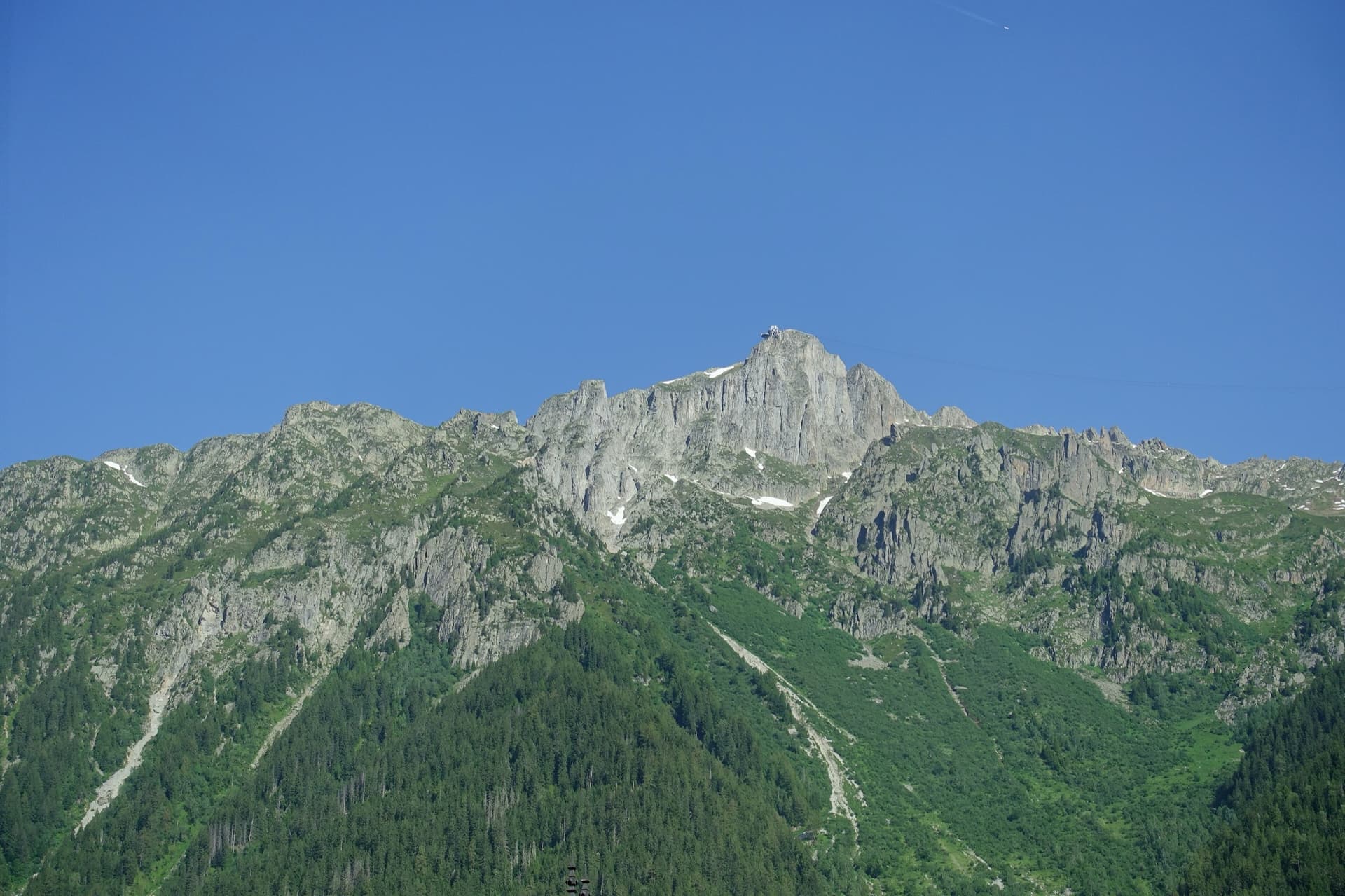
The summit of Le Brévent and the rock face beneath its cable-car station, seen from the Chamonix valley; the Voie Frison-Roche climbs this south-east face, the exact line is not marked.

France · Chamonix valley

Voie Frison-Roche

The great classic of the Aiguilles Rouges: six varied pitches of gneiss, ten minutes downhill from the Brévent cable car and finishing at its top station, with Mont Blanc opposite. The crux is a short, physical corner crack and the last pitch is a long, clean corner. It is extremely popular.

6a+6 pitches200 m

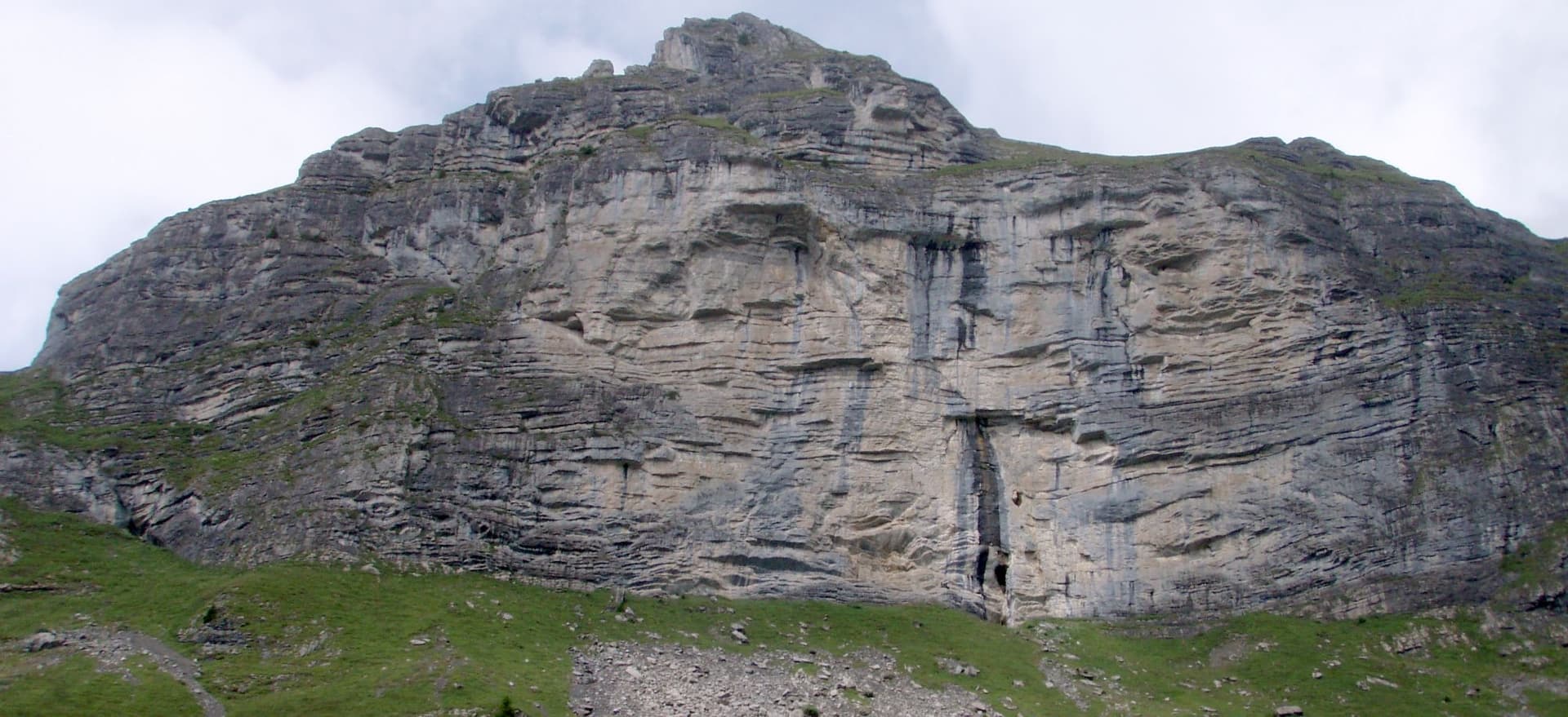
The Hintisberg wall from the alp; Blüemlipfad is on the left-hand sector

Switzerland · Bernese Oberland

Blüemlipfad

Six fairly short pitches on the left-hand sector of Hintisberg, left of the big overhangs. The first three are moderate and on less good rock; the upper three are steeper, with the 6a+ crux on small edges on pitch 4, and finish on a grassy top with the whole Bernese Oberland in view. Grades are on the stiff side.

6a+6 pitches180 m

Compiled from published sources, last verified October 2026. Bolts, anchors and access change: check a current topo and read the disclaimer.