Multipitch Atlas

Quarzader

Speroni di Ponte Brolla · Ticino · Switzerland

Bail with caveatsBolting confidence: medium

Slab pitches give way to a vertical wall threaded with quartz veins, which gives the route its name. It is shady in the morning, and the pitches are short (about 35 m), so 11 go quickly.

Hand-drawn topo of Quarzader on the Speroni di Ponte BrollaPhoto: M4N · CC BY-SA 3.0

Topo

Hand-drawn topo of Quarzader on the Speroni di Ponte BrollaPhoto: M4N · CC BY-SA 3.0
Hardest pitch
6a
Pitches
11
Length
400 m
Approach
20 min
Aspect
W
West-facing
Rope
1×50 m
(walk-off); 2×50 m to abseil

The route

Overview

Quarzader climbs the rounded pillar of the Speroni di Ponte Brolla above the Maggia valley road near Locarno in 11 (some count 12) short pitches, about 380-400 m. The first six pitches are low-angle friction slabs at 5a/5b that most parties find hard for the grade. The route then moves onto a steep wall studded with quartz veins and knobs, with a short, well-bolted crux on pitch 9 graded anywhere from 5c to 6a and easily aided. Bolting is generous, the approach is 20 minutes, and it is in the shade all morning. The awkward part is the descent: a steep, overgrown path down a stream bed.
The climbing

Pitch by pitch

Pitches of Quarzader
PitchGradeNotes
P15aFriction slab.
P25aFriction slab.
P35aFriction slab. Gulliver gives 4c.
P45bFriction slab.
P55bFriction slab.
P65bLast slab pitch. Gulliver gives 4c. At the end of the slabs keep left to start the steep section.
P75a+Vertical wall with good flakes on the left. Starts under a tree; another route leaves further right.
P85aMuch steeper, on quartz veins. A fine pitch.
P96aThe crux: a short, very steep passage on quartz knobs, closely bolted, 6a free or 5b with two points of aid. The Italian camptocamp text gives 5c and Gulliver 5c+. In 2021 this pitch ended at an old-style belay (a ring plus cord through an old peg).
P105bNo description published. Gulliver gives 5a.
P114bEasy finish to the platform at the top. Gulliver gives 4c.

Getting there

Approach

To the parking

From Locarno drive towards the Valle Maggia to Ponte Brolla (about 4 km, level crossing). Continue on the Valle Maggia road towards Avegno to the suspension footbridge over the Maggia; park on the river side opposite the bridge, near the shooting range. Public transport to Tegna/Ponte Brolla is rated good on camptocamp.

On foot · about 20 min

20 min (15-30 in different reports). On the mountain side of the road take a stepped path for about 50 m, then follow the sign 'sentiero di montagna' through the woods. After a few zigzags you reach an electricity pylon; take the path clearly to the right, cross a stream and you arrive at the foot of the spur. Quarzader is the right-hand route; its name is painted at the base but is faded.

Map of the walk-in

  • Crag

Loading map

The point marks the crag, not the exact start of the route.

Coordinates · crag

46.18845, 8.75151

Point from camptocamp waypoint 139810

For your phone or watch

Download GPX

Contains the route point. Opens in most mapping apps and GPS watches.

Points are compiled from published sources, with the precision stated above. They were not surveyed on the ground: check them against a current topo.

Getting down

Descent

Usual descent is on foot, 50 min to 1 h 30 min. From the platform at the top follow a clear track up a broad gully for about 100 m, cross a spur on the right at a big cairn, and continue to a small hut. Below the hut the path drops steeply down a stream bed: vegetated, poorly marked, often wet and slippery, with prickly plants. Lower down it improves and reaches the road; you do not pass the foot of the route. In 2020 fallen trees blocked the last part: either traverse right, or go down to the retaining wall above the road, where there is a ladder roughly every 50 m. Abseiling is possible but the Italian camptocamp text advises against it. A party who abseiled from R9 in April 2021 used chained anchors: from the middle of pitch 9 to the foot of pitch 7 (about 50 m), then to an anchor level with the middle of pitch 5, on the right as you climb (55 m), a short 15-20 m diagonal abseil to R4, then 65 m to R2, which they only just reached on rope stretch (do it in two), and R2 to the ground. It took 1 h 45 min and the rope nearly jammed.

Retreat

Bailing off the route

Bail with caveats

You can abseil off, but it is discouraged and awkward. The normal descent is on foot from the top, and the Italian camptocamp text advises against abseiling. A party who abseiled from R9 in 2021 took 1 h 45 min, nearly jammed their ropes and only just reached one anchor on a 65 m abseil.

Retreat from
The 2021 party went down from the middle of pitch 9 on chained anchors: about 50 m to the foot of pitch 7, 55 m to an anchor level with the middle of pitch 5 (right of the line as you climb), a 15 to 20 m diagonal abseil to R4, then to R2 and the ground. The R4 to R2 stretch is 65 m and should be done in two. Retreat from other belays is not described; older texts say many belays were a single large bolt.
Point of no return
None is documented. The crux on pitch 9 is short and can be aided, and only two easier pitches follow, so from R9 finishing and walking down is likely to be quicker than the abseils (inference).
Carry
2×50 m ropes at least; the reported abseils are 50 to 55 m, so 2×60 m gives more margin. A single 50 m rope is only enough if you top out. Spare cord and a maillon for any old or single-point belay, such as the one at the top of pitch 9.
Basis
Part stated, part inferredCamptocamp's Italian text states that abseiling is possible but not advised, and a 2021 trip report states the abseil sequence, lengths and the near-jammed rope; the rope recommendation and the suggestion to finish from R9 are inferred.

Partly inferred from the route facts

Safety

Hazards

  • Descent path: steep, overgrown, partly in a stream bed and slippery; fallen trees near the bottom were reported in 2020. Take care where you put your hands and feet.
  • Belays: the French camptocamp text says many belays are a single large bolt. Later reports (2020, 2021) say belays now have a large ring plus a smaller, newer one and some are chained, with the exception of the old-style belay at the top of pitch 9.
  • Abseiling the route is discouraged; ropes snag in the vegetated gully on the left bank and one 65 m abseil was only just possible.
  • Slab grades are stiff: several parties rate the first six pitches at 5b/5c rather than 5a/5b. The Italian camptocamp text says bolts are 'sometimes far apart'.
  • Heat: in August the route is only reasonable with a very early start.

Sun and weather

Conditions

West facing at 450-800 m. In the shade all morning, which is ideal in warm weather; the slabs then take the sun and the upper wall gets very hot on summer afternoons. Climbable from spring to late autumn, with reports from late March to mid-November; in summer start at dawn. Friction is poor on the slabs when damp. Popular, with parties often following each other up the slabs. The shooting range below can be noisy.

Usual season · Mar to May, Sep to Nov

Sun on the wall · W-facing

Working out the sunlit hours for this month.

  • January: not yet worked out
  • February: not yet worked out
  • March (usual season): not yet worked out
  • April (usual season): not yet worked out
  • May (usual season): not yet worked out
  • June: not yet worked out
  • July: not yet worked out
  • August: not yet worked out
  • September (usual season): not yet worked out
  • October (usual season): not yet worked out
  • November (usual season): not yet worked out
  • December: not yet worked out

Sun on the wallDaylight, wall in shade● Usual season

Estimated from the wall's aspect only. Ignores surrounding terrain, gullies and the wall's exact shape. Clock times are local to the wall (Central European time), for the 15th of each month.

Monthly climate averages for Ticino, 1991-2020
MeasureJanFebMar (usual season)Apr (usual season)May (usual season)JunJulAugSep (usual season)Oct (usual season)Nov (usual season)Dec
Mean daily high °C671114192325252016106
Mean daily low °C−2−21591315151283−1
Rain days 1 mm or more9911131616141413141210
Sunshine hours a day6.77.79.09.910.811.912.410.99.27.35.95.9

● marks the usual climbing season. Averages for 1991-2020 at about 432 m. Area climate from Open-Meteo reanalysis (about 10 km grid): the wall and valley can differ. Data: Open-Meteo, CC BY 4.0.

What to carry

Gear

If you walk down, a single 50 m rope is enough (Italian camptocamp text); pitches are about 35 m. Take two ropes if you might abseil. No source gives a quickdraw count. Helmet, and approach shoes for the descent. No trad gear is needed; a couple of long slings were suggested when belays were single bolts.

Checklist

Quickdraws
Number not given in the sources
Rope
1×50 m (walk-off); 2×50 m to abseil
Helmet
One each
Abseil device and prusik
The descent or the retreat involves abseiling
Maillons or spare karabiners
To leave behind if you retreat
Cord
Mentioned for retreat

Derived from the route data; check it against a current topo

From climbers

Reader reports

Reader reports are not being collected yet. Until they are, check a current topo and the local club or guidebook publisher for recent changes to Quarzader.

Worth knowing

Tips

  • With a 70 m rope one party linked every pair of pitches.
  • The crux is only a few metres long and can be pulled through on the bolts.
  • After the slabs, stay left to find the start of the steep wall; pitch 7 starts under a tree.
  • The natural pools in the Maggia river by the parking are the standard post-climb swim; there is also a pool in the stream on the way down.
  • Camping Piccolo Paradiso at Avegno is by the river; most campsites in the area close in winter.

Open questions

Where sources disagree

  • Crux grade: 6a (French camptocamp), 5c (Italian camptocamp), 5c+ (Gulliver); one 2020 party saw 'no 6a'. 6a is kept here as the upper bound.
  • Pitch grades: Gulliver gives 5a, 5a, 4c, 5b, 5b, 4c / 5b, 5a, 5c+, 5a, 4c; camptocamp's French grades are followed.
  • Belays: single large bolt (camptocamp French text) versus two points, some chained (2020 and 2021 trip reports); the newer reports are followed.
  • Length and pitch count: 400 m and 11 pitches (camptocamp French), '11 or 12' (camptocamp Italian), 380 m (Gulliver).
  • Descent time: about 1 h (camptocamp Italian), 50 min to 1 h 30 min in trip reports.
  • Bolt spacing: 'excellent' and 'very generous' in French reports, 'sometimes far apart' in the Italian description.

Provenance

Sources

Same area

More in Ticino

All routes in Ticino
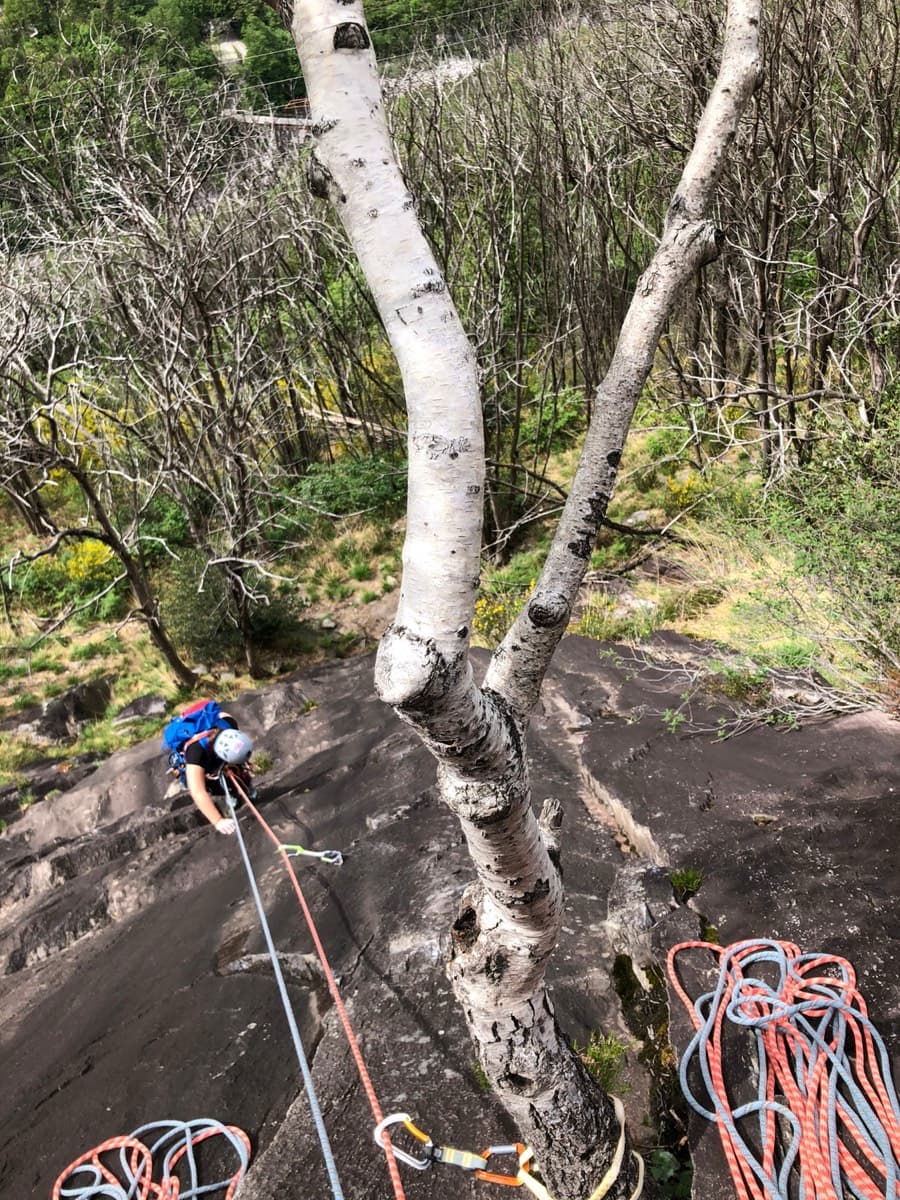
Looking down the dark gneiss slabs low on Nika, Speroni di Ponte Brolla

Switzerland · Ticino

Nika

The easy neighbour of Quarzader: seven pitches of gneiss slab and small steps up the right-hand spur above the Maggia, at 4b if you take the right-hand finish. Much quieter than Quarzader and very well bolted. Finish with a swim in the river.

4b7 pitches250 m

Around 6a · about 11 pitches

Similar elsewhere

Topo of Wings for Life, right of the Crescendo cave, Telendos south face

Greece · Kalymnos & Telendos

Wings for Life

The first route on the wall (Odermatt and Keller, 2008), climbing a long, exposed line on sharp, grippy rock right of the huge roof. The lower pitches are easy for the grade. The two 6a cruxes are a short odd corner over a small roof and a traverse high up, and they come with big exposure. Pitches are short, so you can link them with long draws.

6a11 pitches250 m

Photo-topo of Grimselstrom on the Seeplatten above the Räterichsbodensee, Grimsel

Switzerland · Grimsel

Grimselstrom

Glacier-polished slabs straight above the Räterichsboden dam. Four warm-up pitches lead to sustained 5b–5c slab and a short fissured roof (6a or A0).

6a11 pitches220 m

Read the cautions

Topo of Bucce d'Arancia on the Corma di Machaby, Arnad

Italy · Aosta Valley

Bucce d'Arancia

This is the most-climbed route on the Paretone. It gives sustained, varied slab and crack climbing on good gneiss, and the hardest moves are a fine crack on P2, a slanting corner and a punchy wall. Queues are common on good days. The Mani Nude guidebook grades it stiffly; camptocamp's Italian page calls it sustained at 5b–5c+ with a single 6a.

6a10 pitches290 m

Read the cautions

No photo yet

Italy · Val d'Ossola

Il Cammino del Sole

Twelve long pitches of sunny gneiss slab above Oira, mostly 4c to 5b+ with two 6a pitches: a thin slab at the start and an athletic corner on pitch 10. Pitches are up to 55 m. A winter-sun route with a summit book and plaques at both ends.

6a12 pitches530 m

Compiled from published sources and last verified October 2026. Bolts, anchors and access change. Climbing is dangerous and you are responsible for your own decisions: check a current topo and read the disclaimer.