Multipitch Atlas

Voie Tifégha

Paroi du Levant · Todra Gorge (Todgha) · Morocco

Read the cautionsBail with caveatsBolting confidence: high

A wandering nine-pitch line up the left end of the big wall above Tizgui, mostly 5b to 6a with a superb steep corner on pitch 6. Well bolted but with a mountain feel: it is little travelled, the rock is very abrasive and not fully cleaned, and the belays and the walk-off take some finding.

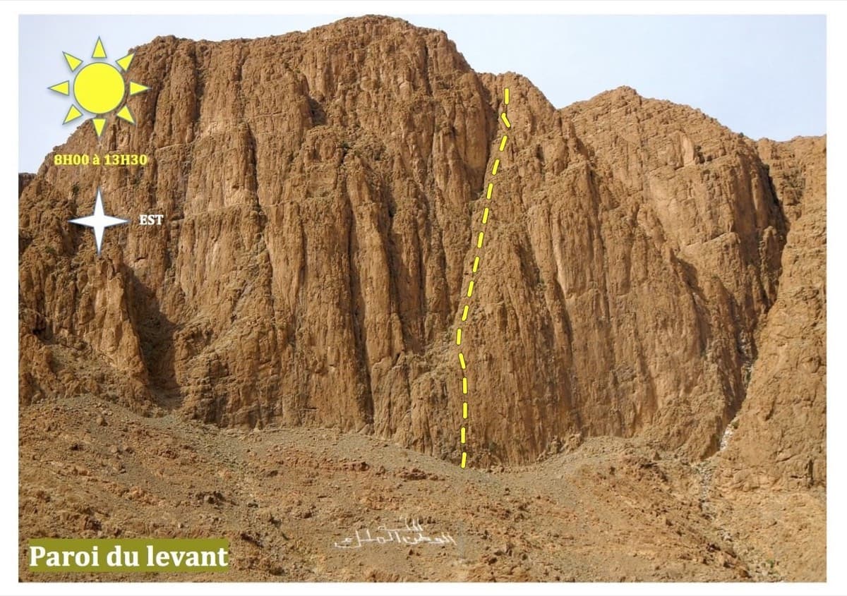
The Paroi du Levant above Tizgui, with the sun hours for the wall; Voie Tifégha is at its left endPhoto: Aventures verticales Maroc · CC BY-SA 3.0

Photo

The Paroi du Levant above Tizgui, with the sun hours for the wall; Voie Tifégha is at its left endPhoto: Aventures verticales Maroc · CC BY-SA 3.0
Hardest pitch
6c
Pitches
9
Length
250 m
Approach
30 min
Aspect
E
East-facing
Rope
–
Read before you go

Generously bolted, but the belays are unlinked and easy to miss, there is loose rock, and the walk-off is hard to find.

The route

Overview

Tifégha ('snake' in Amazigh) snakes up the far left side of the Paroi du Levant, the first big wall on the left before the gorge. Most of it is 5b to 6a, with two harder passages that can be aided on the bolts: a 6b move on pitch 1 (5c/A0) and the 6c corner of pitch 6 (6b/A0). Reports agree that the bolting is generous and the corner pitch is excellent, and also that the line is disjointed, with walking sections, awkwardly placed belays and loose blocks. Treat it as a small mountain route that happens to be bolted.

The climbing

Pitch by pitch

Pitches of Voie Tifégha
PitchGradeNotes
P16bMostly 5b with two moves of 6b, or 5c/A0.
P24A link pitch. The 2026 party found it to be 15 to 20 m of walking to a belay slightly left in easy-angled slabs, and noted the paper topo treats it differently.
P35bAbrasive climbing that ends with a traverse left. The belay sits higher than the start of the next pitch.
P45c/6aStarts below the belay: it is easiest to descend 3 to 4 m and belay from the flat ground. The first bolt is hidden in a small bush about 5 m up. Two parties missed the belay at the top and ran pitches 4 and 5 together.
P55c/6aBelay on the left on a ledge at the foot of a corner. Reported in 2026: a second belay 10 m left along the ledge, better placed for pitch 6.
P66cThe pitch of the route: a steep to slightly overhanging corner climbed delicately on bridging. Given 6c, or 6b/A0 with one 6c move; a 2026 party found it sustained 6b and never identified the 6c move.
P75c/6aThe belay is on the right, off the line of bolts and hidden under a bush. One 2026 leader missed it and belayed on one bolt and cams.
P85cEasier climbing on rough rock.
P95bTo the plateau, with a small slab crux at the exit. Pitches 8 and 9 are often moved together on.

Getting there

Approach

To the parking

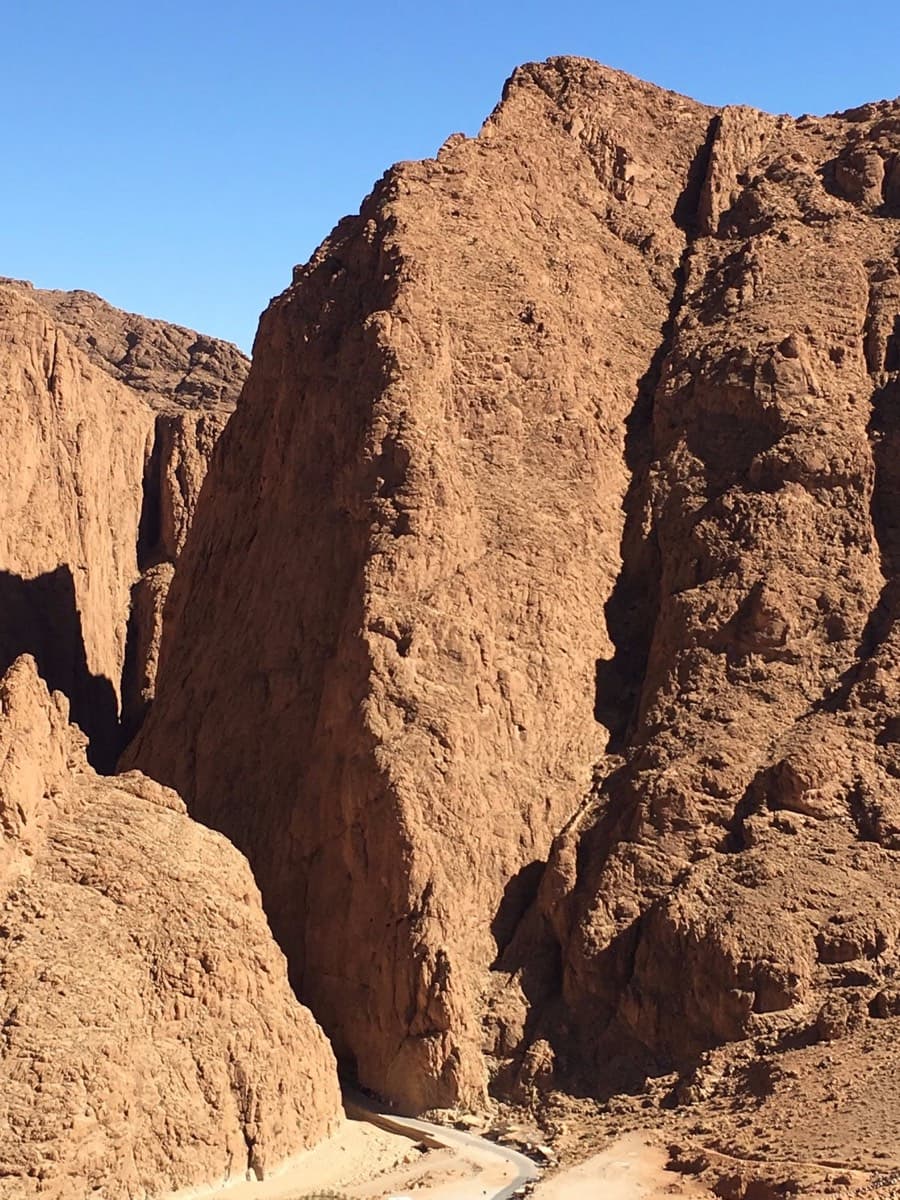
Base yourself at the mouth of the gorge near Tizgui, about 14 km from Tinghir. The gorge-entrance guesthouses are a few minutes on foot from the wall and there is a car park on the left at the gorge entrance, just before the first hotel. Tinghir is reached by road or bus from Marrakech; a taxi covers the last stretch. For this wall you can also start from the old village of Tizgui, 400 m before the gorge.

On foot · about 30 min

30 minutes. From Tizgui take the path that starts above the Berber museum in the old village and passes under the red and white pylon for about 15 minutes, then follow faint tracks for another 15. Or from the gorge entrance follow the foot of the cliff from the Mansour sector for about 30 minutes; a 2026 party found no real path that way. The route is at the far left end of the wall, marked by a faded white arrow. A newer route starts even further left, so check you are on the arrow.

Finding the route · 3 photos

Approach photo

Map of the walk-in

  • Crag
  • GPS line

Loading map

The point marks the crag, not the exact start of the route.

GPS line: one party's recorded GPS track of the whole day, including the climb and the descent. One party's recorded day in May 2026: they approached along the foot of the cliffs from the Mansour side (about 30 minutes, no real path found), climbed the route, then spent an hour finding the way from the top to the path and another hour walking back to the village. Do not follow it blindly.

GPS line: Armand, Anna Tassaux · CC BY-NC-ND 3.0

Coordinates · crag

31.57987, -5.59387

Point from Mountain Project area 111993178 (Paroi du Levant)

For your phone or watch

Download GPX

Contains the route point and a GPS line. Opens in most mapping apps and GPS watches.

Points are compiled from published sources, with the precision stated above. They were not surveyed on the ground: check them against a current topo.

Getting down

Descent

On foot, and not obvious. The camptocamp page lists three options. (1) From the plateau go left to a large gorge with whitened rocks in its bed, fitted with nomad stairways, and descend it towards the red and white pylon above the old village; a 2026 party who looked at this judged it exposed and not something to try in the dark. (2) Climb west to the ridge above, follow it south-south-west, then drop west to the path back to the village; the 2026 party did this in about 2 hours and uploaded a GPS track. (3) Abseil another route on the wall such as The first of Ela, which has linked belays with maillons to R5. The sector page gives 45 minutes to 1 hour 30 for the walk-offs.

Retreat

Bailing off the route

Bail with caveats

Retreat is possible but awkward. The belays are bolted but not linked and a 2026 party judged them unsuitable for abseiling, so you would leave maillons and cord. The line wanders, with traverses on pitches 3 and 5 and walking sections, which makes abseils diagonal. One 2023 party did abseil from the top.

Retreat from
Any bolted belay, leaving gear. The neighbouring The first of Ela has linked belays with maillons up to its fifth belay and is the suggested abseil line from the top.
Point of no return
Not stated. After the traverses of pitches 3 to 5 a retreat becomes progressively more awkward; above pitch 7 it is quicker to finish, as the last two pitches are 5b to 5c.
Carry
Maillons and cord for each belay, and enough rope for abseils of unknown length; take two ropes if you want the option.
Basis
Part stated, part inferredUnlinked belays and the 2023 abseil are stated in trip reports; the effect of the traverses is inferred from the pitch descriptions.

Partly inferred from the route facts

Safety

Hazards

  • Belays are not linked and are poorly suited to abseiling (2026 report); retreating means leaving gear.
  • Loose flakes and detached blocks in many places; the route sees little traffic.
  • Belays at the top of pitches 4 and 7 are easy to miss.
  • The walk-off has caught parties out; the 2026 party finished the last pitch at 20:00 and needed headtorches.
  • There is no mountain rescue service in Morocco.

Sun and weather

Conditions

East facing at about 1900 m. The sector topo shows sun from 8:00 to 13:30 and a 2023 party notes shade from 13:00, so it is an afternoon route in warm weather and a morning one in winter. It is sheltered from a west wind. The crag page lists February to June as the best period.

Usual season · Feb to May, Oct to Nov

Sun on the wall · E-facing

Working out the sunlit hours for this month.

  • January: not yet worked out
  • February (usual season): not yet worked out
  • March (usual season): not yet worked out
  • April (usual season): not yet worked out
  • May (usual season): not yet worked out
  • June: not yet worked out
  • July: not yet worked out
  • August: not yet worked out
  • September: not yet worked out
  • October (usual season): not yet worked out
  • November (usual season): not yet worked out
  • December: not yet worked out

Sun on the wallDaylight, wall in shade● Usual season

Estimated from the wall's aspect only. Ignores surrounding terrain, gullies and the wall's exact shape. Clock times are local to the wall (Moroccan time), for the 15th of each month.

Climate figures for Todra Gorge (Todgha) are not available yet

What to carry

Gear

Quickdraws for bolted pitches of unstated length; one party strung 60 m of rope linking pitches 4 and 5 and ran out of gear, so take plenty and some long ones. Rope length is not specified by any source. Slings and a couple of maillons for the unlinked belays. Headtorch. Helmet.

Checklist

Quickdraws
Number not given in the sources
Rope
Length not given in the sources
Helmet
One each
Abseil device and prusik
The descent or the retreat involves abseiling
Maillons or spare karabiners
To leave behind if you retreat
Cord
Mentioned for retreat

Derived from the route data; check it against a current topo

From climbers

Reader reports

Reader reports are not being collected yet. Until they are, check a current topo and the local club or guidebook publisher for recent changes to Voie Tifégha.

Worth knowing

Tips

  • Start by 14:00 at the latest if you want afternoon shade and daylight for the descent; allow 2.5 to 5 hours on the route.
  • Download the GPS track attached to the 10 May 2026 camptocamp report before you go.
  • Both hard passages can be pulled through on the bolts.

Open questions

Where sources disagree

  • Pitch 2 is grade 4 on camptocamp; the 2026 party found only a walking transition there and says the paper topo shows a 5c pitch at that point. A 2019 party counted one more pitch than the topo, plus an undrawn transition.
  • Pitch 6: 6c on camptocamp, sustained 6b with no distinct 6c move according to the 2026 party.
  • Descent time: 'a good hour' on the route page, 45 minutes to 1 hour 30 on the sector page, about 2 hours for the 2026 party including route-finding.
  • Aspect: east on the route page, south-east on the sector page.
  • A 2023 party reports abseiling ('following the bolts of the last pitch, then straight down'), while the 2026 party says the belays are unsuitable for abseiling.

Provenance

Sources

Same area

More in Todra Gorge (Todgha)

All routes in Todra Gorge (Todgha)
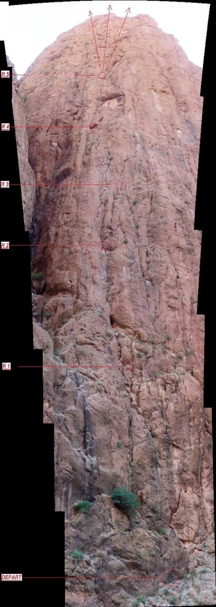
Photo-topo of La Classique on the Pilier du Couchant, Todra Gorge, with belays marked

Morocco · Todra Gorge (Todgha)

La Classique

The classic of the gorge, first climbed in 1977. Sustained and physical 6a climbing up cracks, corners and short bulges on the big pillar at the gorge entrance. The first pitch is the 6a+ crux, straight off the ground. Watch for loose blocks on the last pitch, shared with Chibania.

6a+9 pitches300 m

Read the cautions
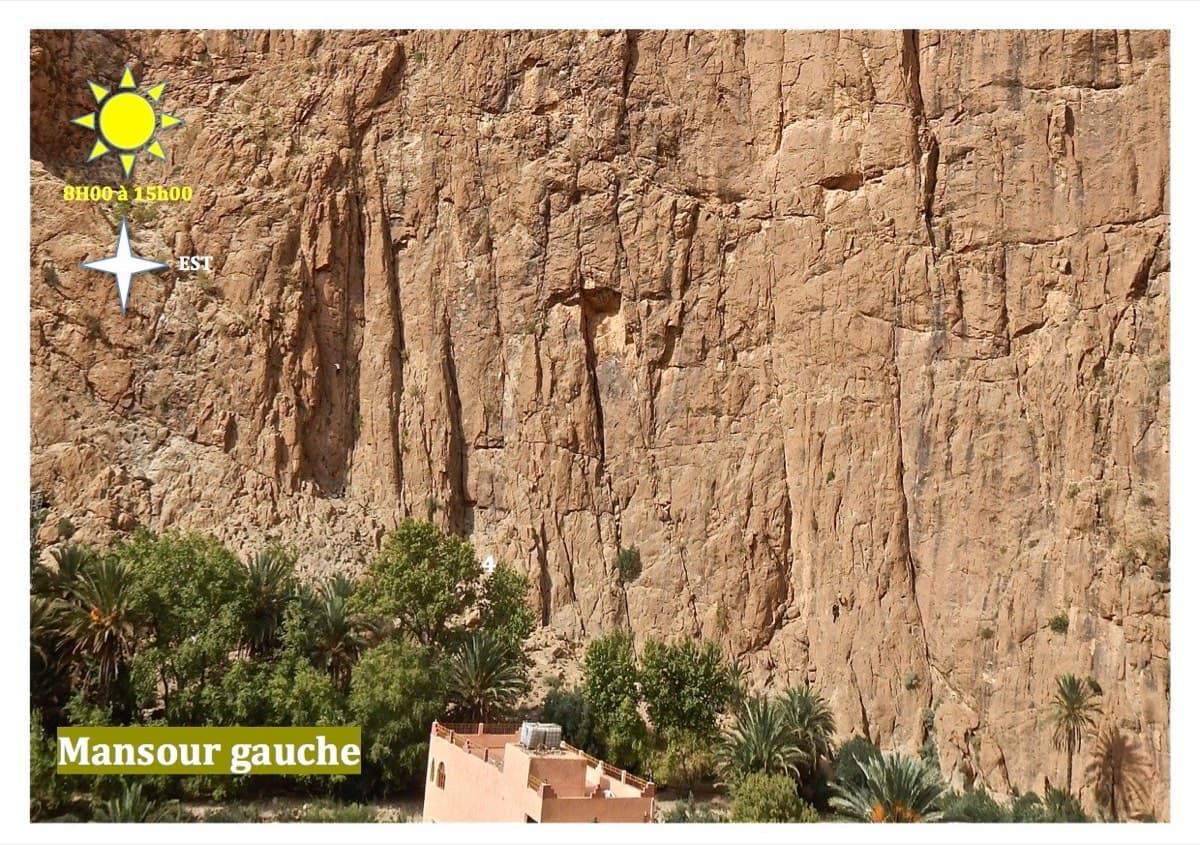
The Mansour Gauche sector, Todra Gorge

Morocco · Todra Gorge (Todgha)

Tiwira

A long, moderate line above the Mansour palm grove at the upstream end of the gorge. Mostly steady 5c with a 6a crack to start and a harder, very abrasive finish. Big views up the valley.

6b7 pitches300 m

Line of Hannah chez les grands drawn on the Paroi du Levant, Todra Gorge

Morocco · Todra Gorge (Todgha)

Hannah chez les grands

Eight pitches up the middle of the Levant wall, with the 6a on the first pitch and steady 5a–5c above. Morning sun. Camptocamp rates the commitment a little higher than the gorge-floor routes because of the length.

6a8 pitches320 m

The Arête Nord, Todra Gorge

Morocco · Todra Gorge (Todgha)

Une arête dans la gorge

The longest route in the gorge: 550 m of easy ridge climbing on the left as you leave the narrows. Sold locally as the beginner's first big bolted route. The first three or four pitches are in shade with a 7 am start; after that you are in the sun.

5c13 pitches550 m

Read the cautions

Around 6c · about 9 pitches

Similar elsewhere

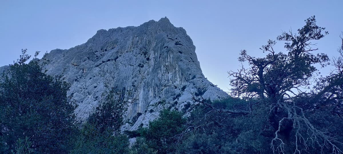
The north-west side of Punta Cusidore at dawn, seen from the approach above Oliena

Italy · Sardinia

L'Ombra della Mia Mano

A 300 m pillar on the 'Dolomite of Sardinia': a hard, smooth first pitch in a north-facing gully, long grey slabs and walls, a demanding technical crux on pitch 6, then exposed climbing on the crest of the pillar on big sculpted holds. Mountain atmosphere with sport protection.

6c9 pitches300 m

Read the cautions

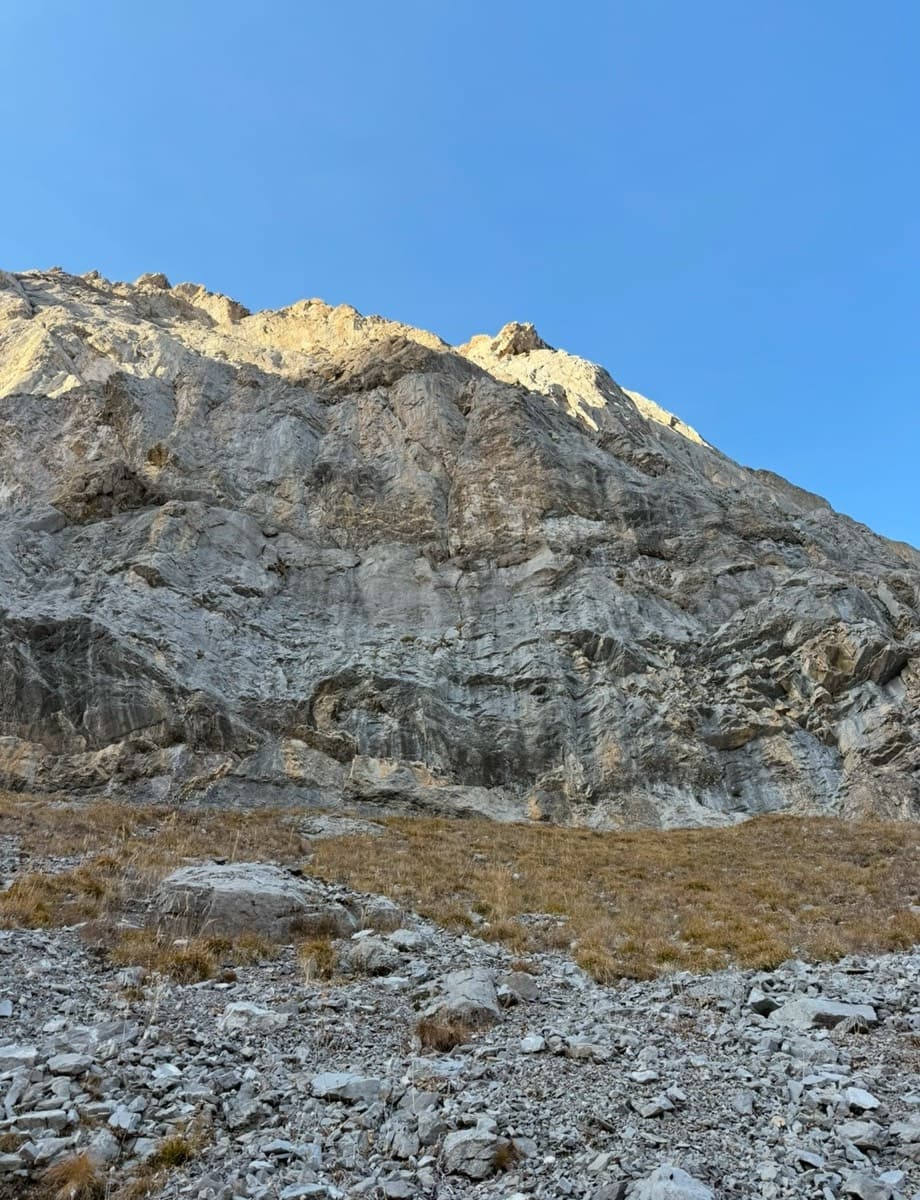
The wall of Les Montons taken by Follomi, seen from the approach

Switzerland · Sanetsch

Follomi

The classic introduction to the Sanetsch at 6c: eight varied pitches up a pillar of superb rough limestone, with the hard climbing packed into a few well-bolted metres on each pitch. A steep corner mantel, a balancy wall, a fine slab and an airy exit from a niche. Tops out on grassy slopes with a walk-off.

6c8 pitches250 m

The north face of Anića kuk, Paklenica, where Alive climbs

Croatia · Paklenica

Alive

Seven sustained pitches of 6a to 6c on the shady north face of Anića kuk, then an easy scramble out. A poor first pitch gives way to a steep ramp, a slightly overhanging 6c wall, an off-width and a fine finishing slab. The rock improves with every pitch.

6c8 pitches220 m

No photo yet

Austria · Ötztal

Linas Traumreise

Steep, exposed gneiss left of the Reinhard Schiestl via ferrata, finding a way between huge roofs. The cruxes are the steep slabs of pitches 5 and 6 (6c). Stiffly graded, and the abseil descent is not for everyone.

6c8 pitches195 m

Compiled from published sources and last verified October 2026. Bolts, anchors and access change. Climbing is dangerous and you are responsible for your own decisions: check a current topo and read the disclaimer.