Multipitch Atlas

Il Solitaire

Alpe Gorta / Fort Apache (Crevoladossola) · Val d'Ossola · Italy

Easy to bailBolting confidence: high

A long, sunny friction-slab route of about 35 m pitches on excellent rock, ideal for learning footwork. The hardest move is a short crack-and-chimney finish on the last pitch. Allow about 3 h up and 1 h down.

Alpe Gorta above Crevoladossola, with the rocky outcrops behind the hutsPhoto: BertrandSemelet · CC BY-NC-ND 3.0

Photo

Alpe Gorta above Crevoladossola, with the rocky outcrops behind the hutsPhoto: BertrandSemelet · CC BY-NC-ND 3.0
Hardest pitch
5b
Pitches
13
Length
430 m
Approach
10 min
Aspect
SW
South-west-facing
Rope
1×70 m

The route

Overview

Thirteen pitches and about 430 m of low-angled friction slab on excellent gneiss above the old Simplon road near Crevoladossola. Twelve of the pitches are pure padding at 3a to 5a; only the last pitch changes style, with a crack, a traverse and a wide chimney at 5b. Bolting is very close stainless steel, so it suits anyone wanting to build slab confidence, though some find so much slab monotonous. The main seriousness is the long abseil descent and the seepage that often runs down the wall.

The climbing

Pitch by pitch

Pitches of Il Solitaire
PitchGradeLengthNotes
P15a35 mFrom the painted name climb a vague spur on a very uniform slab. A few footholds look chipped.
P24c35 mEasier slab (4a on camptocamp) to a belay on a step. From here traverse horizontally right through the trees, following blue marks and a blue arrow, to the foot of the next wall. Do not continue straight up: that is another route. The traverse is often wet.
P34a35 mA short vertical wall, exited on the right, then easy-angled slab.
P45a35 mEasy slab, a step with one athletic move, then a harder 'wavy' slab.
P54a35 mEasier slab. A wet streak here can be turned on the right.
P65a35 mCompact slab with one nice harder move; often crossed by a water streak.
P74a35 mEasy-angled slab to a small step, passed on the right.
P84a35 mEasy-angled slab.
P93a35 mEasy slab.
P104c35 mThe slab steepens after an easy start. It is easier, and on more featured rock, just right of the bolts.
P114c35 mVaried slab to the belay.
P125a35 mA slab sculpted like a chute that threads up into the vegetation. One of the nicer pitches.
P135b–The best and hardest pitch, and the only steep one. A fine crack at the edge of the slab, a traverse right, then a wide crack-chimney climbed with some difficulty (the crux; A0 possible), and a slab to the final belay. About 15 bolts. Just after leaving the belay, where you move right, there are two very large blocks resting on earth: treat them gently. A pole with a flag and a tube with the route book are beside the top belay.

Getting there

Approach

To the parking

Base is Crevoladossola, just north of Domodossola. Take the old Simplon (Sempione) road towards Varzo past the hamlet of San Giovanni and through a short tunnel, and park on the right in a small lay-by at about 400 m with a sign "Vie di Roccia Fort Apache", near the Roman bridge. Road warning from 2023: the old road was closed by a landslide on the Domodossola side, so you had to drive through the tunnel on the main road towards Varzo, turn back and reach the parking from the Varzo side, passing the road-closed barriers (the landslide is further on). Current status is not confirmed.

On foot · about 10 min

10 to 15 minutes. From the lay-by take the path that climbs past the rockfall fences, following red paint marks, to the base of the slabs at about 490 m. The start has the route name painted on the rock, next to the via A. Protti. The Dattilo-Zenié and three 70 m routes (Masciaga, Fattibene, A. Protti) start in the same area.

Finding the route · 1 photo

Approach photo

Map of the walk-in

  • Crag

Loading map

The point marks the crag, not the exact start of the route.

Coordinates · crag

46.16824, 8.28451

Point from gulliver.it "Gorta (Alpe) - Il Solitaire"

For your phone or watch

Download GPX

Contains the route point. Opens in most mapping apps and GPS watches.

Points are compiled from published sources, with the precision stated above. They were not surveyed on the ground: check them against a current topo.

Getting down

Descent

Abseil the route from belay to belay, all on two bolts with chain and ring: 11 abseils down to belay 2, from where you can walk down through the trees instead of abseiling the first two pitches. With 2×60 m ropes most abseils can be paired, but one linked abseil measured 62 to 63 m and another pair left only a couple of metres spare, so knot the rope ends and expect some stations to be only just reachable. Allow 1 to 2 hours. Most belays are hanging stances on the slab with no ledge. There is no known walk-off from the top.

Retreat

Bailing off the route

Easy to bail

Yes. Abseiling the route is the only descent, and every belay has two bolts with chain and ring. Reports say you can stop at any belay and abseil. One party turned round at R11. From R2 you can walk down through the trees.

Retreat from
Any belay. Most are hanging stances on the slab. Below R2 you walk down, so the first two pitches need no abseil.
Carry
1×70 m rope, abseiling belay to belay. Pitches are about 35 m, so knot the ends. With 2×60 m ropes do not count on linking two pitches: one linked abseil measured 62 to 63 m.
Basis
Stated in the sourcesGulliver and camptocamp state the abseil descent and belay equipment, and trip reports state the retreat from R11 and the measured abseil lengths.

Safety

Hazards

  • Abseil lengths: do not assume paired abseils fit a 60 m rope. One was measured at 62 to 63 m; tie knots in the ends.
  • Seepage is frequent and can make whole pitches wet; a January 2025 party found the middle section completely washed and drifted onto a harder neighbouring route with yellow bolts (probably Shark Teeth).
  • Route-finding after pitch 2: you must traverse right to the next wall following the blue marks. A 2017 party carried straight on into the neighbouring route.
  • Two large blocks resting on earth at the start of pitch 13 (reported April 2023).
  • Ticks in the forest on the approach and descent (reported 2019).
  • The old road has been closed by a landslide on the Domodossola side (2023 reports); check access.
  • Brambles on the ledges.

Sun and weather

Conditions

South-west to west facing, at low altitude (400 to 800 m). In April the sun reaches the wall at about 11:00. Climbable for much of the year, including winter days, but too hot in high summer. The slabs seep: after heavy rain allow at least two dry days, and one party still found water streaks after three fine days. The traverse after pitch 2 and pitch 6 are the usual wet spots, and the top can run like a stream. The rock grips well even when damp.

Usual season · Mar to May, Sep to Nov

Sun on the wall · SW-facing

Working out the sunlit hours for this month.

  • January: not yet worked out
  • February: not yet worked out
  • March (usual season): not yet worked out
  • April (usual season): not yet worked out
  • May (usual season): not yet worked out
  • June: not yet worked out
  • July: not yet worked out
  • August: not yet worked out
  • September (usual season): not yet worked out
  • October (usual season): not yet worked out
  • November (usual season): not yet worked out
  • December: not yet worked out

Sun on the wallDaylight, wall in shade● Usual season

Estimated from the wall's aspect only. Ignores surrounding terrain, gullies and the wall's exact shape. Clock times are local to the wall (Central European time), for the 15th of each month.

Monthly climate averages for Val d'Ossola, 1991-2020
MeasureJanFebMar (usual season)Apr (usual season)May (usual season)JunJulAugSep (usual season)Oct (usual season)Nov (usual season)Dec
Mean daily high °C4581217212323191484
Mean daily low °C−5−4−1271113131060−5
Rain days 1 mm or more9911141817171714141310

● marks the usual climbing season. Averages for 1991-2020 at about 643 m. Area climate from Open-Meteo reanalysis. Temperatures are adjusted to the height of the crag; rain comes from a grid cell of about 10 to 25 km, and summer highs on sea cliffs can read a few degrees low. The wall and valley can differ. Data: Open-Meteo, CC BY 4.0.

What to carry

Gear

Single 70 m rope (Gulliver's recommendation) or 2×60 m half ropes if you want to link pitches and abseils. 10 to 13 quickdraws for single pitches; 15 for the last pitch; 16 if linking pitches. Helmet. No cams or nuts needed.

Checklist

Quickdraws
15
Rope
1×70 m
Helmet
One each
Abseil device and prusik
The descent or the retreat involves abseiling

Derived from the route data; check it against a current topo

From climbers

Reader reports

Reader reports are not being collected yet. Until they are, check a current topo and the local club or guidebook publisher for recent changes to Il Solitaire.

Worth knowing

Tips

  • With 2×60 m ropes and 16 quickdraws a 2023 party linked 1+2, 3+4, 5+6, 7+8, 9+10 (rope-stretching, extend the runners) and 11+12 (about 70 m, so about 10 m of easy simul-climbing), then pitch 13 alone, and abseiled the same way.
  • Allow 3 to 4 hours up; parties report 2 to 5 hours depending on linking.
  • If the top is wet you can stop at any belay and abseil; one party turned round at belay 11.
  • Sign the route book at the top.

Open questions

Where sources disagree

  • Pitch 2: 4a on camptocamp, 4c on Gulliver (Gulliver followed, as it is the more detailed and more recently revised description).
  • Approach: 10 min (Gulliver) or 15 min (camptocamp); camptocamp outings show about 30 min from car to climbing.
  • Time on the route: about 3 h (Gulliver) or 4 h (camptocamp); descent 1 h in both, but outings record up to 2 h.
  • Rope: Gulliver recommends a 70 m rope and warns that 60 m ropes may not reach when abseils are linked; several parties nonetheless linked abseils with 2×60 m, with almost no margin.
  • Bolt spacing: most reports say very close ('over-bolted'); a January 2025 report says it gets a little longer after the first pitches but stays safe.
  • Height: 400 m (camptocamp) or 430 m (Gulliver). Individual pitch lengths are not published; both sources only say 'about 35 m each', which is what is entered here for pitches 1 to 12.

Provenance

Sources

Same area

More in Val d'Ossola

All routes in Val d'Ossola
No photo yet

Italy · Val d'Ossola

Il Cammino del Sole

Twelve long pitches of sunny gneiss slab above Oira, mostly 4c to 5b+ with two 6a pitches: a thin slab at the start and an athletic corner on pitch 10. Pitches are up to 55 m. A winter-sun route with a summit book and plaques at both ends.

6a12 pitches530 m
Around 5b · about 13 pitches

Similar elsewhere

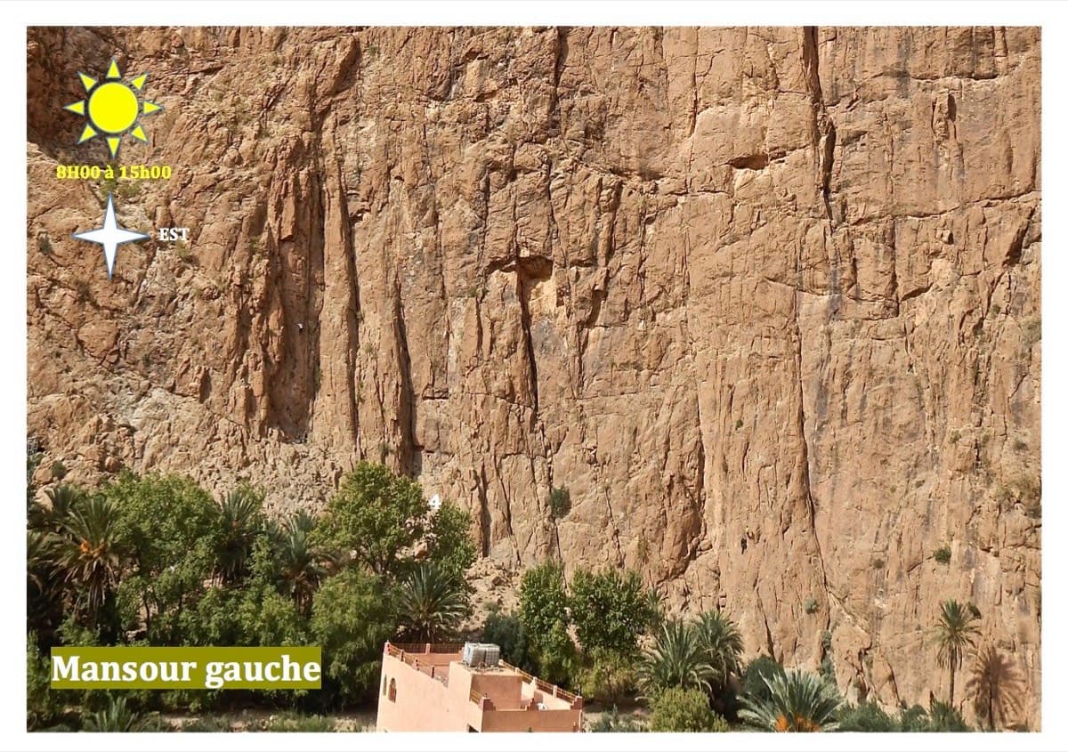
Mansour Gauche sector, Todra Gorge

Morocco · Todra Gorge (Todgha)

Berbertraum

Thirteen short pitches, mostly grade 4, with two 5c steps. The longest pitch is 45 m. A big day of easy mileage in the sun above the palm grove.

5c13 pitches340 m

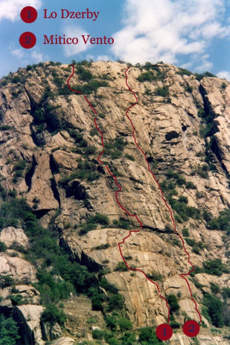
Topo of Lo Dzerby (line 1) and Mitico Vento on the Corma di Machaby, Arnad

Italy · Aosta Valley

Lo Dzerby

A long, easy-angled outing up the full height of the Paretone. A steeper lower half with an exposed pillar on P5 leads to sculpted slabs and broken steps higher up. It's a good first big multipitch.

5c13 pitches400 m

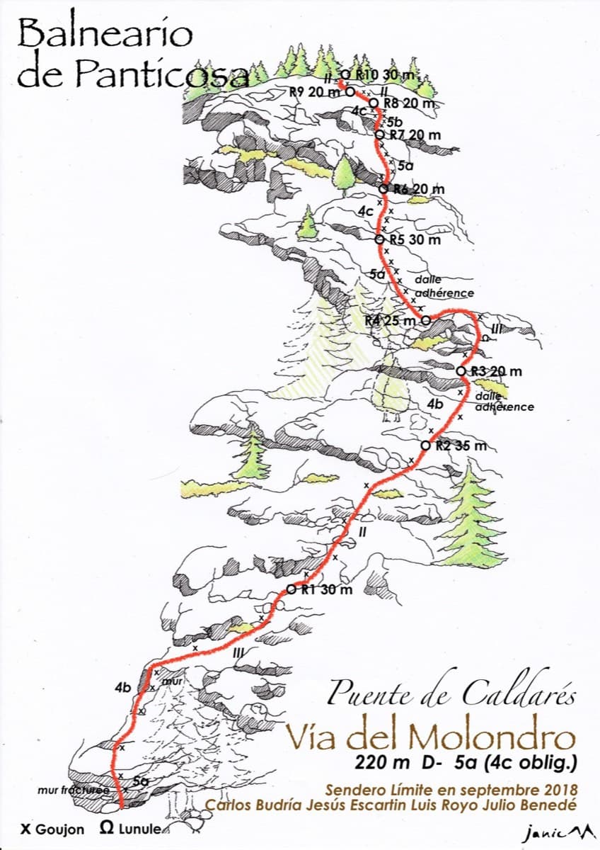
Drawn topo of the Vía del Molondro above the Caldarés bridge, Baños de Panticosa, with bolts and belays marked

Spain · Aragonese Pyrenees (Tena & Canfranc valleys)

Vía del Molondro

Ten short pitches of easy-angled Panticosa granite beside the Caldarés stream, twenty minutes from the car. Mostly friction slabs at 4b to 5a linked by walking-angle ground, with one polished bulge given 5b on the topo. A very gentle first granite multipitch, and a climbing approach to the walls above.

5b10 pitches220 m

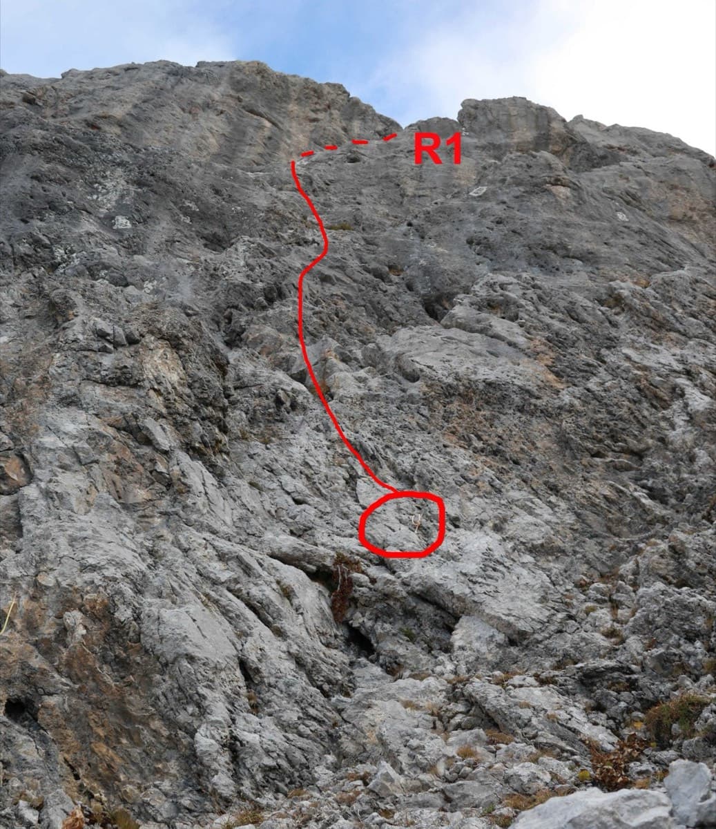
Start of Le sirop pour machin on the Pointe Percée, with the first pitch to belay R1 drawn in red

France · Aravis

Le sirop pour machin

An introduction to mountain multipitch that tops out right under the summit cross of the highest Aravis peak. Grippy fluted limestone is linked by cairned walking sections, and the last pitches are the best.

5b+11 pitches400 m

Compiled from published sources and last verified October 2026. Bolts, anchors and access change. Climbing is dangerous and you are responsible for your own decisions: check a current topo and read the disclaimer.