Multipitch Atlas

La Marbrière

Le Socle de la Carrière · Sainte-Victoire · France

Bail with caveatsBolting confidence: medium

A sunny winter route on Sainte-Victoire's south-side socle. The highlight is a beautiful marbled slab on L5, and a stiff move off the last belay can be aided on a sling. Bring long slings to manage rope drag around the trees.

Le Socle de la Carrière, the pale limestone plinth at the foot of the south face of Sainte-Victoire.Photo: Carcharoth · CC BY-SA 3.0

Photo

Le Socle de la Carrière, the pale limestone plinth at the foot of the south face of Sainte-Victoire.Photo: Carcharoth · CC BY-SA 3.0
Hardest pitch
5c+
Pitches
7
Length
180 m
Approach
20 min
Aspect
S
South-facing
Rope
1×50 m
(walk-off); 2×50 m if you want to be able to retreat

The route

Overview

La Marbrière climbs the full height of the Socle de la Carrière, a south-facing slabby cliff low on the Sainte-Victoire above the old 'marble' quarry. It is mostly easy-angled friction slab on a compact, colourful breccia, broken by a few steeper steps and by ledges, with the hardest move right off the last belay. Bolting is modern (big yellow hangers) but spaced on easy ground, up to about 7 m, and closer on the hard moves. It is widely used as a first multipitch, though several parties warn that leaders should be solid at the grade because of the spacing. Opinion is split: most find it a pleasant outing, one party found it disjointed and overgraded.
In pictures

Photos

Approach photo

The climbing

Pitch by pitch

Pitches of La Marbrière
PitchGradeLengthNotes
P15c45 mTrend up and left (a variation goes right; keep left). First bolt high, about 5 m. Moves on embedded pebbles, a little polished. Belay slightly hidden on a small terrace. grandevoie.com gives 5b, 47 m.
P24b45 mStraight up, slightly left. From this belay an easy ledge leads left as an escape, and also to the route Tambour Magique about 30 m away.
P35b40 mRising traverse to the right. Mostly easy, with a single 5b move near the end.
P45b40 mPass the clump of trees on the right, then traverse diagonally left. Heavy rope drag: use a long sling at the trees. One 2026 party felt 5b+.
P55c35 mA slightly overhanging move at the start with a good hold out right, then a traverse right across the fine marbled slab. A reachy move in the middle for short climbers. grandevoie.com: 5b+.
P64b40 mEasy, finishing with a traverse left to the belay.
P75c+35 mAwkward friction move off the belay into a flared corner; a flint hold for the right hand has broken off. Can be passed in A0 by standing in a sling. Then about 4c to the broad terrace and a last isolated belay. Camptocamp gives 20 m, grandevoie.com 35 m.

Getting there

Approach

To the parking

From Aix-en-Provence take the D17 through Le Tholonet towards Puyloubier. Pass Saint-Antonin-sur-Bayon; about 500 m later the Deux Aiguilles car park is on the right, and about 500 m further is the Carrière / Marbrière car park (signposted, altitude 465 m), where you park. Camptocamp describes it as on the left and grandevoie.com as set back on the right, so follow the sign.

On foot · about 20 min

20 to 25 min. From the car park walk about 100 m along the road and take a wide unmarked path on the left heading north-west (not the track 15 m further right that heads east). After a few metres bear right on a wide path towards the obvious cliff. You join the brown-marked path ('sentier marron') at its left-hand hairpin close to the cliff (around spot height 555). From the hairpin go up onto a small rise right of the brown path, find a discreet cairn and follow a small path that drops right into a gully, then climb the gully to the lowest point of the wall. The last 100 m are overgrown and prickly. The start is in the line of the gully: two bolts are visible, the first about 5 m up, trending left above a hollow. A poorly equipped route with one visible bolt starts 2 m to the right; do not take it.

Finding the route · 1 photo

Approach photo

Map of the walk-in

  • Crag
  • Parking
  • GPS line

Loading map

The point marks the crag, not the exact start of the route.

GPS line: a line of the whole day, including the climb and the descent drawn by its source, not a recorded track. Line attached to the camptocamp route page (about 3 km, 468 m to 725 m): a loop from the Carrière car park to the foot of the wall, the climb, and the return. Do not follow it blindly.

GPS line: camptocamp contributors · CC BY-SA 3.0

Coordinates · crag

43.52640, 5.60301

Parking

43.51930, 5.59470

Parking de la Carrière (camptocamp access point)

Point from camptocamp waypoint 384120

For your phone or watch

Download GPX

Contains the route point, parking and a GPS line. Opens in most mapping apps and GPS watches.

Points are compiled from published sources, with the precision stated above. They were not surveyed on the ground: check them against a current topo.

Getting down

Descent

Walk off. Pick up the brown-marked path close to the last belay and follow it west past the old quarry, then down the approach path to the car park. Keep right along the path leaving the quarry on your left rather than going through it. 20 to 40 min.

Retreat

Bailing off the route

Bail with caveats

There is one easy escape and then it gets awkward. From the second belay an easy ledge leads off left. Above that, pitches 3 to 6 zigzag right and left, the belays are two unlinked bolts, and pitches are 35 to 45 m, so an abseil retreat needs two ropes and left gear. grandevoie.com suggests 2×50 m for exactly this reason.

Retreat from
R2, by the easy ledge to the left (it also reaches the route Tambour Magique about 30 m away). Abseiling from other belays is not described.
Point of no return
Not stated by any source. By inference, once past R2 the traversing pitches make abseiling the line awkward, and the top with its 20 to 40 min walk-off is the simpler way out.
Carry
2×50 m ropes if you want to be able to abseil; a single 50 m does not reach on 45 m pitches. Maillons or old karabiners and cord for the two-bolt belays.
Basis
Part stated, part inferredcamptocamp states the R2 escape ledge and grandevoie.com (via the guide) the 2×50 m advice for retreat; the difficulty of abseiling the traversing pitches and the gear to leave are inferred.

Partly inferred from the route facts

Safety

Hazards

  • Bolts are spaced on the easy sections, up to about 7 m, and you sometimes have to look for the next yellow hanger. The hard moves are well protected.
  • First bolt of pitch 1 is about 5 m up.
  • The start of pitch 7 is harder since a right-hand hold broke; aid it with a sling if needed.
  • Some gravel on ledges and holds that can break (2025 report).
  • Summer access: from 1 June to 30 September access to the massif is regulated by prefectoral order for fire risk and may be closed; check before going.
  • A different, poorly equipped route starts 2 m right of the correct start.

Sun and weather

Conditions

Full south at 465-740 m, in the sun all day. Camptocamp lists September to May; it is a winter and mid-season route and too hot in summer (30 °C by midday in late May 2026). Climbable on cool winter days (12 °C and overcast was fine). Popular: expect several parties on fine weekends.

Usual season · Jan to May, Oct to Dec

Sun on the wall · S-facing

Working out the sunlit hours for this month.

  • January (usual season): not yet worked out
  • February (usual season): not yet worked out
  • March (usual season): not yet worked out
  • April (usual season): not yet worked out
  • May (usual season): not yet worked out
  • June: not yet worked out
  • July: not yet worked out
  • August: not yet worked out
  • September: not yet worked out
  • October (usual season): not yet worked out
  • November (usual season): not yet worked out
  • December (usual season): not yet worked out

Sun on the wallDaylight, wall in shade● Usual season

Estimated from the wall's aspect only. Ignores surrounding terrain, gullies and the wall's exact shape. Clock times are local to the wall (Central European time), for the 15th of each month.

Monthly climate averages for Sainte-Victoire, 1991-2020
MeasureJan (usual season)Feb (usual season)Mar (usual season)Apr (usual season)May (usual season)JunJulAugSepOct (usual season)Nov (usual season)Dec (usual season)
Mean daily high °C9101316202528282318129
Mean daily low °C−0−025914161612941
Rain days 1 mm or more7669853479107

● marks the usual climbing season. Averages for 1991-2020 at about 499 m. Area climate from Open-Meteo reanalysis. Temperatures are adjusted to the height of the crag; rain comes from a grid cell of about 10 to 25 km, and summer highs on sea cliffs can read a few degrees low. The wall and valley can differ. Data: Open-Meteo, CC BY 4.0.

What to carry

Gear

Quickdraws: 11 (grandevoie.com) to 14 (2026 party). Several long slings for rope drag, especially on pitch 4. Slings to link the two-bolt belays. grandevoie.com suggests 2×50 m ropes 'for safety' in case of retreat; the normal descent is on foot. Helmet. Nuts and cams are not needed.

Checklist

Quickdraws
14
Rope
1×50 m (walk-off); 2×50 m if you want to be able to retreat
Helmet
One each
Maillons or spare karabiners
To leave behind if you retreat
Cord
Mentioned for retreat

Derived from the route data; check it against a current topo

From climbers

Reader reports

Reader reports are not being collected yet. Until they are, check a current topo and the local club or guidebook publisher for recent changes to La Marbrière.

Worth knowing

Tips

  • Escape left along the ledge from the second belay if needed.
  • Combine with Tambour Magique (5b max) on the same cliff, or continue above with the Pilier du Singe and then the Piliers de la Carrière for a longer day.
  • Allow 2 to 3 h for the route.
  • The free PDF topo on grandevoie.com is a useful second description.
  • The old quarry and its cable remains are worth a look on the way down.

Open questions

Where sources disagree

  • Grades: camptocamp gives 5c, 4b, 5b, 5b, 5c, 4b, 5c+; grandevoie.com gives 5b, 4b, 5b, 5b, 5b+, 4b, 5b+/5c. The Spanish camptocamp text gives 5b max. This entry uses the French camptocamp grades.
  • Length: camptocamp gives 180 m of height; grandevoie.com gives 260 m of climbing, which matches the pitch lengths.
  • Last pitch: 20 m (camptocamp) vs 35 m (grandevoie.com, which includes the easy ground to the terrace).
  • Date: 2010? (camptocamp) vs 2013-2014? (grandevoie.com).
  • Quality: most reports are positive, but one February 2026 party found it disjointed, half on grade-3 terraces, and overgraded.
  • Season: this entry lists October to May only; camptocamp's crag page lists September to May.

Provenance

Sources

Around 5c+ · about 7 pitches

Similar elsewhere

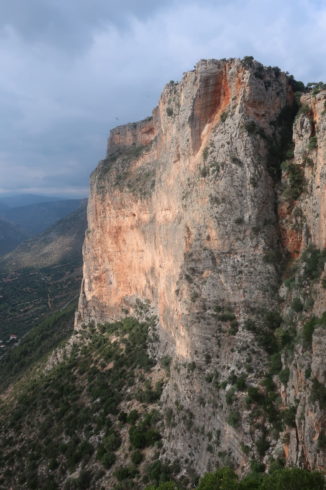
The orange pillar at the right end of the main Kokkinovrachos wall, Leonidio.

Greece · Leonidio & Kyparissi

Mignonette

The easiest multi-pitch on Kokkinovrachos, following the easy-angled arête and pillar above Leonidio, with tufas, crimpy walls and a great view of the town. Rock is good apart from the scrappy P2–P3.

5c+7 pitches175 m

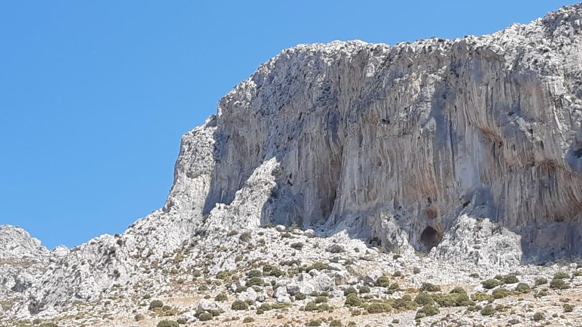
The cliff above the Grande Grotta: 3 Stripes starts on the second-to-last spur on the left and finishes up the shaded wall

Greece · Kalymnos & Telendos

3 Stripes

Kalymnos's best-known introduction to multi-pitch: a series of steps and slabs, always with plenty of holds, finishing on top of the Grande Grotta. The upper pitches feel very exposed. Real pitch lengths are shorter than the guidebook says (20–25 m).

5c+6 pitches175 m

Committing

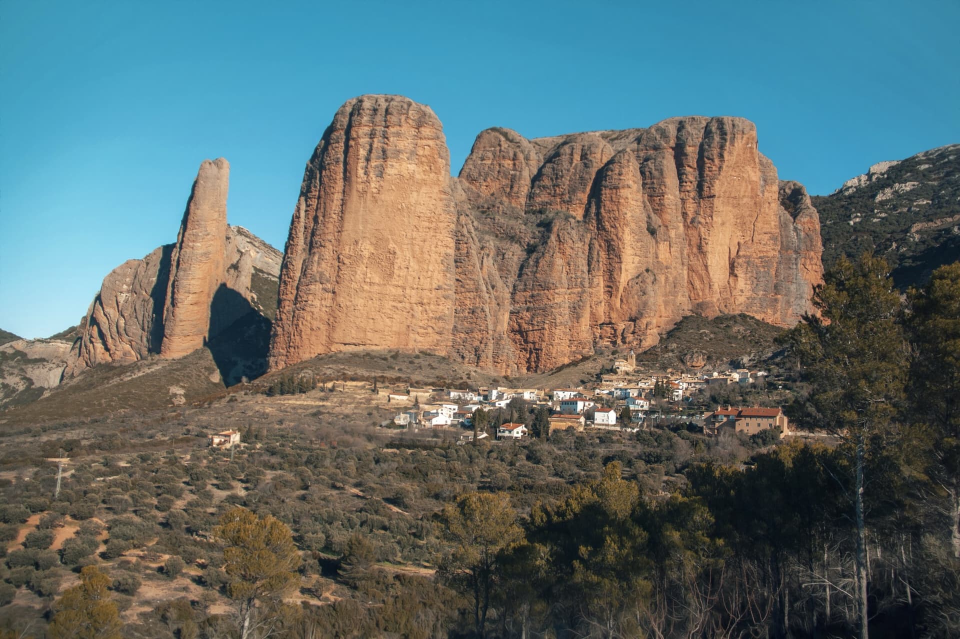
The classic view of Riglos from the south-west: the slender pinnacle of El Puro on the left, the great dome of Mallo Pisón beside it, and the main wall running right to La Visera above the village.

Spain · Riglos & Agüero (Mallos)

Espolón del Adamelo

This is the gentlest way to sample Riglos. Polished pockets and two bulging 'panzas' lead to a 6a crux that can be pulled through on the bolts (A0). The upper spur is easy, and the Pisón towers loom close by.

6a7 pitches175 m

Read the cautions

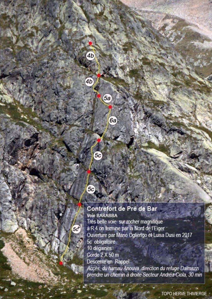
Topo of Barabba on the Contrefort de Pré de Bar, Val Ferret

Italy · Aosta Valley

Barabba

A pretty plaisir route on edgy, quartz-studded granite slabs beneath the Mont Blanc massif. The crux is a short bulge and steep juggy wall on P4. Camptocamp rates it 'great'.

6a7 pitches180 m

Compiled from published sources and last verified October 2026. Bolts, anchors and access change. Climbing is dangerous and you are responsible for your own decisions: check a current topo and read the disclaimer.