Multipitch Atlas

Traversée des Florets

Chaîne de Gigondas – Crête des Florets · Dentelles de Montmirail · France

Easy to bailBolting confidence: high

A west-to-east traverse of the six towers of the Florets crest, alternating short pitches with five short abseils and ending on a knife-edge. First climbed in 1928, it is the classic introduction to ridge climbing in Provence. The moves of 5 are short but polished and cannot be avoided, and all the rope work makes it slower than its length suggests.

The Florets crest on the Gigondas chain of the Dentelles de Montmirail, seen from the northPhoto: Thomas Ribière · CC BY-SA 3.0

Photo

The Florets crest on the Gigondas chain of the Dentelles de Montmirail, seen from the northPhoto: Thomas Ribière · CC BY-SA 3.0
Hardest pitch
5b
Pitches
9
Length
120 m
Approach
–
Aspect
–
Not recorded
Rope
1×40 m minimum
50 m is comfortable

The route

Overview

The Traversée des Florets runs along the western crest of the Gigondas chain from near its west end to the Brèche du Turc. You climb each tower by a short pitch of 3b to 5b and abseil 10 to 20 m off the far side, nine pitches and five abseils in all, finishing along a 50 m crest. The old topo grade was 4c/5a; camptocamp now suggests 5b/c for the cruxes because the footholds are very polished. There are good intermediate belays, and you can escape to the south side at every gap. It is extremely popular with clubs, and queues are common. Allow 3 to 5 hours on the ridge.

The climbing

Pitch by pitch

Pitches of Traversée des Florets
PitchGradeLengthNotes
P15b30 mStraight up towards the gendarme over small blocks with glue-ins, then a short slab move. Abseil 15 m down the south side from the chain and cable on the right.
P25a20 mA big, easy-angled crack. Can be linked with pitch 3 in 50 m.
P34c25 mFollow the ridge as it lies back. The newer chained belay is slightly below. Abseil 10 m and step onto a narrow rock arch, where the belay is not chained. Do not abseil through the lower arch: that misses the next tower and means a 20 m abseil to the trees and a very easy slab to rejoin the route.
P44c15 mCross to the south side, climb a grassy ramp for a few metres, then a crack straight up. The belay chain is behind the top. Abseil 10 m.
P53b30 mSlab and crack to the big summit terrace. Go under the trees, or over the blocks on the left past a stainless glue-in, to the belay on the right. Abseil 20 m.
P65b15 mA slab with a crack on its right. Abseil 20 m.
P75b20 mA slab, best taken on its right side.
P84b50 mAlong the knife-edge crest (the 'rake'). The hard move is in descent but well bolted: clip everything and add slings over spikes if the second is not confident. Chained belay.
P93b30 mA fairly steep down-climb with no bolts into the Brèche du Turc, or a 20 m abseil from the chained belay.

Getting there

Approach

To the parking

From Gigondas follow signs for 'Dentelles de Montmirail' to the Domaine des Florets. The track beyond is closed to vehicles at the hotel (camptocamp says the closure there is now permanent, even if the gate is sometimes open), so park in the large car park opposite and walk up the track to the Col du Cayron in 10 to 15 min. By public transport, take the train to Carpentras and the on-demand Trans'CoVE bus to Gigondas, about 2.5 km from the col.

On foot

From the Col du Cayron there are two ways. Either follow the path with blue dots towards the Brèche de la Pousterle and, just before crossing to the south side, fork right towards the Brèche du Turc and continue west below the Florets chain on the blue dots. Or, less steep and no slower, follow the main track west to the next col, by picnic tables, and pick up the blue-dotted path there. A November 2025 party warns that the first gentle col you reach on the crest is not the start: stay on the north side until you reach the start below an obvious gendarme. The route begins near the west end of the ridge at a gentle col; 15 m above, a pinnacle is wrapped with a cable, chain and maillon (the first abseil). No source gives a total approach time.

Map of the walk-in

  • Crag
  • Parking

Loading map

The point marks the crag, not the exact start of the route.

Coordinates · crag

44.15556, 5.02417

Parking

44.15893, 5.02492

Col du Cayron (camptocamp access point)

Point from camptocamp waypoint 43128

For your phone or watch

Download GPX

Contains the route point and parking. Opens in most mapping apps and GPS watches.

Points are compiled from published sources, with the precision stated above. They were not surveyed on the ground: check them against a current topo.

Getting down

Descent

From the Brèche du Turc, either take the blue-dotted path on the south side for about 20 m east and quickly cross left to the north side through a gap (red dots) to rejoin the approach path, which camptocamp says is not easy to find; or drop slightly down the south side and make a short abseil of 10 to 15 m from a huge polished thread, on the left looking north, straight onto the north-side path. Follow it west, then east along the foot of the cliffs on the blue dots.

Retreat

Bailing off the route

Easy to bail

Camptocamp states that you can escape at every gap between the towers by going down the south side to the path. The towers are short, with chained abseil stations, so you are never more than one pitch and one short abseil from a way off.

Retreat from
Each of the gaps between the six towers, on foot down the south side.
Point of no return
None.
Carry
Nothing beyond the normal kit; the abseils are 10 to 20 m.
Basis
Stated in the sourcesThe escape at each gap is stated in the camptocamp route remarks and confirmed by a 2026 report.

Safety

Hazards

  • The 5a to 5b moves are polished friction steps, obligatory, and cannot be made easier with gear.
  • On pitch 8 the second faces the hard move in descent; a fall there would be a swing.
  • Abseiling into the wrong arch after pitch 3 skips a tower.
  • The massif can be closed by prefectoral order on fire-risk days between 15 June and 15 September; check the Vaucluse fire-risk site the evening before. Camptocamp also mentions organised boar hunts in autumn and winter.
  • The foot descent from the Brèche du Turc is hard to find.

Sun and weather

Conditions

A crest at about 600 m, open to every wind: fine in midsummer thanks to the draught, and cold in a mistral for the rest of the year, so carry a windproof. The crux footholds are very polished. Avoid weekends and holidays if you can; parties report waits of 45 min at the start behind large beginner groups.

Usual season · Mar to Jun, Sep to Nov

Sun on the wall

No estimate: the wall's aspect is not recorded for this route.

Climate figures for Dentelles de Montmirail are not available yet

What to carry

Gear

10 quickdraws, two or three long slings for the unlinked belays and for spikes on the final crest, and a single rope of at least 40 m, which covers the abseils (50 m lets you link pitches). Nuts and cams are useless. Confident seconds climb it in approach shoes, but the polished slab moves are easier in rock shoes. Helmet.

Checklist

Quickdraws
10
Rope
1×40 m minimum (50 m is comfortable)
Helmet
One each
Abseil device and prusik
The descent or the retreat involves abseiling

Derived from the route data; check it against a current topo

From climbers

Reader reports

Reader reports are not being collected yet. Until they are, check a current topo and the local club or guidebook publisher for recent changes to Traversée des Florets.

Worth knowing

Tips

  • Keep the rope work slick: five abseils and nine belays are what take the time. Allow about 5 hours car to car, more behind other parties.
  • A rope of 40 to 50 m is easier to manage on the abseils than a full-length one.
  • Each gap offers a walk-off to the south if the weather or the clock turns.

Open questions

Where sources disagree

  • Grade: 4c/5a overall in the Dentelles topo; camptocamp's header gives 5c (5a obligatory) and its text 5b/c because of polish, while its pitch list tops out at 5b. The pitch list is used.
  • Length: camptocamp's header gives 120 m of difficulties, but the nine pitch lengths add up to 235 m of climbing along the crest.
  • Belays: a May 2026 party says all belays are chained; a November 2025 party lists three that needed rigging. Carry slings.
  • Orientation: camptocamp tags the route 'W' because the traverse starts at the west end; it is a crest, so no single aspect is given here.
  • Access: the route text says the track is permanently closed at the Domaine des Florets; the access waypoint gives a seasonal closure from 1 May to 30 September.
  • No independent online topo was found; the second source is the camptocamp crag page with dated trip reports.

Provenance

Sources

Around 5b · about 9 pitches

Similar elsewhere

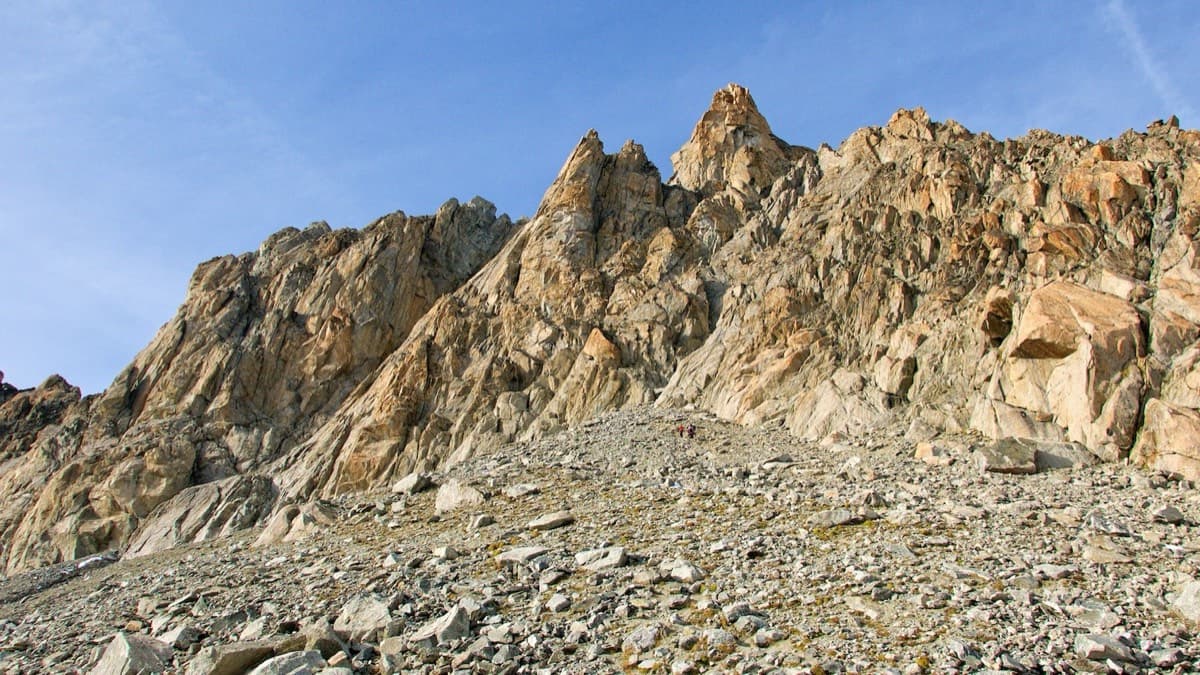
The south side of the Aiguille d'Orny above the scree slope of the approach

Switzerland · Orny (Champex, Mont Blanc massif)

La Moquette

Nine pitches up a granite spur and the final tower of the Aiguille d'Orny to a 3150 m summit, on rough, cracked rock with superb friction. Two moves of 5b, the rest 4b and 4c, closely bolted since 2016 and easy enough to climb in boots. The three steep pitches on the summit tower are the highlight.

5b9 pitches250 m
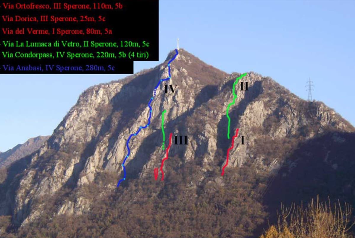
The spurs of the Zucco dell'Angelone above Barzio with route lines marked; Condorpass is on the fourth spur (IV)

Italy · Lecco & Valsassina

Condorpass

The first route opened on the Zucco dell'Angelone, following the natural line of the fourth spur by corners, cracks, a chimney and friction slabs. Eight varied pitches at 5a to 5b with an easy crest to finish. Never hard but never trivial either.

5b8 pitches220 m

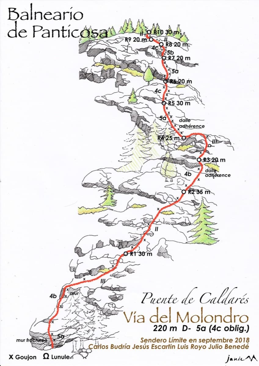
Drawn topo of the Vía del Molondro above the Caldarés bridge, Baños de Panticosa, with bolts and belays marked

Spain · Aragonese Pyrenees (Tena & Canfranc valleys)

Vía del Molondro

Ten short pitches of easy-angled Panticosa granite beside the Caldarés stream, twenty minutes from the car. Mostly friction slabs at 4b to 5a linked by walking-angle ground, with one polished bulge given 5b on the topo. A very gentle first granite multipitch, and a climbing approach to the walls above.

5b10 pitches220 m

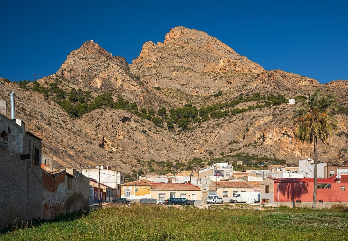
Sierra de Callosa above Redován

Spain · Vega Baja (Orihuela & Callosa)

Espolón P.D.P.

A long, steady V+ spur to the summit of the Sierra de Callosa on exceptional rock. Many terraces allow a safe retreat, which makes it good mileage for building multipitch experience. Check local seasonal climbing restrictions in the Sierra de Callosa.

5+9 pitches500 m

Read the cautions

Compiled from published sources and last verified October 2026. Bolts, anchors and access change. Climbing is dangerous and you are responsible for your own decisions: check a current topo and read the disclaimer.