Multipitch Atlas

Alisée e gli Amici Canterini

Mont Chétif – east face (Pré de Pascal, Courmayeur) · Aosta Valley · Italy

Read the cautionsBail with caveatsBolting confidence: medium

The easiest route on the big east face of Mont Chétif, the rocky pyramid that stands over Courmayeur. Twelve short pitches of well-featured rock, mostly 4b, lead to a steep little corner on pitch 10 that is the one hard passage. You finish a few minutes below a summit with one of the great views of the south side of Mont Blanc.

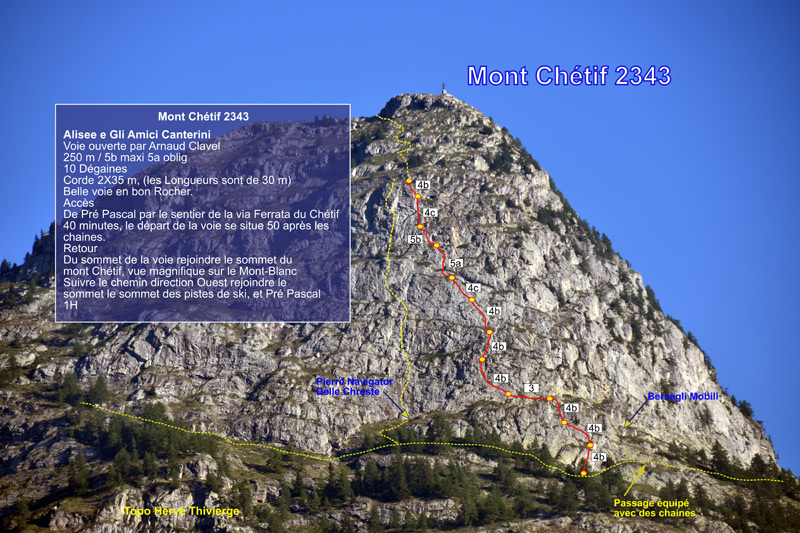
Mont Chétif seen from Courmayeur in the morning: the route climbs the sunlit face below the summitPhoto: Florian Pépellin · CC BY-SA 4.0

Photo

Mont Chétif seen from Courmayeur in the morning: the route climbs the sunlit face below the summitPhoto: Florian Pépellin · CC BY-SA 4.0
Hardest pitch
5b
Pitches
12
Length
250 m
Approach
35 min
Aspect
SE
South-east-facing
Rope
1×50 m
walk-off
Read before you go

Fully bolted with two-bolt belays and no gear needed, but the bolts are spaced on the easy pitches and the belay cords are old, so it needs a leader with a margin.

The route

Overview

Mont Chétif (2343 m) separates Courmayeur from the Val Veny, and its east to south-east face rises straight above the town. This route, opened by Arnaud Clavel, takes a long leftward-trending line up the upper face in twelve pitches of 15 to 30 m. The climbing is on sculpted rock with plenty of holds, interrupted by earthy ledges and juniper, and never harder than 4c until the last third. Pitches 9 and 10 are the crux: a steeper spur and then a short layback corner at 5b that several parties rate 5c. It is a mountain setting at over 2000 m with a short approach, and suits a first long route for a leader who is steady on spaced bolts.

The climbing

Pitch by pitch

Pitches of Alisée e gli Amici Canterini
PitchGradeLengthNotes
P14c25 mThe first bolt is high. A slab with a delicate move before you reach it, then a steeper section to grassy ledges.
P24b30 mDiagonally left on good holds.
P34b15 mContinue up to a good stance. Often linked with pitch 2.
P43b25 mDiagonally left for 5 m between grass and stones to a first bolt, then a horizontal traverse left past two more to a belay on two bolts that you must link yourself. Ignore a sling higher up.
P54b25 mTrend up and left to a stance under a small overhang.
P64c25 mPass the overhang on the right and go straight up to a broad ledge. The first bolt is straight above the belay and slightly right: do not be drawn left.
P75a25 mStraight on up.
P84b25 mDiagonally left on rock that is friable in places, to a stance on an earthy ledge.
P95a25 mEasily left to a short slab with a bolt, up it, then a steeper spur to a grassy ledge. Broken at the start.
P105b25 mThe key pitch. Easily up left to the foot of an obvious corner, then about 5 m of steep laybacking on good holds, the only strenuous climbing on the route, and an awkward exit. Finish easily leftwards for about 7 m. The second bolt in the corner is a long way above the first for a leader at their limit.
P115a20 mContinue upwards, trending left.
P124b20 mA short steep section on the left, then easy ground to the last belay. Often linked with pitch 11.

Getting there

Approach

To the parking

From Courmayeur drive into the Val Veny and take the first left, signed for the Rifugio Monte Bianco. Continue past the hut up the small tarmac road to Pré de Pascal (about 1900 m), where there is an inn and the top station of the gondola from Courmayeur. The road has a barrier: in August 2026 it was closed between 05:00 and 17:30 and opened on request at the intercom, and a September 2026 party had it opened by phoning the inn at Pré de Pascal to say they would eat there. In the summer season you can instead take the gondola from Courmayeur; it had stopped running by 30 August in 2026. Park at the far car park, just right of the gondola station, or at the roadside just before Pré de Pascal.

On foot · about 35 min

30 to 40 min. From Pré de Pascal walk up the broad, steep grassy ski piste on the right, opposite the gondola station (signs for the via ferrata). Where the slope eases, take the path that traverses left around the mountain towards the Courmayeur side. After about ten minutes it follows new via ferrata cables and rungs (installed in summer 2025). At the junction with the path coming up from Courmayeur, continue towards Mont Chétif. About ten minutes later more cables lead downhill. The route starts about 10 to 15 m beyond the end of this equipment, at the lowest point of the cliff and 2 m from the path. There is a plaque on the rock and three bolts are visible on the slab.

Map of the walk-in

  • Crag

Loading map

The point marks the crag, not the exact start of the route.

Coordinates · crag

45.79994, 6.95026

Point from camptocamp waypoint 132156 (summit of Mont Chétif; the route finishes about 10 min below it)

For your phone or watch

Download GPX

Contains the route point. Opens in most mapping apps and GPS watches.

Points are compiled from published sources, with the precision stated above. They were not surveyed on the ground: check them against a current topo.

Getting down

Descent

On foot. A few metres above the last belay there is a bolt and a flat area where you can unrope and change shoes. Faint tracks lead up grassy steps for about 150 m to the ridge left of the statue and the hiking path between the Madonna and the highest point of Mont Chétif: 10 to 20 min. From the summit follow the main path down the west (Val Veny) side until a signpost points right to Pré de Pascal, pass the top of the Zerotta chairlift and follow the 4×4 track and ski piste back down. Allow 40 min to an hour from the summit. Gulliver.it advises against abseiling the route because the line slants and there is a lot of vegetation.

Retreat

Bailing off the route

Bail with caveats

Retreat by abseil is possible but awkward. The belays are two bolts, most with an abseil ring, and the pitches are short. Gulliver.it advises against abseiling the route because the line slants left throughout and crosses a lot of vegetation, so expect diagonal abseils and snagging ropes.

Retreat from
Any belay. The lower pitches (1 to 3) are the most direct; from pitch 4 onwards the route traverses left.
Point of no return
Not stated. Above pitch 8 it is probably quicker to finish and walk down from the summit; the crux corner on pitch 10 is short and can be aided or protected with a cam.
Carry
A rope long enough to abseil 30 m pitches (60 m single or two strands), cord to link belay bolts and a maillon or two.
Basis
Part stated, part inferredAbseil rings and the advice against abseiling are stated by gulliver.it and camptocamp reports; the rope length is inferred from the pitch lengths.

Partly inferred from the route facts

Safety

Hazards

  • Bolts are well spaced on the easy pitches and, being silver on silvery rock, hard to spot. A 2024 party says the leader should be solid at 5b to 5c to enjoy it; a fall on the ledgy easy ground would be serious.
  • The belay cords are old and some are in poor condition; the first belays were found unlinked in 2020. Link the two bolts yourself.
  • Earthy ledges, grass and juniper between the rock steps: the leader sometimes walks on earth or grass, and there are loose stones on the bigger ledges above people on the path.
  • The access road to Pré de Pascal is gated and the gondola closes at the end of August, so check access before you set out.
  • The route ends on an open summit at over 2300 m; plan around summer thunderstorms.

Sun and weather

Conditions

South-east facing, from about 2050 m to just below the 2343 m summit, and in full sun all day. June to October in a normal year. Gulliver.it advises against the hottest spells, and a party in August 2025 started at 08:00 to avoid the heat. The route finishes on an open summit ridge, so keep an eye on the afternoon thunderstorm forecast in summer. Climbing time is 2 to 3 hours for a competent pair.

Usual season · Jun to Oct

Sun on the wall · SE-facing

Working out the sunlit hours for this month.

  • January: not yet worked out
  • February: not yet worked out
  • March: not yet worked out
  • April: not yet worked out
  • May: not yet worked out
  • June (usual season): not yet worked out
  • July (usual season): not yet worked out
  • August (usual season): not yet worked out
  • September (usual season): not yet worked out
  • October (usual season): not yet worked out
  • November: not yet worked out
  • December: not yet worked out

Sun on the wallDaylight, wall in shade● Usual season

Estimated from the wall's aspect only. Ignores surrounding terrain, gullies and the wall's exact shape. Clock times are local to the wall (Central European time), for the 15th of each month.

Monthly climate averages for Aosta Valley, 1991-2020
MeasureJanFebMarAprMayJun (usual season)Jul (usual season)Aug (usual season)Sep (usual season)Oct (usual season)NovDec
Mean daily high °C−20371117202016103−1
Mean daily low °C−8−8−5−148111172−4−8
Rain days 1 mm or more121112131616151312121312

● marks the usual climbing season. Averages for 1991-2020 at about 1489 m. Area climate from Open-Meteo reanalysis. Temperatures are adjusted to the height of the crag; rain comes from a grid cell of about 10 to 25 km, and summer highs on sea cliffs can read a few degrees low. The wall and valley can differ. Data: Open-Meteo, CC BY 4.0.

What to carry

Gear

8 to 10 quickdraws, with some long ones or slings because the line wanders. A single rope of 40 to 50 m is enough: pitches are at most 30 m and you walk off. Hervé Thivierge's topo suggests 2×35 m and a 2025 party found two 40 m strands ideal. Take cord or slings to link the belay bolts. A small cam can be placed in the corner of pitch 10 if you want one, but all sources treat it as optional. Helmet.

Checklist

Quickdraws
10
Rope
1×50 m (walk-off)
Helmet
One each
Abseil device and prusik
The descent or the retreat involves abseiling
Maillons or spare karabiners
To leave behind if you retreat
Cord
Mentioned for retreat

Derived from the route data; check it against a current topo

From climbers

Reader reports

Reader reports are not being collected yet. Until they are, check a current topo and the local club or guidebook publisher for recent changes to Alisée e gli Amici Canterini.

Worth knowing

Tips

  • With a longer rope you can link pitches 2 and 3 and pitches 11 and 12; a 2020 party skipped belays with a 70 m rope.
  • The crux corner is short. If it worries you, a quickdraw to pull on and a small cam make it friendly; it is possible to belay at its foot on one bolt and a medium nut.
  • Go on to the summit: the view of the Aiguille Noire de Peuterey, Mont Blanc and the Grandes Jorasses is the reason people walk up Mont Chétif.
  • The inn at Pré de Pascal is the natural stop afterwards, and eating there is what gets the barrier opened.

Open questions

Where sources disagree

  • Grades: camptocamp's English page gives the pitch grades used here, with 5b for the corner. Thivierge's topo gives 5b maximum and 5a obligatory with mostly 4b pitches. Gulliver.it heads the route 5a maximum, 4 obligatory. The Bal and Raspo guidebook grades are lower again. Three camptocamp parties rate the corner 5c.
  • Bolt spacing: 'well spaced, especially on the easier sections' (camptocamp remarks), 'quite sparse on easier pitches' (2024) and 'rather spaced' (2020), against 'close' and 'fairly well equipped' (two 2026 parties). The more cautious reading is used.
  • Belays: camptocamp says two bolts with no linking chain; gulliver.it and a 2025 party say almost all are linked by cord and have an abseil ring.
  • A missing hanger on the hardest pitch was reported in September 2020; a party in August 2025 states none is missing.
  • Pitch lengths: 25 to 30 m on camptocamp, 'lengths of 30 m' on Thivierge's topo, 10 to 30 m according to a 2026 party.
  • Approach: 30 min (camptocamp French page), 35 min (English page), 40 min (Thivierge).
  • Rock: camptocamp parties call it granite; no source gives a geological description, so the rock type is taken from those reports.

Provenance

Sources

Same area

More in Aosta Valley

All routes in Aosta Valley
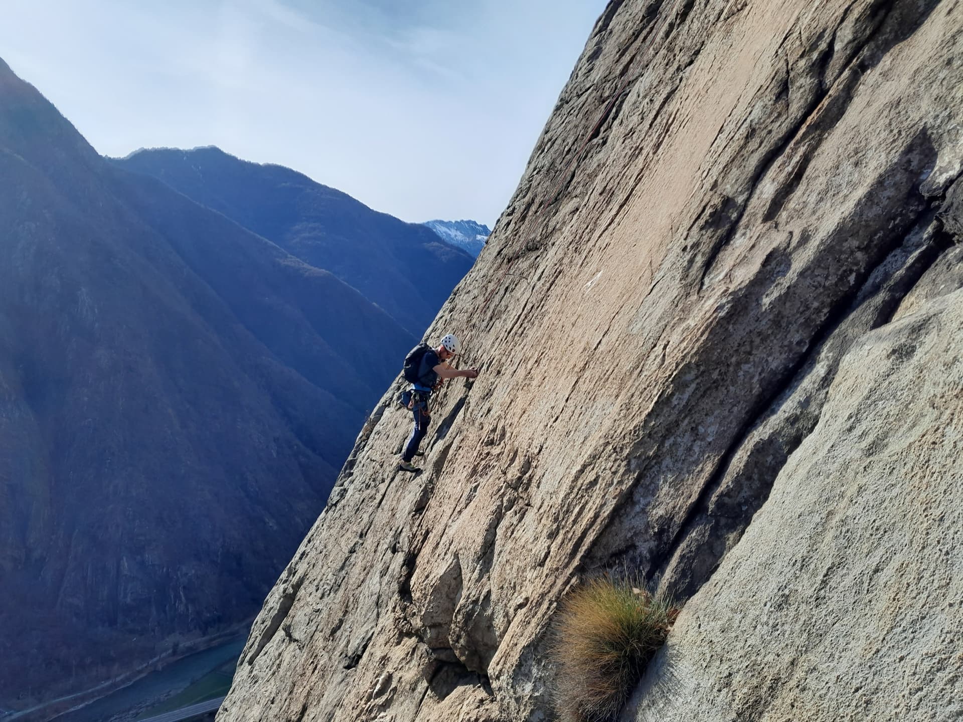
A climber on the sweeping gneiss slab of Bucce d'Arancia on the Paretone di Arnad (Corma di Machaby), with the Dora Baltea valley in shadow far below.

Italy · Aosta Valley

Bucce d'Arancia

This is the most-climbed route on the Paretone. It gives sustained, varied slab and crack climbing on good gneiss, and the hardest moves are a fine crack on P2, a slanting corner and a punchy wall. Queues are common on good days. The Mani Nude guidebook grades it stiffly; camptocamp's Italian page calls it sustained at 5b–5c+ with a single 6a.

6a10 pitches290 m

Read the cautions
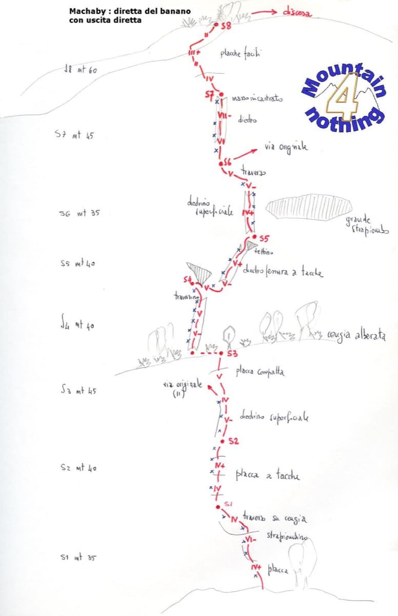
Hand-drawn topo of Diretta al Banano (direct finish), Corma di Machaby

Italy · Aosta Valley

Diretta al Banano

Along with Bucce d'Arancia this is the Paretone's other great classic (first ascent 1977, later retro-bolted). It climbs big, juggy, non-athletic slabs on beautiful rock up the centre of the wall to near the summit. Expect a few metres above the last bolt in places.

5c+9 pitches250 m

Read the cautions

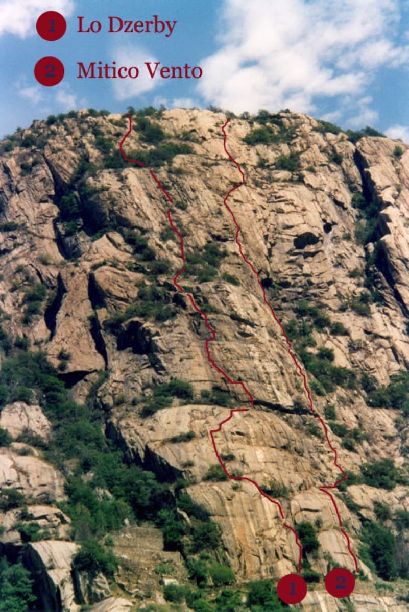
Topo of Lo Dzerby (line 1) and Mitico Vento on the Corma di Machaby, Arnad

Italy · Aosta Valley

Lo Dzerby

A long, easy-angled outing up the full height of the Paretone. A steeper lower half with an exposed pillar on P5 leads to sculpted slabs and broken steps higher up. It's a good first big multipitch.

5c13 pitches400 m

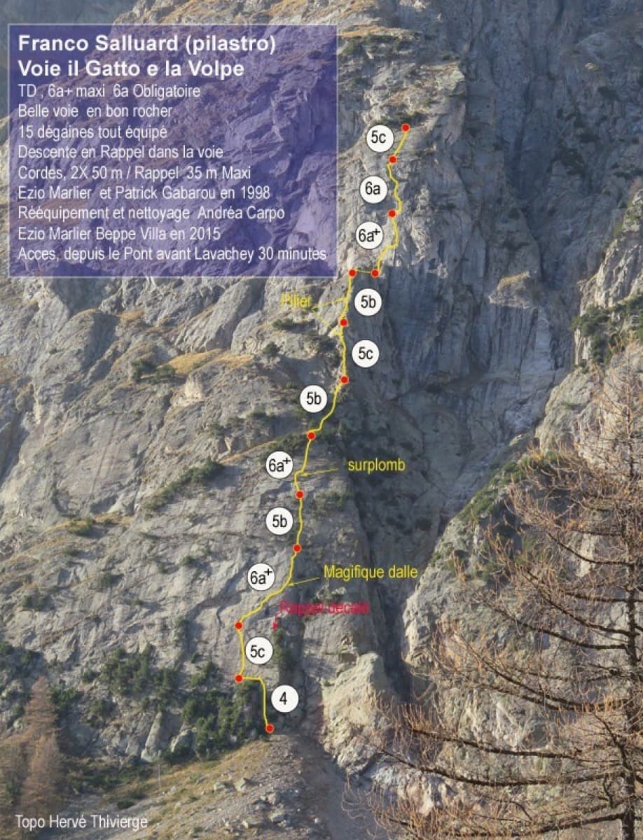
Topo of Il Gatto e la Volpe on the Pilier Franco Salluard, Val Ferret

Italy · Aosta Valley

Il Gatto e la Volpe

Rated 'great' on camptocamp: a wild setting with a short, easy approach from Lavachey. It climbs edgy granite slabs and a pillar crest, with a three-star exposed slab on P9.

6a+11 pitches350 m

Around 5b · about 12 pitches

Similar elsewhere

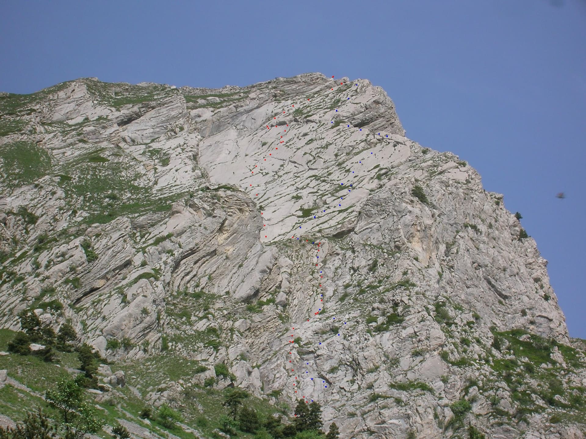
The east face of the Pic de l'Aiguille with two dotted route lines drawn by Serge Luby, one of the equippers. Camptocamp attaches the picture to both À l'aise Gleize and La Barule des Barulots without saying which colour is which.

France · Dévoluy

À l'aise Gleize

Twelve pitches of easy slab on water-worn runnels up the east face of the Pic de l'Aiguille, above Gap, finishing on a summit at 2140 m. Never harder than 5b and mostly 5a, but long: allow four to five hours. The bolts are well placed and spaced, the rock is very grippy, and stonefall from the ledges and from walkers on the summit is the main thing to watch.

5b12 pitches300 m

Read the cautions

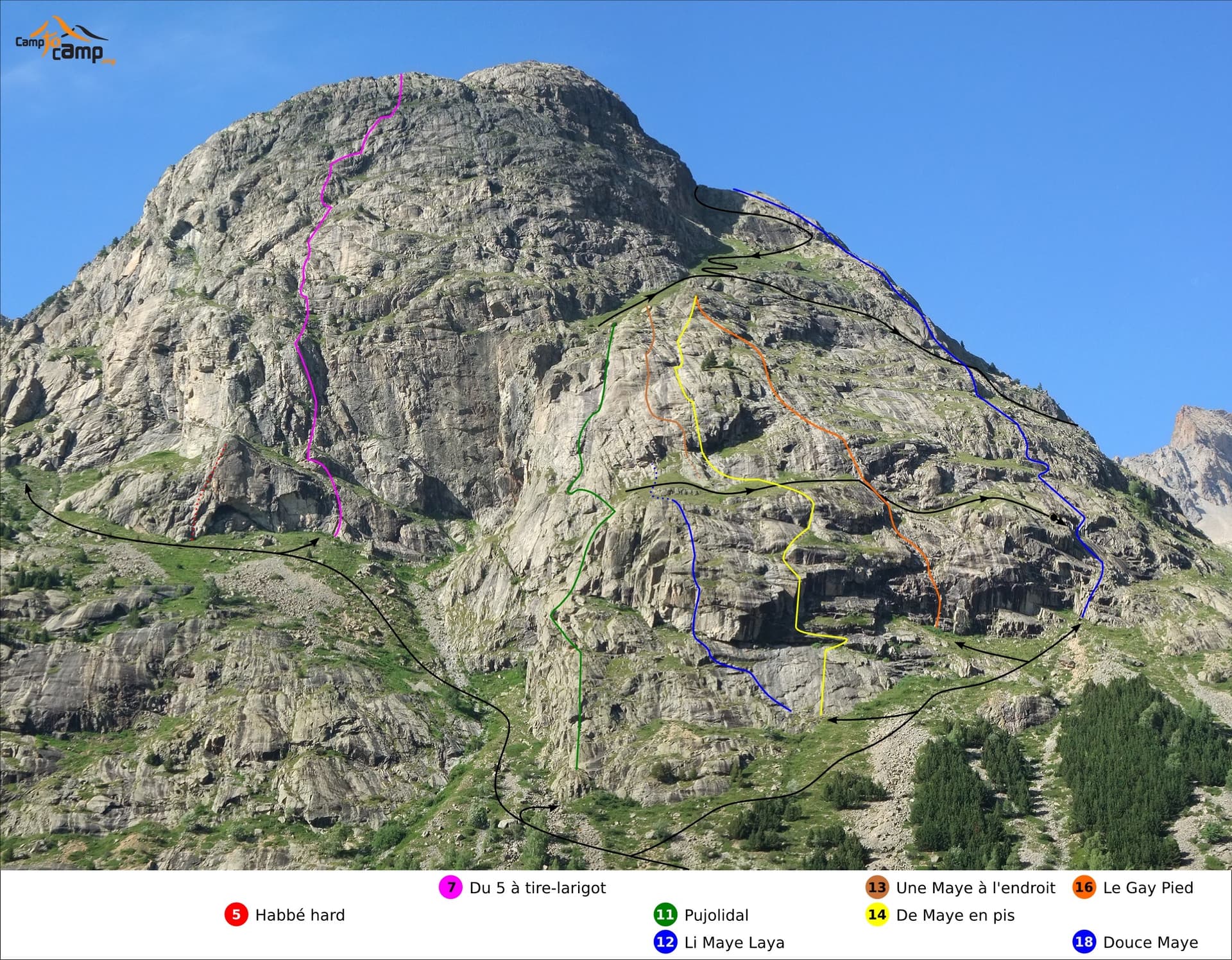
South face of the Tête de la Maye with route lines: Gay Pied is the orange line (16), Douce Maye the blue line on the right (18)

France · La Bérarde (Écrins)

Gay Pied

One of the easiest long routes on the Tête de la Maye: thirteen short pitches of low-angle granite slab, mostly grade 3 to 4, broken by a few steeper steps. The exception is the first pitch, a steep 5a/5b wall that is clearly the hardest and best climbing on the route.

5b13 pitches300 m

Alpe Gorta above Crevoladossola, with the rocky outcrops behind the huts

Italy · Val d'Ossola

Il Solitaire

A long, sunny friction-slab route of about 35 m pitches on excellent rock, ideal for learning footwork. The hardest move is a short crack-and-chimney finish on the last pitch. Allow about 3 h up and 1 h down.

5b13 pitches430 m

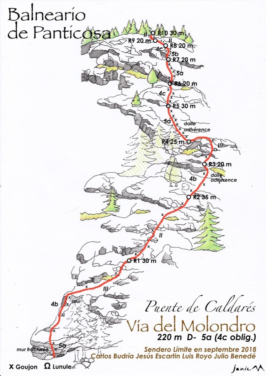
Drawn topo of the Vía del Molondro above the Caldarés bridge, Baños de Panticosa, with bolts and belays marked

Spain · Aragonese Pyrenees (Tena & Canfranc valleys)

Vía del Molondro

Ten short pitches of easy-angled Panticosa granite beside the Caldarés stream, twenty minutes from the car. Mostly friction slabs at 4b to 5a linked by walking-angle ground, with one polished bulge given 5b on the topo. A very gentle first granite multipitch, and a climbing approach to the walls above.

5b10 pitches220 m

Compiled from published sources and last verified October 2026. Bolts, anchors and access change. Climbing is dangerous and you are responsible for your own decisions: check a current topo and read the disclaimer.