Multipitch Atlas

À l'aise Gleize

Pic de l'Aiguille – face est (Col de Gleize) · Dévoluy · France

Read the cautionsBail with caveatsBolting confidence: medium

Twelve pitches of easy slab on water-worn runnels up the east face of the Pic de l'Aiguille, above Gap, finishing on a summit at 2140 m. Never harder than 5b and mostly 5a, but long: allow four to five hours. The bolts are well placed and spaced, the rock is very grippy, and stonefall from the ledges and from walkers on the summit is the main thing to watch.

The east face of the Pic de l'Aiguille with two dotted route lines drawn by Serge Luby, one of the equippers. Camptocamp attaches the picture to both À l'aise Gleize and La Barule des Barulots without saying which colour is which.Photo: Serge Luby · CC BY-SA 3.0

Topo

The east face of the Pic de l'Aiguille with two dotted route lines drawn by Serge Luby, one of the equippers. Camptocamp attaches the picture to both À l'aise Gleize and La Barule des Barulots without saying which colour is which.Photo: Serge Luby · CC BY-SA 3.0
Hardest pitch
5b
Pitches
12
Length
300 m
Approach
50 min
Aspect
E
East-facing
Rope
1×50 m
walk-off
Read before you go

Soundly re-equipped but spaced on easy slabs, with unchained belays and regular stonefall from the ledges and the summit.

The route

Overview

The east face of the Pic de l'Aiguille is a broad sweep of pale limestone slabs at the southern edge of the Dévoluy, reached from the Col de Gleize above Gap. À l'aise Gleize shares its first four pitches with La Barule des Barulots, then slants right for four pitches of slab and runnels to gain the ridge, which it follows to the top. The climbing is homogeneous and friendly, a good first long route for a party that is steady at 5b a little above the bolts. Do not underestimate the length: there are about 430 m of climbing. Some parties find the camptocamp grades generous and say little exceeds 4c apart from a few moves.

The climbing

Pitch by pitch

Pitches of À l'aise Gleize
PitchGradeLengthBoltsNotes
P15b45 m11 bolts5a to 5b, then 4c. Slant up right to a small ledge with two bolts close together on the right, then climb a pillar on the left, where the first bolt is a little hidden. A 'B' with an arrow pointing left marks the continuation of La Barule; a painted pebble with an arrow to the right marks À l'aise Gleize. Straight up to the belay. Manage the rope drag. A direct start above the plaque is sustained grade 6.
P25a30 m4 boltsTraverse a little left on a slab (two bolts), then easy ground straight up. The belay bolts are not linked.
P35b45 m11 boltsA fine easy-angled slab, then a vague corner straight up. Do not go to a lone hanger on the right. The belay is below an earthy step; a second belay 5 m higher is better for what follows.
P43a30 m2 boltsWalk and scramble leftwards through vegetation onto a big terrace (ignore a belay at 15 m), then a little left to the foot of the big slabs, where the belay is a thread and three bolts. The two bolts of La Barule are 10 m to the left. This terrace is exposed to stonefall.
P55a/b25 m–The first of four pitches of slab and runnels slanting right. Camptocamp counts 5 or 6 bolts.
P65a/b35 m–More runnels, 6 or 7 bolts. The belay is well to the left at the end of a short earthy ramp, marked by a bolt and a green arrow. Do not go straight up the small pillar with two old, widely spaced hangers.
P75a/b40 m8 boltsSlab and runnels.
P85a/b30 m8 boltsSlab to gain the ridge.
P95a25 m5 boltsA thin move to leave the ridge on the left.
P104c40 m9 boltsEasier climbing.
P115a43 m–Slightly grassy slab.
P125a42 m4 boltsEasy to a step on the left, which you cross with one 5a move on big holds, then walking. The belay is at the foot of a last short, easy step, which is not protected.

Getting there

Approach

To the parking

From Gap drive up to the Col Bayard on the N85 and take the road to the Col de Gleize (1696 m). The car park is at the col, on the left of the road when coming from the Col Bayard. An alternative start is from the hairpin at about 1570 m on the same road, in front of a barrier at the start of a track.

On foot · about 50 min

From the Col de Gleize follow the track that leaves the col horizontally to the north-east and take the waymarked path via the Chanarette spring, crossing the Lauzon ski tow and a piste. The path joins a dirt track: follow it north for 20 m, then take the path that climbs (very muddy in spring) and crosses the Aiguille ski tow. Continue north to the scree of the Grand Clot, below the east face. Leave the path at an information board about wildlife and follow cairns and a well-worn track up the scree, finishing up its true right side and traversing level to the first bolts. The start is 10 m left of a memorial plaque under the big slab, shared with La Barule des Barulots: the inscription 'Les Barulots' and a painted pebble with the route name mark it. Parties take 40 to 50 minutes; camptocamp gives 45 minutes to 1 h 30 depending on the start.

Map of the walk-in

  • Crag
  • Parking

Loading map

The point marks the crag, not the exact start of the route.

Coordinates · crag

44.64088, 6.04867

Parking

44.62250, 6.04806

Col de Gleize car park (camptocamp waypoint 214492)

Point from camptocamp waypoint 40035 (Pic de l'Aiguille summit)

For your phone or watch

Download GPX

Contains the route point and parking. Opens in most mapping apps and GPS watches.

Points are compiled from published sources, with the precision stated above. They were not surveyed on the ground: check them against a current topo.

Getting down

Descent

From the summit follow the south ridge on a track with easy but airy and sometimes exposed passages to a small saddle at 2101 m between the Aiguille and the Pic de Gleize. Take the left-hand path straight down to the Col de Gleize (the right-hand one goes over the Pic de Gleize). If you started from the 1570 m hairpin, descend the east side on tracks and grass to rejoin the approach. Parties take 50 minutes to an hour.

Retreat

Bailing off the route

Bail with caveats

Camptocamp says the belays are mostly linked but not equipped for abseiling, with a few maillons in place. Retreat therefore means abseiling from bolted belays and leaving your own gear, and pitches of up to 45 m need two ropes. No source describes an escape on foot from the face.

Retreat from
Any belay, leaving a maillon or cord. The big terrace after pitch 4 is the obvious place to decide.
Point of no return
Not documented. From pitch 8 you are on the ridge and the remaining pitches are 4c to 5a, so going up is likely to be simpler (inferred).
Carry
Two 50 m ropes to abseil pitches of 40 to 45 m, plus maillons and cord.
Basis
Part stated, part inferredThe state of the belays is stated on camptocamp; the rope requirement and the advice about the ridge are inferred from the pitch lengths and grades.

Partly inferred from the route facts

Safety

Hazards

  • Stonefall. Walkers on the summit and ropes dragged across the ledges send stones down the face; parties in 2024, 2025 and 2026 each saw volleys fall, mostly onto the slabs of La Barule to the left. The comfortable terrace belay after pitch 4 is in the firing line.
  • Loose stones on the ledges of pitches 1 to 4: an August 2025 party dislodged a whole terrace of blocks on pitch 4.
  • The bolts are spaced and the belays are not rigged for abseil.
  • Rope drag on pitch 1 and off-route hangers on pitches 3 and 6.
  • The descent ridge has exposed passages and the last step to the summit is unprotected.

Sun and weather

Conditions

East to south-east facing, from about 1840 m to 2140 m, in the sun all day in summer and sheltered from the wind on the first six pitches. It gets warm on the rock by late morning. Reports run from mid-May to early November; the approach path is muddy in spring.

Usual season · May to Oct

Sun on the wall · E-facing

Working out the sunlit hours for this month.

  • January: not yet worked out
  • February: not yet worked out
  • March: not yet worked out
  • April: not yet worked out
  • May (usual season): not yet worked out
  • June (usual season): not yet worked out
  • July (usual season): not yet worked out
  • August (usual season): not yet worked out
  • September (usual season): not yet worked out
  • October (usual season): not yet worked out
  • November: not yet worked out
  • December: not yet worked out

Sun on the wallDaylight, wall in shade● Usual season

Estimated from the wall's aspect only. Ignores surrounding terrain, gullies and the wall's exact shape. Clock times are local to the wall (Central European time), for the 15th of each month.

Climate figures for Dévoluy are not available yet

What to carry

Gear

11 quickdraws, not counting extenders and belays, and a 50 m single rope (or 2×50 m). Take slings or cord for the belays, which are not chained. With more quickdraws a confident party can move together on the easier pitches.

Checklist

Quickdraws
11
Rope
1×50 m (walk-off)
Helmet
One each
Maillons or spare karabiners
To leave behind if you retreat
Cord
Mentioned for retreat

Derived from the route data; check it against a current topo

From climbers

Reader reports

Reader reports are not being collected yet. Until they are, check a current topo and the local club or guidebook publisher for recent changes to À l'aise Gleize.

Worth knowing

Tips

  • Parties report 4 to 5 hours on the route; start early to be off before afternoon heat or storms.
  • Belay at the higher of the two anchors after pitch 3: it makes the walk across the terrace simpler.
  • A logbook is kept in a cairn at the top.

Open questions

Where sources disagree

  • Grades: camptocamp gives 5a/b for most pitches; an August 2025 party thought nothing really exceeds 4c apart from a few moves, with the start perhaps the hardest part.
  • Bolting: camptocamp says the bolts are spaced and a June 2026 party agrees; parties in August and September 2025 call the route very well equipped.
  • Approach time: 45 minutes to 1 h 30 on camptocamp; 40 to 50 minutes from the Col de Gleize in 2025 and 2026 reports.
  • The grimper.com page linked from camptocamp for this crag could not be opened, so the record rests on camptocamp and its trip reports.

Provenance

Sources

Same area

More in Dévoluy

All routes in Dévoluy
The Petite Roche wall at Les Gillardes seen from the foot of the face; Les Maîtres du Jeu climbs it, the line is not marked.

France · Dévoluy

Les Maîtres du Jeu

A recent line that has quickly become the friendly way to discover Les Gillardes: 350 m of vertical walls on flint edges, with fair grades and reassuring bolts on a cliff known for neither. Long, continuous pitches of 6b and 6b+, one of 6c, and a conglomerate finish.

6c13 pitches350 m
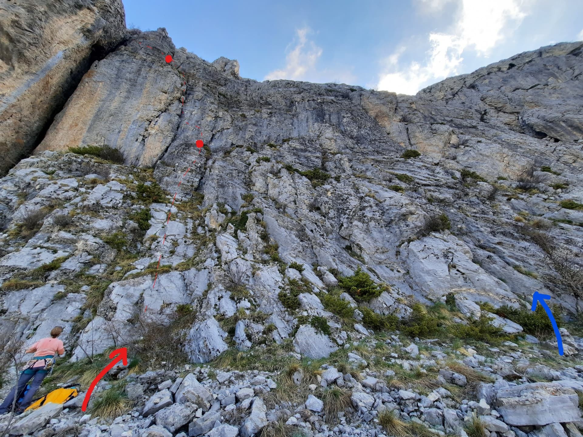
The foot of the south-west face of Pic Crillon. The blue arrow marks the start of Pas Gicon que ça (Gic'N'Roll); the red arrow and dots are its neighbour Gicon d'agneau.

France · Dévoluy

Pas Gicon que ça

Also known as Gic'N'Roll. A long, varied line up the south-west face of Pic Crillon, with the whole Dévoluy as a backdrop: flint-studded walls, a chimney, a fine layback corner and an airy spur, linked by easier and sometimes grassy pitches. By the easier variants it is a steady 5c outing; the original lines on pitches 6 and 10 add two 6a+ sections. You can walk off after pitch 8.

6a+11 pitches220 m

Read the cautions

Le Rêve de Noémie drawn in red on the Gicons cliff, following the big slanting crack-chimney, with the belays marked

France · Dévoluy

Le Rêve de Noémie

Six closely bolted pitches beside the great diagonal crack-chimney that splits the Gicons cliff, visible from the car park. Four pitches at about 5b on very grippy limestone lead to a crux where you either cross the chasm on two moves of 6b (or with the aiders in place) or climb the corner at 6a. Short, shaded until midday, and a good introduction to the Dévoluy.

6b6 pitches150 m

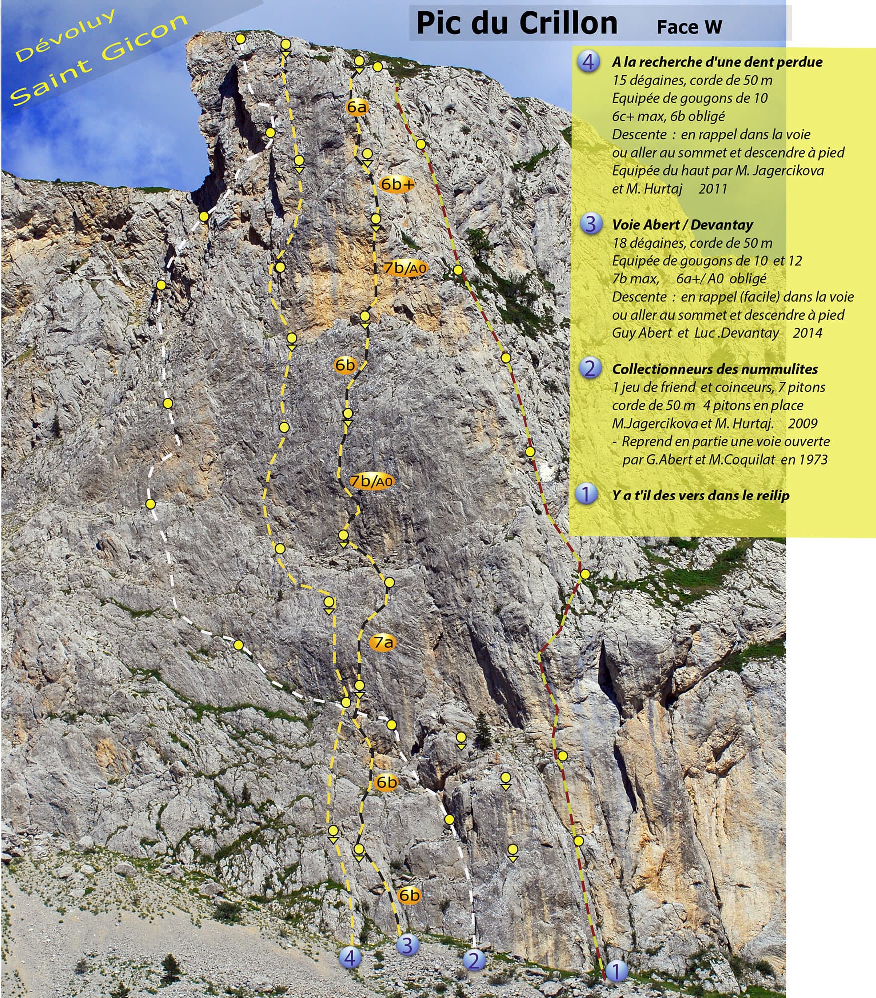
Photo-topo of the west face of Pic Crillon by Guy Abert. À la recherche de la dent perdue is line 4; the orange grade labels belong to line 3, the Abert-Devantay.

France · Dévoluy

À la recherche de la dent perdue

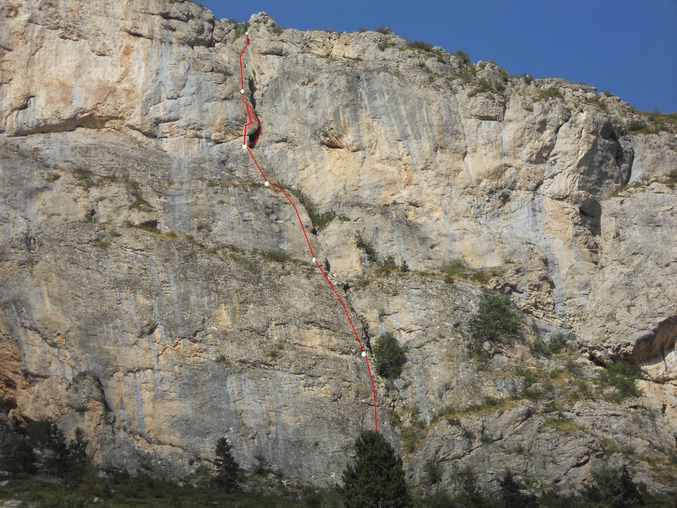
Steep, technical wall climbing up the west face of Pic Crillon on heavily sculpted limestone: seven pitches between 6a+ and 6c+ after an easy start, with good holds and rests but little that can be aided. It stays in the shade until early afternoon, so it works in a heatwave. Come with a 6c level to enjoy it; 6b is obligatory.

6c+9 pitches250 m

Around 5b · about 12 pitches

Similar elsewhere

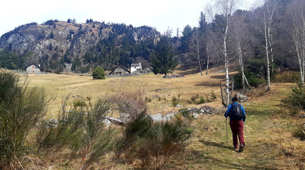
Alpe Gorta above Crevoladossola, with the rocky outcrops behind the huts

Italy · Val d'Ossola

Il Solitaire

A long, sunny friction-slab route of about 35 m pitches on excellent rock, ideal for learning footwork. The hardest move is a short crack-and-chimney finish on the last pitch. Allow about 3 h up and 1 h down.

5b13 pitches430 m

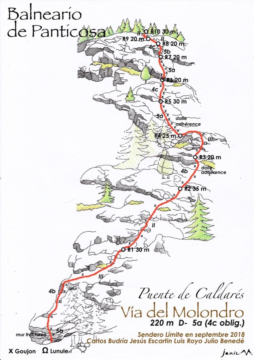
Drawn topo of the Vía del Molondro above the Caldarés bridge, Baños de Panticosa, with bolts and belays marked

Spain · Aragonese Pyrenees (Tena & Canfranc valleys)

Vía del Molondro

Ten short pitches of easy-angled Panticosa granite beside the Caldarés stream, twenty minutes from the car. Mostly friction slabs at 4b to 5a linked by walking-angle ground, with one polished bulge given 5b on the topo. A very gentle first granite multipitch, and a climbing approach to the walls above.

5b10 pitches220 m

The Pointe Percée above the limestone pavement of the Gramusset plateau, seen from the north-west; Le sirop pour machin starts from the crags near the hut and finishes on the summit, the exact line is not marked.

France · Aravis

Le sirop pour machin

An introduction to mountain multipitch that tops out right under the summit cross of the highest Aravis peak. Grippy fluted limestone is linked by cairned walking sections, and the last pitches are the best.

5b+11 pitches400 m

The south side of the Aiguille d'Orny above the scree slope of the approach

Switzerland · Orny (Champex, Mont Blanc massif)

La Moquette

Nine pitches up a granite spur and the final tower of the Aiguille d'Orny to a 3150 m summit, on rough, cracked rock with superb friction. Two moves of 5b, the rest 4b and 4c, closely bolted since 2016 and easy enough to climb in boots. The three steep pitches on the summit tower are the highlight.

5b9 pitches250 m

Compiled from published sources and last verified October 2026. Bolts, anchors and access change. Climbing is dangerous and you are responsible for your own decisions: check a current topo and read the disclaimer.