Menu

Les Amants de Saint Jean

Pont Saint-Joseph · Annot · France

Read the cautionsBail with caveats

A short, homogeneous and varied 6a/6b route on Verdon-like limestone right above the RN 202 near Annot. Arête, a wild traverse, corners, cracks and technical walls, with a walk midway to a detached pinnacle called the menhir. Very well bolted and close to the road.

Climbing mode: Big type, screen kept awake, tick pitches as you go.

Hardest pitch
6b+6b+
Pitches
8
Length
200 m
Approach
15 min
Aspect
SW
South-west-facing
Rope
2×35 m
(70 m) for the abseils; 2×40 m is ideal

Highest point 925 m above sea level (camptocamp route 936561).

Rock
limestone
Season
Feb to May, Oct to Dec
Bolting confidence
High
Last verified
October 2026 · Aggregated by AI from published sources
Read before you go

The route itself is very well bolted, but the exposed descent path relies on fixed ropes reported rotten in 2021 and damaged in 2025.

Photo

Climbing modeBig type, screen kept awake, tick pitches as you go.

Overview

Les Amants de Saint Jean climbs the limestone pillar above the Pont Saint-Joseph, on the RN 202 a few kilometres from Annot. It was opened from the ground up in March 2014 by Marie Line Madelaine and Lionel Catsoyannis, the first equipped multipitch in the sector. Eight short pitches stay consistently in the 6a to 6b+ range, with a walk of about 60 m between pitches 5 and 6. Every report praises the rock and the bolting, and the openers stress that it is easy to get back to the ground if you turn round.

Worth knowing

  • Pitches 2 and 3, 4 and 5, and 6 and 7 can be linked, at the cost of losing sight of your second.
  • The chimney on pitch 6 is awkward with a rucksack; one 2021 climber went round outside it on the left.
  • The single-pitch Saint-Jean crag nearby is reached from the same path.

Pitch by pitch

The atlas doesn't show topos: they are the work of the people who bolt and document these routes. See the topo at Camptocamp – topo photo, or in Escalade à Annot (topo leaflet, 2015).

Pitches of Les Amants de Saint Jean
PitchGradeLengthBoltsNotes
P16a+40 m9 boltsStart in some scrub and climb the west arête of the pillar. The rock looks shattered but has been well cleaned and the holds are solid. A steep, sustained section with one or two boulder moves at the end leads to an unlinked two-bolt belay on the ledge to the right. A 2021 party notes that you climb a little between the bolts.
P26a20 m7 boltsA fine, exposed traverse right, well bolted, using a few juniper bushes as holds.
P35c20 m6 boltsStart right, then straight up a vertical wall on good holds to the top of a spike, then descend rightwards to the belay. About 15 quickdraws if you link pitches 2 and 3.
P46b+35 m12 boltsA crack-corner, easy at first, then a hard move and a technical, sustained finish.
P56b+20 m6 boltsA steep wall rising right (not too hard), then a sustained section straight up to the belay on a ledge. Then walk about 60 m right to the foot of a monolith, the menhir; the fixed ropes there are for the descent, so continue straight above.
P66a20 m6 boltsA fairly wide crack-corner leads to a chimney-crack. The bolt is inside the chimney: squeeze in, or bridge outside with your shoulder on the outer flake. Belay on top of the menhir.
P76a+25 m7 boltsA tricky start, then a fine ramp-corner with a thin slab move, then trend left to the belay.
P85c25 m–A wall with good holds; test them, as the rock is less sound here. Belay on a small wall at the end of a ledge.

Approach

To the parking

Annot is just off the RN 202 between Digne and Nice and has a station on the Chemins de fer de Provence line. Park in the car park just downstream of the Pont Saint-Joseph on the RN 202.

On foot · about 15 min

About 15 min. Do not walk along the road to the bridge. From the car park go up the small ravine on a faint path, which starts at the seventh crash-barrier post counted from the road (overgrown in June 2025). It soon climbs steeply right, then traverses across the slope to come out just above the rockfall nets. At the second post holding the netting, go up 15 m to the foot of a small pillar (arête) where the route starts. An old paved mule track (via romana) also climbs towards the cliff: that is the way back.

Map of the walk-in

Point from camptocamp waypoint 1782364 (Pont Saint Joseph)

For your phone or watch

Download GPX

Contains the route point and parking.

Points from published sources, not surveyed.

Descent

From the top, cross the crest and go down the north side on a path with fixed ropes (exposed; the ropes were described as rotten in 2021 and damaged in June 2025) to the first abseil station. Abseil 30 m down a steep wall; the next station is just to the right behind a juniper. Abseil 35 m, free-hanging, to near the top of pitch 5. Traverse left (facing out) to the fixed ropes at the foot of pitch 6, which lead to the third station, and abseil 40 m past newer single-pitch routes. Then do not follow the foot of the wall: traverse left across the slope to the end of the spur to find the old paved mule track back to the start.

Bailing off the route

Bail with caveats

The openers say it is easy to get back to the ground if you turn back. The belays are two unlinked bolts, so you would need to leave a maillon or cord to abseil, and the 20 to 40 m pitches need the abseil ropes you carry for the descent. Above pitch 5 the abseil descent line itself is close by, via the fixed ropes at the foot of pitch 6.

Retreat from
Any belay, leaving your own gear on the two-bolt stations; from the menhir ledge, the third descent abseil (40 m).
Point of no return
None.
Carry
Ropes for 40 m abseils (2×35 m minimum, 2×40 m ideal), maillons or cord to link the belay bolts.
Basis
Part stated, part inferredEasy retreat is stated by the openers; the unlinked-belay detail is stated; using the descent line from the menhir ledge is inferred from the descent description.

France

In an emergency

In an emergency · France

112Emergency; sends PGHM or CRS mountain rescue

Call 112

Emergency; sends PGHM or CRS mountain rescue

Position of the crag

43.94002, 6.69217

Marks the crag, not the route: give route and pitch.

Say what happened, how many are hurt, and where you are. Checked October 2026 (source).

Hazards

  • The fixed ropes on the exposed descent path were described as rotten in 2021 and damaged in June 2025; check them before trusting them.
  • Test holds on the last pitch.
  • The cliff is directly above the RN 202, protected by rockfall nets: take care not to dislodge stones.
  • The approach path was overgrown in June 2025.

Gear

12 quickdraws (15 if you link pitches), 2 or 3 60 cm slings to extend runners against rope drag, material to build belays on the unlinked two-bolt stations, and ropes for 30 to 40 m abseils. The openers' French gear list says cams are hard to place in this rock, the Spanish one that nuts are useless, and both call the route fully equipped. A 2018 party suggests a few extenders.

Checklist

Quickdraws
12
Rope
2×35 m (70 m) for the abseils; 2×40 m is ideal
Helmet
One each
Abseil device and prusik
For abseiling
Maillons or spare karabiners
To leave behind if you retreat
Cord
Mentioned for retreat

Conditions

Plan B nearby

  • ShorterAylan6b+5 pitchesfaces S18 km away

Straight-line distances, up to 30 km.

Reader reports

No reports yet.

Report a problem with this route

Say what and where. Reports are checked before they appear; no name or email is stored.

Bolts and history

Bolting
Bolted ground up in 2014 by the openers; 6 to 12 bolts per pitch and two-bolt belays, not linked. Parties in 2018, 2019 and 2021 describe the bolting as excellent and the route as not committing; the openers call it fully equipped, and their gear list says cams are hard to place in this rock and nuts are useless. No bolt count is given for pitch 8.
History
Opened from the ground up by Marie Line Madelaine and Lionel Catsoyannis in March 2014, the first equipped multipitch in the sector. The camptocamp description was supplied by the openers.
Guidebook
'Escalade à Annot' is linked to the route on camptocamp; whether it includes this route is not stated. Buy from Annot village shops.

Where sources disagree

  • Grades on the camptocamp photo-topo differ from the text: pitch 1 is 6b (30 m) instead of 6a+ (40 m), pitch 4 is 25 m, and pitch 6 is 6a+ instead of 6a. A 2018 party agreed pitch 1 is 6a+. The text is used.
  • Rope: the French gear list says a 50 m abseil rope, the remarks 70 m (2×35 m), and the Spanish text 2×40 m as ideal; the abseils are 30, 35 and 40 m (about 35 m on the topo for the last), so a single 50 m rope is not enough.
  • Length: 200 m of height; the pitch lengths add up to 205 m.

Sources

Around 6b+ · about 8 pitches

Similar elsewhere

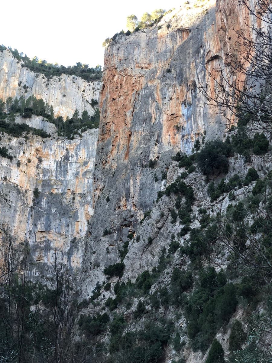
The walls of the Barranco de la Maimona at Montanejos, photographed on an ascent of La Luna.

Spain · Montanejos

La Luna

Eight pitches up a vertical prow deep in the Maimona canyon, on orange rock full of pockets (agujeros means holes). Sustained at 6a+ to 6b and physical throughout, with a huge roof start to the crux pitch and a bench to sit on at the third belay. Closed from January to June.

6b+6b+8 pitches235 m

Read the cautions

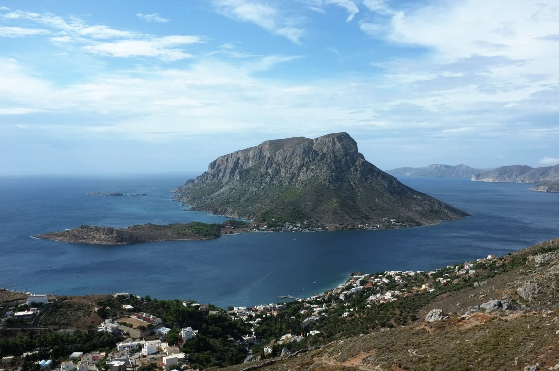
Telendos seen from the hillside above Kamari on Kalymnos, with the long band of cliffs on the south side of the island above the village. De Charybde en Scylla is on the south face; its line is not pointed out.

Greece · Kalymnos & Telendos

De Charybde en Scylla

A sustained wall climb on the Telendos south face, seven pitches of 6a to 6b+ on very sharp, sculpted limestone with a short walk between the second and third. It needs route reading and tough skin. The line stays in the shade longer than its neighbours, until about 11:30.

6b+6b+8 pitches215 m

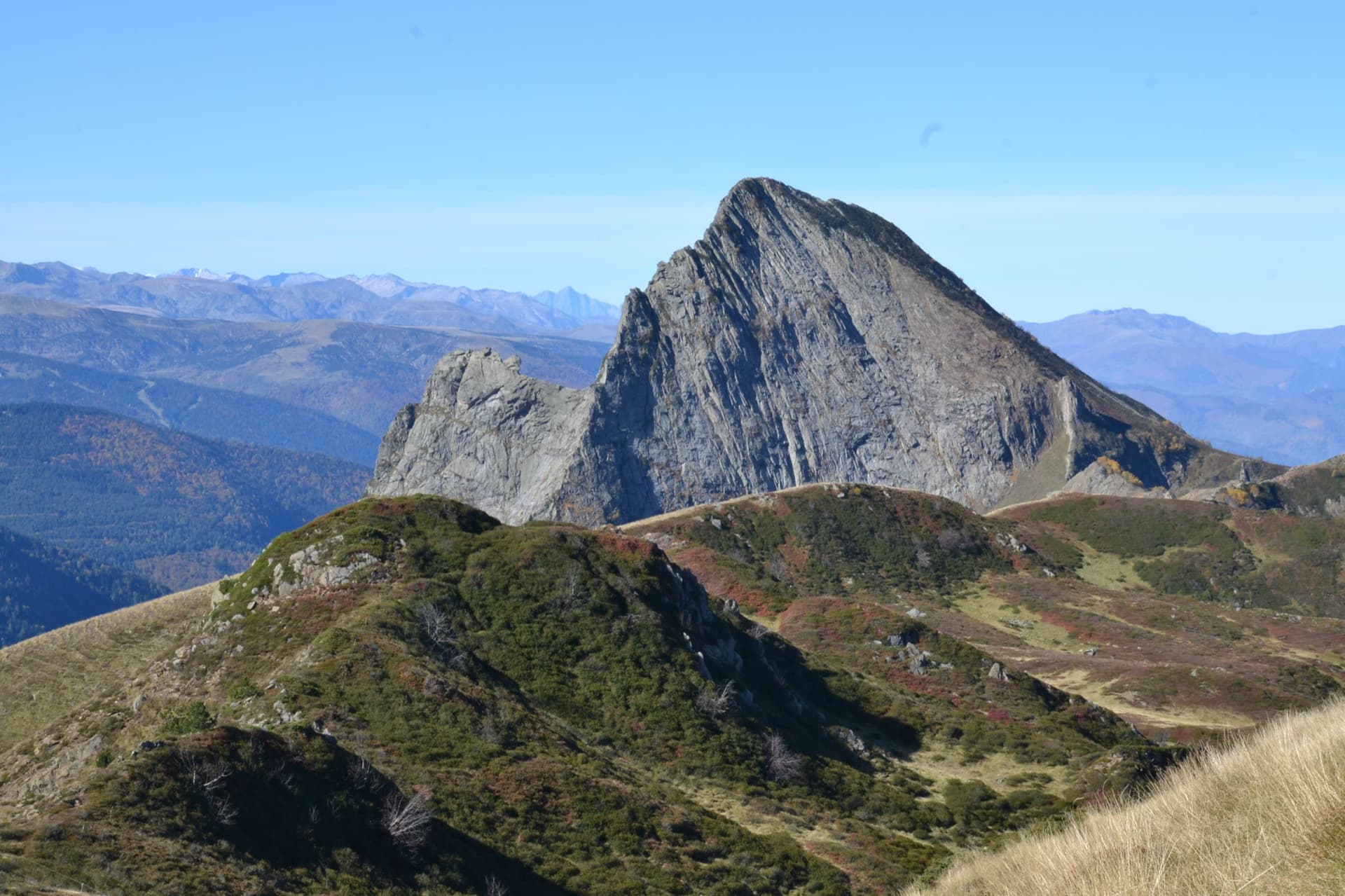
A view of the region, not this route's wall. The east face of the Dent d'Orlu, a sweep of striated gneiss slabs, seen from the Col de l'Egue; Pink Floyd climbs this face, the exact line is not marked.

France · Ariège Pyrenees

Lisa

The finest line on the big grey slabs of the Peppermint sector, a notch harder than Peppermint itself. A reachy 6b+ move and a chimney-corner start the day; a ledge splits the wall; the two pitches above it, a corner and a thin, sustained 6b slab, are the highlight.

6b+6b+8 pitches280 m

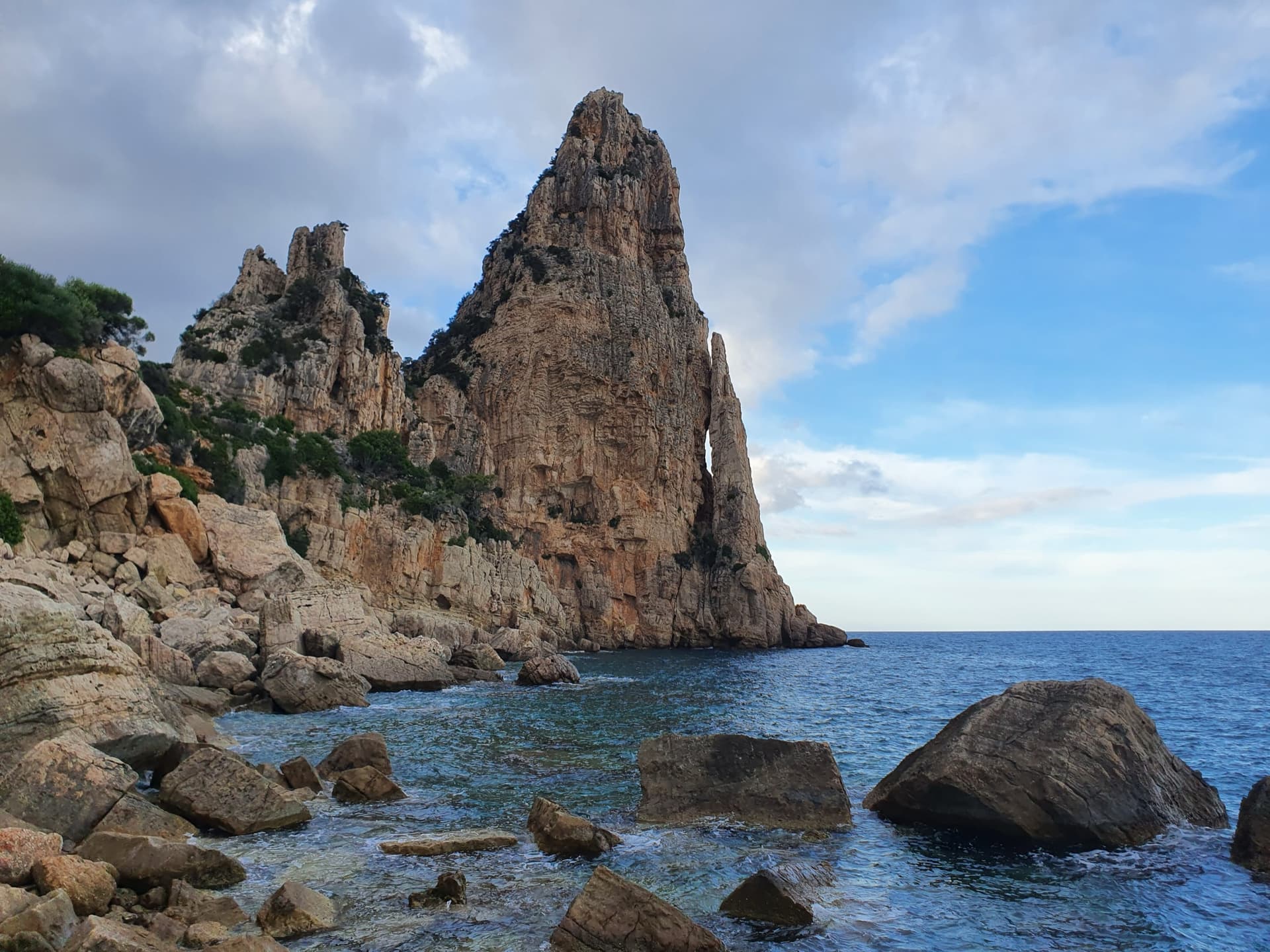
Pedra Longa, the 128 m limestone tower on the Baunei coast, seen from the shoreline rocks at its foot.

Italy · Sardinia

Cromosomi Corsari

A sea-level start reached by abseil, then seven short pitches up the seaward face of Pedra Longa. The third pitch is a wildly exposed traverse above a line of roofs; two easy pitches on rock that needs care lead to a technical 6b and 6b+ finish on grey slab.

6b+6b+7 pitches175 m

Researched and aggregated by AI from published sources, last compiled October 2026. It can be wrong, and bolts, anchors and access change: check a current guidebook and read the disclaimer.