Multipitch Atlas

Tike Saab

Paretone di Arnad / Corma di Machaby (Arnad) · Aosta Valley · Italy

Bail with caveatsBolting confidence: medium

One of the most approachable lines on the Paretone and one of its best: ten pitches of sculpted gneiss slab, sustained at about 5c, with two steeper passages. The third pitch has one 6a move out of a slot and the sixth climbs two small overhangs at 6a+. Both are closely bolted and go at about 5c with a pull on a quickdraw.

Photo-topo of Tike Saab on the Corma di Machaby above Arnad, with pitch grades and the walk-off markedPhoto: Hervé Thivierge · CC BY-SA 3.0

Topo

Photo-topo of Tike Saab on the Corma di Machaby above Arnad, with pitch grades and the walk-off markedPhoto: Hervé Thivierge · CC BY-SA 3.0
Hardest pitch
6a+
Pitches
10
Length
280 m
Approach
30 min
Aspect
S
South-facing
Rope
1×60 m
walk-off

The route

Overview

Tike Saab takes the lowest point of the big south face of the Corma di Machaby, just left of Bucce d'Arancia, and climbs it in ten pitches to the top. Most of it is slab climbing on small edges at 5b to 5c, on rough, water-sculpted gneiss. The two harder pitches are short steep steps: a slot or shallow corner on pitch 3 and a pair of overhangs on pitch 6. It shares a wooded ledge and belay with Bucce d'Arancia after pitch 4, and the two lines run side by side higher up, so check which bolts you are following. The name is a greeting used by Pakistani porters.

The climbing

Pitch by pitch

Pitches of Tike Saab
PitchGradeNotes
P15b+Straight up the slab from the plaque, looking for the easiest line on small edges. Easy to start, with a few moves and longer gaps between bolts higher up. Camptocamp gives nearly 50 m; gulliver.it gives 30 m.
P25cStraight up from the belay on a black, sculpted slab, keeping slightly right, to a belay below a slightly overhanging corner. Do not drift right into the crack of Bucce d'Arancia or left onto a harder slab pitch of Spit Trip. A faded painted name on the rock here is misleading: follow the central line of bolts.
P36aEasy at first, then move right to a vertical wall cut by a slot that forms a kind of corner. One athletic move gets you established on the far side, then the slab on the right leads to the belay. Goes at 5c+ with a point of aid.
P45a+Short and easy: up a small arete to its end, then about ten metres of path to the belay on the ledge. This belay is shared with Bucce d'Arancia.
P55cA plaque shows the way. Keep left of the corner on a technical slab that steepens but has good holds. One bolt sits right under a tree and can be hard to reach when the vegetation is thick; in that case use the first metres of Bucce d'Arancia, which starts from the same belay.
P66a+The key pitch and the best one. Steep from the belay, then a slightly overhanging wall that needs a few athletic moves (there is a good hold out left). Above, go right to a flared, water-polished corner and a second small roof, then easy ground to the belay. The bolts are close here and it goes at 5c with aid.
P75cSlightly rightwards up the slab to a comfortable belay.
P85c+The small slab above the belay, then a short vertical wall climbed on small footholds.
P95aFlakes on the left, then more holds and easier ground to a very comfortable ledge. The bolts out right belong to Bucce d'Arancia.
P103Easy rock steps and a short, well-featured wall to the last belay. Pitches 9 and 10 can be linked with a 60 m rope.

Getting there

Approach

To the parking

Arnad is in the lower Aosta Valley. Leave the Torino to Aosta motorway at Pont-Saint-Martin (or Verrès if you come from the north) and follow the main road. The face is obvious above the flat ground about 1 km east of Arnad, just after the fort of Bard if you come from the south. There are small parking places at the foot of the face; a July 2025 party used the half-dozen spaces just past the Osteria l'Arcade on the SS26. A second access is from the car park below the Machaby sanctuary on the north side of the hill, reached by the side road signed 'Machaby'.

On foot · about 30 min

From below, about 30 min. From the small parking follow the path marked with red paint, signed 'Machaby' at the start. It is steep, with a few fixed ropes. About five minutes in, the path forks right; a 2025 party missed this and ended up on poor rock until they rejoined the fixed ropes. The path comes to the foot of the wall, where the routes are named on small plaques. Tike Saab starts a few metres left of where you arrive, at the lowest point of the face, below a fine slab. Note that there are some short single-pitch routes at the base. From the Machaby side (about 30 min): cross the bridge, walk up the cobbled track past the church to the agriturismo, follow the dirt road, and where it bends left beyond a ruined building take the path straight on. Keep right at junctions and descend the steep path beside the wall to its foot.

Map of the walk-in

  • Crag
  • Parking

Loading map

The point marks the crag, not the exact start of the route.

Coordinates · crag

45.63498, 7.73580

Parking

45.63457, 7.72929

Arnad (camptocamp access point 189739)

Point from camptocamp waypoint 39748

For your phone or watch

Download GPX

Contains the route point and parking. Opens in most mapping apps and GPS watches.

Points are compiled from published sources, with the precision stated above. They were not surveyed on the ground: check them against a current topo.

Getting down

Descent

On foot, about 45 min to the lower parking. From the last belay join a path on the right that leads to the top of the Corma, then follow the good path down the far side to the half-abandoned hamlet of Machaby. Pass the Machaby fort by a stone staircase and follow the signs for 'Parcheggio' to the right (yellow arrows and red dots). This path drops steeply beside the wall and is equipped with ropes and ladders. A gentler alternative is the old mule track on the north side, past the sanctuary to the upper car park, followed by a long walk along the road; a March 2026 party preferred it and lost little time. If you approached from the Machaby side, the agriturismo is only a few minutes from the top.

Retreat

Bailing off the route

Bail with caveats

You can abseil off. Camptocamp says the route is also equipped for abseiling and the belays are not far off line, and Scuola Guido della Torre says every belay has a ring. The catch is rope length: the route is normally climbed on a single rope and the first pitch is close to 50 m, so a single rope will not get you back to the ground from the first belay.

Retreat from
Any belay. The ledge after pitch 4 is wooded and shared with Bucce d'Arancia, but no source describes a way off it on foot.
Point of no return
None stated. Above pitch 6 the climbing eases and finishing is usually quicker than descending.
Carry
Two ropes if you want to be sure of abseiling every pitch; with one 60 m rope you would need intermediate anchors on the longest pitches, which are not documented.
Basis
Part stated, part inferredAbseil equipment is stated by camptocamp and the Scuola; the two-rope advice is inferred from camptocamp's length for the first pitch.

Partly inferred from the route facts

Safety

Hazards

  • Bolts are well spaced by sport-climbing standards on the easier slab pitches. Parties in 2026 say you must be comfortable climbing above your protection, and that the grades feel stiff (the 6a+ pitch has been called closer to 6b).
  • On pitch 5 a bolt was reported missing in 2011 and still in 2013, which makes that section a little bolder. No later report mentions it, so its present state is not known.
  • Several lines share belays or run close together (Bucce d'Arancia, Spit Trip). Taking the wrong line on pitch 2 puts you on a 6b slab.
  • The descent path beside the wall is steep, with fixed ropes and ladders, and is unpleasant when wet.
  • A very popular route: expect other parties above you at weekends.

Sun and weather

Conditions

South facing at low altitude, between about 400 and 800 m. Scuola Guido della Torre calls it climbable all year; in winter the face gets the sun from mid-morning. It is hot in summer: a July 2025 party chose a day with light cloud and a breeze. After heavy rain the first pitch can be wet and seepage lines appear higher up (April 2025). Allow 3 to 4 hours for the climb. The valley motorway and main road run directly below, so expect traffic noise.

Usual season · Feb to Jun, Sep to Nov

Sun on the wall · S-facing

Working out the sunlit hours for this month.

  • January: not yet worked out
  • February (usual season): not yet worked out
  • March (usual season): not yet worked out
  • April (usual season): not yet worked out
  • May (usual season): not yet worked out
  • June (usual season): not yet worked out
  • July: not yet worked out
  • August: not yet worked out
  • September (usual season): not yet worked out
  • October (usual season): not yet worked out
  • November (usual season): not yet worked out
  • December: not yet worked out

Sun on the wallDaylight, wall in shade● Usual season

Estimated from the wall's aspect only. Ignores surrounding terrain, gullies and the wall's exact shape. Clock times are local to the wall (Central European time), for the 15th of each month.

Monthly climate averages for Aosta Valley, 1991-2020
MeasureJanFeb (usual season)Mar (usual season)Apr (usual season)May (usual season)Jun (usual season)JulAugSep (usual season)Oct (usual season)Nov (usual season)Dec
Mean daily high °C−20371117202016103−1
Mean daily low °C−8−8−5−148111172−4−8
Rain days 1 mm or more121112131616151312121312

● marks the usual climbing season. Averages for 1991-2020 at about 1489 m. Area climate from Open-Meteo reanalysis. Temperatures are adjusted to the height of the crag; rain comes from a grid cell of about 10 to 25 km, and summer highs on sea cliffs can read a few degrees low. The wall and valley can differ. Data: Open-Meteo, CC BY 4.0.

What to carry

Gear

12 quickdraws. A single 60 m rope is enough because you walk off; Hervé Thivierge's topo lists a 50 m rope, but camptocamp gives the first pitch as nearly 50 m, so 60 m is the safer choice. Cams and nuts are not needed. Helmet, and good shoes for the descent path.

Checklist

Quickdraws
12
Rope
1×60 m (walk-off)
Helmet
One each

Derived from the route data; check it against a current topo

From climbers

Reader reports

Reader reports are not being collected yet. Until they are, check a current topo and the local club or guidebook publisher for recent changes to Tike Saab.

Worth knowing

Tips

  • Both hard passages (pitch 3 and pitch 6) can be aided on the bolts, which brings the obligatory grade to about 5c. Gulliver.it notes that you still have to make a move on each.
  • Recent parties took between 3 h and 3 h 50 min car to car when moving quickly, and up to 8 h for a relaxed day.
  • The Fort de Machaby hostel and the agriturismo at Machaby are the usual places to stay or eat nearby.

Open questions

Where sources disagree

  • Grade: camptocamp and gulliver.it give 6a+ for pitch 6; Scuola Guido della Torre grades the whole route 6a (5c+ obligatory). The obligatory grade is 5c on camptocamp and Thivierge's topo, 5c+ at the Scuola and 6a on gulliver.it.
  • Pitch grades differ by a plus or minus between sources. Camptocamp's French page is used here; the Scuola gives 5b, 5c, 6a, 5a, 5b, 6a, 5b, 5c, 5a, 3a.
  • Pitch lengths: gulliver.it lists 30, 30, 25, 30, 30, 30, 30, 25, 30 and 20 m (280 m), while camptocamp says pitch 1 is nearly 50 m. Because they conflict, no lengths are given in the pitch list.
  • Number of pitches: ten on camptocamp, gulliver.it and at the Scuola; Thivierge's photo-topo draws nine.
  • Rope: 50 m (Thivierge), 60 m single (Scuola), and camptocamp notes that linking the last two pitches needs 60 m.

Provenance

Sources

Same area

More in Aosta Valley

All routes in Aosta Valley
A climber on the sweeping gneiss slab of Bucce d'Arancia on the Paretone di Arnad (Corma di Machaby), with the Dora Baltea valley in shadow far below.

Italy · Aosta Valley

Bucce d'Arancia

This is the most-climbed route on the Paretone. It gives sustained, varied slab and crack climbing on good gneiss, and the hardest moves are a fine crack on P2, a slanting corner and a punchy wall. Queues are common on good days. The Mani Nude guidebook grades it stiffly; camptocamp's Italian page calls it sustained at 5b–5c+ with a single 6a.

6a10 pitches290 m

Read the cautions
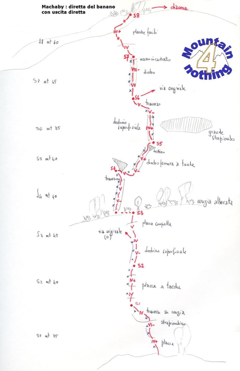
Hand-drawn topo of Diretta al Banano (direct finish), Corma di Machaby

Italy · Aosta Valley

Diretta al Banano

Along with Bucce d'Arancia this is the Paretone's other great classic (first ascent 1977, later retro-bolted). It climbs big, juggy, non-athletic slabs on beautiful rock up the centre of the wall to near the summit. Expect a few metres above the last bolt in places.

5c+9 pitches250 m

Read the cautions

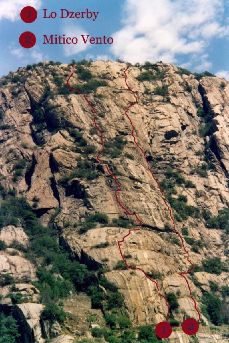
Topo of Lo Dzerby (line 1) and Mitico Vento on the Corma di Machaby, Arnad

Italy · Aosta Valley

Lo Dzerby

A long, easy-angled outing up the full height of the Paretone. A steeper lower half with an exposed pillar on P5 leads to sculpted slabs and broken steps higher up. It's a good first big multipitch.

5c13 pitches400 m

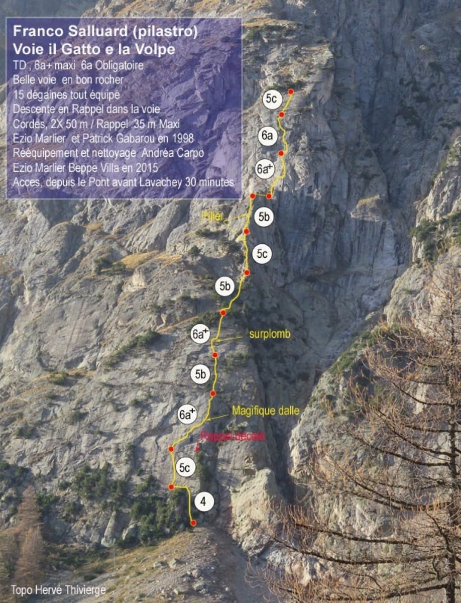
Topo of Il Gatto e la Volpe on the Pilier Franco Salluard, Val Ferret

Italy · Aosta Valley

Il Gatto e la Volpe

Rated 'great' on camptocamp: a wild setting with a short, easy approach from Lavachey. It climbs edgy granite slabs and a pillar crest, with a three-star exposed slab on P9.

6a+11 pitches350 m

Around 6a+ · about 10 pitches

Similar elsewhere

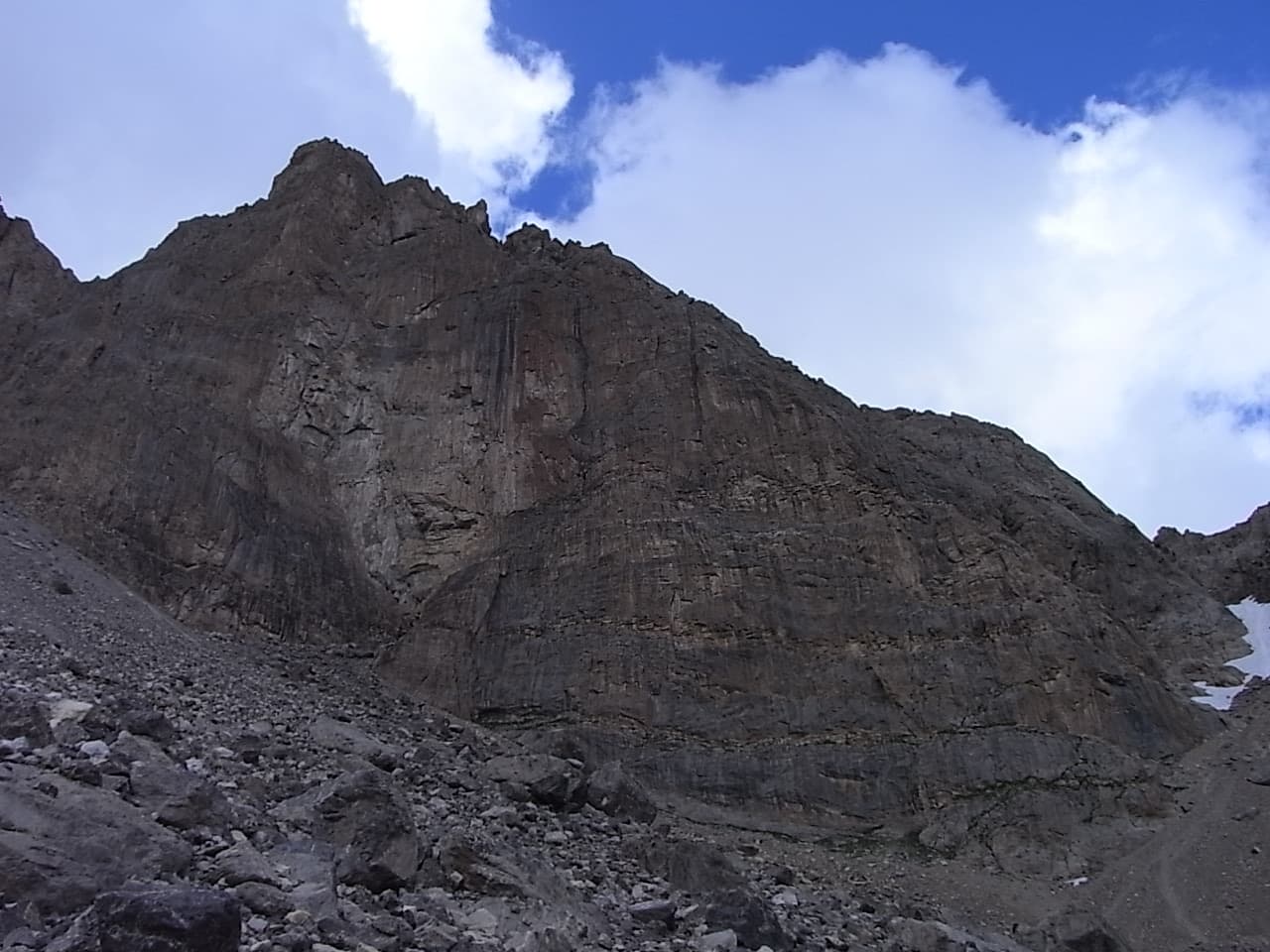
The south-west face of the Tour Termier from the scree below

France · Cerces

Ponant Neuf

The most popular route on the Tour Termier, a 3070 m limestone tower near the Col du Galibier. Sustained and varied at 5c to 6a+ on rough, sculpted rock, with several traverses that add length and a much-photographed 6a+ finish. It is the easier neighbour of Feu Sacré but still a mountain route: cold, often windy, and you climb between the bolts.

6a+10 pitches345 m

Read the cautions

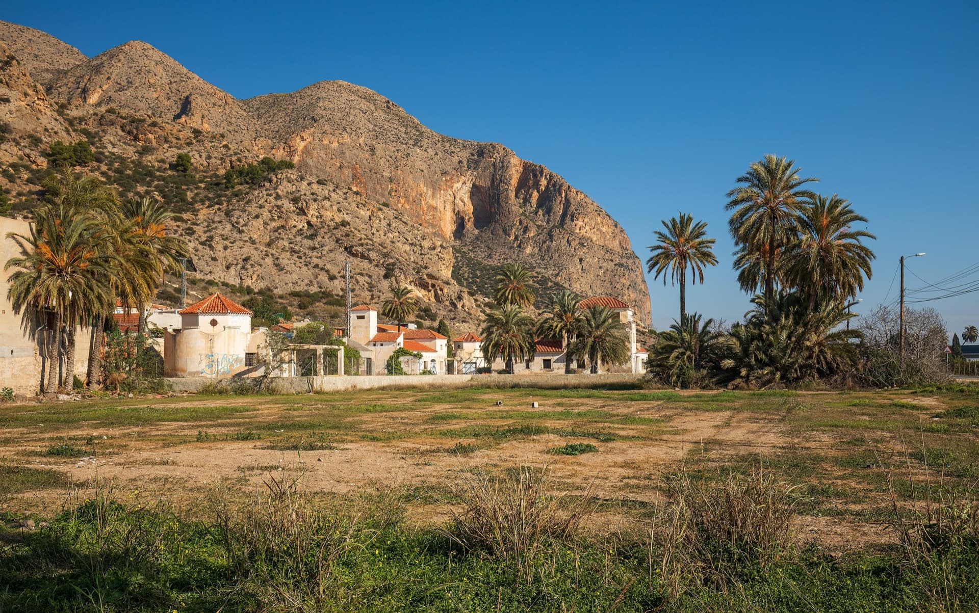
The big orange limestone wall of the Sierra de Callosa directly above Redován, seen from the edge of the village.

Spain · Vega Baja (Orihuela & Callosa)

Botri

The classic of Redován: ten pitches and 300 m of steady grade 5 with three steeper pitches on red rock. The eighth pitch, a traverse right into an overhanging corner above the orange cliffs, is the one people remember. Closed from January to June for nesting eagles.

6a+10 pitches300 m

The Röthelstein seen from a spur of the Rote Wand, looking west across the Bucheben saddle; the SO-Sporn routes finish at the climbers' summit and descend to this saddle

Austria · Grazer Bergland

Broken Soul

A modern plaisir line on the south-east spur of the Röthelstein, finished in 2018 by linking three old, forgotten pitches with six newly cleaned ones. The fifth and sixth pitches are rated among the best on the Röthelstein. UIAA 6+ at the hardest, with only 5 obligatory.

6a+10 pitches315 m

The Berchtesgadener Hochthron, highest point of the Untersberg, seen from Maria Gern: the south face in afternoon light, with the south-east walls on the right.

Germany · Berchtesgaden & Bad Reichenhall

Dahoam is Dahoam

A long-day alpine-flavoured plaisir route on the Untersberg's summit wall. Pitches range from UIAA 5+ to 6+ (≈5b–6b), with 5+ obligatory.

6a+10 pitches250 m

Compiled from published sources and last verified October 2026. Bolts, anchors and access change. Climbing is dangerous and you are responsible for your own decisions: check a current topo and read the disclaimer.