Multipitch Atlas

Ponant Neuf

Tour Termier – south-west face · Cerces · France

Read the cautionsBail with caveatsBolting confidence: high

The most popular route on the Tour Termier, a 3070 m limestone tower near the Col du Galibier. Sustained and varied at 5c to 6a+ on rough, sculpted rock, with several traverses that add length and a much-photographed 6a+ finish. It is the easier neighbour of Feu Sacré but still a mountain route: cold, often windy, and you climb between the bolts.

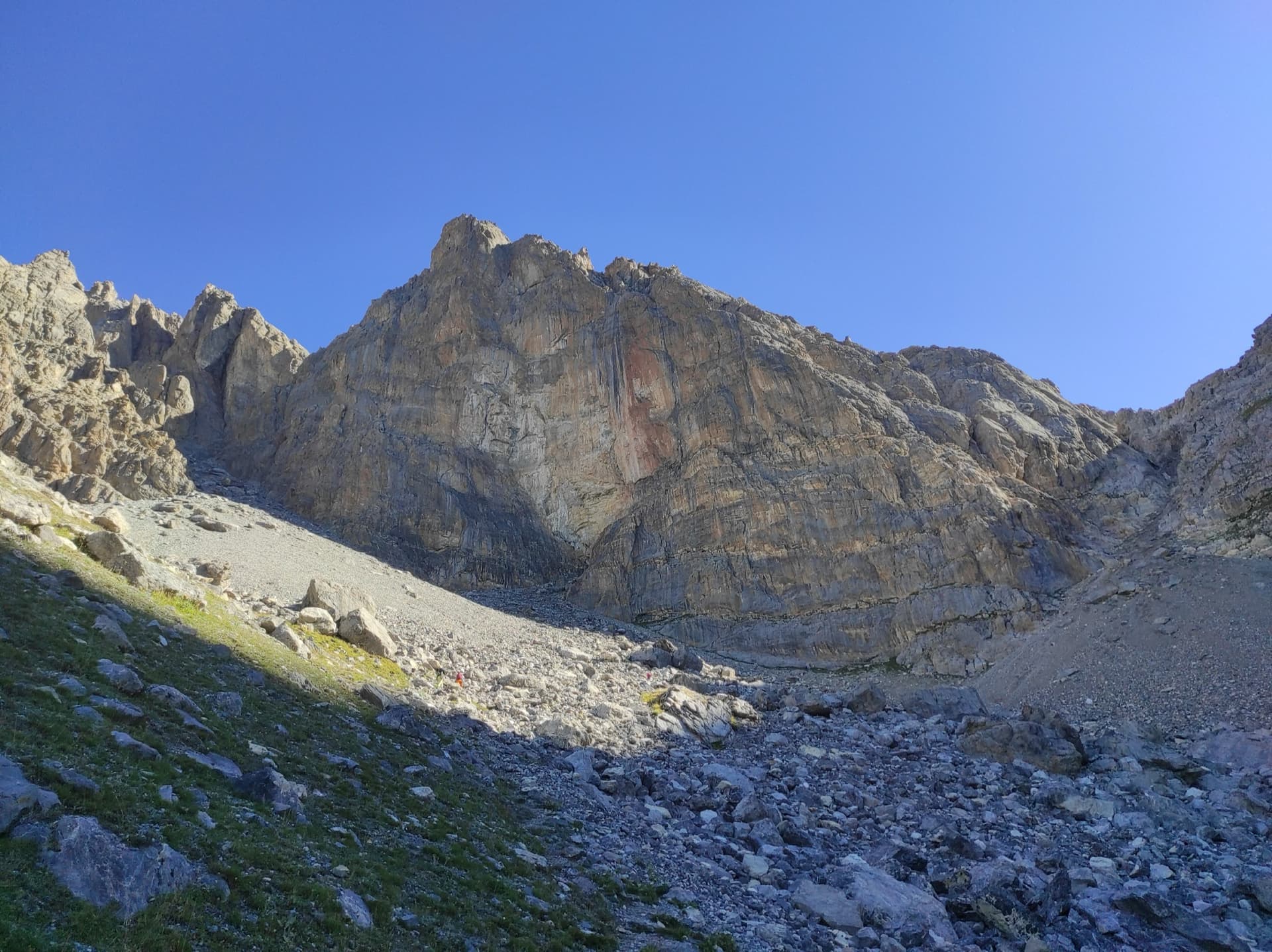
The south-west face of the Tour Termier from the scree belowPhoto: CHNOS5808 · CC BY-SA 3.0

Photo

The south-west face of the Tour Termier from the scree belowPhoto: CHNOS5808 · CC BY-SA 3.0
Hardest pitch
6a+
Pitches
10
Length
345 m
Approach
65 min
Aspect
SW
South-west-facing
Rope
2×50 m
Read before you go

Sound bolts and belays, but spaced on the easier ground with one obligatory move above the bolt, at 3000 m with a mountain descent; some parties add a few cams.

The route

Overview

Ponant Neuf climbs the south-west face of the Tour Termier, starting just left of Feu Sacré, left of the big corner that splits the wall. Cambon created it in 1999 by reworking his 1974 route Ponant, keeping only the traverse of pitch 5 and the direct finish. It gives ten pitches of sustained 5c to 6a+ on excellent abrasive limestone, with a terrace after pitch 3, a long traverse on pitch 5 and a choice of two exits to the summit of the tower. The wall is at 2800 to 3070 m and faces south-west, so it is in shade until late morning. It is one of the busiest routes in the Cerces: on fine August days parties queue from 9:00.

The climbing

Pitch by pitch

Pitches of Ponant Neuf
PitchGradeLengthBoltsNotes
P14b15 m2 boltsA short easy pitch, numbered L0 on camptocamp. It can be linked with the next (45 m) but the drag is heavy.
P26a30 m8 boltsAn athletic finish. On the vertical section a loose block of about 15 kg sits on the right; it is not needed as a hold.
P36a+30 m8 boltsMostly 5c with one harder move near the end, harder for the short. Parties in 2026 found the first part committing.
P45b/c35 m7 boltsNot easy at 5c if you follow the two bolts straight up; 5a/b by going left and clipping one bolt. Then steps to a large terrace. Belay on the left at the foot of a small knoll, left of a grassy gully; do not use the belay 10 m to the right, which is Feu Sacré's.
P56a+40 m10 boltsCross the gully (one bolt), climb a slab with delicate moves and a harder one to reach a ledge, and follow the ledge right. One slab move is obligatory and well above the bolt. The belay is shared with Feu Sacré's fifth.
P65c/6a25 m6 boltsTraverse left, rising slightly and then horizontally. Awkward clips.
P76a50 m12 boltsStraight up a vague runnel that becomes a corner and gully. An optional belay after 15 to 20 m is recommended; do not take the Boucs en stock belay just to the left. Continue 10 to 15 m in the gully, then pull out right. If you reach a belay on two pegs and a sling you have gone too high: traverse right.
P85c45 m9 boltsA grassy gully to an abseil station (4c, 25 m, 3 bolts), then on up the gully and a wall with two layback cracks (5c, 20 m, 5 bolts). Do not stop at the abseil station.
P96a+40 m12 boltsStraight up a wall to an abseil station (6a/+, 25 m, 7 bolts), then a rising traverse right (6a+, 15 m, 4 bolts) which holds the crux. Extend or skip the abseil station to limit drag.
P106a35 m8 boltsRight-hand exit: traverse 5 m right (6a), then a corner and chimney (5c) to a belay 3 m below the top of the tower. The left-hand exit, shared with Boucs en stocks, is 6a+: traverse left and up a few metres (5a, optional belay), then a delicate, airy traverse right and an athletic move right of the big roof to the very top.

Getting there

Approach

To the parking

From Briançon drive up the Guisane valley to the Col du Lautaret and take the Col du Galibier road. Park inside the hairpin 600 m before the memorial and the Galibier tunnel; in early season part of it is occupied by a snow drift. The road is closed by snow outside summer. The Briançon to Grenoble coach (ZOU 55) stops at the Col du Lautaret, from where parties cycle up.

On foot · about 65 min

A little over 1 hour, with about 300 m of ascent. Take the well-marked level path heading east from the hairpin, cross several streams and continue to the combe below the Tour Termier. Climb the combe and its scree to the bottom of the face. The route starts on the wall left of the big corner, just left of Feu Sacré and right of a horizontal band of whitish rock; the first bolt is high but on easy ground. Gold bolts.

Map of the walk-in

  • Crag

Loading map

The point marks the crag, not the exact start of the route.

Coordinates · crag

45.05927, 6.43720

Point from camptocamp waypoint 39495 (Tour Termier summit)

For your phone or watch

Download GPX

Contains the route point. Opens in most mapping apps and GPS watches.

Points are compiled from published sources, with the precision stated above. They were not surveyed on the ground: check them against a current topo.

Getting down

Descent

On foot, the usual choice: from the summit descend the north-east side, trending left, into the south-east combe of the Grand Galibier and follow it down to about 2900 m. Cross into the west gully of the Col Termier and descend its steps, mostly on the true left, to the scree below the face. Camptocamp gives 30 minutes to the foot of the Roc Termier; parties report 1.5 to 2 hours back to the car. Gulliver describes a short abseil or down-climb off the summit onto a slope that often holds snow. By abseil: seven abseils down the route from the left-hand exit, or seven by the Feu Sacré stations from the right-hand exit (40, 45, 45, 30, 45, 30 and 50 m). Despite its steepness the wall has many flakes and spikes that snag ropes, and ledges that shed stones and can cut ropes.

Retreat

Bailing off the route

Bail with caveats

Equipped abseil stations exist down the line, some of them in the middle of pitches, and the Feu Sacré stations are alongside, so retreat by abseil is possible from most of the route with two 50 m ropes. Camptocamp warns that the wall snags ropes on flakes and spikes and that the ledges shed stones.

Retreat from
From the belays and the mid-pitch abseil stations on pitches 7, 8 and 9; from the terrace after pitch 3 and the shared belay after pitch 4 by the Feu Sacré line.
Point of no return
None stated. The traverse of pitch 6 takes you away from the Feu Sacré line; above it the route's own stations are used.
Carry
2×50 m ropes. Extend or flick ropes clear of flakes before pulling, and watch for parties below.
Basis
Part stated, part inferredCamptocamp lists both abseil lines station by station and warns of snagging; no trip report read describes an actual retreat, so the choice of stations from part-way is inferred.

Partly inferred from the route facts

Safety

Hazards

  • Bolts are 5 to 7 m apart on the easier sections, some of them steep, and pitch 5 has an obligatory slab move well above the last bolt. This is P1+ in a mountain setting, not crag bolting.
  • A loose block of about 15 kg sits on pitch 2.
  • Abseiling snags ropes and sends stones down from the ledges onto a busy wall. Walk off if the face is crowded or if you top out late.
  • The walk-off crosses snow early in the season and is inadvisable in fog; it is tiring for parties unused to steep scree.
  • Several routes cross or share belays (Feu Sacré, Boucs en stocks). Parties regularly start up the wrong one.
  • Altitude, cold and afternoon storms: the wall is at 3000 m.

Sun and weather

Conditions

South-west facing at 2800 to 3070 m. The sun arrives at about 11:30 in July; a 2026 party reached the sixth belay as it came into the sun around noon, and it is cold before 10:00. There is nearly always wind, whether weather or thermal. The season is set by the Galibier road, roughly mid-June to September, with ascents recorded into early November in dry autumns. Early in the season the descent on the north-east side holds snow. Allow 4 to 6 hours on the route.

Usual season · Jun to Sep

Sun on the wall · SW-facing

Working out the sunlit hours for this month.

  • January: not yet worked out
  • February: not yet worked out
  • March: not yet worked out
  • April: not yet worked out
  • May: not yet worked out
  • June (usual season): not yet worked out
  • July (usual season): not yet worked out
  • August (usual season): not yet worked out
  • September (usual season): not yet worked out
  • October: not yet worked out
  • November: not yet worked out
  • December: not yet worked out

Sun on the wallDaylight, wall in shade● Usual season

Estimated from the wall's aspect only. Ignores surrounding terrain, gullies and the wall's exact shape. Clock times are local to the wall (Central European time), for the 15th of each month.

Climate figures for Cerces are not available yet

What to carry

Gear

2×50 m ropes and 12 quickdraws. Optionally a few nuts or two or three medium cams for the easier, more spaced sections. Helmet. Warm and windproof clothing even in August.

Checklist

Quickdraws
12
Rope
2×50 m
Helmet
One each
Abseil device and prusik
The descent or the retreat involves abseiling

Derived from the route data; check it against a current topo

From climbers

Reader reports

Reader reports are not being collected yet. Until they are, check a current topo and the local club or guidebook publisher for recent changes to Ponant Neuf.

Worth knowing

Tips

  • Leave nothing at the foot of the route if you plan to walk off; the descent comes out lower down the scree.
  • Be at the foot by 8:30 on a summer weekend to avoid queues.
  • A popular combination climbs pitches 1 to 5 of Feu Sacré and finishes up pitches 5 to 9 of Ponant Neuf, avoiding most of the terraces.
  • The rock is very abrasive on the fingers; holds become greasy in hot weather.

Open questions

Where sources disagree

  • Grades: camptocamp gives 4b, 6a, 6a+, 5b/c, 6a+, 5c/6a, 6a, 5c, 6a+ and 6a or 6a+ for the exits, 6a obligatory; gulliver gives 3, 5c/6a, 6a+, 4c, 6a, 5c, 6a, 5c, 6a+ and 5c or 6a+, with 5b obligatory. Recent parties side with camptocamp and find the 6a grades stiff.
  • Length: the camptocamp pitch lengths add up to 345 m; its header gives 270 m of difficulties and gulliver 300 m.
  • Approach: gulliver gives 150 m of ascent and camptocamp 300 m; timed reports are about 1 h 05 to 1 h 30.
  • Descent time on foot: 30 minutes to the foot of the Roc Termier on camptocamp, 1 hour from the summit on gulliver, 1.5 to 2 hours to the car in trip reports.
  • Aspect: south-west on camptocamp, west on gulliver.

Provenance

Sources

Same area

More in Cerces

All routes in Cerces
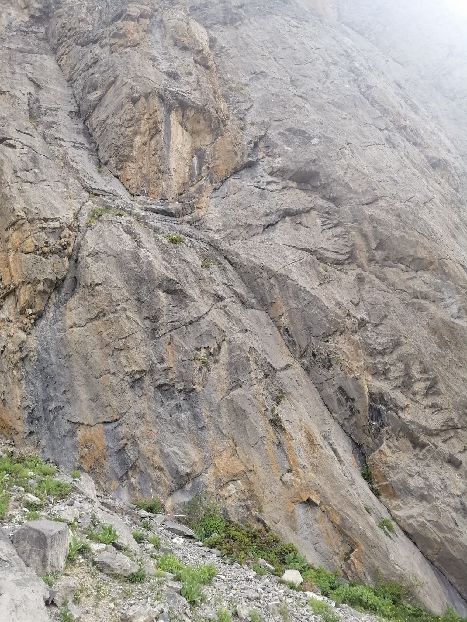
The face of the Tour Termier above its scree bowl in the Cerces; Feu Sacré climbs this wall, the line is not marked.

France · Cerces

Feu Sacré

The classic hard route of the Tour Termier: ten steep, technical pitches on superb compact limestone at 3000 m, a short walk from the Col du Galibier road. It is never athletic but sustained at 6a+ to 6b, with a 7a pitch and a 6c move that both go at 6a A0. Cold, wind and thin footwork make it feel bigger than the numbers.

7a10 pitches320 m
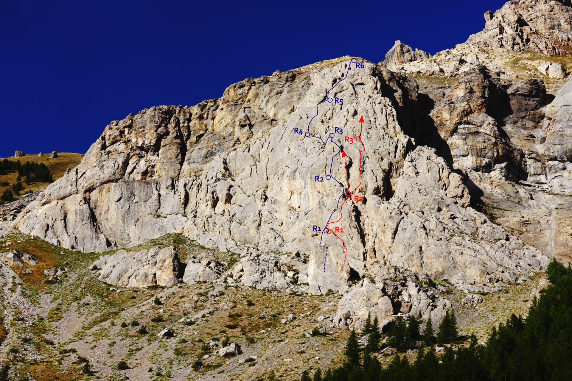
The Éperon du chemin du Roy with Che Guevaroux and the Voie des Quarante drawn in; from pitch 3 the red line shows the neighbouring Faux-cil variant, the original Quarante staying in the chimney

France · Cerces

Voie des Quarante

A friendly six-pitch route on the lower buttress of Roche Robert, half an hour above the Lautaret road. Sustained grade 4 on good limestone, with slabs, a chimney and two steeper steps of 5a to 5b near the top. Stances are big ledges and there is little exposure, so it suits a first multipitch.

5b6 pitches180 m

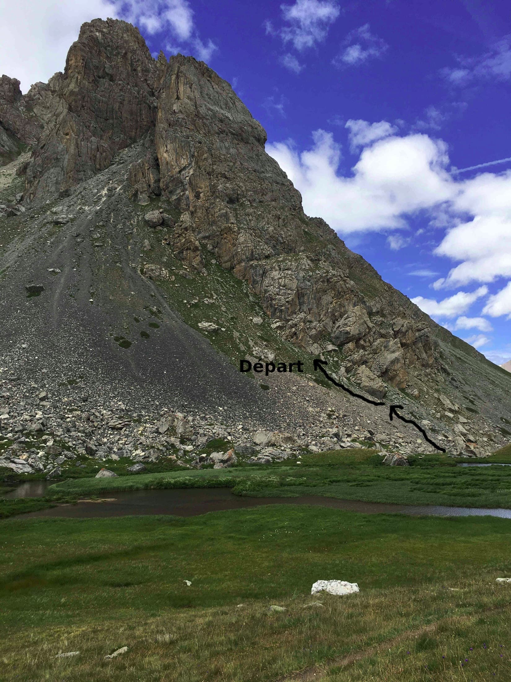
The Pavé du Chardonnet from the marshy flats above the hut, with the way to the start marked

France · Cerces

Dessine-moi un 4 sup

A long, easy mountain route above the Chardonnet hut in the upper Clarée valley: ten pitches of slabs, a chimney, grooved grey rock and a crest, linked by ledges and one 75 m walk. It is never sustained, with the 5c on a slabby traverse, and the best pitches are near the top. The setting is the attraction; the descent gully is the price.

5c10 pitches300 m

The lower wall of the first Queyrellin tower: the route follows the slabby ramp slanting up to the left

France · Cerces

Nulle Part Ailleurs

A short, varied route on the first tower of the Queyrellin ridge above the Chardonnet hut: a slabby ramp, a traverse across a grey slab and an exposed pillar on exceptional rough limestone. Continuous 5c to 6a with one aidable 6b+ step on poorer yellow rock and a thin 6b move on the pillar. The last three pitches are airy.

6b+5 pitches170 m

Around 6a+ · about 10 pitches

Similar elsewhere

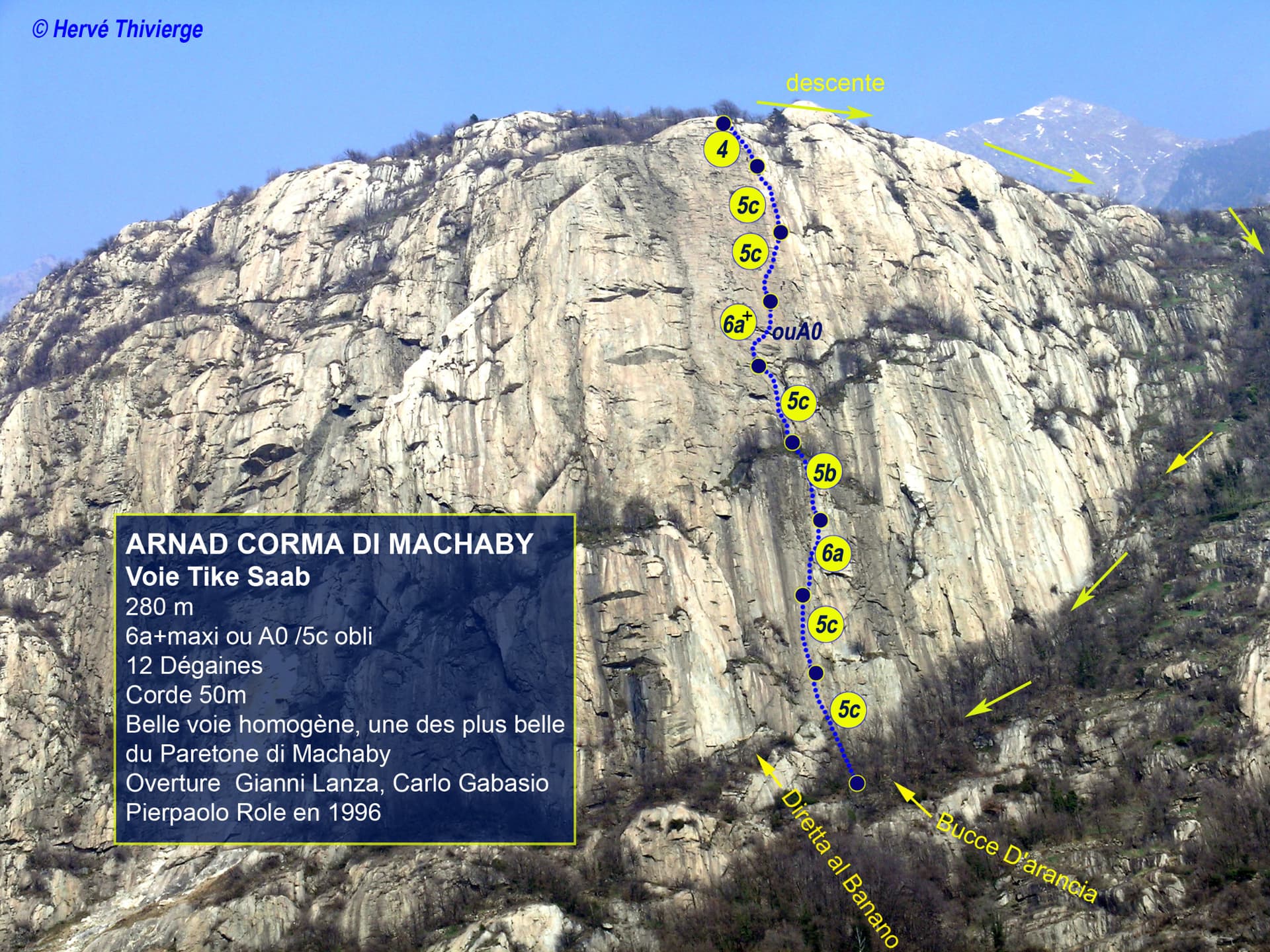
Photo-topo of Tike Saab on the Corma di Machaby above Arnad, with pitch grades and the walk-off marked

Italy · Aosta Valley

Tike Saab

One of the most approachable lines on the Paretone and one of its best: ten pitches of sculpted gneiss slab, sustained at about 5c, with two steeper passages. The third pitch has one 6a move out of a slot and the sixth climbs two small overhangs at 6a+. Both are closely bolted and go at about 5c with a pull on a quickdraw.

6a+10 pitches280 m

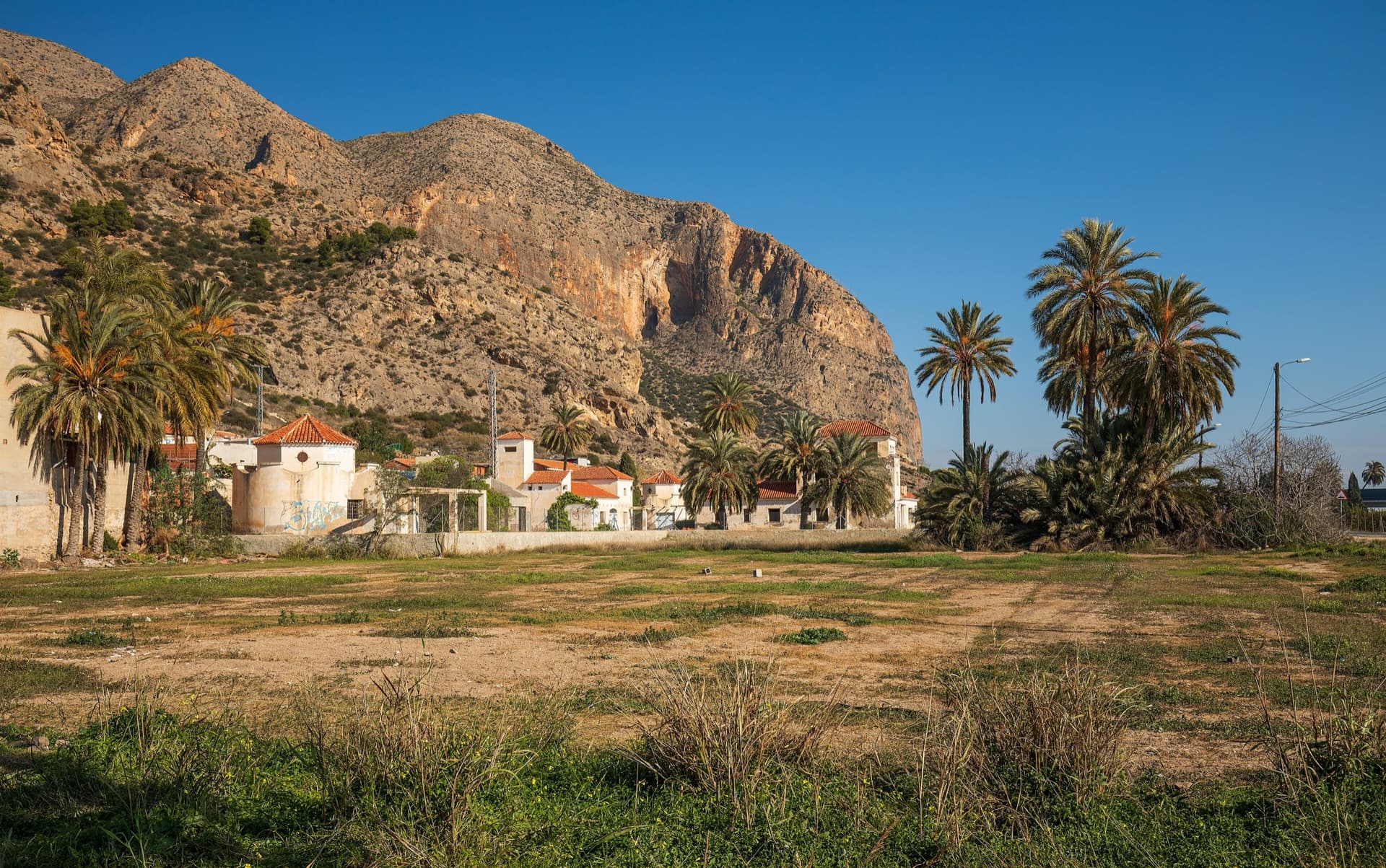
The big orange limestone wall of the Sierra de Callosa directly above Redován, seen from the edge of the village.

Spain · Vega Baja (Orihuela & Callosa)

Botri

The classic of Redován: ten pitches and 300 m of steady grade 5 with three steeper pitches on red rock. The eighth pitch, a traverse right into an overhanging corner above the orange cliffs, is the one people remember. Closed from January to June for nesting eagles.

6a+10 pitches300 m

The Röthelstein seen from a spur of the Rote Wand, looking west across the Bucheben saddle; the SO-Sporn routes finish at the climbers' summit and descend to this saddle

Austria · Grazer Bergland

Broken Soul

A modern plaisir line on the south-east spur of the Röthelstein, finished in 2018 by linking three old, forgotten pitches with six newly cleaned ones. The fifth and sixth pitches are rated among the best on the Röthelstein. UIAA 6+ at the hardest, with only 5 obligatory.

6a+10 pitches315 m

The Berchtesgadener Hochthron, highest point of the Untersberg, seen from Maria Gern: the south face in afternoon light, with the south-east walls on the right.

Germany · Berchtesgaden & Bad Reichenhall

Dahoam is Dahoam

A long-day alpine-flavoured plaisir route on the Untersberg's summit wall. Pitches range from UIAA 5+ to 6+ (≈5b–6b), with 5+ obligatory.

6a+10 pitches250 m

Compiled from published sources and last verified October 2026. Bolts, anchors and access change. Climbing is dangerous and you are responsible for your own decisions: check a current topo and read the disclaimer.