Multipitch Atlas

Nulle Part Ailleurs

Crête du Queyrellin – 1ère Tour · Cerces · France

Easy to bailBolting confidence: high

A short, varied route on the first tower of the Queyrellin ridge above the Chardonnet hut: a slabby ramp, a traverse across a grey slab and an exposed pillar on exceptional rough limestone. Continuous 5c to 6a with one aidable 6b+ step on poorer yellow rock and a thin 6b move on the pillar. The last three pitches are airy.

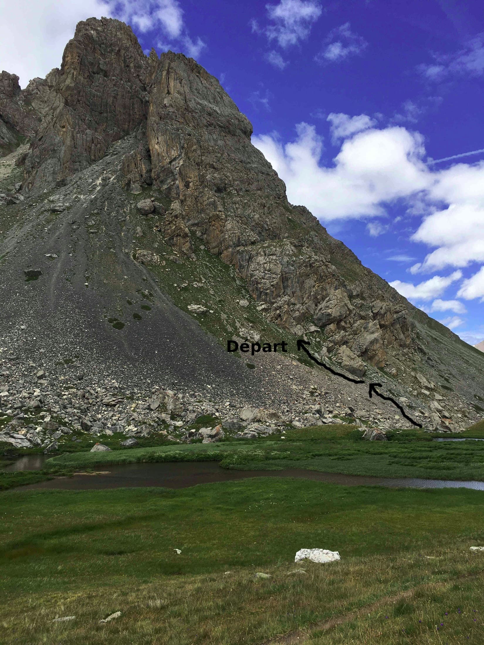
The lower wall of the first Queyrellin tower: the route follows the slabby ramp slanting up to the leftPhoto: Antoine Marnat · CC BY-SA 3.0

Photo

The lower wall of the first Queyrellin tower: the route follows the slabby ramp slanting up to the leftPhoto: Antoine Marnat · CC BY-SA 3.0
Hardest pitch
6b+
Pitches
5
Length
170 m
Approach
85 min
Aspect
SW
South-west-facing
Rope
2×50 m

The route

Overview

The Crête du Queyrellin is a line of limestone towers above the Refuge du Chardonnet in the upper Clarée valley. Nulle Part Ailleurs, opened in 1993, uses the left side of the first tower: it climbs a steep slabby ramp up and left, crosses a slab to gain the left-hand pillar and follows its crest to the top. At 150 to 170 m it is short for the walk, but the climbing is continuous and never banal, the rock is among the best in the Cerces and the route is not polished. The base is at about 2450 m.

The climbing

Pitch by pitch

Pitches of Nulle Part Ailleurs
PitchGradeLengthBoltsNotes
P15c35 m9 boltsThe steep slabby ramp, rising to the left, with a move at the exit of a small corner.
P26b+40 m9 boltsA few metres of easy but loose ground across the ledge, then a single hard step to regain the ramp on fractured yellow rock (6b+, easily aided on the bolt). Above, a crack at 6a going left and a slab at 5c to the belay.
P36a33 m10 boltsThe finest pitch: up and left, an elegant traverse right across the slab, then a delicate pillar. One move here stopped a party of 6c climbers in 2023, who aided it with a sling.
P46b33 m9 boltsGain the crest of the left-hand pillar and climb it. One delicate 6b move, less easy to aid than the one on pitch 2, the rest 5c to 6a. New chain at the belay in 2025.
P55c30 m7 boltsFinish up the narrowing pillar on many undercut holds to the last bolt, then traverse right to the belay. Two belays are in place at the top, only one of them chained.

Getting there

Approach

To the parking

From Briançon drive up the Clarée valley to Névache and on to the Chalets de Fontcouverte (1861 m), where the road is followed by a campsite and the trailhead. From mid-July to the end of August the upper valley road is closed to uphill motor traffic from 8:30 to 18:00: go up earlier, or park free at Roubion at the entrance to Névache and take the shuttles (free to Névache Ville-Haute, paying on to Fontcouverte). In summer and winter seasons bus line L7 runs from Briançon station to Névache.

On foot · about 85 min

About 1 h 20 to 1 h 30 from Fontcouverte. Walk to the Refuge du Chardonnet (45 minutes), continue on the path towards the Col du Chardonnet until you reach a marshy flat, cross it and climb the scree opposite to the first tower (35 minutes from the hut). The route is the left-most bolted line at the foot of the tower, starting up a ramp near the lowest point; the name is hard to find. An alternative from just after the Fontcouverte campsite goes by the Chalets du Queyrellin, passes below the Pavé du Chardonnet and reaches the tower by a traverse across the scree from the right, which avoids the tiring direct slog.

Map of the walk-in

  • Crag
  • Parking

Loading map

The point marks the crag, not the exact start of the route.

Coordinates · crag

45.03221, 6.51600

Parking

45.03402, 6.54534

Névache, Fontcouverte trailhead (camptocamp waypoint 104309)

Point from camptocamp waypoint 43106 (Crête du Queyrellin, 1ère Tour)

For your phone or watch

Download GPX

Contains the route point and parking. Opens in most mapping apps and GPS watches.

Points are compiled from published sources, with the precision stated above. They were not surveyed on the ground: check them against a current topo.

Getting down

Descent

By abseil down the face, off the line of the climb and to its right. Gulliver gives three abseils of 50, 40 and 40 m; camptocamp says three or four. The rope catches easily on the first abseil from the summit: break it at one of the intermediate stations, or do as a 2025 party did and abseil from the chain at the fourth belay without climbing the last pitch.

Retreat

Bailing off the route

Easy to bail

Abseiling is the normal descent and there are many stations on the face, so you can retreat from any belay with two ropes. A 2025 party chose to descend from the chained fourth belay. The only reported trouble is ropes snagging on the top abseil.

Retreat from
Any belay; the fourth has a new chain. The abseil line lies right of the climb, so from the lower belays you abseil the route itself.
Point of no return
None.
Carry
2×50 m ropes.
Basis
Part stated, part inferredThe abseil descent and its stations are stated by camptocamp and gulliver, and the descent from belay 4 by a 2025 report; abseiling from belays 1 to 3 is inferred from the bolted belays and pitch lengths.

Partly inferred from the route facts

Safety

Hazards

  • The first abseil snags: ropes have been stuck here by several parties.
  • The 6b move on pitch 4 and the delicate step on pitch 3 are harder to aid than the 6b+, and you climb between the bolts on the 6a sections.
  • The ledge at the start of pitch 2 is loose.
  • High mountain weather with a long retreat to the car; afternoon storms are common in summer.

Sun and weather

Conditions

South-west facing at 2450 to 2600 m. The season is about mid-June to September; snow can linger on the approach in June. It is often windy on the pillar: a July 2023 party started in T-shirts and finished in jackets. Allow 3 to 4 hours for the route and abseils, and a full day from the valley.

Usual season · Jun to Sep

Sun on the wall · SW-facing

Working out the sunlit hours for this month.

  • January: not yet worked out
  • February: not yet worked out
  • March: not yet worked out
  • April: not yet worked out
  • May: not yet worked out
  • June (usual season): not yet worked out
  • July (usual season): not yet worked out
  • August (usual season): not yet worked out
  • September (usual season): not yet worked out
  • October: not yet worked out
  • November: not yet worked out
  • December: not yet worked out

Sun on the wallDaylight, wall in shade● Usual season

Estimated from the wall's aspect only. Ignores surrounding terrain, gullies and the wall's exact shape. Clock times are local to the wall (Central European time), for the 15th of each month.

Climate figures for Cerces are not available yet

What to carry

Gear

2×50 m ropes and about 12 quickdraws: no pitch has more than 10 bolts. A sling is useful as a foot loop if you aid the hard moves. Helmet.

Checklist

Quickdraws
12
Rope
2×50 m
Helmet
One each
Abseil device and prusik
The descent or the retreat involves abseiling

Derived from the route data; check it against a current topo

From climbers

Reader reports

Reader reports are not being collected yet. Until they are, check a current topo and the local club or guidebook publisher for recent changes to Nulle Part Ailleurs.

Worth knowing

Tips

  • 'Pour le plaisir' (6b) on the same tower makes a natural second route.
  • The hut is 35 minutes below and serves meals on its terrace; staying there makes for an easy early start.
  • Grades are old-school: parties repeatedly find the single moves of 6a and 6b stiff.

Open questions

Where sources disagree

  • Pitch 1 is 5c and 35 m on camptocamp; an older gulliver trip report describes a 40 m first pitch at 6b, which does not match either site's route description and may refer to a different start.
  • Pitch lengths: 35, 40, 33, 33 and 30 m on camptocamp (171 m); 30 m each on gulliver (150 m).
  • Obligatory grade: 6a on camptocamp, 5c on gulliver.
  • Pitch 4: 6b on camptocamp, 6a on gulliver, which also gives the last pitch 5c/6a.
  • Descent: three abseils of 50, 40 and 40 m on gulliver; three or four on camptocamp.

Provenance

Sources

Same area

More in Cerces

All routes in Cerces
The face of the Tour Termier above its scree bowl in the Cerces; Feu Sacré climbs this wall, the line is not marked.

France · Cerces

Feu Sacré

The classic hard route of the Tour Termier: ten steep, technical pitches on superb compact limestone at 3000 m, a short walk from the Col du Galibier road. It is never athletic but sustained at 6a+ to 6b, with a 7a pitch and a 6c move that both go at 6a A0. Cold, wind and thin footwork make it feel bigger than the numbers.

7a10 pitches320 m
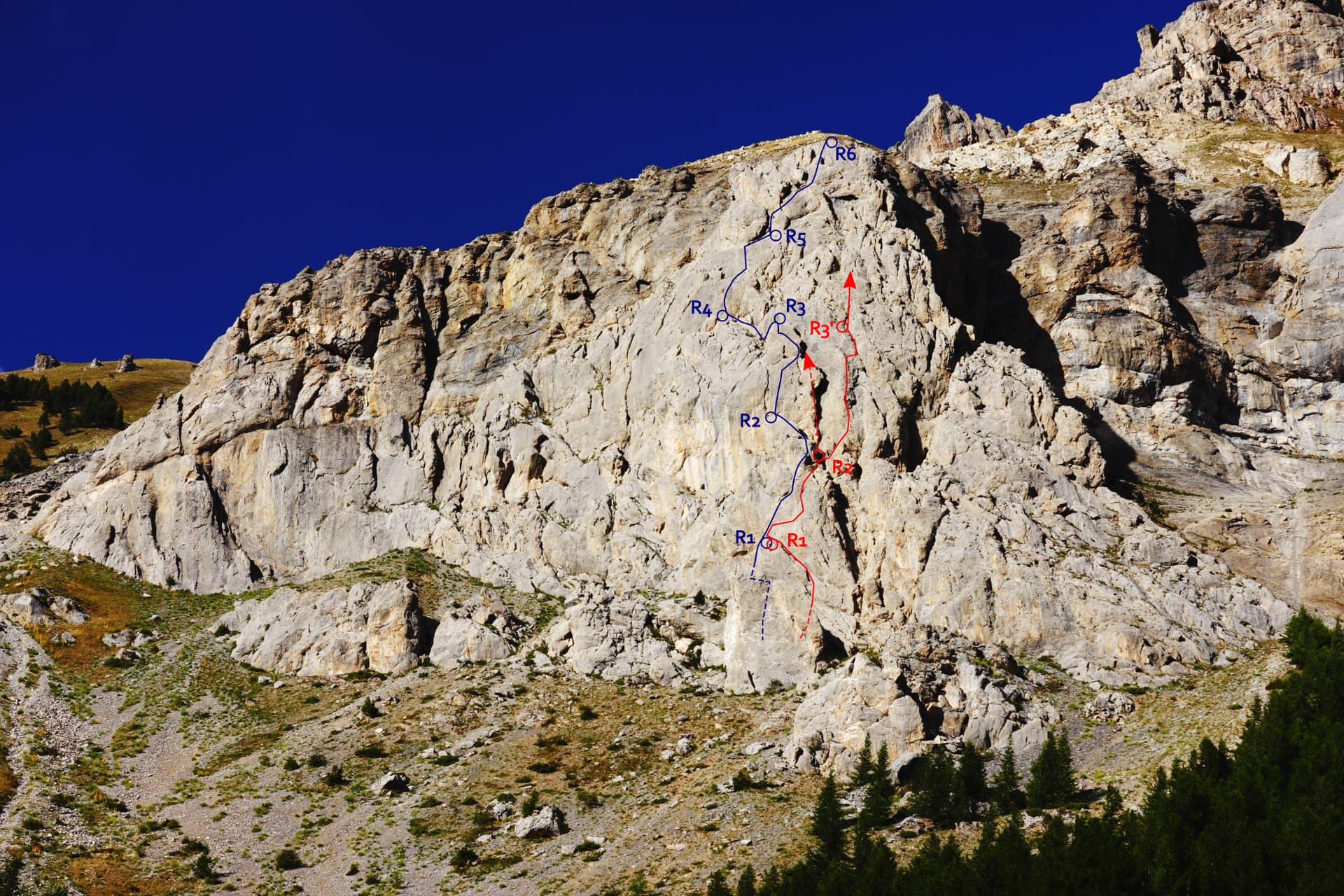
The Éperon du chemin du Roy with Che Guevaroux and the Voie des Quarante drawn in; from pitch 3 the red line shows the neighbouring Faux-cil variant, the original Quarante staying in the chimney

France · Cerces

Voie des Quarante

A friendly six-pitch route on the lower buttress of Roche Robert, half an hour above the Lautaret road. Sustained grade 4 on good limestone, with slabs, a chimney and two steeper steps of 5a to 5b near the top. Stances are big ledges and there is little exposure, so it suits a first multipitch.

5b6 pitches180 m

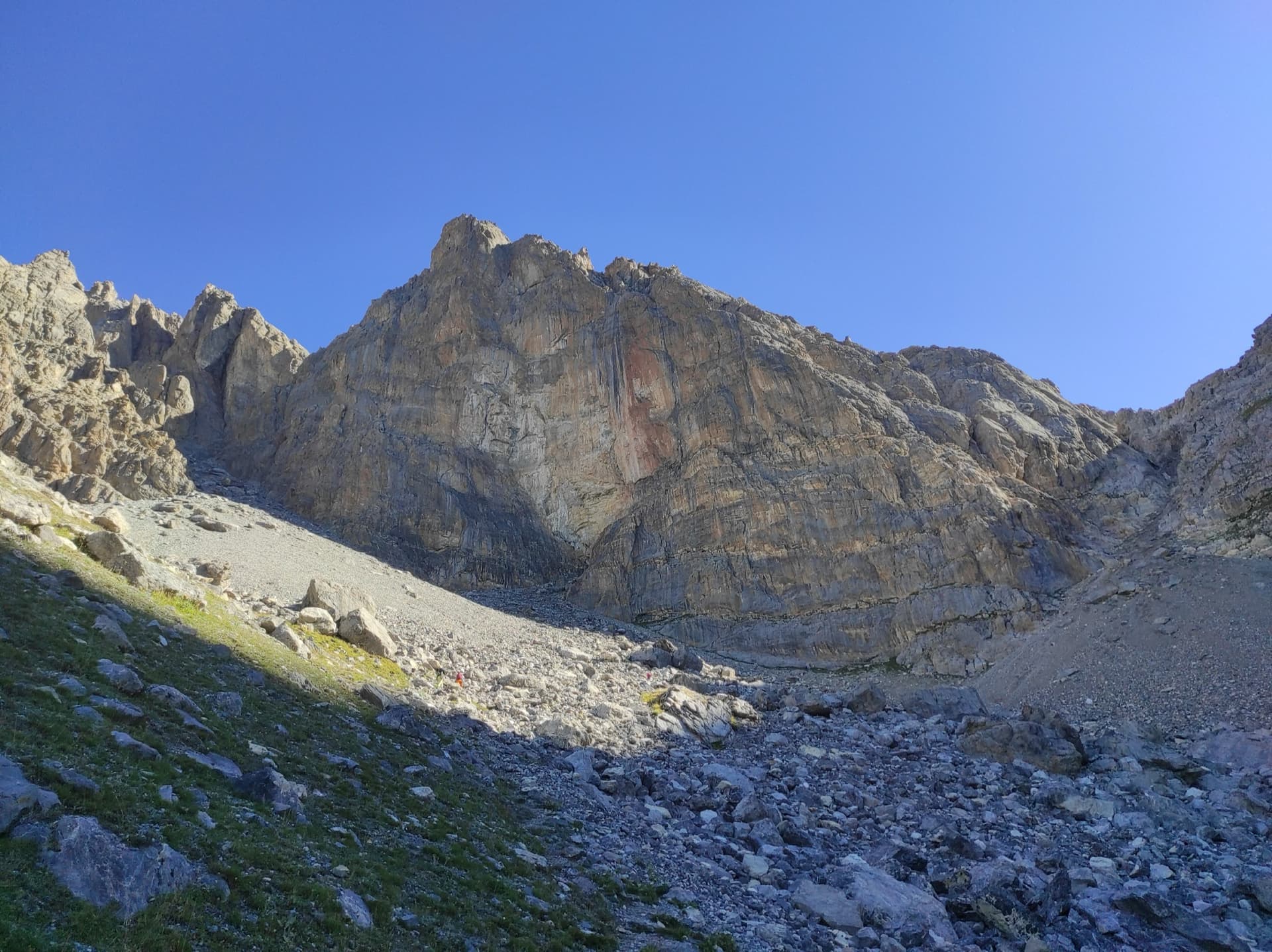
The Pavé du Chardonnet from the marshy flats above the hut, with the way to the start marked

France · Cerces

Dessine-moi un 4 sup

A long, easy mountain route above the Chardonnet hut in the upper Clarée valley: ten pitches of slabs, a chimney, grooved grey rock and a crest, linked by ledges and one 75 m walk. It is never sustained, with the 5c on a slabby traverse, and the best pitches are near the top. The setting is the attraction; the descent gully is the price.

5c10 pitches300 m

The south-west face of the Tour Termier from the scree below

France · Cerces

Ponant Neuf

The most popular route on the Tour Termier, a 3070 m limestone tower near the Col du Galibier. Sustained and varied at 5c to 6a+ on rough, sculpted rock, with several traverses that add length and a much-photographed 6a+ finish. It is the easier neighbour of Feu Sacré but still a mountain route: cold, often windy, and you climb between the bolts.

6a+10 pitches345 m

Read the cautions

Around 6b+ · about 5 pitches

Similar elsewhere

The Puig de Son Nasi (left) and the pointed Puig de s'Alqueria, the Sa Gubia peak, seen from the Sóller railway to the east. The climbing walls are out of sight in the gorge on the far side.

Spain · Mallorca (Sa Gubia)

Sexo Débil

A weaving line up the shady right-hand side of the bay through dramatic ground: an exposed wall, a traverse under a bulge to tufas and bolted-on holds, a superb rising leftward traverse on immaculate rock to a hanging belay, and a traverse back right to an open groove. Originally an aid pitch in the middle, now free at 6b+.

6b+5 pitches100 m

Read the cautions

A view of the region, not this route's wall. The painted stone that marks the start of Strada del Sole at the foot of the Nösslachwand

Austria · Ötztal

Caipirinha

A mix of slabs and steep, juggy passages in the Sonnenblume sector, mostly around 5b to 5c+. The one hard move is a small roof on pitch 4 (6b+), which goes easily on aid.

6b+5 pitches170 m

El Chorro: the reservoir and the limestone walls above it, seen from the hillside. A general view of the area; the route is not marked.

Spain · El Chorro

Ébola

The direct line just right of Amptrax, following what used to be that route's abseil descent. Two easy pitches lead to two good ones that each start with a bulge out of a cave: a 6a+ and then the 6b+ crux, short and powerful before a vertical grey wall on good holds. The rock is compact and the belays are comfortable.

6b+5 pitches155 m

The Biddiriscottai sea cliff north of Cala Gonone, seen from the scramble along its foot on the approach to Oceano Mare.

Italy · Sardinia

Oceano Mare

Five steep, sustained pitches at 6b to 6b+ straight out of the sea on new titanium bolts, on abrasive, pocketed limestone. Bulges, a smooth roof, a corner and a thin finishing crack, with a cave belay after pitch 1.

6b+5 pitches160 m

Compiled from published sources and last verified October 2026. Bolts, anchors and access change. Climbing is dangerous and you are responsible for your own decisions: check a current topo and read the disclaimer.