Multipitch Atlas

Alhambra

Geierwand, Haiming · Inntal (Haiming Geierwand) · Austria

Bail with caveatsBolting confidence: high

The longest route on the Geierwand and its most popular easy outing: rough slabs low down, a walk across the big ledge, then steeper, pocketed and more exposed climbing above. The crux is a short traverse to the belay on pitch 10. The last two pitches are scrambling over loose ground.

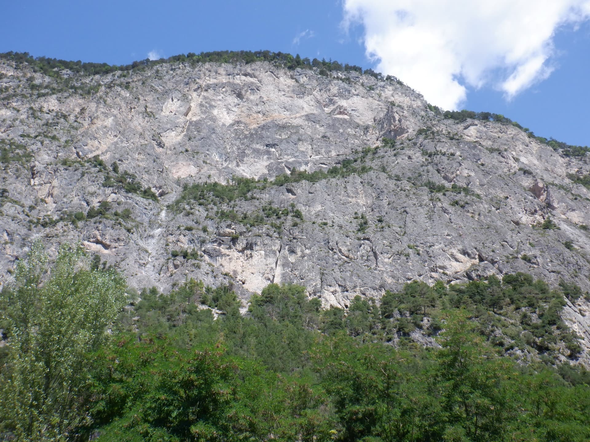
The Geierwand above Haiming seen from the car park; Alhambra climbs the full height of the wall, crossing the vegetated ledge at mid-heightPhoto: Théo Giani · CC BY-SA 3.0

Photo

The Geierwand above Haiming seen from the car park; Alhambra climbs the full height of the wall, crossing the vegetated ledge at mid-heightPhoto: Théo Giani · CC BY-SA 3.0
Hardest pitch
6a+
Pitches
12
Length
430 m
Approach
15 min
Aspect
S
South-facing
Rope
2×60 m or 1×70 m

The route

Overview

Alhambra runs the full height of the Geierwand in twelve pitches, immediately left of the Klettersteig. The lower half is easy-angled rough slab at 5a to 5b with one vegetated pitch, the big ledge is crossed on foot, and the upper half steepens through pocketed walls to a short 6a+ traverse on pitch 10. Most of the route is no harder than 5c and the hard move is well bolted. The rock is good where it is clean but not solid everywhere, and the final two pitches are a scramble through rubble to the top. You walk down.

The climbing

Pitch by pitch

Pitches of Alhambra
PitchGradeLengthNotes
P15a40 mRough slab trending slightly left. camptocamp gives 35 m; the 2025 party found 5b.
P25b37 mMore slab, again trending slightly left. camptocamp gives 35 m.
P33a45 mAn easy, vegetated pitch where stones are easily dislodged. camptocamp gives III and 40 m.
P45a30 mStarts leftwards in a scoop, athletic for a few moves. bergsteigen.com shows pleasant slabs here.
P54c30 mEasier climbing to the big central ledge. camptocamp gives 4b and 25 m.
P6150 mWalk across the ledge, trending slightly left. The first half is very unstable ground. A metal plate marked 'Alhambra' shows where the upper part starts.
P76a35 mA long pitch climbing well to the left with the difficulty at the exit. A bergsteigen.com caption says the start is easy but brittle with wide bolt spacing. camptocamp gives 5c and 40 m.
P85a+30 mEasier, with one move below the belay. bergsteigen.com shows a fine slab below an overhang in this part of the route.
P95c23 mA hard start traversing left, which the 2025 party thought a solid 6a, then very easy ground to a belay that is not linked.
P106a+35 mThe key pitch: a fine pillar with a crack line and a ramp, then a short hard traverse to the belay (UIAA 6/6+). Very well bolted. Climbers Paradise gives no grade for this pitch; camptocamp gives 6a+ and 25 m.
P11325 mFirst exit pitch (III). The second half is unstable, with a lot of rubble. Belay on a sling out on the right.
P12150 mScrambling over loose 'chamois terrain' with a few trees for protection. Final belay on a solid tree. camptocamp gives 60 m.

Getting there

Approach

To the parking

Haiming lies in the Inn valley at the mouth of the Ötztal in Tyrol. Leave the A12 at Mötz or Ötztal, drive into Haiming and follow the 'Rafting-Center' signs. Turn right straight after the bridge over the Inn and continue past the rafting centre to the car park with the large Klettersteig board, at about 660 m. By public transport take the train to Haiming and a bus to the Innbrücke stop.

On foot · about 15 min

15 to 20 min. From the car park follow the Klettersteig signs towards the motorway and cross it. On the far side go a few steps left along the track to a rockfall net, then take the path uphill to the rock. At the top of the path go all the way right to the Klettersteig; Alhambra starts just left of it and is named on a metal plate. You can also reach the start by the lowest section of the Klettersteig or by the route Turmfalke (5).

Map of the walk-in

  • Route base
  • Parking

Loading map

The point marks the base of the route.

Coordinates · route base

47.26250, 10.87820

Parking

47.26020, 10.87830

Car park after the rafting centre, Haiming (bergsteigen.com marker 'Parkplatz')

Point from bergsteigen.com map marker 'Einstieg'; camptocamp crag waypoint 1793379 is the same point

For your phone or watch

Download GPX

Contains the route point and parking. Opens in most mapping apps and GPS watches.

Points are compiled from published sources, with the precision stated above. They were not surveyed on the ground: check them against a current topo.

Getting down

Descent

About 1 h on foot. From the top head for two twin pines, then follow a faint, sparsely marked track up and left for about 100 m, keeping left at the rock band, to a small plateau with a barbecue spot. Take the marked path east (right) down to the Klettersteig descent trail, which becomes wide and waymarked, and follow it to the foot of the wall and back right to the car park. Alternative: abseil after pitch 10 down the Sunset Boulevard abseil line to the big ledge, follow path traces along the ledge to a second abseil line (for example Nebraska) and abseil to the ground.

Retreat

Bailing off the route

Bail with caveats

You can retreat from the top of pitch 10 by the abseil line of Sunset Boulevard to the big ledge, then walk along the ledge to a second abseil line such as Nebraska's and continue to the ground. Lower down, the big ledge after pitch 5 is the natural place to stop, and shorter routes that end there are normally abseiled. Abseil lengths are not published in the free sources.

Retreat from
Top of pitch 10 (stated). The big ledge at pitches 5 and 6, from where routes such as Kollerweg and Montania are abseiled (stated for those routes).
Point of no return
Above pitch 10 the route becomes a scramble over rubble and you should continue to the top and walk down.
Carry
2×60 m ropes or a single 70 m, and the topo to find the two abseil lines.
Basis
Part stated, part inferredbergsteigen.com describes the abseil alternative after pitch 10; retreat from the ledge is inferred from the descents given for the neighbouring routes.

Partly inferred from the route facts

Safety

Hazards

  • Rockfall: loose stones lie on the ledges and terraces and are easily knocked off, especially when you pull ropes. Climbers Paradise asks for extreme care whenever other parties are on the wall. Wear a helmet from the foot of the wall.
  • The last two pitches run through scree and rubble directly above the rest of the wall: move carefully and do not dislodge stones.
  • The rock is not solid everywhere. bergsteigen.com says the good bolting makes the brittle passages less worrying; the 2025 camptocamp party found good rock on all but three pitches.
  • Many newer routes now interweave with the lower part and it is easy to drift onto another line. The 2025 party ended up further left on the first three pitches and counted six pitches below the ledge instead of five.
  • The wall stands directly above the A12 motorway and traffic noise accompanies you all the way up.

Sun and weather

Conditions

South facing, with the base at about 740 m and the top of the wall at about 1050 m. bergsteigen.com shows a season from March to November and Climbers Paradise calls the wall climbable almost all year, but both warn that it is very hot in summer. Spring and autumn are the best times. The route is in full sun; a party in July 2025 found it hot but bearable and took seven hours car to car.

Usual season · Mar to Jun, Sep to Nov

Sun on the wall · S-facing

Working out the sunlit hours for this month.

  • January: not yet worked out
  • February: not yet worked out
  • March (usual season): not yet worked out
  • April (usual season): not yet worked out
  • May (usual season): not yet worked out
  • June (usual season): not yet worked out
  • July: not yet worked out
  • August: not yet worked out
  • September (usual season): not yet worked out
  • October (usual season): not yet worked out
  • November (usual season): not yet worked out
  • December: not yet worked out

Sun on the wallDaylight, wall in shade● Usual season

Estimated from the wall's aspect only. Ignores surrounding terrain, gullies and the wall's exact shape. Clock times are local to the wall (Central European time), for the 15th of each month.

Monthly climate averages for Inntal (Haiming Geierwand), 1991-2020
MeasureJanFebMar (usual season)Apr (usual season)May (usual season)Jun (usual season)JulAugSep (usual season)Oct (usual season)Nov (usual season)Dec
Mean daily high °C3581216212222191594
Mean daily low °C−7−5−12610121295−1−5
Rain days 1 mm or more121215162121211916131313

● marks the usual climbing season. Averages for 1991-2020 at about 723 m. Area climate from Open-Meteo reanalysis. Temperatures are adjusted to the height of the crag; rain comes from a grid cell of about 10 to 25 km, and summer highs on sea cliffs can read a few degrees low. The wall and valley can differ. Data: Open-Meteo, CC BY 4.0.

What to carry

Gear

12 quickdraws (Climbers Paradise says 15), helmet, and either 2×60 m ropes or a single 70 m; camptocamp suggests 100 m of rope in total, that is 2×50 m. No nuts or cams are listed by any source.

Checklist

Quickdraws
12
Rope
2×60 m or 1×70 m
Helmet
One each
Abseil device and prusik
The descent or the retreat involves abseiling

Derived from the route data; check it against a current topo

From climbers

Reader reports

Reader reports are not being collected yet. Until they are, check a current topo and the local club or guidebook publisher for recent changes to Alhambra.

Worth knowing

Tips

  • bergsteigen.com describes Montania and the Rampensau/Little King combination as 'overtaking lanes' to the big ledge, useful when the lower half of Alhambra is busy.
  • If parties are below you, consider finishing at the pitch 10 belay and abseiling rather than crossing the rubble of the last two pitches.
  • Allow 3.5 hours of climbing according to bergsteigen.com; the 2025 camptocamp party needed much longer.

Open questions

Where sources disagree

  • Grade: 6a+ on camptocamp and in the Climbers Paradise route title; bergsteigen.com gives UIAA 6/6+ with 5 obligatory; the Climbers Paradise pitch table leaves pitch 10 ungraded.
  • Pitch lengths: Climbers Paradise gives 40, 37, 45, 30, 30, 50, 35, 30, 23, 35, 25, 50 m (430 m); camptocamp gives 35, 35, 40, 25, 25, 50, 40, 25, 25, 25, 25, 60 m. bergsteigen.com gives 420 m in total. The Climbers Paradise figures are used here.
  • Pitch grades: pitch 5 is 4c on Climbers Paradise and 4b on camptocamp; pitch 7 is 6a against 5c. The July 2025 camptocamp party graded the first pitches 5b, 5b/c and 5c and found one more pitch below the ledge than the topo shows.
  • Quickdraws: 12 on bergsteigen.com and camptocamp, 15 on Climbers Paradise.

Provenance

Sources

Same area

More in Inntal (Haiming Geierwand)

All routes in Inntal (Haiming Geierwand)
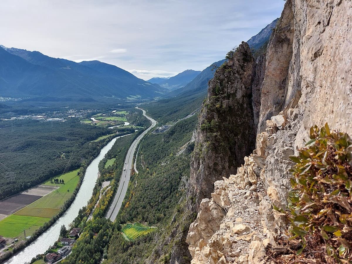
View west along the Inn valley from the top of the Geierwand near Haiming, with part of the wall on the right

Austria · Inntal (Haiming Geierwand)

Sunset Boulevard

Billed as probably the best mid-grade multipitch at the Geierwand (UIAA 6/6+, 5 obligatory). It starts with steep, juggy climbing, and the upper pitches are rough pocketed slabs. It can be combined with Alhambra's upper pitches.

6a+12 pitches345 m
The Geierwand above Haiming seen from the car park; Nebraska takes the left side of the wall from bottom to top

Austria · Inntal (Haiming Geierwand)

Nebraska

bergsteigen.com calls this the best route on the Geierwand: steep, almost always vertical pocket climbing on the left side of the wall. The hardest move comes on pitch 2, but the upper half stacks several 6b pitches one after another and tires the forearms. Recommended to climbers who are comfortable at 6b.

6b+13 pitches355 m

The Geierwand above Haiming seen from the car park; Inntalsynfonie climbs to the vegetated ledge and on to mid-height in the upper wall

Austria · Inntal (Haiming Geierwand)

Inntalsynfonie

One of the longer and more popular lines on the Geierwand, at much the same grade as Alhambra but with rather better climbing. Well-featured slabs lead to the big ledge; above it the route continues to mid-height in the upper wall, where a few pitches are brittle but closely bolted. It ends in the middle of the wall and you abseil.

6a+10 pitches261 m

The Geierwand above Haiming seen from the car park; Im Auge des Geiers climbs the centre of the upper wall above the vegetated ledge

Austria · Inntal (Haiming Geierwand)

Geierwandführe + Im Auge des Geiers

A two-part combination: the four-pitch Geierwandführe as a warm-up to the big ledge, then five pitches of Im Auge des Geiers straight up the central 'eye' of the upper wall on pocketed, slightly overhanging rock with fine slabs to finish. Sustained at 6b in the upper part, but a little less demanding than Nebraska.

6b+9 pitches230 m

Around 6a+ · about 12 pitches

Similar elsewhere

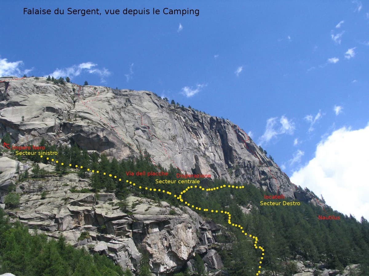
The Sergent seen from the campsite, with sector names and a few lines marked (left-hand sector at left)

Italy · Valle dell'Orco

Via per Giorgio

A rare fully bolted slab line on the Sergent, the home of Orco trad. It's mostly easy-angled granite slabs with a vertical corner on P3 and an overhanging start to the final 6a+ pitch (5c obligatory, A0 possible).

6a+12 pitches350 m

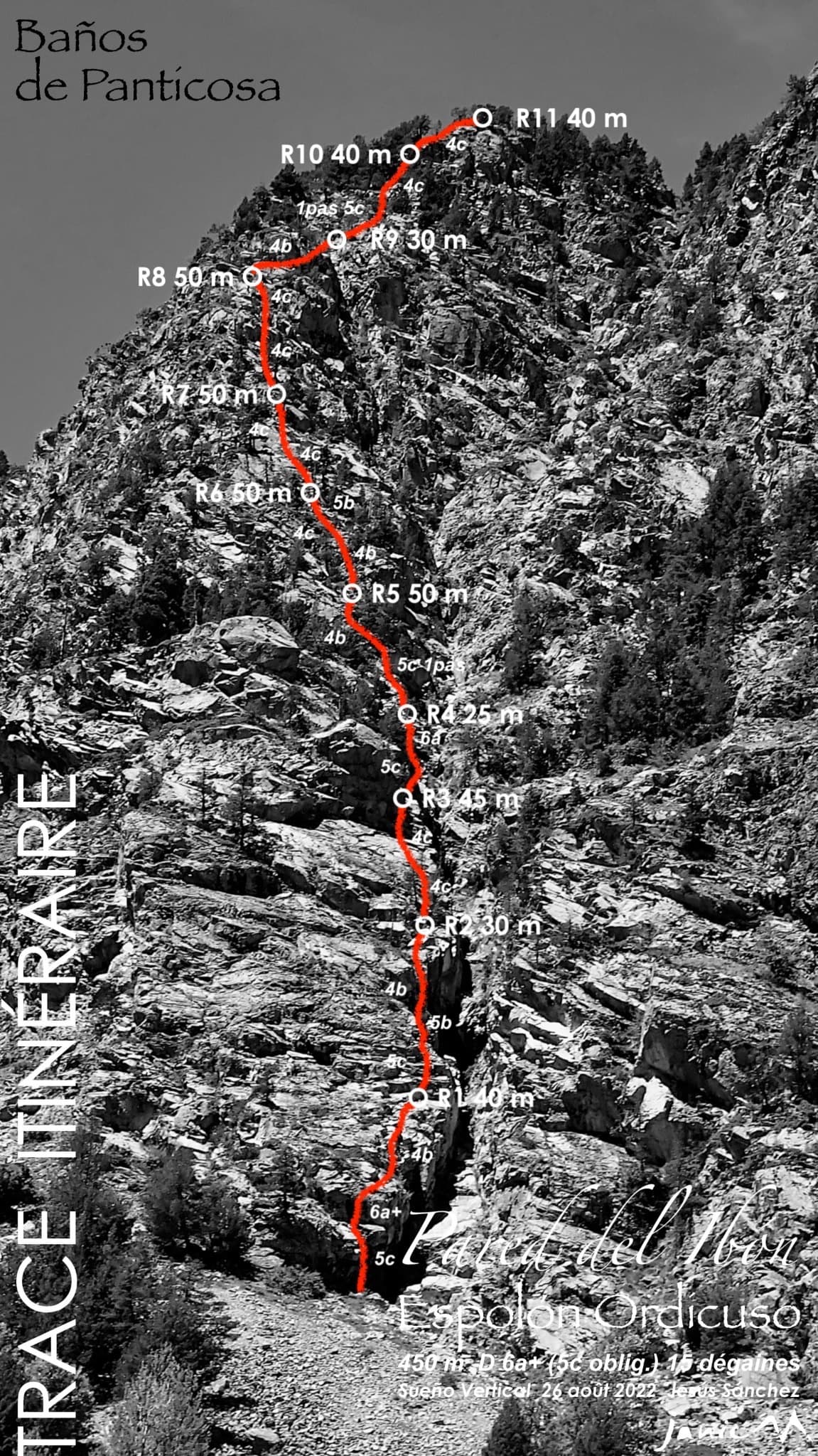
The Ordicuso spur above Baños de Panticosa with the line, belays and pitch grades of Espolón Ordicuso

Spain · Aragonese Pyrenees (Tena & Canfranc valleys)

Espolón Ordicuso

A 450 m granite spur above the lake at Baños de Panticosa, the opener's answer to anyone wanting a long, easy, bolted mountain route. Most of it is 4c to 5a on slabs, steps and short walls, with isolated moves of 5c to 6a+ that all have a cord on the bolt. Not steep or sustained, but a full day out that ends five minutes from the Ordicuso lakes.

6a+11 pitches450 m

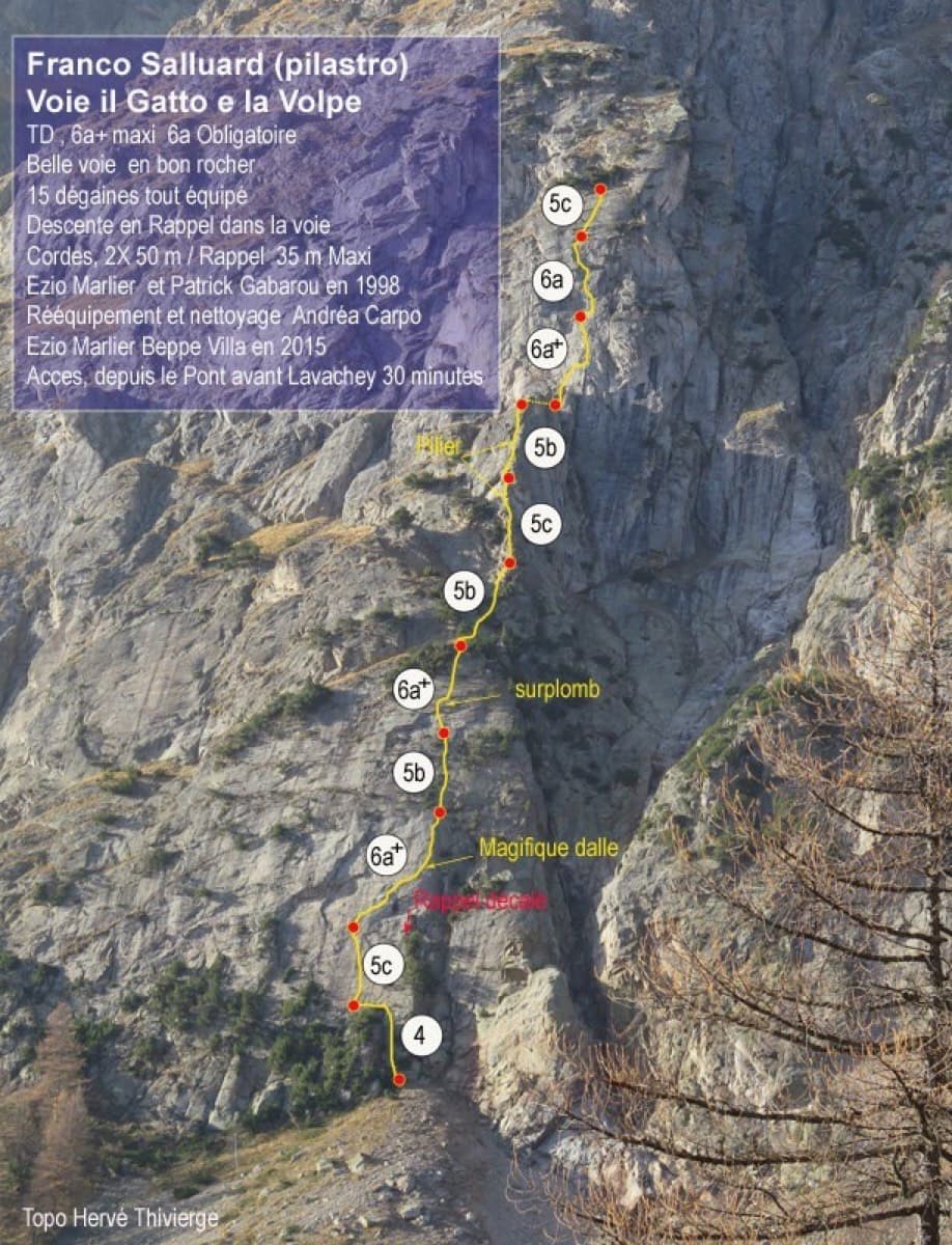
Topo of Il Gatto e la Volpe on the Pilier Franco Salluard, Val Ferret

Italy · Aosta Valley

Il Gatto e la Volpe

Rated 'great' on camptocamp: a wild setting with a short, easy approach from Lavachey. It climbs edgy granite slabs and a pillar crest, with a three-star exposed slab on P9.

6a+11 pitches350 m

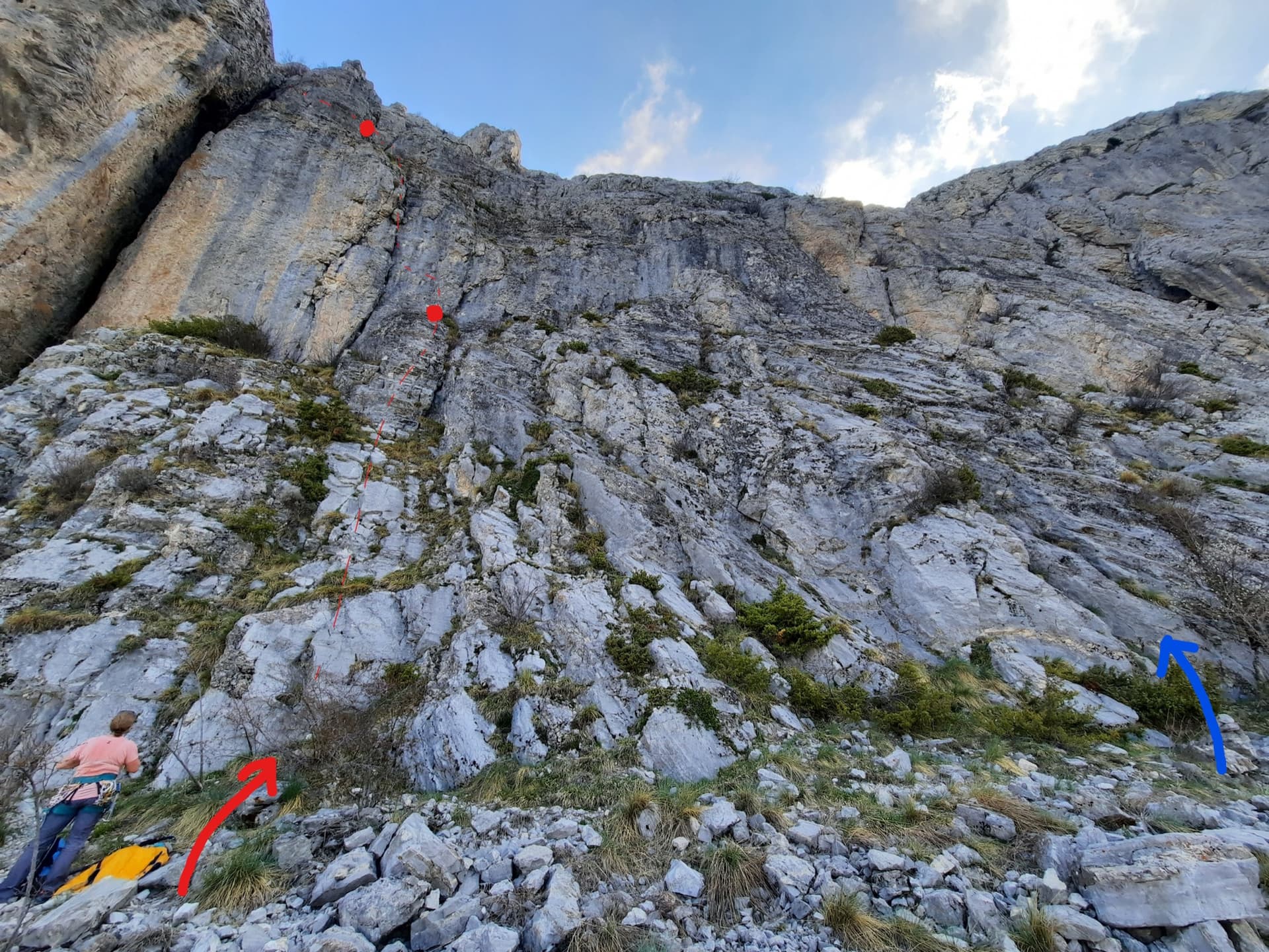
The foot of the south-west face of Pic Crillon. The blue arrow marks the start of Pas Gicon que ça (Gic'N'Roll); the red arrow and dots are its neighbour Gicon d'agneau.

France · Dévoluy

Pas Gicon que ça

Also known as Gic'N'Roll. A long, varied line up the south-west face of Pic Crillon, with the whole Dévoluy as a backdrop: flint-studded walls, a chimney, a fine layback corner and an airy spur, linked by easier and sometimes grassy pitches. By the easier variants it is a steady 5c outing; the original lines on pitches 6 and 10 add two 6a+ sections. You can walk off after pitch 8.

6a+11 pitches220 m

Read the cautions

Compiled from published sources and last verified October 2026. Bolts, anchors and access change. Climbing is dangerous and you are responsible for your own decisions: check a current topo and read the disclaimer.