Multipitch Atlas

Spelling need not be exact.

Ginseng

La Chandelle (south pillar) · Pic du Gar (Comminges) · France

Easy to bail

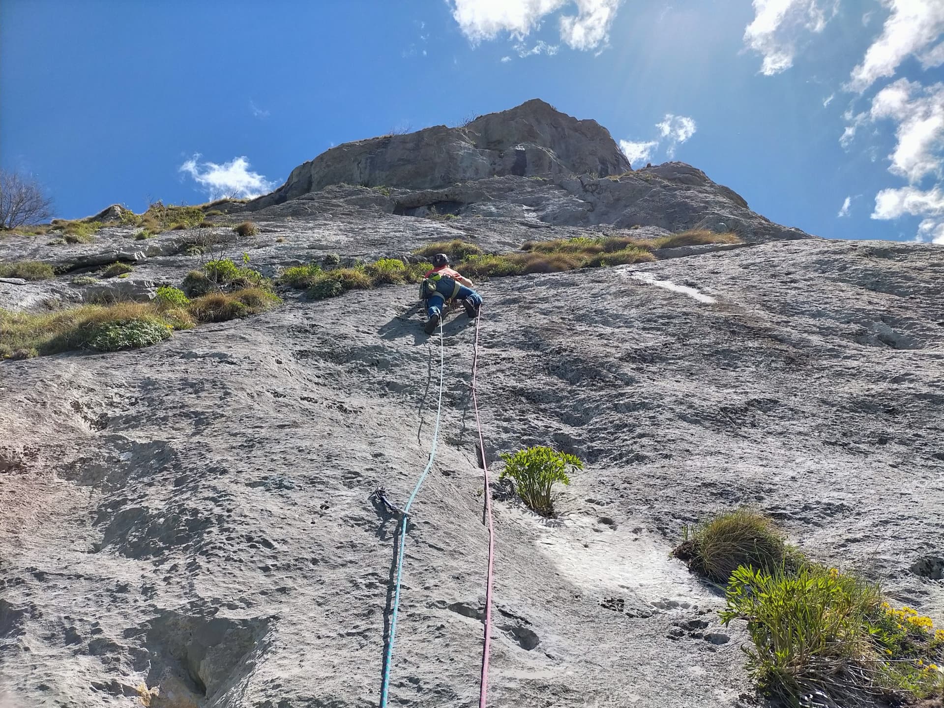
The classic of the Pic du Gar: eight sustained pitches of 6a to 6b on sculpted, fluted limestone up a slender south-facing pillar above Bézins-Garraux. Mostly technical footwork and slab, with a short steep crux on pitch 4 that can be aided. Newly rebolted with glue-ins in 2026, and in a grand, quiet setting facing the Luchon mountains.

Aerial view of the south pillars of the Pic du Gar above Bézins-Garraux, where Ginseng climbsPhoto: Seb3165 · CC BY-SA 3.0

Photo

Hardest pitch
6b
Pitches
8
Length
210 m
Approach
90 min
Aspect
S
South-facing
Rope
2×50 m
abseil descent
Rock
limestone
Season
Mar to Jun, Sep to Nov
Bolting confidence
High
Last verified
October 2026 · Compiled from published sources

Overview

Ginseng climbs the slender south pillar (the 'chandelle') of the Pic du Gar in eight pitches, sustained at 6a with a 6b crux on pitch 4. The climbing is mostly on the feet, on sculpted grey limestone with flutes, slabs, a corner and a finishing pitch of fine runnels. The line was first climbed with pegs and wooden wedges in 1964, re-equipped more directly by the PGHM Luchon in 1992, and rebolted again with glue-ins and chained belays in spring 2026. Parties since the rebolt are enthusiastic about the protection but several say the grades are stiff, so come with 6a well in hand.

Worth knowing

  • Do not park at the church in Bézins; use the cemetery car park.
  • Allow about 4 to 5 hours on the route, and 7 to 9 hours car to car.
  • Tall climbers clip more comfortably; a shorter partner found the first pitches harder in 2023 (before the rebolt).
  • The short summit ridge is worth it for the view back down the pillar, if you carry a little gear.

Pitch by pitch

No topo we can show. See: Quelques topos montagne des Pyrénées – Ginseng au pic du Gar.

Pitches of Ginseng
PitchGradeLengthNotes
P16a25 mSlab alongside a leaning pillar, 6a then 5b. Belay on a grassy ledge.
P26a+30 mHanging belay at the top. A remark in 2026 says the old R2 was not yet removed: use the new belay slightly higher.
P36a25 mSustained climbing on sculpted rock.
P46b30 mThe crux pitch: 6a+ then 6b, sustained, or 6a with a short section of aid on the bolts. Since the rebolt the old sling used to aid it is no longer needed and the pitch is less exposed.
P56a25 mCorner then a small overhang; belay in a niche on the left. This belay can be skipped with a 50 m rope, and an October 2026 party linked pitches 5 and 6.
P65c15 mShort pitch to a belay in a niche right of the line.
P75c25 mCrack pitch.
P85a35 mFine fluted runnels to the belay on top of the pillar.

Approach

To the parking

Drive to Bézins-Garraux: from Montréjeau head up the Garonne valley towards Luchon, at the Chaum roundabout turn towards Saint-Béat, then after about 2 km turn left for Eup and Bézins-Garraux and follow signs for Bézins. Parking at the church in Bézins is now forbidden; use the car park built by the cemetery, about 5 minutes before the church.

On foot · about 90 min

About 1 h 30. Follow the Pic du Gar path from Bézins. Leave it at about 1250 m where it turns west, at a double cairn and a dead, topped tree (a 2026 party reports a red R painted on it). Climb the grassy spur above towards the cliffs, cross or skirt left a small rock band at about 1360 m, go up almost to the foot of the cliffs, then make a descending traverse east under a first pillar on a faint, hard-to-find path to a vague spur facing the pillar. The original start (R0, two bolts) is on a small ledge about 70 m above the base. A 2026 party found fixed lines in place to reach the start. Alternatively start from the base of the pillar's plinth and climb two extra pitches (about grade III, 25 m, then 5c, 45 m) to R0.

Map of the walk-in

Coordinates · crag

42.95043, 0.69888

Point from camptocamp waypoint 42300 (Pic du Gar summit, above the pillar)

For your phone or watch

Download GPX

Contains the route point.

Points from published sources, not surveyed.

Descent

Abseil the route on the chained belays: with 50 m abseils, six rappels are enough (skip R5 and R2), then walk back down the approach (about 1 h to 1 h 30). Optional: from the top of the pillar continue along the summit ridge (grade 4 climbing, a 30 m abseil into a notch, then II to III along a knife-edge ridge, very few bolts) to the col between the Pic du Gar and Pic Saillant, and descend the waymarked path, first on the north-west side then the south side, back to Bézins.

Bailing off the route

Easy to bail

Abseiling the route is the normal descent, from chained belays with glued-in bolts installed in 2026. You can retreat from any belay; one party in 2023 backed off after pitch 2 because of the heat.

Retreat from
Any belay; R1 to R8 are all on the abseil line.
Point of no return
None on the route itself. The optional summit ridge beyond R8 involves an abseil into a notch and is the only committing part.
Carry
Ropes for abseils of up to about 40 m if you skip belays (double 50 m); with shorter ropes, use every belay.
Basis
Stated in the sourcesCamptocamp and topospyreneens both give abseiling the route as the descent; the rope reading is inferred.

In an emergency · France

112Emergency; sends PGHM or CRS mountain rescue

  • 17Gendarmerie and police

Position of the crag

42.95043, 0.69888

Marks the crag, not the route: give route and pitch.

Say what happened, how many are hurt, and where you are. Checked October 2026 (source).

Hazards

  • Seepage in places after rain; avoid the route after heavy rainfall.
  • Grades feel stiff: an August 2026 party found pitches 5 to 8 about one grade harder than the topo and recommends being solid at 6c; a 2024 party also added half a grade on pitches 1 to 6.
  • The approach off the path is steep grass and woods with only a faint trail; parties have lost a lot of time looking for it, and one 2024 party warns that a slip on the steep grass or the small rock band at about 1350 m must not happen.
  • The summit ridge beyond the route is barely bolted, includes a 30 m abseil and loose rock, and needs some gear; it is not part of the bolted route.
  • Several parties may queue on popular weekends: in October 2026 a party waited an hour below the 6b pitch.

Gear

16 quickdraws (camptocamp, updated after the rebolt; older topos said 10). Ropes for 50 m abseils. Helmet. For the optional summit ridge only: one or two cams and a few slings.

Checklist

Quickdraws
16
Rope
2×50 m (abseil descent)
Helmet
One each
Abseil device and prusik
For abseiling

Conditions

Plan B nearby

Straight-line distances, up to 30 km.

Reader reports

No reports yet.

Report a problem with this route

Say what and where. Reports are checked before they appear; no name or email is stored.

Bolts and history

Bolting
Rebolted in spring 2026 by the PGHM Luchon with glued-in bolts and chained belays, funded by the FFME; two parties in August and October 2026 call the bolting perfect. Before that it had 10 mm expansion bolts (1992), sometimes spaced. The optional summit ridge above the route is barely bolted and needs a cam or two and slings.
History
First climbed on 1 and 2 May 1964 by Philippe Sol and Claude Valleau, in 18 hours with a bivouac in étriers, left equipped with pegs and wooden wedges. Re-equipped in December 1992 by the PGHM Luchon on a more direct line a few metres right of the original. Rebolted with glued-in bolts and chained belays in spring 2026 by the PGHM Luchon with funding from the FFME.
Guidebook
Older topo in 'Escalade en Pyrénées centrales' (out of print). Up-to-date topo on camptocamp.

Where sources disagree

  • Quickdraws: 10 in older topos and the Spanish camptocamp text (before the rebolt); 16 in the current French camptocamp text after the 2026 rebolt.
  • Length: 210 m in topospyreneens and camptocamp; Denis Corpet's 2009 page calls it 300 m and a topo photo posted in 2026 says 7 pitches and 280 m. The 8 pitches listed add up to 210 m above R0.
  • Grades: camptocamp gives 6b max, 6a obligatory; several parties say it is stiff, and an August 2026 party called the crux 6c.
  • Rope: camptocamp and topospyreneens advise '50 m' abseils; as some skipped-belay abseils are about 40 m, this means double 50 m ropes (or one 100 m rope). This reading is inferred.
  • A 2024 party (before the rebolt) found the bolts spaced and offline and called cams useful; this no longer applies after the 2026 rebolt according to the August and October 2026 reports.

Sources

More in Pic du Gar (Comminges)

All routes in Pic du Gar (Comminges)
Climbing the friction slab of pitch 2 of Un sourire parmi les étoiles, Pic du Gar

France · Pic du Gar (Comminges)

Un sourire parmi les étoiles

A modern, generously bolted route on clean grey limestone at the Prat Dessus cliff of the Pic du Gar, dedicated to a mountain rescue doctor. The three lower pitches are excellent technical slab and wall climbing on small edges and friction, with a short steep bulge on pitch 3; after a grassy terrace, two easier pitches on more fragile rock reach the top. Great views over the Garonne valley and the Luchon peaks.

6c5 pitches150 m

Read the cautions

Around 6b · about 8 pitches

Similar elsewhere

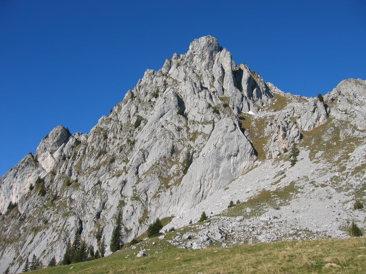
The south-east side of the Wandflue above the Gastlosen pastures

Switzerland · Gastlosen

Toto le héros

One of the best routes at 6a to 6b in the Gastlosen: eight varied pitches of pocketed slab, short walls, pillars and water-drop rock on the south-east face of the Wandflue. The first pitch is the 6b crux and the steep, pocketed wall of pitch 7 is the highlight. A few grassy ledges link the good rock.

6b8 pitches250 m

Read the cautions

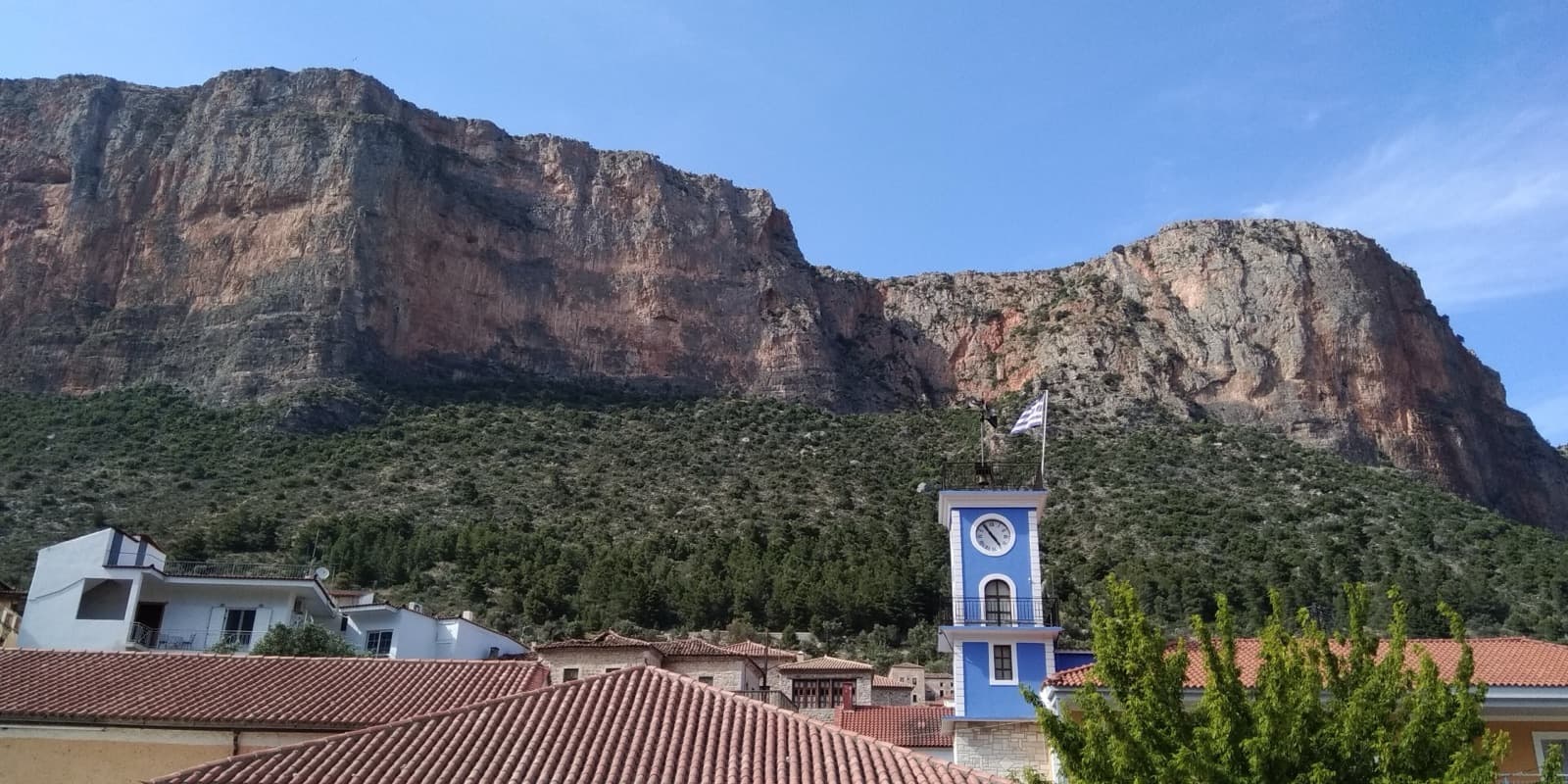
The Kokkinovrachos cliffs above the roofs and clock tower of Leonidio; the rounded buttress on the right is the eastern end of the cliff line.

Greece · Leonidio & Kyparissi

Aghios Lemmy

Short, mostly vertical pitches on beautiful multi-coloured limestone with varied climbing. It is sustained at 6a+/6b from P2 to the top. The route name is written at its base.

6b8 pitches160 m

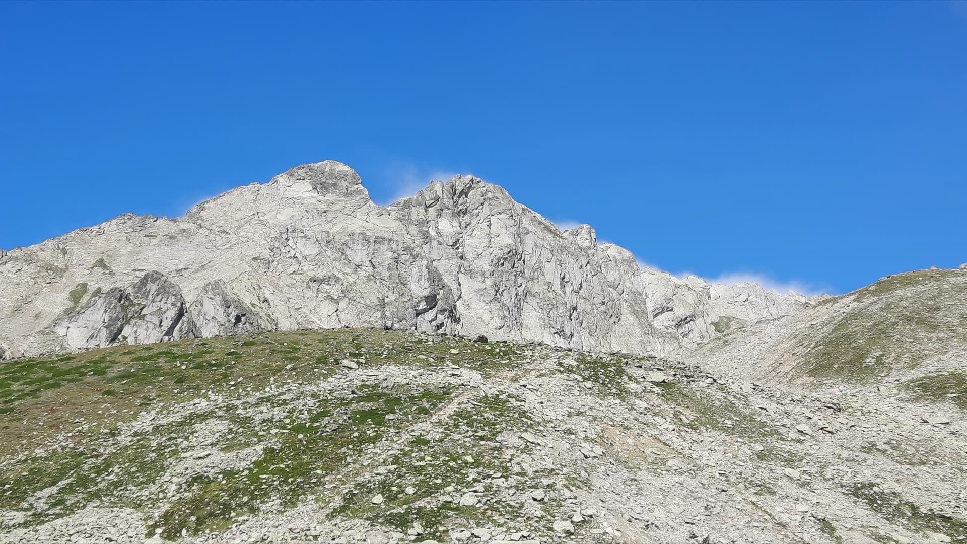
The Klein and Gross Öugstchummuhorn seen from the approach to the Wiwannihütte

Switzerland · Wiwanni (Baltschiedertal)

Im Licht und Schatten

Eight short, varied pitches on the Gross Öugstchummuhorn. Three slab pitches lead to a steep, athletic 6a+ through a series of bulges and a tricky, exposed 6b traverse near the top. In the afternoon the pitches alternate between sun and shade, which gave the route its name.

6b8 pitches185 m

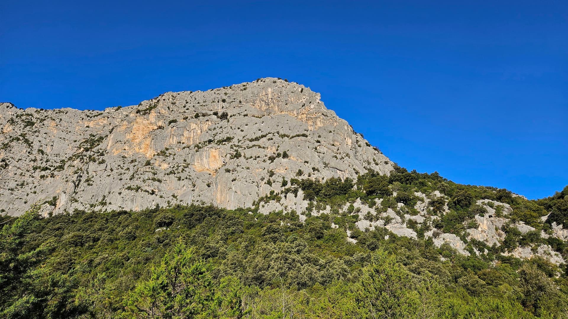
The east face of Monte Oddeu above the Flumineddu valley near Dorgali, seen on the approach; L'Imbrago... Bello Stretto climbs this face.

Italy · Sardinia

L'Imbrago... Bello Stretto

Eight short, steep pitches up the grey and yellow east face of Monte Oddeu, sustained at 6a with two pitches of 6b. Sculpted, grippy rock that parties compare to the Verdon, with ledges that give comfortable belays. The hard move on pitch 5 can be aided.

6b8 pitches185 m

Compiled from published sources, last verified October 2026. Bolts, anchors and access change: check a current topo and read the disclaimer.