Multipitch Atlas

La Fiesta del Sud

Tenailles de Montbrison – south-east face · Briançonnais · France

Easy to bailBolting confidence: high

The popular modern route of the Tenailles de Montbrison, a group of pale limestone towers high above the Durance. The lower pitches are slabby and beginning to polish; from the fifth pitch on it steepens into a 35 m crack, a thin slab and a final pitch with a leftward traverse, all at 6a+ to 6b. Grades are firm and you climb between the bolts.

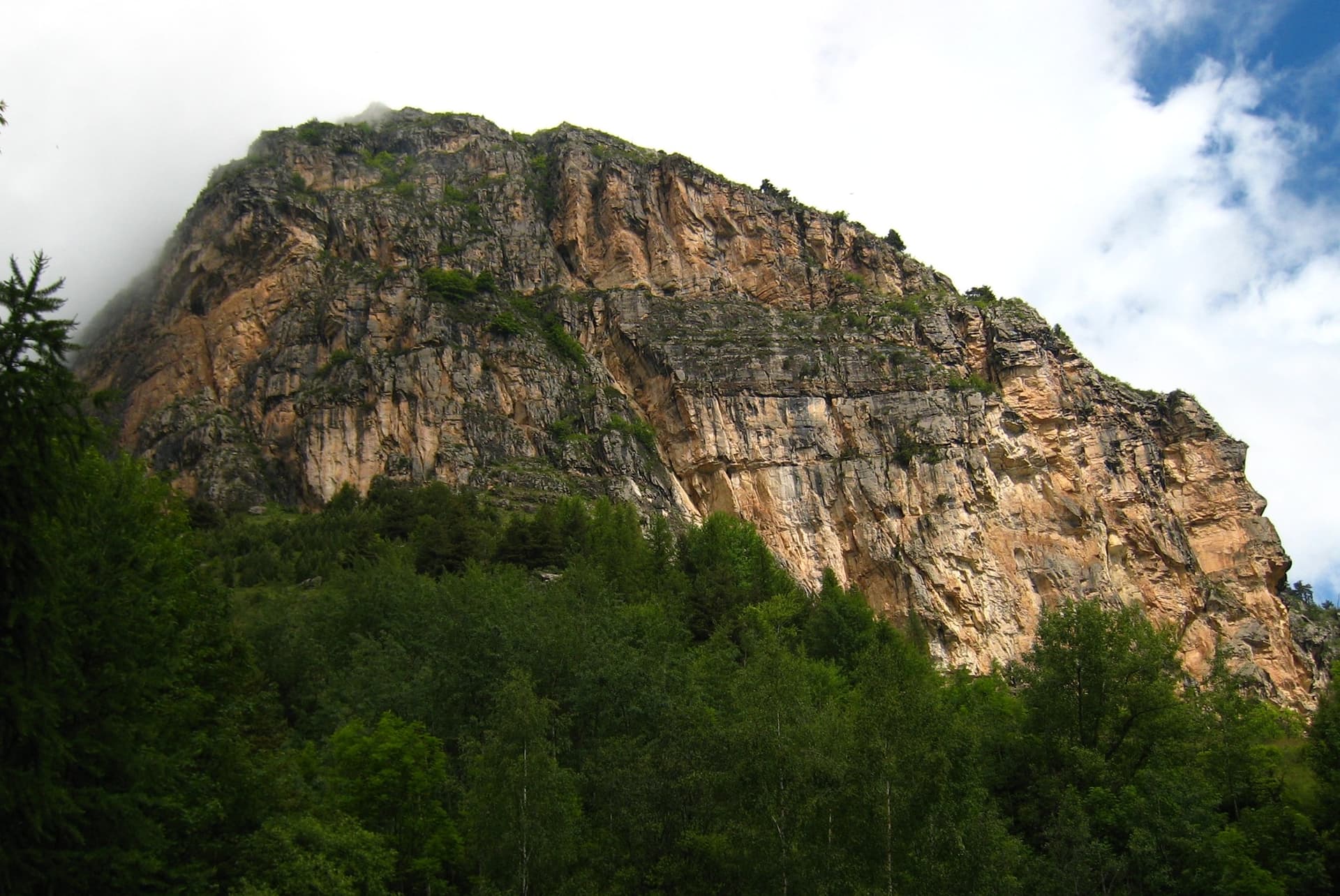
The towers of the Tenailles de Montbrison seen from the approachPhoto: Arnaud Saint Léger · CC BY-NC-ND 3.0

Photo

The towers of the Tenailles de Montbrison seen from the approachPhoto: Arnaud Saint Léger · CC BY-NC-ND 3.0
Hardest pitch
6b
Pitches
9
Length
280 m
Approach
60 min
Aspect
SE
South-east-facing
Rope
2×50 m

The route

Overview

The Tenailles de Montbrison are the limestone towers north-east of the Tête d'Aval, reached by a rough forest track from the hamlet of Bouchier. La Fiesta del Sud climbs the middle of the south-east face, left of a large and obvious cave, and has become the classic of the wall since Cambon bolted it in 2009. It is homogeneous at 6a to 6b: slabs and short walls low down, then a long crack, a steep slab on footholds and a final pitch with two harder moves. Despite the name the wall faces east of south and is in shade in the afternoon. The base is at about 2280 m.

The climbing

Pitch by pitch

Pitches of La Fiesta del Sud
PitchGradeLengthBoltsNotes
P15c35 m9 boltsSlab with a traversing move right. A 6a+ variant on the right is pleasant and well bolted.
P25c45 m9 boltsStraight up for a few metres, then a long traverse left; one well-protected slab move where the lines divide.
P36a/6a+35 m10 boltsVertical ground with feet to find, then 5 or 6 m of hard slab with two delicate moves. They can be aided on the bolts but you must climb between them.
P46a+20 m7 boltsA short pitch, usually linked with the transition that follows.
P53c15 m2 boltsTransition across easy ground. A large block came off here under a climber in 2024.
P66a30 m9 boltsLong and vertical; bolts a little further apart.
P76a+/6b40 m14 boltsThe crack: about 35 m of sustained, physical crack climbing with 14 bolts and 3 pegs, two of the bolts on 8 mm studs. You can belay at the top of the crack, or more comfortably 7 or 8 m further on. Many find this the crux and nearer 6b+; cams of about 0.5 and 0.75 fit.
P86a+25 m9 boltsA short, steep slab that needs reading and precise footwork. Well bolted.
P96b35 m14 boltsTwo harder moves, the crux on a horizontal traverse left. Closely bolted at the crux; several parties find it no harder than the pitches below.

Getting there

Approach

To the parking

Find the hamlet of Bouchier, reached by a long stony track from the minor road on the right bank of the Durance between Prelles and Les Vigneaux. Just before entering Bouchier turn sharp right onto a rougher track and follow it for 3 km, past meadows and a small house below on the right (La Blétonnée). Park beside the track without blocking it about 100 m further on, by a stream. The track is hard on low cars; several parties leave the car at Bouchier and walk about 2 h 15 by the Croix de la Salcette, or ride an electric bike. L'Argentière-la-Bessée and Briançon have railway stations.

On foot · about 60 min

About 1 hour from La Blétonnée with 580 m of ascent. Take the path that starts on the left bank of the stream, cross the stream higher up to reach a green side valley on the left, and follow a good path up it and then cairns through scree to the foot of the south-east face. Keep to the good path until above a rocky step; do not turn off at the first side valley. The route starts in the middle of the face, left of the big cave, at a gold bolt with a white cord and 'FDS' engraved; two variant starts are visible 8 m up.

Map of the walk-in

  • Crag
  • Parking

Loading map

The point marks the crag, not the exact start of the route.

Coordinates · crag

44.85232, 6.54458

Parking

44.85912, 6.56273

La Blétonnée, roadside parking at the end of the Bouchier forest track (camptocamp waypoint 664095)

Point from camptocamp waypoint 40844 (Tenailles de Montbrison summit)

For your phone or watch

Download GPX

Contains the route point and parking. Opens in most mapping apps and GPS watches.

Points are compiled from published sources, with the precision stated above. They were not surveyed on the ground: check them against a current topo.

Getting down

Descent

By abseil directly beside the route, moving slightly east each time: 48 m to belay 6; 40 m down and right to the ledge of belay 5; 45 m down and right to a three-bolt belay; 45 m to a ledge that descends to the left, or to the ground with 2×60 m ropes; and an optional 25 m abseil from the first belay of Les Carnutes to avoid walking down the ledge. Parties with 60 m ropes do it in four. Several recent parties prefer to walk off instead: continue above the last belay to an obvious notch and follow cairns down behind it, which brings you back past the foot of the route.

Retreat

Bailing off the route

Easy to bail

Abseiling beside the route is a normal descent and the stations are in place, so you can retreat from the belays that the abseil line passes: the top, belay 6, the ledge of belay 5 and the stations below. You need two ropes, as the abseils are 40 to 48 m.

Retreat from
From the top, belay 6 and the ledge at belay 5 directly onto the abseil line, which lies just to the side (east) of the climb; lower down the line continues to a ledge and the ground.
Point of no return
None stated.
Carry
2×50 m ropes. Watch for stonefall when pulling ropes through the gully below the third station.
Basis
Stated in the sourcesCamptocamp lists the abseils station by station and several 2025 and 2026 parties report them as efficient; none reports a retreat from part-way, so the lower belays of the climb itself are assumed rather than confirmed to link to the line.

Safety

Hazards

  • The abseil line crosses a stony gully below the third station and the walk-off scree sits above the route: both send stones down the line. Do not descend above other parties.
  • The crack pitch is long and its bolts are further apart than elsewhere; it is the one pitch where you cannot easily pull through.
  • Pitch 3 has one or two obligatory thin moves between bolts.
  • The approach track is rough and long. Budget extra time if you walk from Bouchier.

Sun and weather

Conditions

South-east to east facing between about 2280 and 2510 m: sun in the morning and shade from early afternoon, cold in a north wind. The season runs from June to early October; a party on 31 May 2024 met snow patches on the approach and descent and climbed in the cold, while 31 May 2025 was excellent. After rain the crack pitch seeps. Allow 3 to 5 hours on the route and about an hour for the abseils.

Usual season · Jun to Oct

Sun on the wall · SE-facing

Working out the sunlit hours for this month.

  • January: not yet worked out
  • February: not yet worked out
  • March: not yet worked out
  • April: not yet worked out
  • May: not yet worked out
  • June (usual season): not yet worked out
  • July (usual season): not yet worked out
  • August (usual season): not yet worked out
  • September (usual season): not yet worked out
  • October (usual season): not yet worked out
  • November: not yet worked out
  • December: not yet worked out

Sun on the wallDaylight, wall in shade● Usual season

Estimated from the wall's aspect only. Ignores surrounding terrain, gullies and the wall's exact shape. Clock times are local to the wall (Central European time), for the 15th of each month.

Climate figures for Briançonnais are not available yet

What to carry

Gear

2×50 m ropes and 14 quickdraws including 4 long ones. Two medium cams (0.5 and 0.75) are optional for the crack pitch. Helmet.

Checklist

Quickdraws
14
Rope
2×50 m
Helmet
One each
Abseil device and prusik
The descent or the retreat involves abseiling

Derived from the route data; check it against a current topo

From climbers

Reader reports

Reader reports are not being collected yet. Until they are, check a current topo and the local club or guidebook publisher for recent changes to La Fiesta del Sud.

Worth knowing

Tips

  • Link pitch 4 with the 3c transition: it works without much drag.
  • Footholds on the first five pitches are starting to polish; the upper half is the better half.
  • On a hot day your feet suffer on the slabs; pick a cool day or start early.

Open questions

Where sources disagree

  • Grades: camptocamp gives 5c, 5c, 6a/+, 6a+, 3c, 6a, 6a+/b, 6a+, 6b with 6b the maximum; gulliver gives 6a+, 5c, 6a, 6a+, 3b, 5c, 6a+, 6a, 6a with 6a+ the maximum. Recent camptocamp parties tend to rate the crack pitch 6b or 6b+ and the last pitch about 6a.
  • Length: the camptocamp pitch lengths add up to 280 m; its header gives 230 m of difficulties and gulliver gives 250 m.
  • Aspect: south-east on camptocamp, south on gulliver; a 2024 party stresses that the wall faces east and loses the sun in the afternoon.
  • Quickdraws: 14 in the French camptocamp text, 12 in the Spanish one. Parties who run the crack pitch on to the further belay say 14 is the minimum.
  • Approach: 580 m of ascent from La Blétonnée on camptocamp; gulliver gives 400 m, measured from the end of the track.

Provenance

Sources

Same area

More in Briançonnais

All routes in Briançonnais
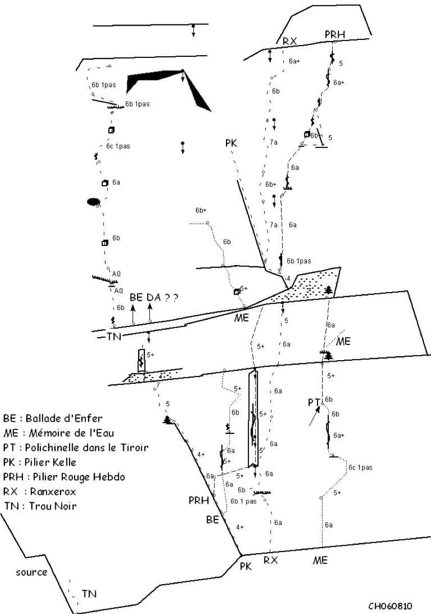
Sketch topo of the Ranxerox sector of the Tête d'Aval; La mémoire de l'eau is the line marked ME

France · Briançonnais

La mémoire de l'eau

One of the most admired lines on the Tête d'Aval: eleven sustained pitches, first up steep cracks and walls, then across orange limestone studded with small spikes. The grade is 6c with a 6c+ passage that has a fixed sling for aid, and 6b is obligatory. Parties advise being comfortable at 6c, because the bolting is sound but not generous.

6c+11 pitches300 m

Read the cautions
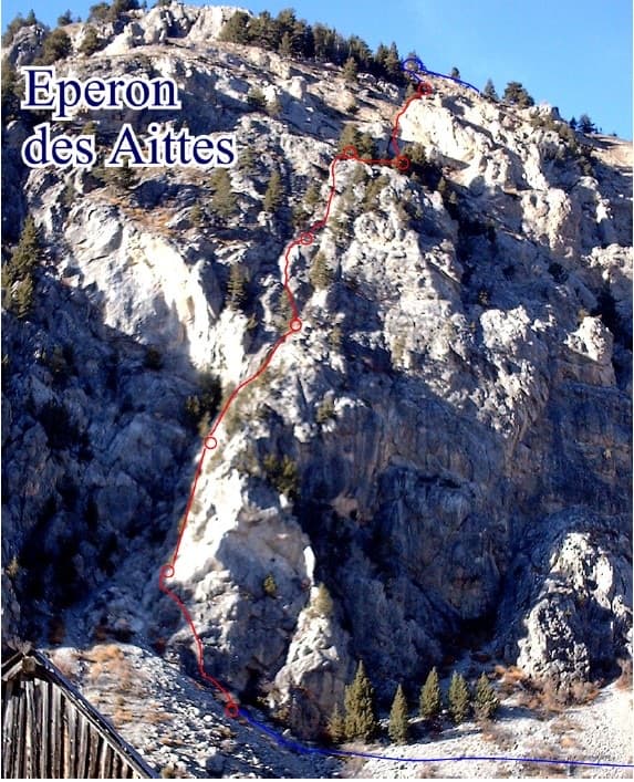
Photo-topo of the Éperon des Aittes above the Fonts de Cervières road, with El Boboch drawn in red

France · Briançonnais

El Boboch

A beginner's multipitch on a limestone spur above the Fonts de Cervières road, five minutes from the car. The first four pitches give real climbing at 3c to 4c on slabs and short walls; above that the route is mostly walking and scrambling on earthy, stony ground to the crest. Follow the expansion bolts, not the army glue-ins, for the better rock and less rope drag.

4c8 pitches250 m

Hand-drawn topo of Joli coup Baron showing the three steps, the walks between them and the pitch grades

France · Briançonnais

Joli coup Baron

Twelve short pitches up three separate quartzite steps on the west side of the Rocher Baron, ten minutes from the road in the Durance valley south of Briançon. It starts very easy and steepens as it goes: the top step has the 5a bulge and the best climbing. A first multipitch, low and quick to reach, with road noise on the lower part.

5a12 pitches210 m

The multipitch wall of Le Ponteil above Champcella

France · Briançonnais

La diagonale de gauche

The gentlest way up the big limestone wall of Le Ponteil: short walls and slabs that slant leftwards across the south-west facet, with a ledge walk in the middle. Most of it is 4b to 5c on very featured rock; one well-bolted move round a block gives the 6a. It gets better as it goes, and pitches 4 and 6 are the ones people remember.

6a7 pitches200 m

Around 6b · about 9 pitches

Similar elsewhere

The Paroi de la Fissure above Ailefroide, with the long crack that names it; La Snoopy directe climbs the face to its left

France · Ailefroide

La Snoopy directe

Nine pitches of sustained 6a on featured granite behind the campsite, the hard counterpart to À tire d'ailefroide. It gets better from pitch 4, a steep wall on pockets and edges that leads into a superb layback and is the short 6b crux. The last two pitches are slab.

6b9 pitches210 m

The Frontales cliffs above El Chorro seen across the Tajo de la Encantada reservoir, with the big Poema de Roca cave at the foot of the central dome. The Solarium sector is towards the right-hand end of the cliff; the line is not marked.

Spain · El Chorro

Estrella Polar

Ten varied pitches on good rock in a superb position: a roof, slabs, a tenuous traverse by a cave and a steep corner. Several pitches feel stiff for the grade, especially the P2 crux.

6b10 pitches279 m

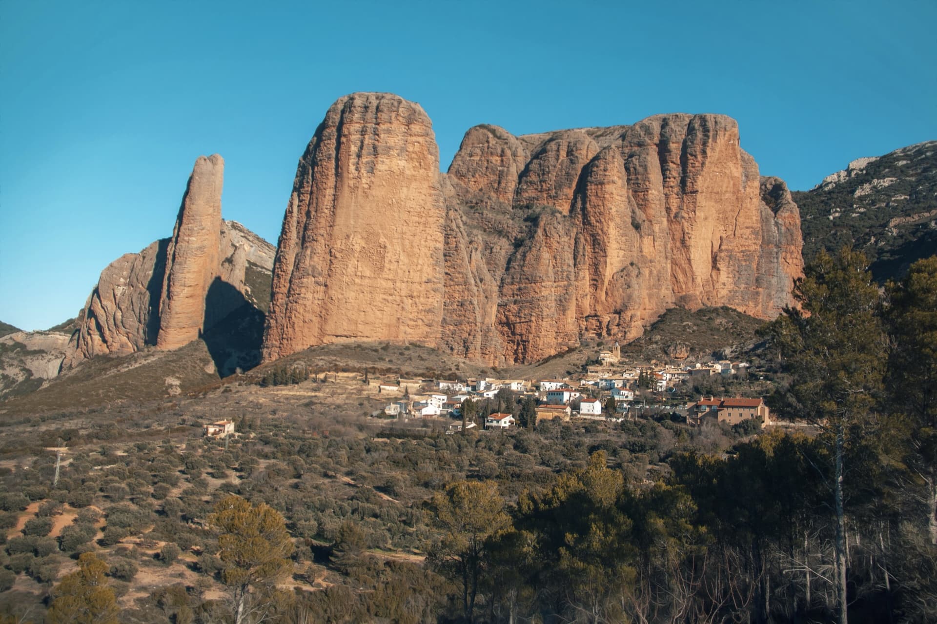
The classic view of Riglos from the south-west: the slender pinnacle of El Puro on the left, the great dome of Mallo Pisón beside it, and the main wall running right to La Visera above the village.

Spain · Riglos & Agüero (Mallos)

Normal al Puro

The way up the detached cigar that is the symbol of Riglos, first climbed in 1953. A polished corner, then the chimney between the Puro and the Pisón, then three short pitches on the outside of the needle to a tiny summit. Very polished in the chimney and on the boulder moves. In shade most of the day.

6b10 pitches180 m

Read the cautions

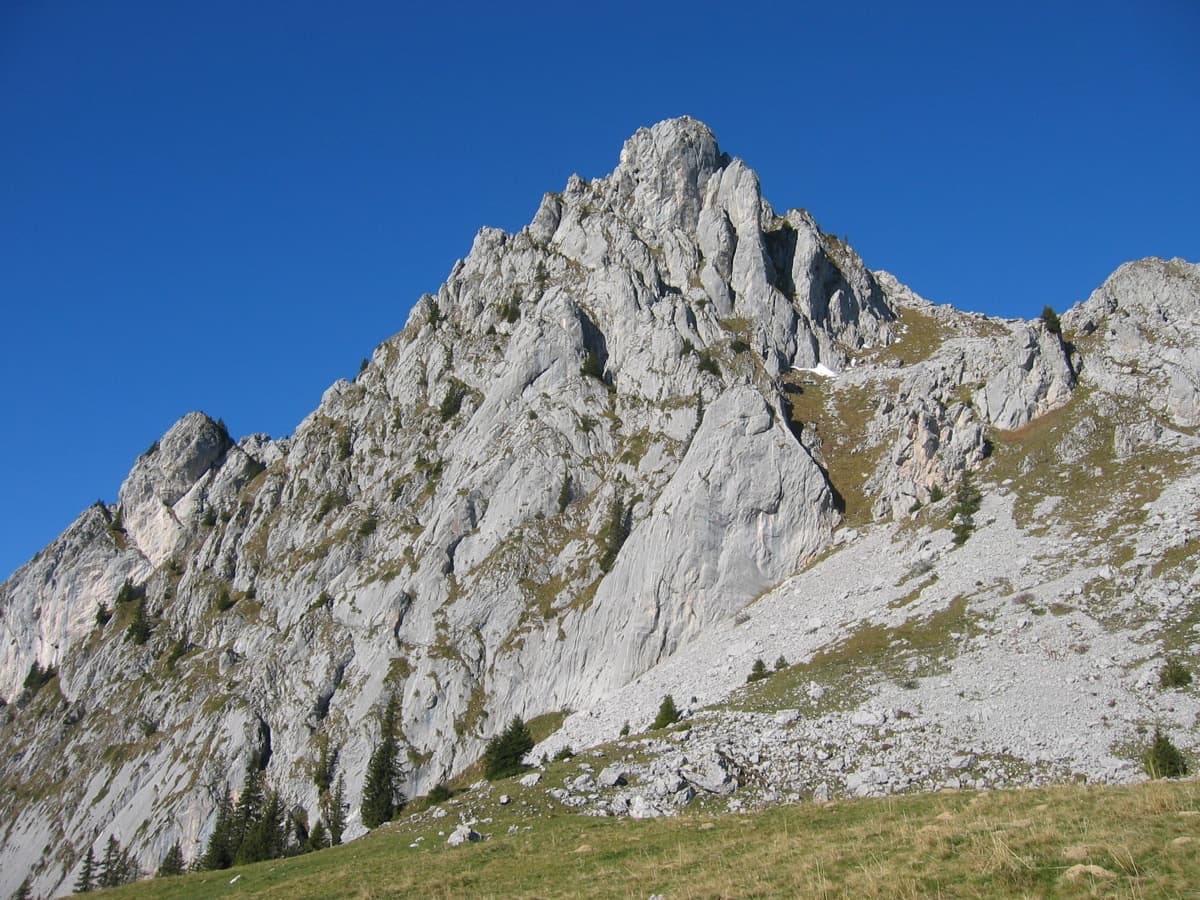
The south-east side of the Wandflue above the Gastlosen pastures

Switzerland · Gastlosen

Toto le héros

One of the best routes at 6a to 6b in the Gastlosen: eight varied pitches of pocketed slab, short walls, pillars and water-drop rock on the south-east face of the Wandflue. The first pitch is the 6b crux and the steep, pocketed wall of pitch 7 is the highlight. A few grassy ledges link the good rock.

6b8 pitches250 m

Read the cautions

Compiled from published sources and last verified October 2026. Bolts, anchors and access change. Climbing is dangerous and you are responsible for your own decisions: check a current topo and read the disclaimer.