Multipitch Atlas

Hanimoon

Hannibalturm · Furka · Switzerland

Easy to bailBolting confidence: high

Five sustained pitches on the left side of the Hannibalturm, never easier than 5c+ and never much harder than 6a+. A smooth friction slab leads to steep wall climbing, a pillar, a flake and a corner, and the route finishes up a ladder of huge quartz knobs. Many parties rate it the best line on the tower and find the second pitch the hardest.

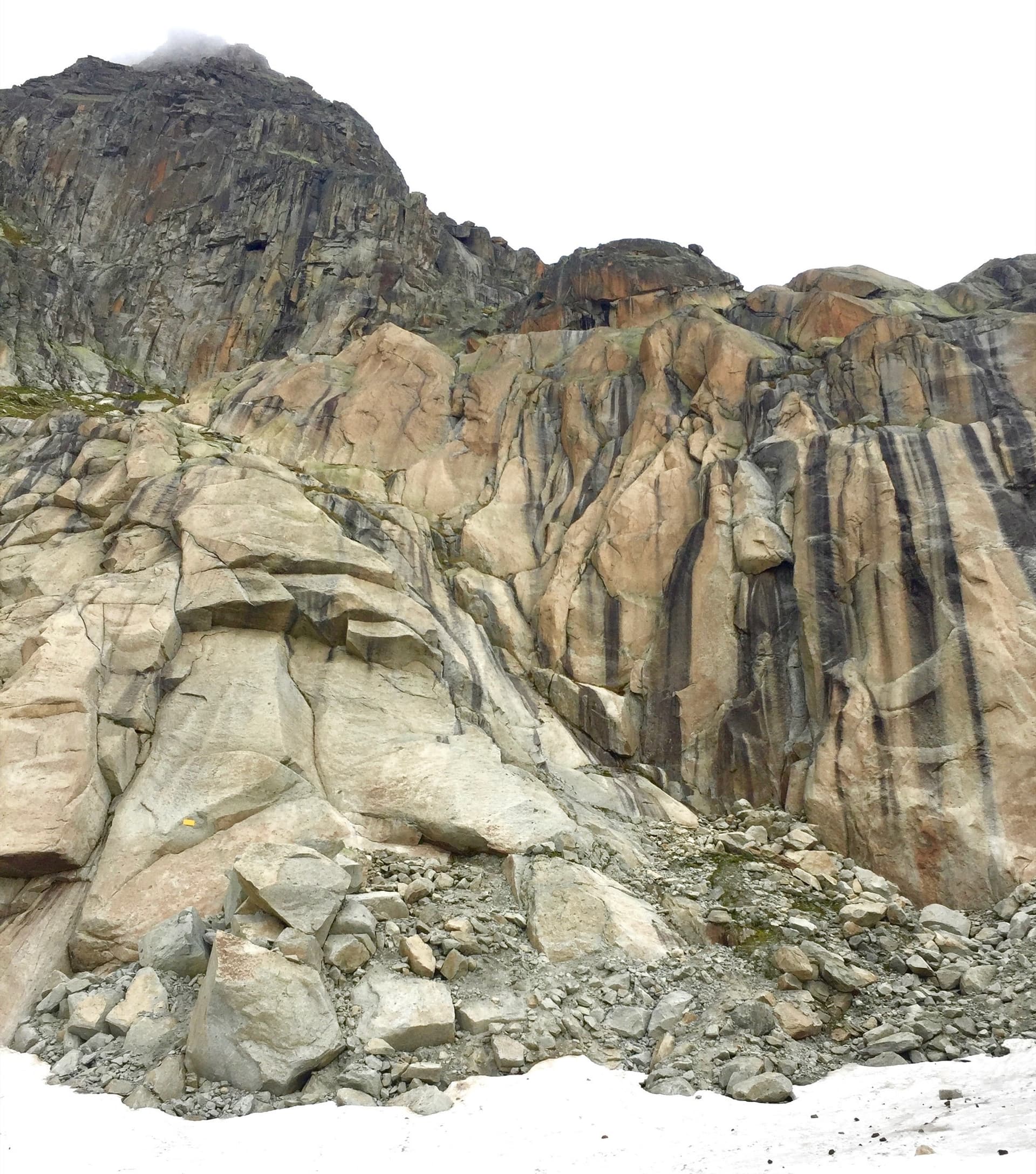
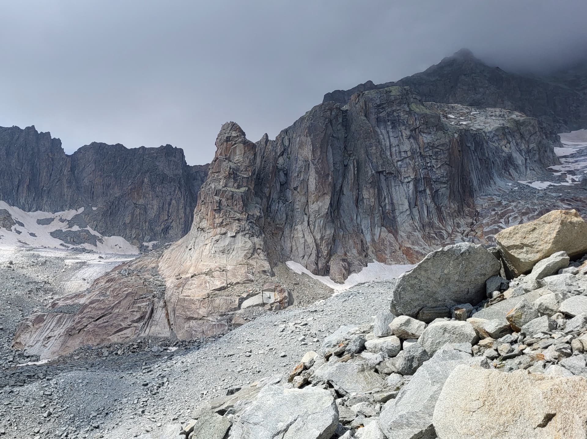
The Hannibalturm in early season, with snow still lying at its footPhoto: alexduchablais · CC BY-SA 3.0

Photo

The Hannibalturm in early season, with snow still lying at its footPhoto: alexduchablais · CC BY-SA 3.0
Hardest pitch
6a+
Pitches
5
Length
170 m
Approach
75 min
Aspect
S
South-facing
Rope
2×50 m or a single 70 m
(opener's topo); 2×60 m allows three abseils

The route

Overview

Hanimoon climbs the left-hand part of the Hannibalturm (also written Hanibal, P. 2882), the red-brown granite tower that stands in the Sidelen glacier basin in front of the Galenstock. It was opened in 2009 as a wedding-present route and bolted to what its author calls a generous plaisir standard, though he stresses that 5c+ is obligatory. The climbing is homogeneous and varied: friction, steep face, cracks and corners, then an athletic bulge and a line of quartz knobs to the bench on the summit. It is very popular and often has a queue at weekends.

The climbing

Pitch by pitch

Pitches of Hanimoon
PitchGradeLengthBoltsNotes
P15c+40 m9 boltsA friction slab that starts smooth and steepens onto small edges higher up. Parties find it an abrupt start when cold, with the bolts feeling far apart. Camptocamp gives 50 m; the opener's topo and a 2026 party give 40 m. Bolt count from the 2026 party.
P26a+35 m9 boltsAlong a quartz band for a few metres, then straight up a technical slab and a steepening wall. Long and sustained, and several parties grade it 6b and call it the crux of the route. The bolt count is a 2026 party's estimate.
P36a35 m6 boltsUp the orange pillar (the start is not easy and the first bolt is hard to clip), then a flake and a corner. Keep left: the belay joined with cord on the right belongs to Elefantenrüssel, and the Hanimoon belay is the chained one further left.
P46a+25 m6 boltsA few steep moves, then a traverse left on small holds across a slab. Two hard passages, both well protected.
P56a35 m11 boltsSteep flakes (climb them gently), an athletic bulge on good holds, then the ladder of large quartz knobs to the belay beside the summit bench.

Getting there

Approach

To the parking

The Furka Pass road links Andermatt (Uri) and the upper Rhône valley (Valais) and is open in summer only. Park at the Hotel Furkablick, a little east of the pass. The Sidelenhütte (2708 m) above is the alternative base; it is about 15 to 20 minutes from the tower.

On foot · about 75 min

From the Hotel Furkablick follow the marked path towards the Sidelenhütte. The opener's topo leaves the path about 400 m south-west of the hut, crosses the rubble-covered ice of the Sidelen glacier and gains the slabs at the foot of the tower over a moraine ridge, 60 to 75 minutes. Camptocamp describes staying on the moraine after the footbridge and heading for the tower by sight shortly before the hut, 1 h 30; a 2026 party went faster along the left bank of the stream after the footbridge and took an hour. Reach the starting ledge from the left of the plinth, or from the right (east) with a short exposed down-climb. From the Sidelenhütte allow about 15 to 20 minutes. Route names are painted at the foot.

Map of the walk-in

  • Crag
  • Parking

Loading map

The point marks the crag, not the exact start of the route.

Coordinates · crag

46.59920, 8.41970

Parking

46.57639, 8.42146

Hotel Furkablick on the Furka Pass road (camptocamp access waypoint 569751)

Point from camptocamp waypoint 175119 (Hannibalturm); Mountain Project places the tower about 100 m away at 46.5983, 8.4198

For your phone or watch

Download GPX

Contains the route point and parking. Opens in most mapping apps and GPS watches.

Points are compiled from published sources, with the precision stated above. They were not surveyed on the ground: check them against a current topo.

Getting down

Descent

Abseil the route from the chain belays. The opener's topo gives five abseils with a double rope or a single 70 m. A 2020 party did it in three with 2×60 m (R5 to R3, R3 to R1, R1 to the ground) and warns that shorter ropes will not reach. Watch where the ropes run; in early season a loop can jam between the rock and the snow at the base.

Retreat

Bailing off the route

Easy to bail

Abseiling the route is the normal descent and every belay is a chain belay, so you can turn round at any stance. No party reports trouble beyond ropes catching in the snow at the base early in the season.

Retreat from
Any belay (R1 to R5).
Point of no return
None.
Carry
A double rope or a single 70 m, as for the normal descent.
Basis
Stated in the sourcesThe opener's topo states chain belays and abseils down the route; a 2020 party describes the abseil sequence.

Safety

Hazards

  • The approach crosses moraines and the rubble-covered edge of the Sidelen glacier. In early season the snow can be frozen: parties recommend mountain boots and sometimes an axe.
  • Bolts are spaced on the easier ground, with a long way to the first ones on the pitch 1 slab; 5c+ is obligatory.
  • A 2016 party found a few hangers that turned even with the nuts tight.
  • Hollow-sounding flakes at the start of pitch 5.
  • Crowds: several parties are usually on the tower, and abseiling parties come down the same line.
  • High mountain setting at 2700 to 2900 m with afternoon thunderstorms in summer.

Sun and weather

Conditions

The foot of the route is at about 2700 m and faces south. Parties report sun on the wall from late morning in June. Snow lingers at the base well into July, which can make the start awkward, and the Furka road is open in summer only. The hut is wardened from late June to early October.

Usual season · Jul to Sep

Sun on the wall · S-facing

Working out the sunlit hours for this month.

  • January: not yet worked out
  • February: not yet worked out
  • March: not yet worked out
  • April: not yet worked out
  • May: not yet worked out
  • June: not yet worked out
  • July (usual season): not yet worked out
  • August (usual season): not yet worked out
  • September (usual season): not yet worked out
  • October: not yet worked out
  • November: not yet worked out
  • December: not yet worked out

Sun on the wallDaylight, wall in shade● Usual season

Estimated from the wall's aspect only. Ignores surrounding terrain, gullies and the wall's exact shape. Clock times are local to the wall (Central European time), for the 15th of each month.

Monthly climate averages for Furka, 1991-2020
MeasureJanFebMarAprMayJunJul (usual season)Aug (usual season)Sep (usual season)OctNovDec
Mean daily high °C−10−8−5−227101062−5−9
Mean daily low °C−15−15−12−9−5−122−2−6−11−14
Rain days 1 mm or more131214151719201915141514

● marks the usual climbing season. Averages for 1991-2020 at about 2839 m. Area climate from Open-Meteo reanalysis. Temperatures are adjusted to the height of the crag; rain comes from a grid cell of about 10 to 25 km, and summer highs on sea cliffs can read a few degrees low. The wall and valley can differ. Data: Open-Meteo, CC BY 4.0.

What to carry

Gear

12 quickdraws and a helmet. The opener states that extra protection is neither necessary nor useful; camptocamp and two trip reports say a few small cams can shorten the run-outs if you are at your limit. Mountain boots, and possibly an ice axe, for the approach when the snow is hard.

Checklist

Quickdraws
12
Rope
2×50 m or a single 70 m (opener's topo); 2×60 m allows three abseils
Helmet
One each
Abseil device and prusik
The descent or the retreat involves abseiling

Derived from the route data; check it against a current topo

From climbers

Reader reports

Reader reports are not being collected yet. Until they are, check a current topo and the local club or guidebook publisher for recent changes to Hanimoon.

Worth knowing

Tips

  • Go on a weekday or sleep at the Sidelenhütte to be first on the route.
  • It combines well with Conquest of Paradise on the same tower for a full day.
  • Do not stop at the Elefantenrüssel belay on pitch 3.

Open questions

Where sources disagree

  • Grade of pitch 2: the opener's topo and the guidebooks give 6a+; several camptocamp parties (2018, 2021, 2026) and camptocamp's Spanish text give 6b. The card keeps 6a+.
  • Pitch 1 length: 50 m on camptocamp, 40 m in the opener's topo.
  • Approach time: 60 to 75 minutes in the opener's topo, 1 h 30 on camptocamp.
  • Protection: the opener says extra gear cannot be placed usefully; camptocamp and some parties suggest a few cams.

Provenance

Sources

Same area

More in Furka

All routes in Furka
The Hannibalturm, a granite tower standing in front of the walls of the Gross Bielenhorn above the Sidelen glacier.

Switzerland · Furka

Conquest of Paradise

The classic of the Hannibalturm: six short, wandering pitches of slab, quartz veins, cracks and a 6a+ slab crux on perfect high-mountain granite at 2800 m. A bench and a bus-stop sign wait on the summit. Very popular, so expect company.

6a+6 pitches180 m
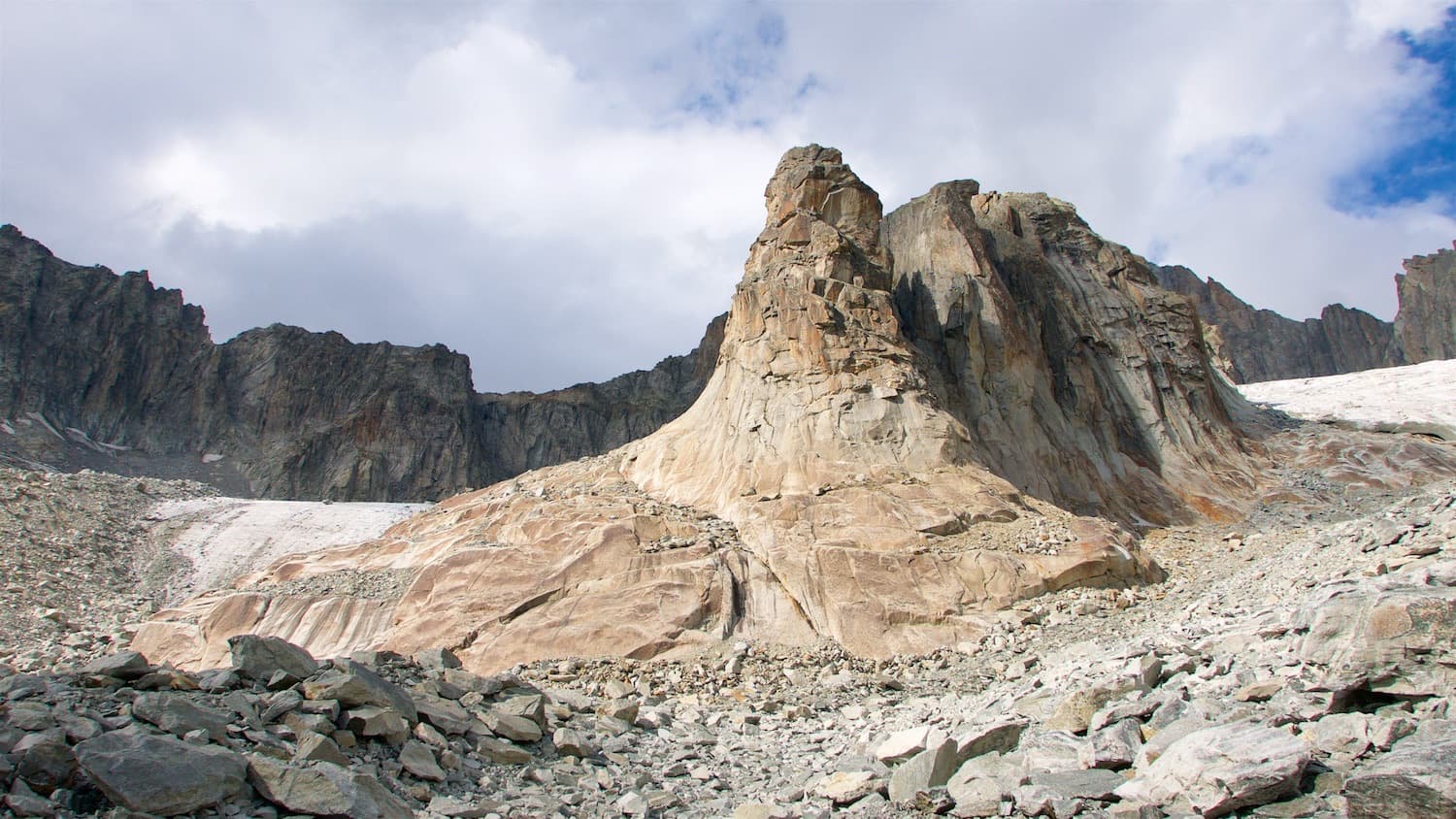
The Hannibalturm above the moraines of the Sidelen glacier

Switzerland · Furka

Kassensturz

The right-hand route on the Hannibalturm and the hardest of its plaisir lines. Two slab pitches lead to a layback crack, an awkward overhanging crack and corner, and a bulge above an athletic layback that gives the 6c crux. The first pitch is easy for the grade but boldly bolted.

6c6 pitches170 m

Read the cautions

The Kristall sector at the foot of the Gross Furkahorn, with the snow patch below the slabs

Switzerland · Furka

Kristall

The most popular route on the lowest tier of slabs under the Gross Furkahorn, the quickest climbing to reach from the Furka Pass. A corner and slabs lead to a fine thin crack at 6a and a short steep step. It is often used as the first part of the Kombination link-up towards the summit.

6a5 pitches163 m

Around 6a+ · about 5 pitches

Similar elsewhere

West side of the Gorros sector, Montserrat

Spain · Montserrat

Integral d'en Pitu i la Nuri

A modern linkup over two pinnacles on excellent conglomerate. Overhanging 6a and 6a+ walls alternate with easy 'potato-field' slabs. The new bolting makes it one of the most reassuring long lines in the massif.

6a+5 pitches185 m

The Verdon gorge from the Belvédère de la Carelle, where the abseils to the route start

France · Verdon

Afin que nul ne meure

A 1985 classic of the Escalès, a grade harder and noticeably bolder than Les Dalles Grises next door. Five pitches on pockets and slabs, starting with polished rising traverses and finishing up a sculpted wall of vertical flutings, an overhanging crack and a bulge at 6a+. You need to be solid at 6a to enjoy it.

6a+5 pitches150 m

Read the cautionsCommitting

The Geiselstein and Gabelschrofen in the Ammergebirge nature reserve

Germany · Ammergauer Alpen

Balisto

The popular sport line of the Geiselstein south face, straight up to the summit cross. Long, steep pitches on excellent rough limestone, sustained at UIAA 6- to 6 with two short passages of 6+ and one easier pitch on less reliable rock. Never easy and never crowded with bolts: you climb between them.

6a+5 pitches210 m

Read the cautions

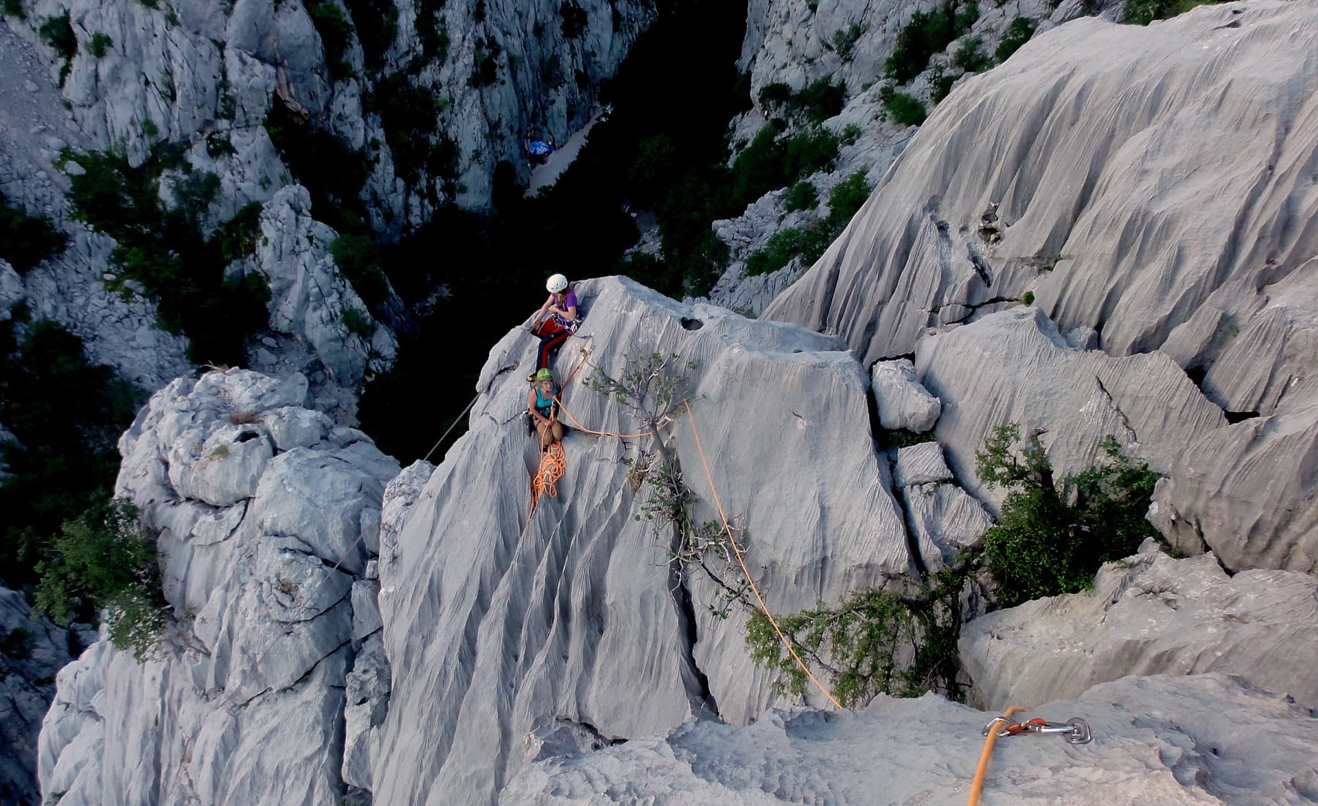
Giant water-worn flutes on Kuk od Skradelin: looking down from the top of Dreaming the Lost Friends to climbers at the last belay.

Croatia · Paklenica

Dreaming the Lost Friends

A short, high-quality modern line: a clean straight first pitch, then a steep crack crux and magnificent water grooves.

6a+5 pitches100 m

Read the cautions

Compiled from published sources and last verified October 2026. Bolts, anchors and access change. Climbing is dangerous and you are responsible for your own decisions: check a current topo and read the disclaimer.