Multipitch Atlas

Afin que nul ne meure

Escalès – Carelle Amont · Verdon · France

Read the cautionsCommittingBolting confidence: medium

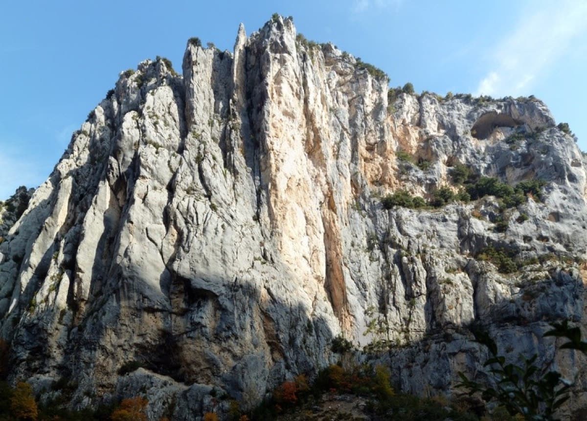
A 1985 classic of the Escalès, a grade harder and noticeably bolder than Les Dalles Grises next door. Five pitches on pockets and slabs, starting with polished rising traverses and finishing up a sculpted wall of vertical flutings, an overhanging crack and a bulge at 6a+. You need to be solid at 6a to enjoy it.

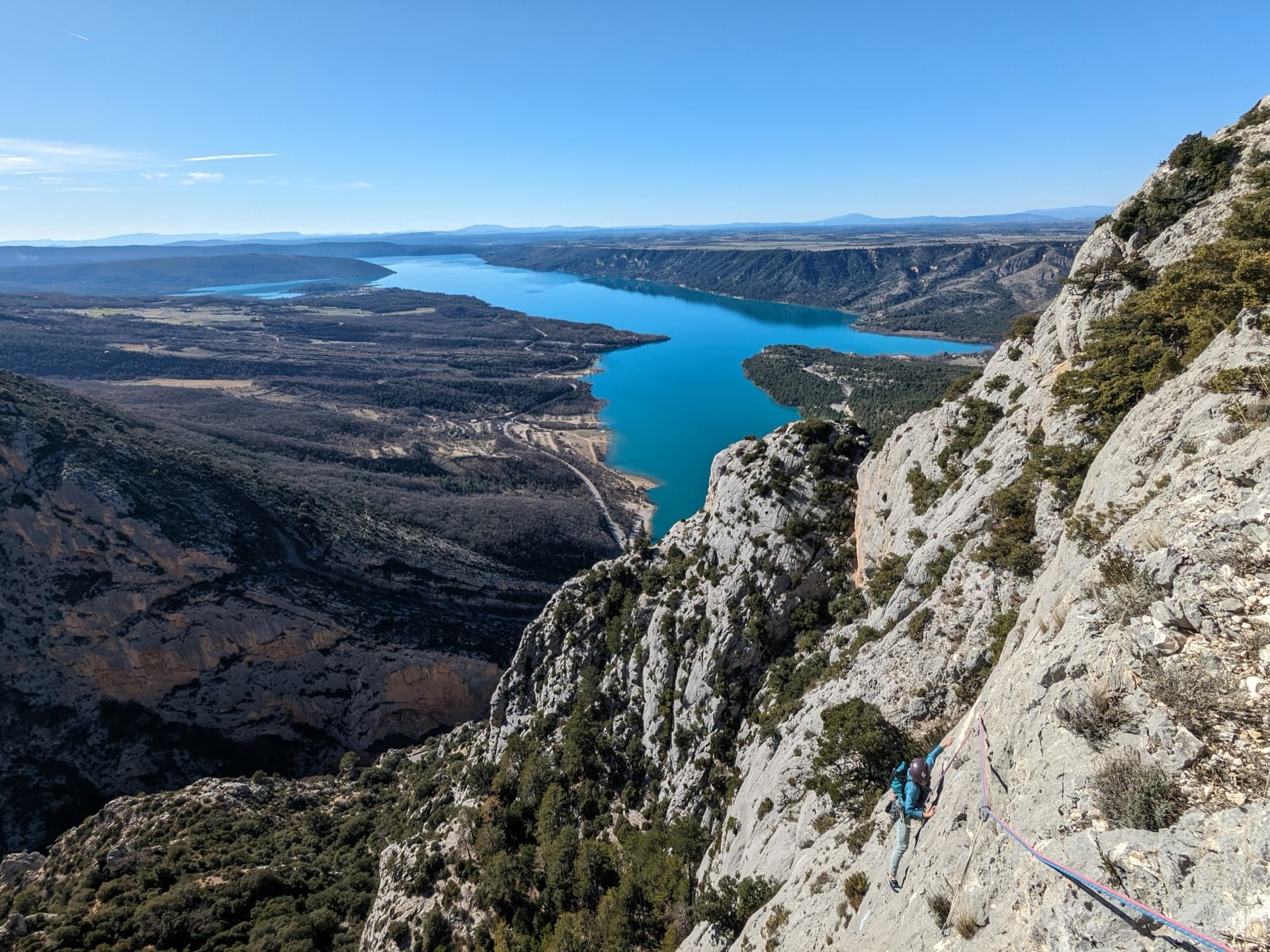
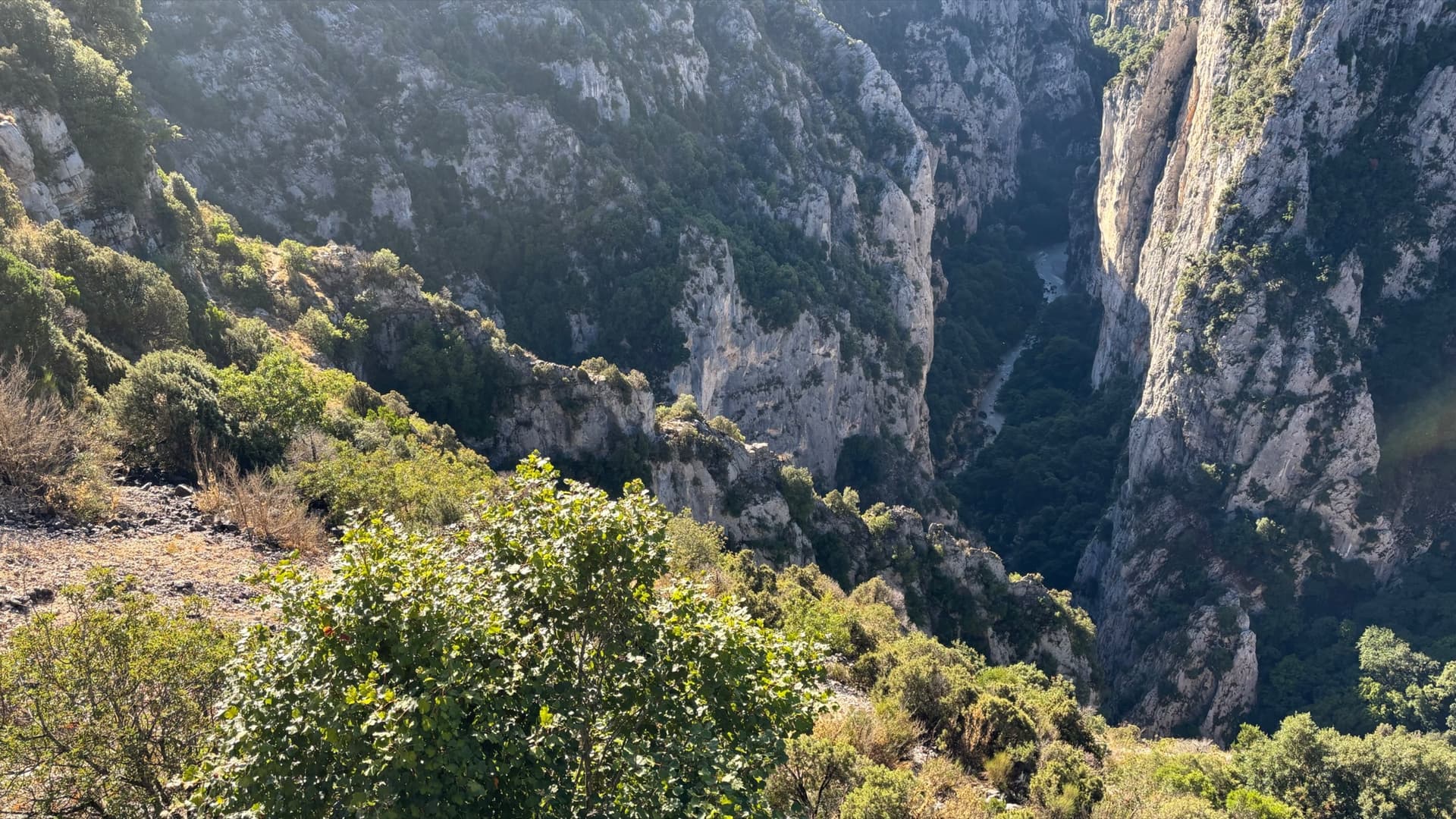
The Verdon gorge from the Belvédère de la Carelle, where the abseils to the route startPhoto: Einaz80 · CC BY-SA 4.0

Photo

The Verdon gorge from the Belvédère de la Carelle, where the abseils to the route startPhoto: Einaz80 · CC BY-SA 4.0
Hardest pitch
6a+
Pitches
5
Length
150 m
Approach
45 min
Aspect
SE
South-east-facing
Rope
Two ropes for the four abseils in
lengths not stated by camptocamp
Read before you go

Bolted from bottom to top, but with wide Verdon spacing, polished rock and traverses that make retreat awkward after abseiling in.

The route

Overview

Afin que nul ne meure starts at the left end of the Jardin des Écureuils and climbs 150 m to the rim in five pitches. With nearly a hundred outings on camptocamp it is one of the most climbed 6a routes in the gorge. The rock is excellent but heavily polished on the first pitches, and the climbing is about positions: pockets, slabs and reading the line. What sets it apart from the modern routes is the spacing of the bolts, which every recent report mentions, some with pleasure and some without. The first two pitches traverse, so backing off is awkward. Go when 6a feels comfortable, not when it is your limit.

The climbing

Pitch by pitch

Pitches of Afin que nul ne meure
PitchGradeLengthNotes
P15c/6a30 mShared with Pichenibule: a rising traverse left on good but polished pockets, then straight up for 5 m to the belay, by a tree. Do not continue further left onto another route. Hard when cold, with spaced bolts.
P25c/6a30 mAbout 3 m left, then straight up, then left again (there is an arrow on the rock) to a belay in a small scoop. The directional bolt at the belay tempts you straight up: traverse first. Polished.
P36a30 mStraight up to a good ledge. A delicate move on polished pockets near the start, then easier, though the next bolt is not always easy to see: follow the polish.
P46a–Straight up, without straying into the routes on either side, then right to the belay. A fine, less polished slab pitch with a protected traverse move, and the one most parties rate highest. The 2022 guidebook's 5b+ for this pitch is wrong, according to a 2025 party.
P56a+–Straight up to the top on very sculpted rock: vertical flutings, then an overhanging crack and a bulge. The most physical pitch; one party felt 6b.

Getting there

Approach

To the parking

Base yourself at La Palud-sur-Verdon, which has campsites, gîtes and a climbers' bar. From La Palud drive the Route des Crêtes (D23) to the Belvédère de la Carelle and park there. A 2025 party found the car park crowded and suggests cycling.

On foot · about 45 min

From the Belvédère de la Carelle take the path north-east along the cliff edge for about 100 m to a big block carrying the abseil chain of Les Dalles Grises. Four abseils lead down to the Jardin des Écureuils, a wooded terrace part-way down the wall. A second abseil line starts a few metres lower to the right as you face out, reached by a handrail, which helps when the first is busy. Do not underestimate the time the abseils take: 45 min is typical, and more with a queue. A 2025 party used a line further left and warns of ropes jamming. The route starts at the far left end of the terrace as you face the rock (the west end), where 'Afin…' is painted in red.

Map of the walk-in

  • Crag
  • Parking

Loading map

The point marks the crag, not the exact start of the route.

Coordinates · crag

43.77551, 6.38511

Parking

43.77509, 6.38340

Belvédère de la Carelle on the Route des Crêtes (camptocamp access waypoint 127667)

Point from camptocamp waypoint 1205951 (Verdon - Escalès - Carelle Amont)

For your phone or watch

Download GPX

Contains the route point and parking. Opens in most mapping apps and GPS watches.

Points are compiled from published sources, with the precision stated above. They were not surveyed on the ground: check them against a current topo.

Getting down

Descent

From the top walk 100 m, slightly uphill, to the car.

Retreat

Bailing off the route

Committing

Camptocamp states that going back down is rather complicated because of the traverses at the start of the route. You have also abseiled in to a terrace part-way down the wall, so even a successful retreat leaves you needing to climb out, and the easiest way out, Les Dalles Grises, is sustained 5c.

Retreat from
The first belay at best; after the second traverse an abseil no longer leads back to the start.
Point of no return
Effectively the first abseil of the approach; on the route itself, the second pitch.
Carry
A solid 6a leader. Two ropes and maillons if you try to descend; another party's rope from above is the realistic rescue.
Basis
Part stated, part inferredThe retreat warning is stated on camptocamp; the consequences of the abseil approach are inferred.

Partly inferred from the route facts

Safety

Hazards

  • Bolts are widely spaced by modern standards, about one every 4 m, with harder moves between them.
  • The first two pitches traverse, so retreat is complicated, and you have abseiled in.
  • Heavy polish on the lower pitches.
  • Several lines cross or run alongside: it is easy to stray onto Pichenibule or a neighbouring route.
  • A busy wall: watch for stones and for ropes from parties abseiling.

Sun and weather

Conditions

South-east facing at about 950 to 1100 m. Camptocamp recommends autumn and spring; winter is possible in the sun on a mild day, and in summer you should start at noon to climb in the shade. The wall has the sun in the morning and can turn properly cold afterwards: the rim is at 1100 m and it can snow or hail in April. A party on 1 October 2023 waited at the foot until 14:30 for shade and still found it too hot.

Usual season · Mar to May, Oct to Nov

Sun on the wall · SE-facing

Working out the sunlit hours for this month.

  • January: not yet worked out
  • February: not yet worked out
  • March (usual season): not yet worked out
  • April (usual season): not yet worked out
  • May (usual season): not yet worked out
  • June: not yet worked out
  • July: not yet worked out
  • August: not yet worked out
  • September: not yet worked out
  • October (usual season): not yet worked out
  • November (usual season): not yet worked out
  • December: not yet worked out

Sun on the wallDaylight, wall in shade● Usual season

Estimated from the wall's aspect only. Ignores surrounding terrain, gullies and the wall's exact shape. Clock times are local to the wall (Central European time), for the 15th of each month.

Monthly climate averages for Verdon, 1991-2020
MeasureJanFebMar (usual season)Apr (usual season)May (usual season)JunJulAugSepOct (usual season)Nov (usual season)Dec
Mean daily high °C781114182326262116118
Mean daily low °C−1−21481214141173−1
Rain days 1 mm or more778121185689108

● marks the usual climbing season. Averages for 1991-2020 at about 822 m. Area climate from Open-Meteo reanalysis. Temperatures are adjusted to the height of the crag; rain comes from a grid cell of about 10 to 25 km, and summer highs on sea cliffs can read a few degrees low. The wall and valley can differ. Data: Open-Meteo, CC BY 4.0.

What to carry

Gear

Camptocamp lists no gear for this route. Parties recommend extendable quickdraws for the wandering first pitches; the neighbouring Dalles Grises asks for 12 quickdraws. Two ropes for the abseils, slings for the belays, helmet.

Checklist

Quickdraws
Number not given in the sources
Rope
Two ropes for the four abseils in (lengths not stated by camptocamp)
Helmet
One each
Maillons or spare karabiners
To leave behind if you retreat

Derived from the route data; check it against a current topo

From climbers

Reader reports

Reader reports are not being collected yet. Until they are, check a current topo and the local club or guidebook publisher for recent changes to Afin que nul ne meure.

Worth knowing

Tips

  • Allow 3 h 30 to 4 h for the climbing.
  • Carry a few long quickdraws for the first two pitches.
  • If the abseil line of Les Dalles Grises is queuing, the second line beside it works; a 2023 party who tried the Chlorochose abseils could not find the second station.
  • A few parties in the gorge carry a small rack to supplement spaced bolts; no report describes placing any on this route.

Open questions

Where sources disagree

  • Grades: the French text gives 5c/6a, 5c/6a, 6a, 6a, 6a+; the older Spanish version gives 5b/c, 5c, 5c, 5c+, 6a+; parties in 2023 and 2024 felt roughly 5c+, 5c, 5c+ or 6a, a solid 6a, then 6a+ to 6b.
  • Bolt spacing: 'very spaced by modern standards' and 'old school' (2023), 'often airy but intelligently placed' (2024), 'not too far apart' (2025).
  • Pitch lengths are not in the route description; about 30 m each for the first three comes from a 2024 trip report.

Provenance

Sources

Same area

More in Verdon

All routes in Verdon
Overview of the Malines cliff, Verdon

France · Verdon

Golondrina

A modern (2019) line up a staircase of limestone pillars above the Chalet de la Maline, with short walking links between them. Harder than its old 6a grade suggests: recent parties report obligatory 6a+/6b moves on the first three pitches, and the last pitch is 6b+ or A0.

6b+10 pitches300 m

Read the cautions
The Imbut gorge from the Maugué belvedere: the Arête de l'Herbetto is the narrow rib in the gorge below; the photographer does not mark which one.

France · Verdon

L'Herbetto

The easiest way to climb out of the Verdon gorge: a long, wandering ridge of short pitches at grade 3 and 4 that starts close to the river and finishes near the rim road. The climbing is modest but the setting is the full Verdon. You walk down a steep path with fixed ropes to reach the start, so the route is your way back up.

4c9 pitches180 m

Read the cautions

Pitch 5 of Dans les Yeux d'Hervé: a climber low on the grey limestone of Galetas supérieur, with the Lac de Sainte-Croix beyond.

France · Verdon

Dans les Yeux d'Hervé

Seven pitches of compact grey water-pocketed wall high above the mouth of the Verdon gorge, with a view over the Lac de Sainte-Croix. It zigzags a great deal, so both leader and second need to be happy on traverses. A short, bouldery 6c+ bulge (6a/A0) is the only move above 6b+, and the final pillar pitch is the highlight.

6c+7 pitches160 m

Committing

On the second pitch of L'Usage du Monde, Mainmorte sector

France · Verdon

L'Usage du Monde

One of the few Verdon multipitches at an even 5b: five short pitches on featured grey limestone above the Baou Béni, with a 6a variant for the third pitch. The approach is part of the outing: you go down a 100 m wall on fixed ropes, the escape route of the Mainmorte canyon. Well bolted and popular as a first Verdon route.

5b+5 pitches120 m

Around 6a+ · about 5 pitches

Similar elsewhere

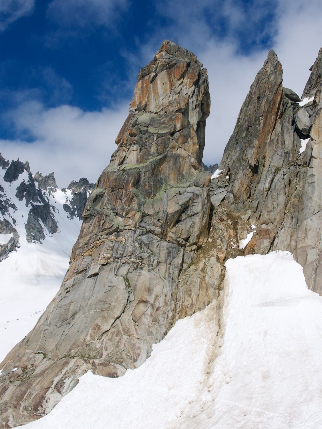
The Hannibalturm in early season, with snow still lying at its foot

Switzerland · Furka

Hanimoon

Five sustained pitches on the left side of the Hannibalturm, never easier than 5c+ and never much harder than 6a+. A smooth friction slab leads to steep wall climbing, a pillar, a flake and a corner, and the route finishes up a ladder of huge quartz knobs. Many parties rate it the best line on the tower and find the second pitch the hardest.

6a+5 pitches170 m

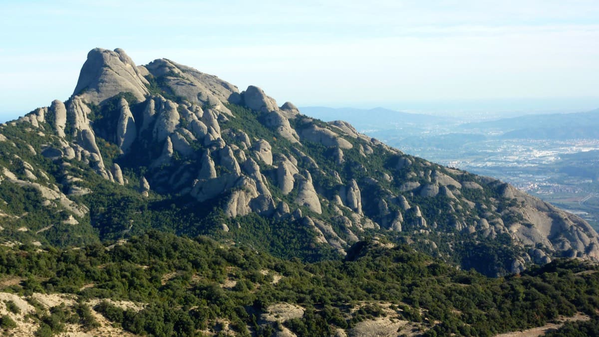
West side of the Gorros sector, Montserrat

Spain · Montserrat

Integral d'en Pitu i la Nuri

A modern linkup over two pinnacles on excellent conglomerate. Overhanging 6a and 6a+ walls alternate with easy 'potato-field' slabs. The new bolting makes it one of the most reassuring long lines in the massif.

6a+5 pitches185 m

The Geiselstein and Gabelschrofen in the Ammergebirge nature reserve

Germany · Ammergauer Alpen

Balisto

The popular sport line of the Geiselstein south face, straight up to the summit cross. Long, steep pitches on excellent rough limestone, sustained at UIAA 6- to 6 with two short passages of 6+ and one easier pitch on less reliable rock. Never easy and never crowded with bolts: you climb between them.

6a+5 pitches210 m

Read the cautions

Giant water-worn flutes on Kuk od Skradelin: looking down from the top of Dreaming the Lost Friends to climbers at the last belay.

Croatia · Paklenica

Dreaming the Lost Friends

A short, high-quality modern line: a clean straight first pitch, then a steep crack crux and magnificent water grooves.

6a+5 pitches100 m

Read the cautions

Compiled from published sources and last verified October 2026. Bolts, anchors and access change. Climbing is dangerous and you are responsible for your own decisions: check a current topo and read the disclaimer.