Multipitch Atlas

Tout Shiva pour ça ?

Falaise des Cavaliers (left bank) · Verdon · France

CommittingBolting confidence: high

A summer route on the shady left bank of the gorge. It follows the first three pitches of the Traversée des Cavaliers, an airy horizontal journey above the void with one athletic 6b move that goes on aid, then climbs back to the rim by single-pitch lines through the Shiva cave and a big chimney. Five minutes from the car.

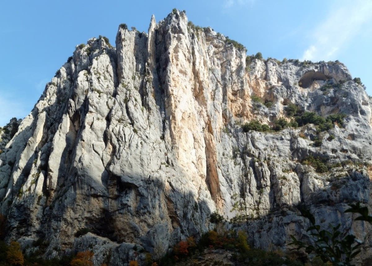
Photo-topo of Tout Shiva pour ça ? on the Cavaliers cliff, with the two abseils, belays R0 to R7 and the variant finishPhoto: phill06 · CC BY-SA 3.0

Topo

Photo-topo of Tout Shiva pour ça ? on the Cavaliers cliff, with the two abseils, belays R0 to R7 and the variant finishPhoto: phill06 · CC BY-SA 3.0
Hardest pitch
6b
Pitches
7
Length
180 m
Approach
5 min
Aspect
N
North-facing
Rope
1×50 m abseil rope
two abseils in, 30 and 35 m

The route

Overview

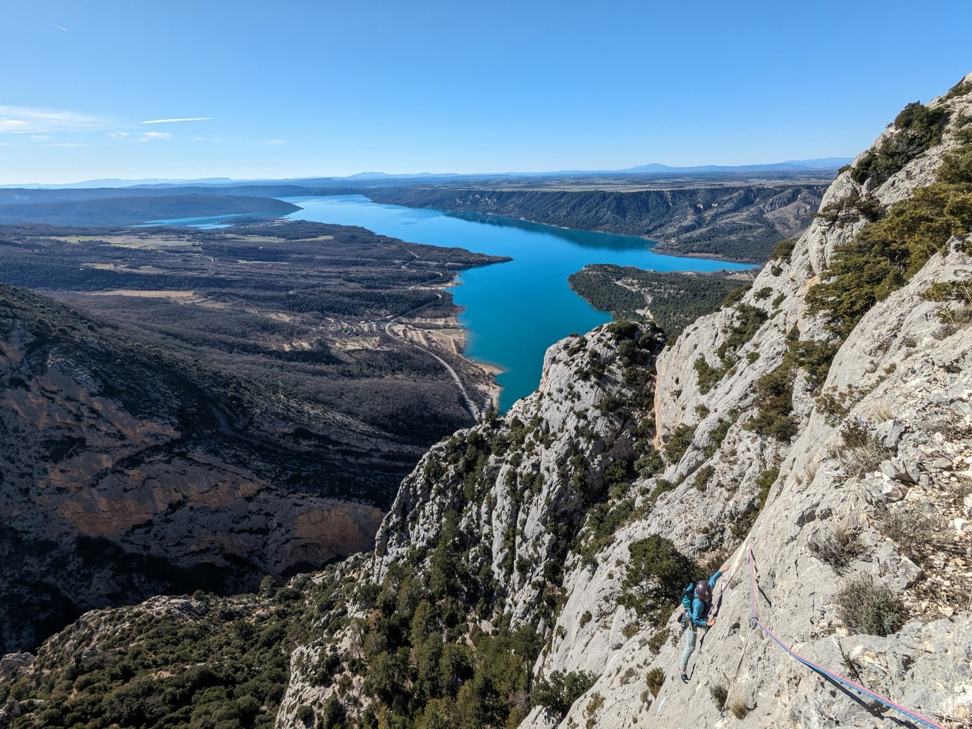
Tout Shiva pour ça ? is a link-up on the Cavaliers cliff, on the Aiguines side of the gorge. Two short abseils from near the helicopter landing area reach the start of the Traversée des Cavaliers, whose first three pitches you follow sideways across the wall on closely spaced glue-ins. You then leave the traverse and climb back up by two pitches of the route No Bramashari for ever to the Shiva cave, walk across the ledge under a big lime tree, and finish by two more pitches up a corner and a chimney, or by a 35 m wall variant. The rock is excellent north-face limestone and the whole route stays in the shade, which is why the logged ascents are in July, August and September. The traverses mean a strong second is as important as a strong leader.
The climbing

Pitch by pitch

Pitches of Tout Shiva pour ça ?
PitchGradeLengthBoltsNotes
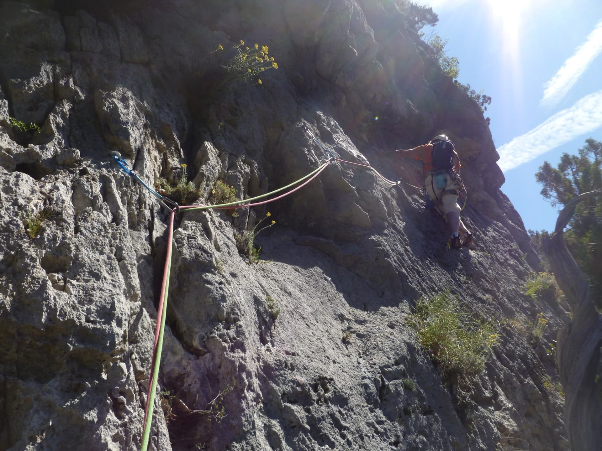
P15c+30 m11 boltsTraverse downstream following the glue-ins: easy at first, then an airy, well-protected passage of 5c+ where the good handholds are hidden above you. Communication with the belayer is poor as you reach the belay.
P25a30 m10 boltsContinue the traverse with one or two moves of 5a.
P36b (A0)30 m11 boltsGo down two metres to the right, then make a very athletic 6b move that goes well by pulling on the bolts, though it stays physical even on aid. Mantel in a very exposed position using a dead juniper, traverse more easily above two junipers and climb a last steep wall on good holds. Here you leave the Traversée des Cavaliers.
P45c20 m4 boltsAn easy traverse to start, then an airy section with little for the feet, well protected, and a mantel to a belay in a hollow. A 2026 party found one move here hard for 5c.
P56a25 m7 boltsMove easily onto the angle of the cliff, then climb beside a steep corner to a belay to the right of the Shiva cave. Small and medium cams can supplement the bolts here if you want. Then walk left along the ledge, under the big lime tree and past the cave, to the next chained belay.
P65c20 m7 boltsAn airy but easy traverse left to the foot of a corner; climb it, with a move of 5c at the start, then bear left to a chained belay above a block.
P76a25 m10 boltsGo left and bridge up the big, magnificent chimney to the chained belay on the plateau. Variant: a 35 m, 14-bolt 6a straight up the vertical wall above the belay, which a 2026 party found very sustained for the grade.

Getting there

Approach

To the parking

The route is on the left bank, reached by the D71 (Corniche Sublime) from Aiguines or from Comps-sur-Artuby. Park at the Auberge des Cavaliers. La Palud-sur-Verdon, the usual climbers' base, is on the other side of the gorge, a long drive round.

On foot · about 5 min

About 5 min. Walk to the helicopter landing area about 250 m upstream of the Auberge des Cavaliers. Do not use the abseil station just downstream of it: that one is at the top of the route's exit chimney and leads to the Shiva cave in two abseils of about 25 and 15 m. From the landing area go towards the cliff edge and down a few metres to a chained station. Two abseils of 30 and 35 m lead to the start; the second station is offset to the left and reached by a handrail. The first belay of the route (R0) is on two glue-ins.

Map of the walk-in

  • Area: approximate
  • Parking

Loading map

The point is approximate: it marks the area, not the crag.

Coordinates · area: approximate

43.73694, 6.34583

Parking

43.73694, 6.34583

Auberge des Cavaliers car park (camptocamp access waypoint 127665)

Point from camptocamp access waypoint 127665 (Verdon - Cavaliers car park); the route has no point of its own and starts about 250 m upstream

For your phone or watch

Download GPX

Contains the route point and parking. Opens in most mapping apps and GPS watches.

Points are compiled from published sources, with the precision stated above. They were not surveyed on the ground: check them against a current topo.

Getting down

Descent

You come out on the plateau between the firemen's hut and the auberge. Walk back along the road in about 3 min.

Retreat

Bailing off the route

Committing

Not documented, and awkward by the nature of the route. You abseil in and then traverse horizontally for three pitches, so an abseil from those belays does not return to anything useful and the abseils cannot be climbed back. From the fifth belay, at the Shiva cave ledge, the only ways out described are the two exit pitches (5c and 6a) or the 6a variant.

Retreat from
No retreat point is described. The Shiva cave ledge is a comfortable place to wait, directly below an abseil line from the rim.
Point of no return
Pulling the ropes after the second abseil.
Carry
The ability to aid the 6b move and to climb 6a to get out; a party at the rim could drop a rope down the abseil line that reaches the cave.
Basis
Inferred from the route factsInferred from the abseil approach, the traversing line and the abseil line to the cave described on camptocamp; no source describes a retreat.

Partly inferred from the route facts

Safety

Hazards

  • Horizontal traverses for three pitches: a fall is a swing for leader and second alike, and a tired second cannot simply be lowered.
  • After the abseils and the traverse, retreat is not straightforward.
  • Poor communication at the first belay.
  • Do not confuse the two abseil stations near the landing area.

Sun and weather

Conditions

North and north-west facing at about 720 to 800 m, on the left bank: in the shade all day, according to a party in mid-August 2026. It is a route for warm weather, and logged ascents run from early July to late September. No source describes conditions outside those months.

Usual season · May to Oct

Sun on the wall · N-facing

Working out the sunlit hours for this month.

  • January: not yet worked out
  • February: not yet worked out
  • March: not yet worked out
  • April: not yet worked out
  • May (usual season): not yet worked out
  • June (usual season): not yet worked out
  • July (usual season): not yet worked out
  • August (usual season): not yet worked out
  • September (usual season): not yet worked out
  • October (usual season): not yet worked out
  • November: not yet worked out
  • December: not yet worked out

Sun on the wallDaylight, wall in shade● Usual season

Estimated from the wall's aspect only. Ignores surrounding terrain, gullies and the wall's exact shape. Clock times are local to the wall (Central European time), for the 15th of each month.

Monthly climate averages for Verdon, 1991-2020
MeasureJanFebMarAprMay (usual season)Jun (usual season)Jul (usual season)Aug (usual season)Sep (usual season)Oct (usual season)NovDec
Mean daily high °C781114182326262116118
Mean daily low °C−1−21481214141173−1
Rain days 1 mm or more778121185689108

● marks the usual climbing season. Averages for 1991-2020 at about 822 m. Area climate from Open-Meteo reanalysis. Temperatures are adjusted to the height of the crag; rain comes from a grid cell of about 10 to 25 km, and summer highs on sea cliffs can read a few degrees low. The wall and valley can differ. Data: Open-Meteo, CC BY 4.0.

What to carry

Gear

A 50 m abseil rope, 12 quickdraws including some extendable ones, slings for the belays and a helmet. A few small and medium cams are optional for pitch 5. You can walk from the car in rock shoes or leave your shoes at the top of the abseils.

Checklist

Quickdraws
12
Rope
1×50 m abseil rope (two abseils in, 30 and 35 m)
Helmet
One each

Derived from the route data; check it against a current topo

From climbers

Reader reports

Reader reports are not being collected yet. Until they are, check a current topo and the local club or guidebook publisher for recent changes to Tout Shiva pour ça ?.

Worth knowing

Tips

  • The 6b of pitch 3 has good handholds throughout and is easily aided; the obligatory grade is given as 5c+.
  • Visit the Shiva cave on the ledge between pitches 5 and 6.
  • From the top you can abseil back from the last belay to climb the 35 m variant as well.
  • The full Traversée des Cavaliers continues from the third belay if you want more traversing another day.

Open questions

Where sources disagree

  • Abseils in: 30 m and 35 m in the text, two abseils of 35 m on the photo-topo.
  • Height: camptocamp gives 200 m of difficulties, but the seven pitches add up to 180 m, much of it sideways, and the elevation range given is only 720 to 800 m.
  • Pitch 4: 5c in the description; a 2026 party met a move they could not read at that grade.
  • Pitch 5 is described as bolted (7 bolts), with cams as an optional supplement; no trip report mentions placing any.

Provenance

Sources

Same area

More in Verdon

All routes in Verdon
Overview of the Malines cliff, Verdon

France · Verdon

Golondrina

A modern (2019) line up a staircase of limestone pillars above the Chalet de la Maline, with short walking links between them. Harder than its old 6a grade suggests: recent parties report obligatory 6a+/6b moves on the first three pitches, and the last pitch is 6b+ or A0.

6b+10 pitches300 m

Read the cautions

The Imbut gorge from the Maugué belvedere: the Arête de l'Herbetto is the narrow rib in the gorge below; the photographer does not mark which one.

France · Verdon

L'Herbetto

The easiest way to climb out of the Verdon gorge: a long, wandering ridge of short pitches at grade 3 and 4 that starts close to the river and finishes near the rim road. The climbing is modest but the setting is the full Verdon. You walk down a steep path with fixed ropes to reach the start, so the route is your way back up.

4c9 pitches180 m

Read the cautions

Pitch 5 of Dans les Yeux d'Hervé: a climber low on the grey limestone of Galetas supérieur, with the Lac de Sainte-Croix beyond.

France · Verdon

Dans les Yeux d'Hervé

Seven pitches of compact grey water-pocketed wall high above the mouth of the Verdon gorge, with a view over the Lac de Sainte-Croix. It zigzags a great deal, so both leader and second need to be happy on traverses. A short, bouldery 6c+ bulge (6a/A0) is the only move above 6b+, and the final pillar pitch is the highlight.

6c+7 pitches160 m

Committing

On the second pitch of L'Usage du Monde, Mainmorte sector

France · Verdon

L'Usage du Monde

One of the few Verdon multipitches at an even 5b: five short pitches on featured grey limestone above the Baou Béni, with a 6a variant for the third pitch. The approach is part of the outing: you go down a 100 m wall on fixed ropes, the escape route of the Mainmorte canyon. Well bolted and popular as a first Verdon route.

5b+5 pitches120 m

Around 6b · about 7 pitches

Similar elsewhere

The Calanque de l'Eissadon and its cliffs seen from above

France · Calanques

Avec Toi, C'est Extra

A big, remote wall climb from the sea to the plateau on the east end of the Devenson cliffs, above the Calanque de l'Eissadon. After two easier pitches it is continuous at 6a+ to 6b up white walls and a striking vein of aragonite, technical on the feet and vertical. Four abseils and a two-hour walk each way make it a full day at the end of the world.

6b7 pitches215 m

Read the cautionsCommitting

The orange limestone of the Paroi des Sources at Taghia, with climbers on its routes.

Morocco · Taghia

Les babouches de Mostafa

The friendly way into Taghia, starting at the water's edge beside the springs. Seven varied pitches, well bolted by Taghia standards. Go left around the unstable rock below the second belay; fragile blocks are marked in red. In shade until midday.

6b7 pitches270 m

Committing

The Falkensteinwand rising from the Wolfgangsee, seen from the lake

Austria · Salzkammergut

Seenot

The best known multipitch route of the Salzkammergut: seven pitches straight out of the Wolfgangsee. You abseil in from the top of the Falkenstein cliff, or arrive by boat, and start from a hanging belay at the waterline. Mostly grade 5 slabs with exposed traverses, then a steep section and a holdless corner equipped with artificial holds.

6b7 pitches185 m

Committing

The narrows of the Todra Gorge in late afternoon light, a few minutes' walk upstream of the Mansour wall; a view of the gorge, not of this route's wall.

Morocco · Todra Gorge (Todgha)

Tiwira

A long, moderate line above the Mansour palm grove at the upstream end of the gorge. Mostly steady 5c with a 6a crack to start and a harder, very abrasive finish. Big views up the valley.

6b7 pitches300 m

Compiled from published sources and last verified October 2026. Bolts, anchors and access change. Climbing is dangerous and you are responsible for your own decisions: check a current topo and read the disclaimer.