Multipitch Atlas

Via del Carles

Gorra Frígia (Gorros) · Montserrat · Spain

Bail with caveatsBolting confidence: high

A straightforward line up the 'Phrygian cap' visible from the monastery. Only the short vertical step on pitch 3 is sustained. It is a good route for learning Montserrat pebble technique and has a summit cross with a big view. The approach takes about 10 min from the Sant Joan funicular top.

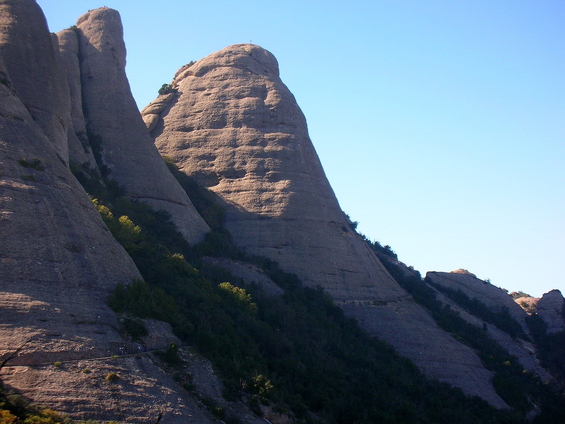
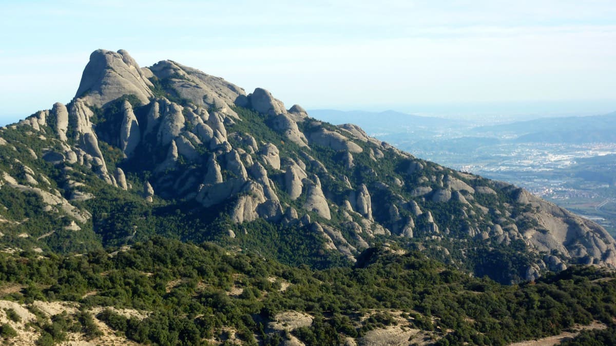
The Gorra Frígia, the Phrygian-cap tower of the Gorros, seen from the Camí Nou de Sant Jeroni, which passes the foot of its north-east side where Via del Carles starts. The line itself is not marked.Photo: Pere Ramon · CC BY-SA 3.0

Photo

The Gorra Frígia, the Phrygian-cap tower of the Gorros, seen from the Camí Nou de Sant Jeroni, which passes the foot of its north-east side where Via del Carles starts. The line itself is not marked.Photo: Pere Ramon · CC BY-SA 3.0
Hardest pitch
5c
Pitches
5
Length
140 m
Approach
10 min
Aspect
NE
North-east-facing
Rope
1×60 m

The route

Overview

The Via del Carles climbs the north-east face of the Gorra Frígia, the 'Phrygian cap' tower that stands out above Montserrat monastery, in five pitches to a summit cross. It is one of the most repeated routes in the massif and a standard introduction to pebble climbing. The climbing is mostly easy (4a to 4c) on solid conglomerate, with one short vertical step of 5c on pitch 3. It is bolted throughout with abseil-ready belays, but the bolts are well spaced where the climbing is easy.

In pictures

Photos

Approach photo

The climbing

Pitch by pitch

Pitches of Via del Carles
PitchGradeLengthBoltsNotes
P14c30 m6 boltsStraight up, with one harder move in the middle. Belay on two bolts. Bolts are far apart on the easy ground. Original grade IV+.
P24b35 m7 boltsStraight up, steepening slightly. Belay on two bolts with rings. Original grade IV+.
P35c20 m6 boltsThe crux. An easy start, then the vertical step, taken slightly to the left: a few metres on holds that are nearly good, with closer bolts. Original grade V+.
P44a35 m7 boltsUp and right for 25 m, pass a belay, then straight up for 10 m to a belay shared with another route (three bolts and a maillon). Spaced bolts. Original grade IV.
P54c40 m6 boltsAbout 15 m of easy ground without bolts to the foot of the cap, then pull over its lip on good holds (well protected) and continue easily to the belay at the summit cross. Original grade IV+.

Getting there

Approach

To the parking

Montserrat monastery, reached by road from Monistrol (BP-1121), or by FGC train from Barcelona (Manresa line) connecting with the rack railway or the cable car. From the monastery take the Sant Joan funicular, or walk up. A guide-service page quotes about 40 minutes on foot to the Gorros or 15 minutes by funicular (€16).

On foot · about 10 min

About 10 minutes from the top station of the Sant Joan funicular. Take the wide, comfortable Sant Jeroni path (Camí Nou), which contours round the Gorros on the north-east side and is cut into the rock at the foot of the Gorra Frígia. Look for a metal cross about 10 m above the path: the route starts 5 m to its left. The hangers were originally painted green; camptocamp's French text says the re-equipped line is on gold-coloured hangers. On foot from the monastery, use the GR4 then the PR C-19 after Santa Anna, or the Sant Joan track; the funicular saves about 350 m of ascent.

Finding the route · 3 photos

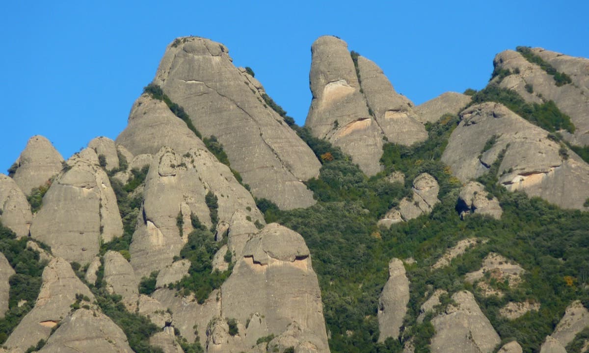
  • OverviewThe Gorros group, titled by the photographer from left to right: Gorra Marinera (the big dome on the left), the slender Magdalenes towers, the Gorra Frígia (the big cone on the right) and Trencabarrals. Via del Carles is on the Gorra Frígia.Photo: Michmuch06 · CC BY-SA 3.0
  • Walk-inThe railed Sant Jeroni path at the start of the route, where it is cut into the rock at the foot of the Gorra Frígia.Photo: phill06 · CC BY-NC-ND 3.0
  • Start of the routeLooking down the first pitch: the route starts straight off the railed path, seen below.Photo: Cesc Grau · CC BY-NC-ND 3.0

Approach photo

Map of the walk-in

  • Crag
  • Parking

Loading map

The point marks the crag, not the exact start of the route.

Coordinates · crag

41.58986, 1.82608

Parking

41.58849, 1.83337

Funicular de Sant Joan (camptocamp access point)

Point from camptocamp waypoint 187036

For your phone or watch

Download GPX

Contains the route point and parking. Opens in most mapping apps and GPS watches.

Points are compiled from published sources, with the precision stated above. They were not surveyed on the ground: check them against a current topo.

Getting down

Descent

Two options. (1) Abseil: walk 20 m down the south side from the summit to a chained anchor, then make two or three equipped abseils (25 m then 50 m, or 3×25 m) into the gap between the Gorra Frígia and the Magdalena Superior, and walk down to the Sant Jeroni path. (2) On foot: camptocamp's Catalan text describes an equipped descent, in effect a via ferrata. From a large cairn follow cables and chains down to the south-east to a ledge, descend a corner into a holm-oak grove, follow the track to another cable, then traverse left to the col between the Gorra Frígia and the Magdalena Superior. Cross to the other side and go down the wooded gully (a chain halfway) to the Sant Jeroni path. Turn right for Sant Joan.

Retreat

Bailing off the route

Bail with caveats

Yes, by abseil. Camptocamp states that the belays are equipped for abseiling. The catch is rope length: pitches are 30 to 35 m, so a single 60 m rope does not reach on the longer ones, and you should have two ropes to be sure. The route is very popular, so expect parties below you.

Retreat from
Any belay. R2 has two ringed bolts and R4 is three bolts and a maillon shared with another route; there is also an intermediate belay 25 m up pitch 4.
Point of no return
The lip of the summit cap on pitch 5. Once over it you are at the cross and the normal descent is the way down. This is inferred.
Carry
Two ropes (Camptocamp lists 2×40 m as an alternative to 1×60 m). With a single 60 m, the 35 m pitches are out of reach unless you find intermediate anchors.
Basis
Part stated, part inferredCamptocamp states 'the belays are equipped for abseil' and gives the pitch lengths and rope options; the need for two ropes on the 35 m pitches is inferred.

Partly inferred from the route facts

Safety

Hazards

  • Protection is spaced on the easy sections: a 2020 report describes distant bolts on pitches 1 and 4 and about 15 m without a bolt at the start of pitch 5. The crux and the summit lip are closely bolted.
  • The 25 m + 50 m abseil option cannot be done on a single 60 m rope; use three 25 m abseils or the cabled walk-down.
  • The summit is very exposed to wind; a 2020 party had near-storm gusts on top while the face was climbable.
  • Very popular: expect queues and people above you.

Sun and weather

Conditions

North-east facing (camptocamp), so mostly in shade. Parties report it sheltered from westerly wind on the face but very windy on the summit. Climbing time about 1 h 30. Almost always has at least one party on it.

Usual season · Apr to Jun, Sep to Oct

Sun on the wall · NE-facing

Working out the sunlit hours for this month.

  • January: not yet worked out
  • February: not yet worked out
  • March: not yet worked out
  • April (usual season): not yet worked out
  • May (usual season): not yet worked out
  • June (usual season): not yet worked out
  • July: not yet worked out
  • August: not yet worked out
  • September (usual season): not yet worked out
  • October (usual season): not yet worked out
  • November: not yet worked out
  • December: not yet worked out

Sun on the wallDaylight, wall in shade● Usual season

Estimated from the wall's aspect only. Ignores surrounding terrain, gullies and the wall's exact shape. Clock times are local to the wall (Central European time), for the 15th of each month.

Monthly climate averages for Montserrat, 1991-2020
MeasureJanFebMarApr (usual season)May (usual season)Jun (usual season)JulAugSep (usual season)Oct (usual season)NovDec
Mean daily high °C681113172124231915107
Mean daily low °C−3−30361013141071−2
Rain days 1 mm or more667109779121076

● marks the usual climbing season. Averages for 1991-2020 at about 1072 m. Area climate from Open-Meteo reanalysis. Temperatures are adjusted to the height of the crag; rain comes from a grid cell of about 10 to 25 km, and summer highs on sea cliffs can read a few degrees low. The wall and valley can differ. Data: Open-Meteo, CC BY 4.0.

What to carry

Gear

Camptocamp: 1×60 m rope or 2×40 m, and 7 quickdraws. With a single 60 m rope use the 3×25 m abseil option; the 50 m abseil needs two ropes. A French topo site (seen only in a search summary; the page could not be read in full) suggests about fifteen quickdraws.

Checklist

Quickdraws
7
Rope
1×60 m
Helmet
One each
Abseil device and prusik
The descent or the retreat involves abseiling

Derived from the route data; check it against a current topo

From climbers

Reader reports

Reader reports are not being collected yet. Until they are, check a current topo and the local club or guidebook publisher for recent changes to Via del Carles.

Worth knowing

Tips

  • Count on 1 h 30 for the climb.
  • The blog gorrofrigi.blogspot.com has a near-complete list and topos of every route on the tower if you want a second line.
  • The Sant Joan funicular runs about every half hour from the monastery (camptocamp).
  • Guiding companies offer this as a first multipitch.

Open questions

Where sources disagree

  • Descent: camptocamp's French and Spanish texts give abseils from a chained anchor on the south side; its Catalan text gives a cabled walk-down with no abseil. Both are reported.
  • Length: 140 m of climbing on camptocamp; 155 m on a guide-service page and a French topo site.
  • Pitch lengths: camptocamp's French text gives 30, 35, 20, 35, 40 m; its Spanish and Catalan texts give 35, 30, 20, 35, 35 m. The French version, which also has bolt counts, is used.
  • Quickdraws: 7 on camptocamp; about fifteen in a search summary of climbing7.com, a page that could not be read in full. Seven matches the bolt counts of 6 to 7 per pitch.
  • Hanger colour: green in the Spanish and Catalan texts and on other sites; gold after re-equipping in the French text.
  • Bolting feel: listed here as fully re-bolted; a search summary of climbing7.com calls the gear good but old, and a 2020 report calls it good but spaced on easy ground.

Provenance

Sources

Same area

More in Montserrat

All routes in Montserrat
West side of the Gorros sector, Montserrat

Spain · Montserrat

Integral d'en Pitu i la Nuri

A modern linkup over two pinnacles on excellent conglomerate. Overhanging 6a and 6a+ walls alternate with easy 'potato-field' slabs. The new bolting makes it one of the most reassuring long lines in the massif.

6a+5 pitches185 m
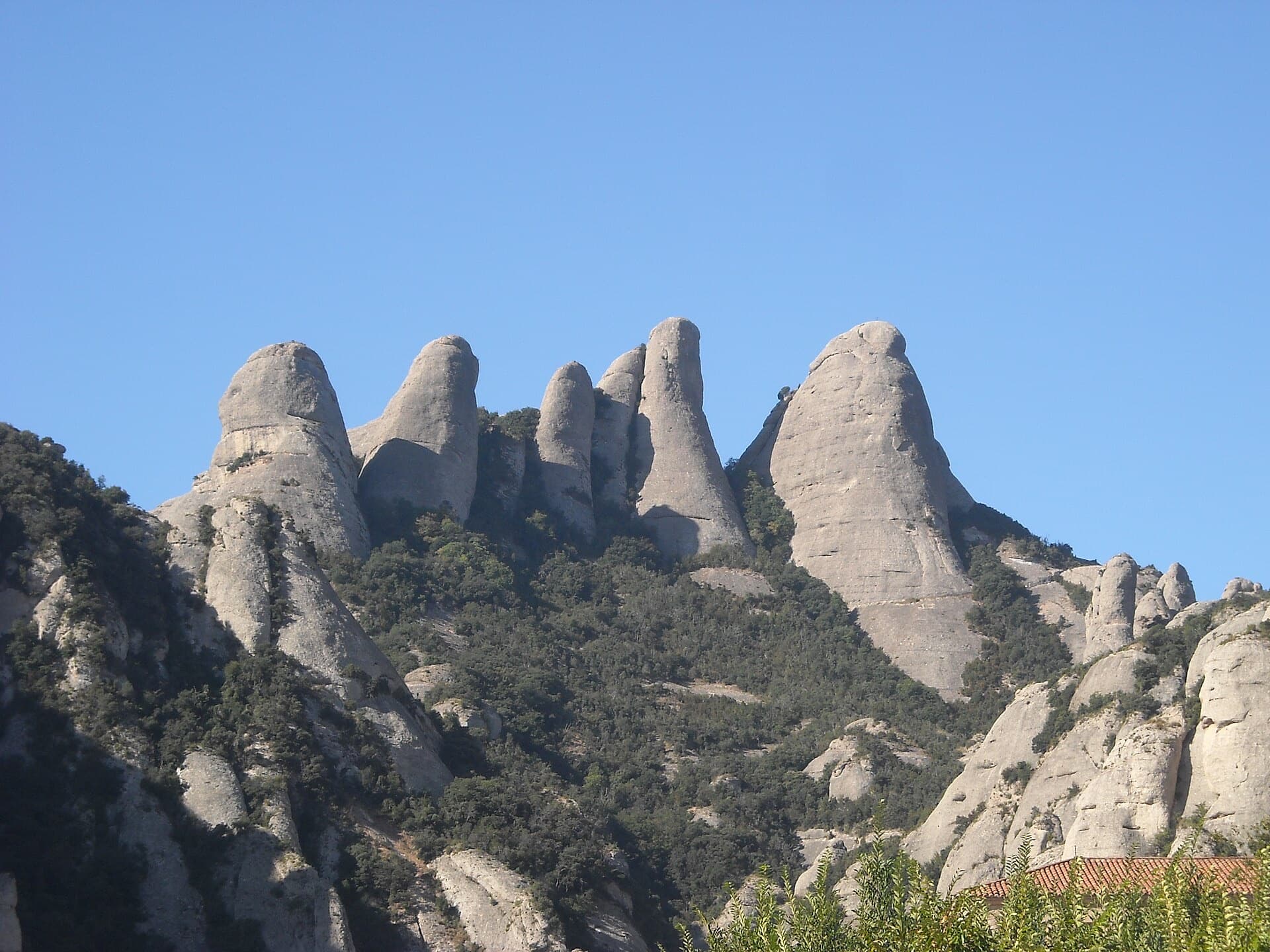
The Gorros of Montserrat from the monastery side: left to right the Gorra Marinera, the Magdalenes and the Gorra Frígia. Via Sargantanes climbs the Gorra Marinera, the left-hand tower.

Spain · Montserrat

Via Sargantanes

A popular first Montserrat multipitch close to the monastery. Steep pebble walls at 5b are split by easy slabs, finishing on an airy summit cap.

5b6 pitches145 m

Read the cautions

The Gorra Frígia seen from the Camí Nou de Sant Jeroni on the northern side of the Gorros, Montserrat. Via Stromberg climbs the north face; the line is not marked.

Spain · Montserrat

Via Stromberg

A shady north-face outing that suits warm days. Steady 5c pebble climbing leads to a short overhang crux (6a, or 5c/A0) and the summit cross.

6a4 pitches120 m

Gorra Frígia and Magdalena Superior seen from the south-west, Montserrat

Spain · Montserrat

98 Octanos

An exposed, airy line with unusually good holes and jugs for Montserrat, shaded in the afternoon. The 6a pitch is a sustained vertical 20 m. Going straight up instead of following the line is closer to 6b+.

6a4 pitches140 m

Around 5c · about 5 pitches

Similar elsewhere

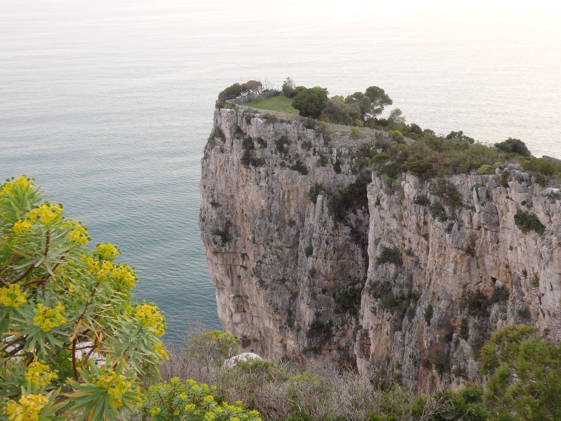
The limestone sea cliff of the Montagna Spaccata on Monte Orlando, Gaeta, dropping from the park's edge into the Tyrrhenian Sea. Via dello Spigolo is on these cliffs; the exact line is not marked.

Italy · Gaeta & Sperlonga

Via dello Spigolo

This was the second route on Montagna Spaccata and is the cliff's classic moderate. It's never hard but never trivial, with continuous exposure above the sea: a horizontal crack traverse, an athletic juggy chimney and corners. Gulliver gives UIAA grades V–V+ / IV+–V / V+ / V / V–IV+ (5c max), converted here.

5c5 pitches125 m

Read the cautionsCommitting

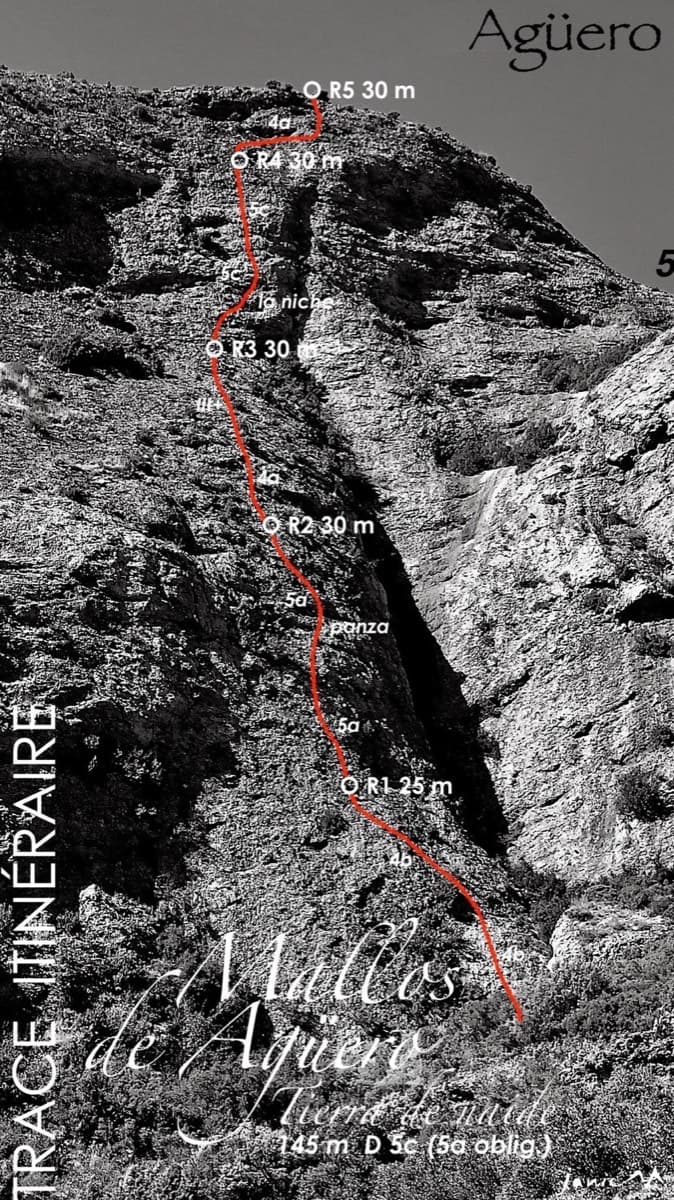
Topo of Tierra de Naide, Mallos de Agüero

Spain · Riglos & Agüero (Mallos)

Tierra de Naide

A morning-sun route at the quieter Agüero mallos. Easy slabs separate two fine steep walls, including a superb vertical 5c plaque on pitch 4. Take care with some loose cobbles on the last traverse.

5c5 pitches145 m

The Oujdad above Taghia

Morocco · Taghia

Ibtisane

The easiest bolted line at Taghia: three steep 5c walls linked by two long, easy garden pitches. Goes into shade around midday in April.

5c5 pitches235 m

Read the cautions

Line of The first of Ela on the Paroi du Levant, Todra Gorge

Morocco · Todra Gorge (Todgha)

The first of Ela

Five long pitches of 5c in the centre of the Levant wall, sharing its first pitch with Tromba Bitonale.

5c5 pitches195 m

Read the cautions

Compiled from published sources and last verified October 2026. Bolts, anchors and access change. Climbing is dangerous and you are responsible for your own decisions: check a current topo and read the disclaimer.