Multipitch Atlas

Voie Rodrigue

Pointe de Sosay (Cenise) · Aravis · France

Read the cautionsBail with caveatsBolting confidence: medium

A varied summit route in a quiet pastoral corner above the Cenise plateau: a string of short, surprisingly compact walls separated by wooded ledges, each with a different crux. The hard moves are brief and athletic. North-west facing and cool in summer.

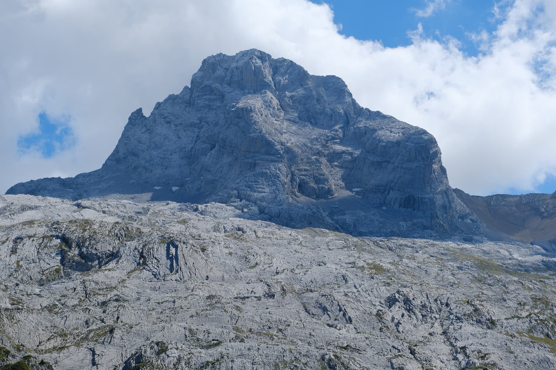
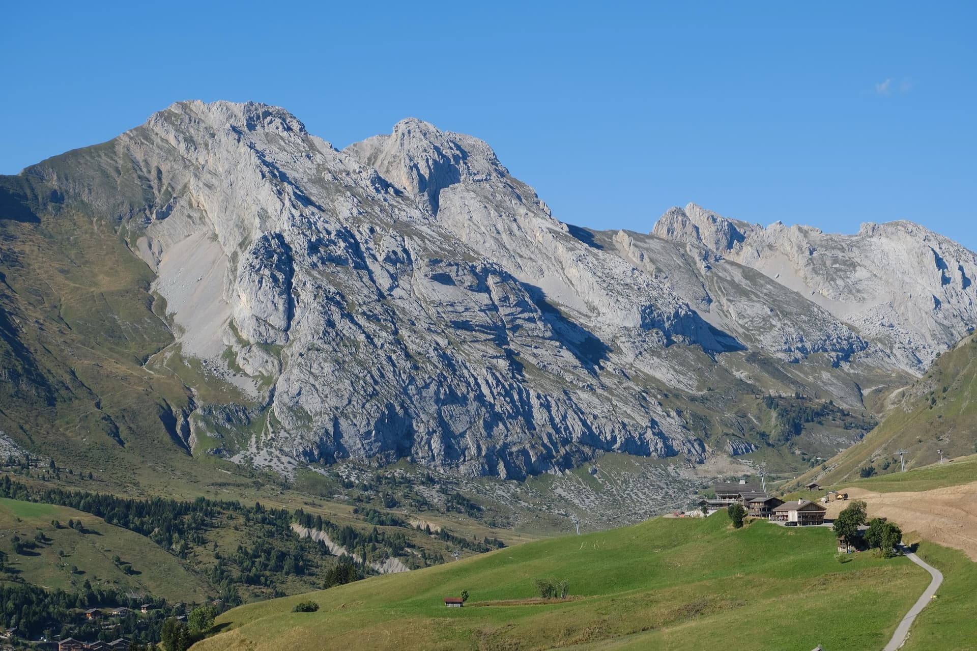
The Pointe de Sosay above the Cenise pastures; the Voie Rodrigue climbs the tiered face to the summitPhoto: David Bochot · CC BY-SA 3.0

Photo

The Pointe de Sosay above the Cenise pastures; the Voie Rodrigue climbs the tiered face to the summitPhoto: David Bochot · CC BY-SA 3.0
Hardest pitch
6b
Pitches
13
Length
250 m
Approach
20 min
Aspect
NW
North-west-facing
Rope
2×50 m
Read before you go

Well protected on the hard moves, but the 5c slab of pitch 3 is run-out and there is loose rock on the easier tiers.

The route

Overview

The Voie Rodrigue climbs the north-west face of the Pointe de Sosay (1894 m) to the cross on its summit. Nine climbing pitches are linked by four walking or scrambling sections through firs and across ledges, so it has little big-wall atmosphere, but the climbing on each tier is good and the setting, with the Cenise refuge below, is idyllic. The difficulties are concentrated in three places: a bouldery crack start on pitch 3 (6b, or 5c with a pull on a draw), a strenuous corner on pitch 6 (6a+) and an athletic leftward pitch higher up (6a). Expect some loose rock and vegetation on the easier pitches. Parties take 4 to 5 h 30 min.
The climbing

Pitch by pitch

Pitches of Voie Rodrigue
PitchGradeNotes
P15bFirst pitch; links with pitch 2 (48 m together, easy on a 60 m rope).
P25aEasier ground to the foot of the crux wall.
P36bA bouldery move at the start of the crack (6b, or 5c/A0, well protected), then 5c slab on which the bolts are far apart: a 2023 party says you must not fall there. On reaching the ledge move 4 m left to climb the second small wall, which has one hanger that is hard to see.
P4–A walking link: go up to the right and through the firs, then along the rock for 15 m to the left to a hanger with a maillon. A 2026 party says go up 3 m above the belay and straight into the trees, not right.
P55bRising leftwards. A band of delicate, loose rock in the middle, then a nice exit wall.
P66a+Two or three athletic moves in the corner at the start, well protected; rounded holds. A 2023 party warned of a large block at the very start of the corner.
P7–A link: traverse left across the side of a small col (sling on a fir, then cords) and climb straight up 10 m to a belay on the left behind a fir.
P85aGood rock to start, a little vegetated to finish. A 2026 party found the start athletic and could not link it with the next pitch because of rope drag and falling gravel.
P95aA nice crack for 4 m, then walk: go down left to a cord threaded through a drilled hole, then 3 m further down left to the belay. From here you can escape across the grass slopes east of the summit.
P106aA fine, rather athletic pitch rising leftwards, with a hard traversing move at the third bolt. Once past the difficulties keep traversing up left into a rocky gully (hangers up on the left, one marked with a metre of cord). A dead tree lies across the top of the pitch and hides a bolt.
P115c6a if you go straight up the last compact section, which is easily turned on the right. The finish is on very good grey rock.
P12–Put on trainers and walk to a small col and a belay.
P13–Two easy climbing moves, then walk to the cross and belay on it. Pitches 12 and 13 together are 60 m.

Getting there

Approach

To the parking

From Le Petit-Bornand take the road behind the school that climbs to Cenise. Park at the second car park, on the left, 300 m before the Cenise refuge (about 1560 m). Livestock graze freely: close the fences behind you. A party in 2023 walked in from Le Frachet over the Col de Cenise instead, which adds about 30 min in all.

On foot · about 20 min

About 20 min. From the top of the car park take the wide track (barrier) to a first isolated chalet and then the two chalets of Comborse. 100 m after the chalets go up left across the pasture towards the cliff (cairns) before entering the forest. Climb a track in the scree to the foot of the cliff, then continue a few dozen metres left to the first bolt, which is about 3 m off the ground. There is no name at the foot of the route. In 2023 a temporary sheep pen at the first chalet forced a detour and a 40 min approach.

Map of the walk-in

  • Crag

Loading map

The point marks the crag, not the exact start of the route.

Coordinates · crag

46.00500, 6.44513

Point from camptocamp waypoint 43113 (Pointe de Sosay summit)

For your phone or watch

Download GPX

Contains the route point. Opens in most mapping apps and GPS watches.

Points are compiled from published sources, with the precision stated above. They were not surveyed on the ground: check them against a current topo.

Getting down

Descent

On foot. From the cross descend towards the Col du Rasoir, then turn right onto a small track that soon fades, and easily join the very good path that comes down from the Col de Sosay. The foot of the route is 20 min from the col. If you stop at the ninth belay, cross the grass slopes east of the Pointe de Sosay and descend to Cenise. Abseiling the route is not recommended, although the maillons are in place, because of the ledges.

Retreat

Bailing off the route

Bail with caveats

Camptocamp advises against abseiling the route because of its ledges, although maillons are in place at the belays. The stated escape is on foot from the ninth belay across the grass slopes east of the summit to Cenise. Lower down, the wooded ledges between the tiers break the route into short sections from which a single abseil would reach the ledge below.

Retreat from
The ninth belay, on foot. Abseil from lower belays on the in-place maillons if you must.
Point of no return
None documented.
Carry
2×50 m ropes if you plan to abseil; care with ropes snagging and dislodging stones on the ledges.
Basis
Part stated, part inferredThe foot escape and the advice against abseiling are stated on camptocamp; abseiling tier by tier is inferred from the maillons and the ledges.

Partly inferred from the route facts

Safety

Hazards

  • The 5c slab on pitch 3 is run-out above the well-protected start.
  • Loose rock on pitch 5 and in places elsewhere; gravel falls from the ledges onto the ropes and the belayer.
  • A large suspect block was reported at the start of the pitch 6 corner in 2023.
  • The walking links are not obvious; several are marked only by old cords.
  • The last belay before the final scramble is badly placed for rope drag: a 2024 party suggests belaying on the last bolt before the flat ground.

Sun and weather

Conditions

North-west facing between 1640 and 1894 m: ideal in hot weather. The face is easy-angled enough for the sun to reach several pitches from late morning in summer; in early October it arrives around 13:00 to 14:00. The rock takes a little getting used to but is mostly sound.

Usual season · Jun to Oct

Sun on the wall · NW-facing

Working out the sunlit hours for this month.

  • January: not yet worked out
  • February: not yet worked out
  • March: not yet worked out
  • April: not yet worked out
  • May: not yet worked out
  • June (usual season): not yet worked out
  • July (usual season): not yet worked out
  • August (usual season): not yet worked out
  • September (usual season): not yet worked out
  • October (usual season): not yet worked out
  • November: not yet worked out
  • December: not yet worked out

Sun on the wallDaylight, wall in shade● Usual season

Estimated from the wall's aspect only. Ignores surrounding terrain, gullies and the wall's exact shape. Clock times are local to the wall (Central European time), for the 15th of each month.

Monthly climate averages for Aravis, 1991-2020
MeasureJanFebMarAprMayJun (usual season)Jul (usual season)Aug (usual season)Sep (usual season)Oct (usual season)NovDec
Mean daily high °C−7−5−21610131395−2−6
Mean daily low °C−16−15−12−8−4133−1−5−11−15
Rain days 1 mm or more131113151918171614131413

● marks the usual climbing season. Averages for 1991-2020 at about 2371 m. Area climate from Open-Meteo reanalysis. Temperatures are adjusted to the height of the crag; rain comes from a grid cell of about 10 to 25 km, and summer highs on sea cliffs can read a few degrees low. The wall and valley can differ. Data: Open-Meteo, CC BY 4.0.

What to carry

Gear

Two 50 m ropes and 11 quickdraws according to camptocamp; a 2026 party did everything with a single 60 m rope and 10 draws. Slings for the belays above the fourth, where the bolts are not linked. Nuts and cams are useful only if you are not comfortable at 6a, particularly on pitch 3. Shoes for the walk down. Helmet.

Checklist

Quickdraws
11
Rope
2×50 m
Helmet
One each
Abseil device and prusik
The descent or the retreat involves abseiling

Derived from the route data; check it against a current topo

From climbers

Reader reports

Reader reports are not being collected yet. Until they are, check a current topo and the local club or guidebook publisher for recent changes to Voie Rodrigue.

Worth knowing

Tips

  • Many parties coil the rope at the top of pitch 11 and walk to the cross.
  • The Cenise refuge below serves food and makes a good end to the day.
  • A good choice on a hot or unsettled day: it is lower and less exposed to weather than the Jallouvre.

Open questions

Where sources disagree

  • This record rests on camptocamp alone (route text and trip reports from 2023 to 2026).
  • Pitch grades are published for the nine climbing pitches only (5b, 5a, 6b, 5b, 6a+, 5a, 5a, 6a, 5c); the four links have no grade, so the card shows no pitch-grade list.
  • Where the partial first ascent stopped: the French history says the ninth belay, the Spanish text the sixth; likewise the on-foot escape is placed at the ninth belay in French and the seventh in Spanish. The numbering differs because the links are counted differently.
  • Pitch 7: the French text says descend 2 m across the side of a col; a 2026 party says there is no real descent, just a track left past three cords.
  • Rope: 2×50 m in the route text, although the descent is on foot and a 2026 party used a single 60 m.

Provenance

Sources

Same area

More in Aravis

All routes in Aravis
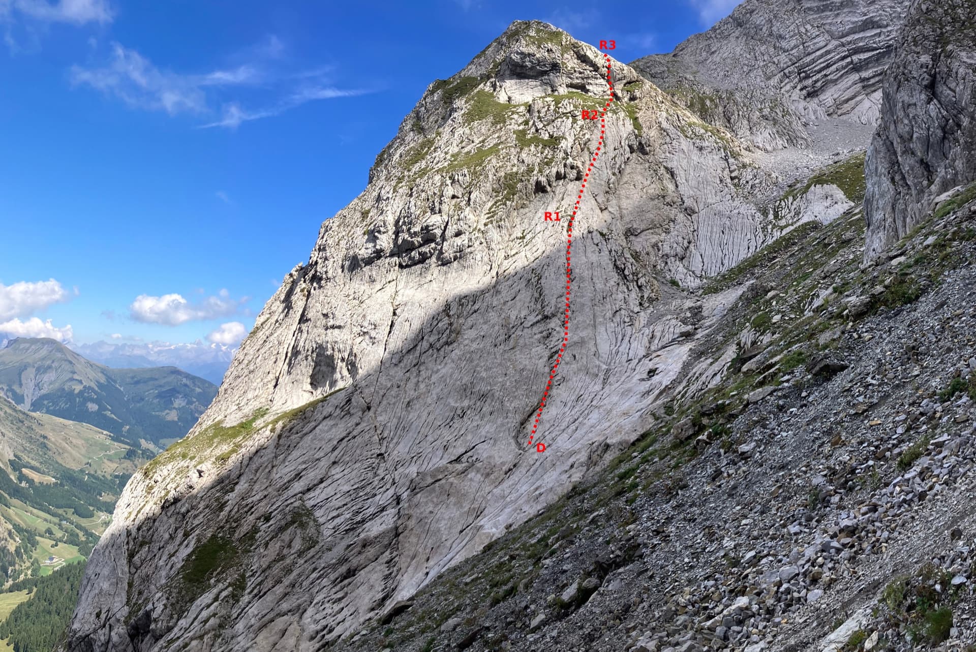
The Pointe Percée above the limestone pavement of the Gramusset plateau, seen from the north-west; Le sirop pour machin starts from the crags near the hut and finishes on the summit, the exact line is not marked.

France · Aravis

Le sirop pour machin

An introduction to mountain multipitch that tops out right under the summit cross of the highest Aravis peak. Grippy fluted limestone is linked by cairned walking sections, and the last pitches are the best.

5b+11 pitches400 m

The south face of the Pic de Jallouvre (left summit) and the Pointe Blanche above the chalets of Le Grand-Bornand, on the road to the Col de la Colombière; the Voie des Cristaux climbs the right-hand side of the Jallouvre face.

France · Aravis

Voie des Cristaux

Sixteen pitches of easy slabs and water-worn runnels above the Col de la Colombière, on the border between scrambling, climbing and mountaineering. Nothing is harder than 4b and most of it is grade 3, on sculpted, grippy limestone among ibex and edelweiss. Many parties carry on up the Arête des Bouquetins to the summit for a very long day.

4b16 pitches400 m

The north-west face of the Pointe Percée rising above the limestone pavement of the Gramusset plateau, seen from the Col des Annes side; Heididoune climbs this face to the summit, the exact line is not marked.

France · Aravis

Heididoune

A ten-pitch line to the summit of the Pointe Percée, the high point of the Aravis, following green hangers up the cool north-west face. Seven long pitches, mostly easy with a 6a+ wall, reach the notch of the Arête du Doigt; three independent pitches finish it, including a memorable slab traverse of 6b+ that can be aided on the bolts.

6b+10 pitches400 m

Read the cautions

The first three pitches of the Arête à Marion drawn on the slab at the foot of the ridge, with the belays marked

France · Aravis

Arête à Marion

The classic easy ridge of the Aravis: three bolted slab and chimney pitches, then a long, airy limestone crest with Mont Blanc in view all the way. Most of it is grade 3 and is often climbed moving together. The steep scree of the approach and descent is the hard part of the day.

4c13 pitches300 m

Read the cautions

Around 6b · about 13 pitches

Similar elsewhere

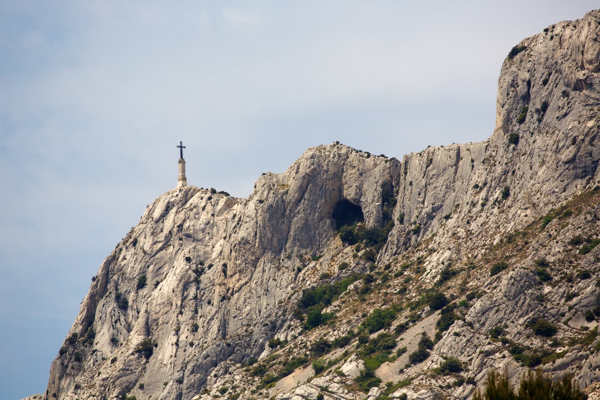
The Croix de Provence and the upper cliffs of Sainte-Victoire; La Commande finishes at the priory near the cross

France · Sainte-Victoire

La Commande

The long bolted route of Sainte-Victoire: 400 m from the foot of the mountain to the priory beside the Croix de Provence, in thirteen pitches up to 6b. Conglomerate walls low down, superb grey slabs higher up, and short walks between the tiers. Sustained around 6a, with a hard traverse on the second pitch.

6b13 pitches400 m

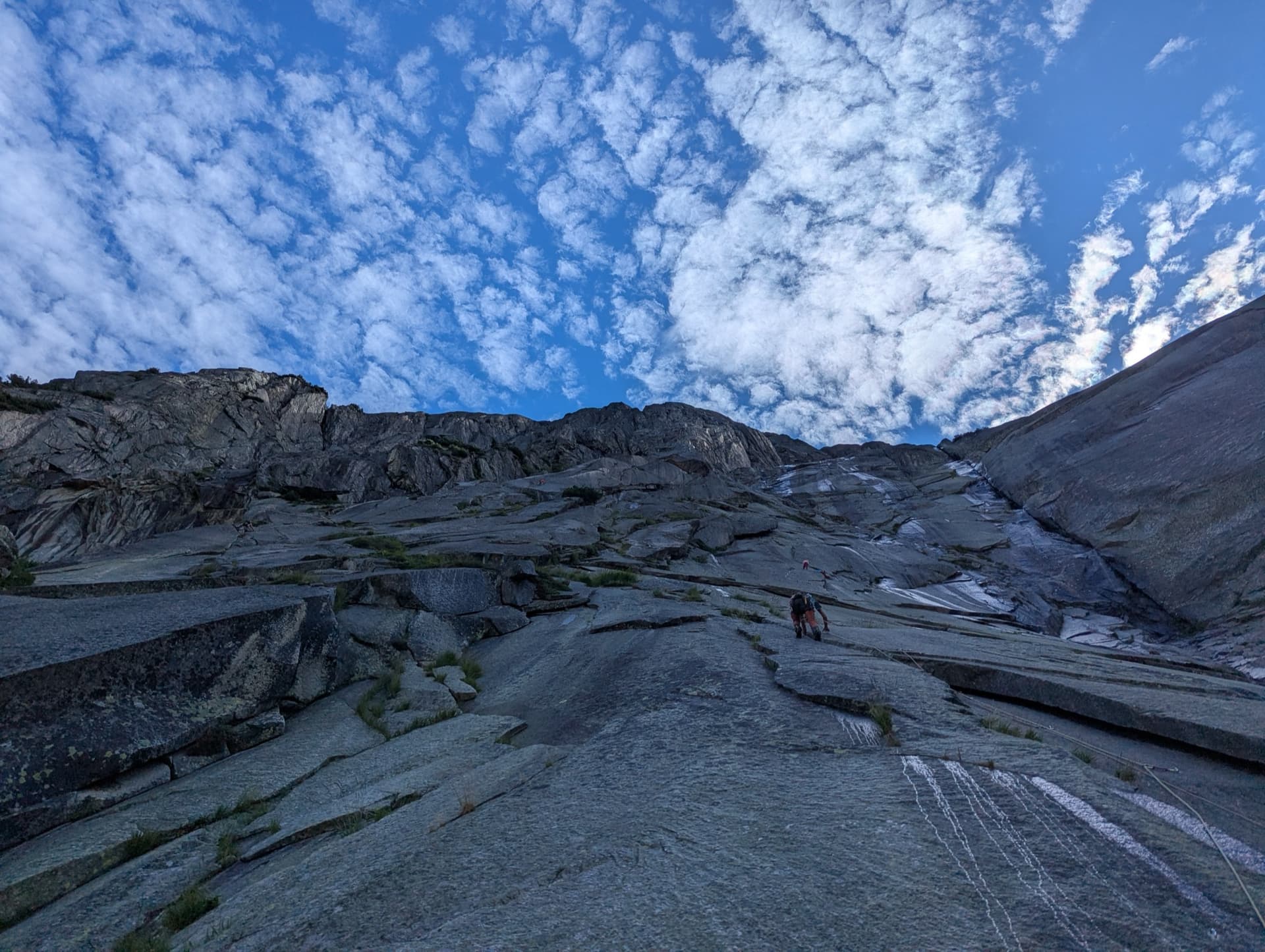
The granite slabs of the Gelmerfluh under a mackerel sky, photographed from pitch 3 of Savoir Vivre.

Switzerland · Grimsel

Sagittarius

A Grimsel granite classic: low-angle slabs lead to the famous 6a+ crack pitches and a thin 6b traverse, then steeper, sculpted ground. Sustained at 5c/6a throughout.

6b13 pitches400 m

Looking down on the Pedra Longa stack and the coast from high on Atlantide

Italy · Sardinia

Atlantide

A 400 m plaisir route above Pedra Longa with the sea behind you all day. Eight easy, vegetated pitches lead to a steep finish: the last three or four pitches, up to 6b, are the real climbing. Closely bolted throughout; the long abseil descent through bushes needs care.

6b12 pitches400 m

The Geierwand above Haiming seen from the car park; Nebraska takes the left side of the wall from bottom to top

Austria · Inntal (Haiming Geierwand)

Nebraska

bergsteigen.com calls this the best route on the Geierwand: steep, almost always vertical pocket climbing on the left side of the wall. The hardest move comes on pitch 2, but the upper half stacks several 6b pitches one after another and tires the forearms. Recommended to climbers who are comfortable at 6b.

6b+13 pitches355 m

Compiled from published sources and last verified October 2026. Bolts, anchors and access change. Climbing is dangerous and you are responsible for your own decisions: check a current topo and read the disclaimer.