Multipitch Atlas

Eau de mai

Pointe de la Vuzelle – north face · Vanoise (Grand Bec) · France

Read the cautionsBail with caveatsBolting confidence: high

A long, easy mountain route up the shady north face of the Pointe de la Vuzelle, finishing at a summit cross above the Refuge du Grand Bec. The climbing is in the first two pitches and the seventh; the rest is short steps of 3b to 5a linked by walking pitches over grass and unstable scree. Go for the outing and the summit, not for sustained rock.

General view of Eau de mai on the north face of the Pointe de la Vuzelle, with the start and belays R1 to R11 markedPhoto: cassien vanoise · CC BY-SA 3.0

Topo

General view of Eau de mai on the north face of the Pointe de la Vuzelle, with the start and belays R1 to R11 markedPhoto: cassien vanoise · CC BY-SA 3.0
Hardest pitch
5c
Pitches
12
Length
300 m
Approach
60 min
Aspect
N
North-facing
Rope
1×50 m
2×50 m if you want to be able to retreat
Read before you go

Very well bolted, but it is mountain terrain: loose rock, scree-covered walking pitches and an exposed scramble off the summit ridge.

The route

Overview

Eau de mai climbs about 300 m of quartzite on the north face of the Pointe de la Vuzelle, the small peak that stands above the Refuge du Grand Bec. It was bolted between 2013 and 2015 as an accessible mountain route: twelve short pitches, none harder than 5b apart from one move of 5c at the start of the second pitch that you can pull through on a bolt. Opinions are split. Most parties log it as a pleasant, well-bolted day in a fine setting, but a 2018 party disliked the loose rock and the scree pitches, and the rock does need care away from the steep sections. It finishes at the first cross on the summit ridge, with a short, exposed scramble down to the hut.

The climbing

Pitch by pitch

Pitches of Eau de mai
PitchGradeNotes
P15bTwo successive steps, mostly 5a with a harder move. One of the better pitches.
P25cA particularly steep step: the first move is the hardest of the route (given 5b with one move of 5c, and a 2018 party thought it harder still). The bolts are close enough to pull on. Slow to dry.
P35aSections of 4b, 5a and 4a.
P44aEasy climbing at about 4a.
P53bA short pitch, 3b at most, that can be linked with the next one.
P6easyEasy ground on foot across very unstable scree. No grade is given.
P75bMostly 5a with one move of 5b. A 2018 party found loose blocks on this pitch.
P8easyEasy mixed ground of rock, grass and scree. No grade is given.
P94bFrom the belay go about 20 m left to a bolt marked with a piece of cord, then 4a to 4b.
P104a3c to 4a.
P113b3b at most. Follow the bolts marked with cord to a belay in the middle of a slab.
P125a4b to 5a to a belay on a large block at the top. You come out at the first cross, on the hut side of the summit ridge.

Getting there

Approach

To the parking

From Moûtiers drive towards Pralognan-la-Vanoise. After the village of Le Planay take the small road on the left towards Chambéranger and continue up the steep hairpins to Plan Fournier (about 1720 m), where you can park. A forest track continues to a higher car park in the trees at about 1850 m, the usual start for the Refuge du Grand Bec; its last 600 m are rough, and parties in 2020 and 2021 found the track rutted and unsuitable for low cars, so many stop at about 1770 to 1800 m.

On foot · about 60 min

From Plan Fournier or the upper car park follow the path towards the Refuge du Grand Bec. Once out of the forest you can pick out the grassy shoulder that leads to the foot of the route and a small cave just right of the start. Level with the route, a cairn and a rock with the route name painted on it mark where to leave the hut path; a line of cairns leads up the grassy shoulder, then you traverse to the cliff. The first bolt carries a piece of cord. Parties report 45 min to 1 h from the upper car park, and up to 1 h 30 from Plan Fournier. From the hut itself the start is about 15 min away.

Map of the walk-in

  • Crag
  • Parking

Loading map

The point marks the crag, not the exact start of the route.

Coordinates · crag

45.41560, 6.72844

Parking

45.42761, 6.71656

Forest parking above Plan Fournier at about 1800 m, 600 m before the end of the track (camptocamp access waypoint 104249, Chambéranger); the last part of the track is rough

Point from camptocamp waypoint 353356 (Pointe de la Vuzelle summit; the route climbs the north face below it). The route's own camptocamp point was not used.

For your phone or watch

Download GPX

Contains the route point and parking. Opens in most mapping apps and GPS watches.

Points are compiled from published sources, with the precision stated above. They were not surveyed on the ground: check them against a current topo.

Getting down

Descent

About 30 min to the hut. From the first cross follow the crest of the ridge as closely as you can towards the Refuge du Grand Bec; a few bolts let you belay a tired or nervous partner, and a 2018 party made a short abseil from one of them. A 2021 party calls this ridge quite exposed and says it needs a lot of care. The other option given is to pick a way down the face on the hut side, between grass slopes and rock outcrops. From the hut walk back down the path, about 1 h to 1 h 30 to the car.

Retreat

Bailing off the route

Bail with caveats

A 2021 party states that with a 2×50 m abseil rope you can retreat from the lower part of the route, where the belays are linked and have a maillon, up to the third belay. Higher up nothing is rigged for abseiling and the line wanders across scree ledges with walking pitches, so the practical way off from there is to finish, at grades of 5a or less with one move of 5b.

Retreat from
The first three belays (linked, with maillon). Above that, not documented.
Point of no return
Above the third belay. The climbing above is easy, so continuing is usually simpler than descending.
Carry
2×50 m ropes, which is more than the single 50 m the route is normally climbed on.
Basis
Stated in the sourcesFrom a detailed August 2021 camptocamp trip report; the route description itself says nothing about retreat.

Safety

Hazards

  • Loose rock and unstable scree on the linking pitches (6, 8 and 11 in particular). The leader can easily send stones onto the second.
  • A 2021 party advises against moving together: it raises the stonefall risk a lot, and the belays are placed to shelter the second.
  • The descent along the summit ridge is exposed, with only a couple of bolts.
  • The first two pitches stay wet after rain and the crux move is at the start of pitch 2.
  • After the storms of August 2018, signs at Plan Fournier closed some paths; check locally after severe weather.

Sun and weather

Conditions

North-facing between about 2200 and 2500 m, in the shade most of the day: parties use it as a heatwave route, and a September 2024 party found it cold in the wind. Camptocamp warns against going after heavy rain, as the steep, hard pitches can take several days to dry, although a June 2025 party found dry rock the day after a storm. Logged ascents run from 21 June to 7 September. The Refuge du Grand Bec is wardened from mid-June to mid-September.

Usual season · Jul to Sep

Sun on the wall · N-facing

Working out the sunlit hours for this month.

  • January: not yet worked out
  • February: not yet worked out
  • March: not yet worked out
  • April: not yet worked out
  • May: not yet worked out
  • June: not yet worked out
  • July (usual season): not yet worked out
  • August (usual season): not yet worked out
  • September (usual season): not yet worked out
  • October: not yet worked out
  • November: not yet worked out
  • December: not yet worked out

Sun on the wallDaylight, wall in shade● Usual season

Estimated from the wall's aspect only. Ignores surrounding terrain, gullies and the wall's exact shape. Clock times are local to the wall (Central European time), for the 15th of each month.

Monthly climate averages for Vanoise (Grand Bec), 1991-2020
MeasureJanFebMarAprMayJunJul (usual season)Aug (usual season)Sep (usual season)OctNovDec
Mean daily high °C−9−8−5−228111172−5−9
Mean daily low °C−16−16−13−9−6−122−2−6−12−16
Rain days 1 mm or more131213141618161413131313

● marks the usual climbing season. Averages for 1991-2020 at about 2779 m. Area climate from Open-Meteo reanalysis. Temperatures are adjusted to the height of the crag; rain comes from a grid cell of about 10 to 25 km, and summer highs on sea cliffs can read a few degrees low. The wall and valley can differ. Data: Open-Meteo, CC BY 4.0.

What to carry

Gear

12 quickdraws at least, a few slings to cut rope drag, a single 50 m rope and a helmet. Camptocamp describes the pitches as 20 to 30 m, but a 2021 party says two of them are about 45 m. The same party recommends 2×50 m so that you can abseil off the lower part if you need to. No cams or nuts.

Checklist

Quickdraws
12
Rope
1×50 m (2×50 m if you want to be able to retreat)
Helmet
One each
Abseil device and prusik
The descent or the retreat involves abseiling

Derived from the route data; check it against a current topo

From climbers

Reader reports

Reader reports are not being collected yet. Until they are, check a current topo and the local club or guidebook publisher for recent changes to Eau de mai.

Worth knowing

Tips

  • Allow about 4 hours on the route; a fast 2018 party took the same from the foot to the summit.
  • The hut is 30 min below the top and serves food in season; several parties stop there on the way down.
  • Take a wind layer even in a heatwave.
  • If you enjoy this, Vendredi 13 on the Contreforts du Grand Bec is the sunny counterpart from the same hut.

Open questions

Where sources disagree

  • Grade of pitch 2: the original text gives 5b with one move of 5c, the Spanish version marks that 5c as unconfirmed, and a 2018 party thought the move harder than 5c. The camptocamp page now carries 5c overall.
  • Belays: the route text says two bolts; a 2021 party describes three linked points.
  • Pitch lengths: 20 to 30 m in the route text, but a 2021 party says two pitches are about 45 m.
  • Approach time: 45 min, 1 h and 1 h 30 are all reported, depending on where the car is left.
  • Quality: reports from 2017 to 2025 are mostly positive, but a 2018 party rated the rock poor and several pitches unpleasant.

Provenance

Sources

Same area

More in Vanoise (Grand Bec)

All routes in Vanoise (Grand Bec)
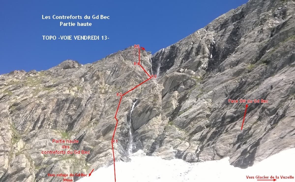
Photo-topo of Vendredi 13 on the upper Contreforts du Grand Bec, with belays R1 to R5

France · Vanoise (Grand Bec)

Vendredi 13

A short, sunny high-mountain route at 2800 m in the Vanoise: five 25 to 30 m pitches of 4b to 5b with one or two moves of 5c that can be pulled through, then an easy scramble. The bolting is generous enough that parties with little experience enjoy it. The setting, below the south-west face of the Grand Bec, is the reason to walk up.

5c6 pitches180 m
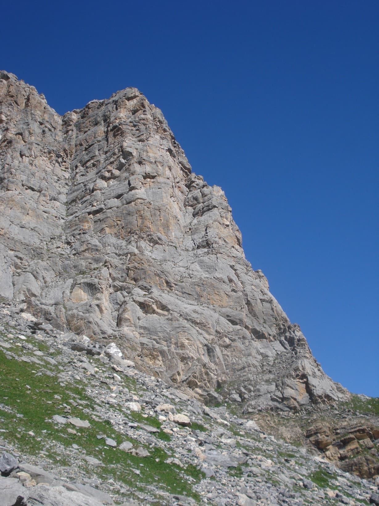
The east pillar of the Grand Marchet, seen face on in the centre; the abseil line comes down the corner on the left

France · Vanoise (Grand Bec)

Pilier Est

The leftmost route on the steep south-east face of the Grand Marchet, in the Cirque du Dard above Pralognan. Short but varied limestone climbing with a lot of air for the grade: slabs, steps, a superb corner, an old-style chimney and a vertical wall, getting harder as you go. The two 6a pitches are closely bolted and go at about 5c with a pull.

6a7 pitches180 m

The south face of the Petite Aiguille de l'Arcelin above the Cirque de l'Arcelin

France · Vanoise (Grand Bec)

Voie Vion

The classic hard line of the south face of the Petite Aiguille de l'Arcelin, in a high cirque above Pralognan. Nine varied pitches on good grey limestone: corners, slabs, short overhangs and a technical 6c crux pitch with at least one obligatory move of 6b. Every pitch climbs, and the descent is a small mountain trip of its own.

6c9 pitches220 m

Read the cautions

The Petite Aiguille de l'Arcelin from the approach through the Cirque de l'Arcelin

France · Vanoise (Grand Bec)

Stop ou Encore

A short, wild, modern route on the grey limestone of the Petite Aiguille de l'Arcelin, in two halves: thin, technical slab low down, including a sustained 6b+ with obligatory moves, then steep walls with a very sustained 7a pitch of two bouldery cruxes. Seldom climbed for its quality.

7a6 pitches190 m

Read the cautions

Around 5c · about 12 pitches

Similar elsewhere

The Palavar slabs above Ailefroide; Palavar-les-Flots follows the leaning pillar on the left

France · Ailefroide

Palavar-les-Flots

Ailefroide's best-known easy long route: a consistent run of 4th-grade slab and pillar climbing with two harder steps (5b+ on L4, a 5c friction move on L8). It is very popular, so start early.

5c12 pitches310 m

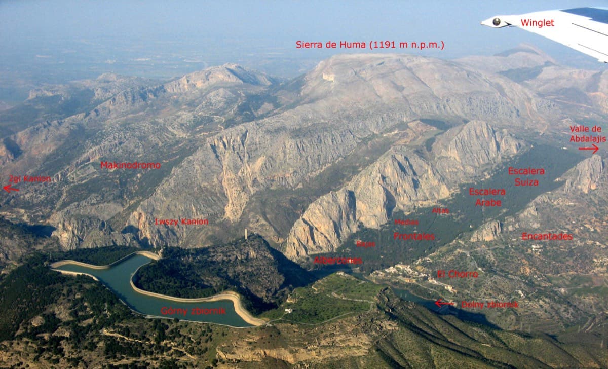
Annotated aerial view of El Chorro showing Frontales, Escalera Árabe and Escalera Suiza (labels in Polish)

Spain · El Chorro

Blue Line

The longest easy line in El Chorro. It starts up a broken corner-ramp, then climbs a steeper wall trending right to the top. It's uncommitting and easy to link pitches, with some loose rock to watch for.

5c12 pitches310 m

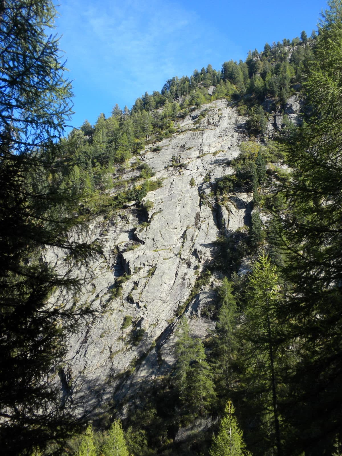
The slab of L'île aux Razmokets in the Vallon de Bérard, seen through the larches from the valley path; the line is not marked.

France · Chamonix valley

L'île aux Razmokets

A long, friendly slab route in the quiet Vallon de Bérard: twelve pitches that follow a chain of cracks and flakes across a compact gneiss slab, with two sustained 5c pitches low down. It stays in the shade until about midday, which makes it a summer route, and it dries slowly. Many parties stop after pitch 7 or 8 and abseil.

5c12 pitches350 m

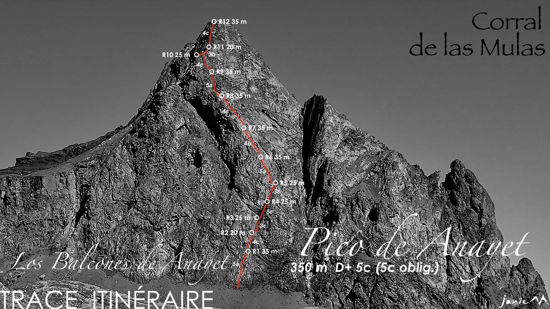
The east face of Pico de Anayet with the line and belays of Los Balcones de Anayet

Spain · Aragonese Pyrenees (Tena & Canfranc valleys)

Los Balcones de Anayet

A long, easy mountain route to a 2545 m summit above the Anayet lakes, on the dark volcanic rock of an old volcanic plug. Mostly 4c to 5a with one fine 5c corner on pitch 4; the lower half has broken rock and grassy channels, the upper 'balconies' are better. The day is long: two hours in, a via ferrata step on the approach and two hours out.

5c12 pitches350 m

Read the cautions

Compiled from published sources and last verified October 2026. Bolts, anchors and access change. Climbing is dangerous and you are responsible for your own decisions: check a current topo and read the disclaimer.