Multipitch Atlas

Pilier Est

Grand Marchet – south-east face (Pralognan) · Vanoise (Grand Bec) · France

Bail with caveatsBolting confidence: high

The leftmost route on the steep south-east face of the Grand Marchet, in the Cirque du Dard above Pralognan. Short but varied limestone climbing with a lot of air for the grade: slabs, steps, a superb corner, an old-style chimney and a vertical wall, getting harder as you go. The two 6a pitches are closely bolted and go at about 5c with a pull.

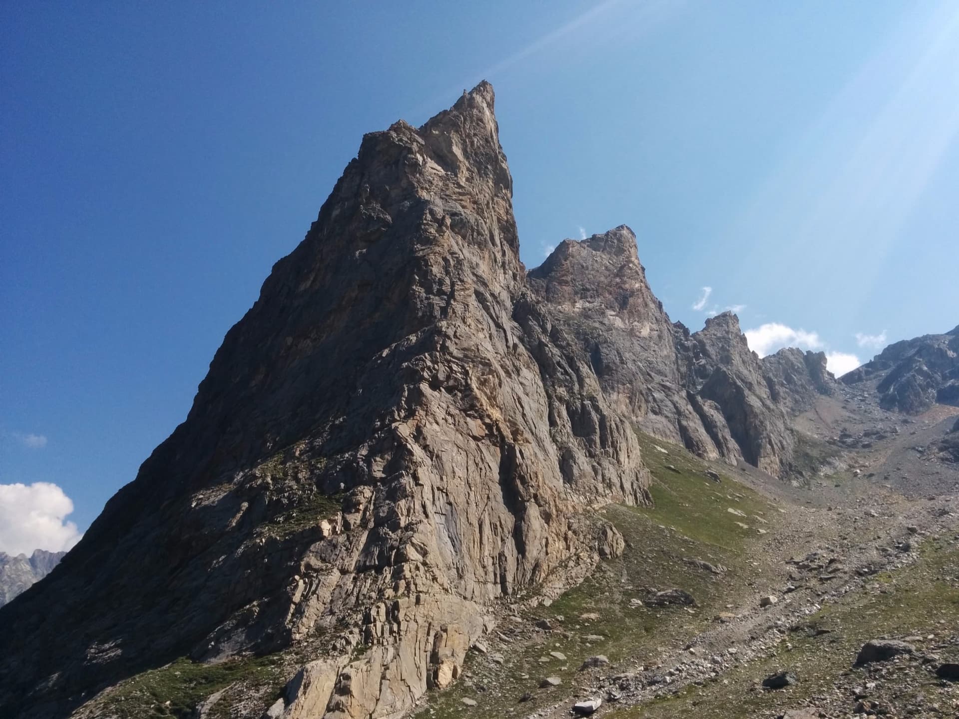
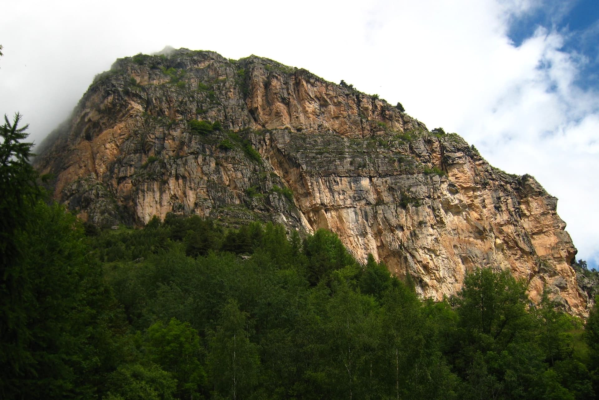
The east pillar of the Grand Marchet, seen face on in the centre; the abseil line comes down the corner on the leftPhoto: J.Marc · CC BY-SA 3.0

Photo

The east pillar of the Grand Marchet, seen face on in the centre; the abseil line comes down the corner on the leftPhoto: J.Marc · CC BY-SA 3.0
Hardest pitch
6a
Pitches
7
Length
180 m
Approach
90 min
Aspect
SE
South-east-facing
Rope
2×50 m
abseils of up to 45 m

The route

Overview

Despite its name the pillar faces south-east. The route gives about 180 m of climbing in seven pitches on pleasant, unpolished limestone, surprisingly easy for how vertical it is, and with rising difficulty: the first four pitches are 3c to 5a+, then a 5b+ corner, a short 6a chimney and a 6a wall shared with the neighbouring route Méli-mélo. Since its complete rebolting, camptocamp describes it as a modern, very well equipped route. The catch is the approach: about 700 m of ascent, with snow patches early in the season. The rock is excellent where it matters and sometimes friable on the easy ledges.

The climbing

Pitch by pitch

Pitches of Pilier Est
PitchGradeLengthNotes
P13c40 mVery easy steps for 10 m, with several bolts, then a rising traverse right across a slab and along a ledge. Do not stop after 20 m at the old two-peg belay: continue to the good two-bolt belay on a terrace at 40 m, shared with Méli-mélo.
P24c20 mA crack on the left, then a step.
P35a20 mSteps. Pitches 2 and 3 link well with a few extendable quickdraws.
P45a+25 mTurn a roof on the left. The belay is on a ledge, out left.
P55b+30 mA bulge, then a superb corner. Do not stop at the intermediate belay: go on to the one at the top of the corner, on a wide platform from which you see the three bolts and two pegs of the next pitch.
P66a15 mAn old-fashioned chimney on the right at 6a, which goes at A0 on three bolts, with a slightly bold 5c exit onto a small arête. Very short; a 2024 party measured it at 15 m.
P76a25 mA vertical wall climbed by two successive corners with a short traverse left between them, which is the crux. Shared with Méli-mélo.

Getting there

Approach

To the parking

Drive up the Tarentaise to Moûtiers, then the Bozel valley to Pralognan-la-Vanoise, and take the Fontanettes road to the car park at its end (1640 m), at the foot of the Génépi lift. Camptocamp notes that this car park has been pay parking since 2025 (10 euros for 24 hours). Without a car: train to Moûtiers, bus to Pralognan, then a half-hour path from the tourist office to the car park; free summer shuttles run in July and August.

On foot · about 90 min

From Les Fontanettes follow the signposted path up towards the Cirque du Dard and the Col du Grand Marchet. At about 2300 m leave the col path and climb right for about 50 m of height towards the south-east face, to an enormous block at about 2350 m. The start is behind the block, directly below the abseil line, where several hangers are visible; the initials 'PE' are written at the foot. Parties take from 1 h (fast) to 1 h 45.

Map of the walk-in

  • Crag
  • Parking

Loading map

The point marks the crag, not the exact start of the route.

Coordinates · crag

45.37274, 6.75103

Parking

45.38213, 6.73687

Les Fontanettes car park above Pralognan, 1640 m (camptocamp access waypoint 104461); pay parking since 2025

Point from camptocamp waypoint 40621 (Grand Marchet summit; the south-east face is just below). The route's own camptocamp point is a midpoint and was not used.

For your phone or watch

Download GPX

Contains the route point and parking. Opens in most mapping apps and GPS watches.

Points are compiled from published sources, with the precision stated above. They were not surveyed on the ground: check them against a current topo.

Getting down

Descent

From the top follow the ridge south-west for about 40 m to an abseil chain. Four abseils, 45 m obligatory, bring you back exactly to the foot of the route; the stations are all on chains and are sheltered from stonefall. This line serves every route on the face. With 2×60 m ropes the third and fourth abseils can be joined (55 m). Allow 30 to 40 min, then about 45 min to 1 h back to the car. Leaving over the summit and the Col du Grand Marchet, the original way off, involves a very exposed gully and is no longer recommended.

Retreat

Bailing off the route

Bail with caveats

Every belay has two bolts, but they are not linked and the abseil descent uses a separate line of chained stations in the corner to the left, so retreating down the route means leaving gear. The first belay is shared with Méli-mélo and the pitches are short (15 to 40 m). With two ropes a retreat from the lower pitches is reasonable; nobody has described doing it.

Retreat from
Any belay, on your own maillons or cord. The first pitch traverses right along a ledge, so the lowest abseil will not follow the line of ascent.
Point of no return
Not documented. The two 6a pitches at the top can be aided on the bolts, so from the top of the corner (pitch 5) finishing is likely to be quicker than descending.
Carry
Two ropes of at least 45 m, maillons or cord for the unlinked belays.
Basis
Inferred from the route factsCamptocamp states the belay hardware and the abseil line; retreat itself is inferred from them.

Partly inferred from the route facts

Safety

Hazards

  • Stony ledges on the easy ground and at the belays: watch for stones dislodged by the rope, especially when pulling the abseils.
  • Several parties warn that the abseil ropes can jam.
  • The first two abseils are steep and intimidating.
  • Snow on the approach in early summer.
  • It is easy to miscount the belays: there are old intermediate stations on pitches 1 and 5.

Sun and weather

Conditions

South-east facing between about 2350 and 2500 m; the sun reaches the combe fairly late in the morning. Early in the season the approach path disappears under snow and camptocamp advises crampons; a party on 8 June 2025 crossed two snow patches but found the foot of the route clear. Logged ascents run from early June to late September. Afternoon storms build quickly here: a July 2024 party started at 05:40 and still abseiled in rain.

Usual season · Jun to Sep

Sun on the wall · SE-facing

Working out the sunlit hours for this month.

  • January: not yet worked out
  • February: not yet worked out
  • March: not yet worked out
  • April: not yet worked out
  • May: not yet worked out
  • June (usual season): not yet worked out
  • July (usual season): not yet worked out
  • August (usual season): not yet worked out
  • September (usual season): not yet worked out
  • October: not yet worked out
  • November: not yet worked out
  • December: not yet worked out

Sun on the wallDaylight, wall in shade● Usual season

Estimated from the wall's aspect only. Ignores surrounding terrain, gullies and the wall's exact shape. Clock times are local to the wall (Central European time), for the 15th of each month.

Monthly climate averages for Vanoise (Grand Bec), 1991-2020
MeasureJanFebMarAprMayJun (usual season)Jul (usual season)Aug (usual season)Sep (usual season)OctNovDec
Mean daily high °C−9−8−5−228111172−5−9
Mean daily low °C−16−16−13−9−6−122−2−6−12−16
Rain days 1 mm or more131213141618161413131313

● marks the usual climbing season. Averages for 1991-2020 at about 2779 m. Area climate from Open-Meteo reanalysis. Temperatures are adjusted to the height of the crag; rain comes from a grid cell of about 10 to 25 km, and summer highs on sea cliffs can read a few degrees low. The wall and valley can differ. Data: Open-Meteo, CC BY 4.0.

What to carry

Gear

12 quickdraws, slings to link the two belay bolts, and two ropes of at least 45 m for the abseils. Helmet. Crampons for the approach early in the season. No cams or nuts: recent parties added nothing.

Checklist

Quickdraws
12
Rope
2×50 m (abseils of up to 45 m)
Helmet
One each
Abseil device and prusik
The descent or the retreat involves abseiling
Maillons or spare karabiners
To leave behind if you retreat
Cord
Mentioned for retreat

Derived from the route data; check it against a current topo

From climbers

Reader reports

Reader reports are not being collected yet. Until they are, check a current topo and the local club or guidebook publisher for recent changes to Pilier Est.

Worth knowing

Tips

  • Allow about 2 h to 2 h 15 on the route.
  • Do not try to double the pitches beyond linking 2 and 3: the route wanders and the drag is bad.
  • Leave the sacks at the foot: the abseils return there.
  • The Refuge des Barmettes is an alternative base, reached in about 1 h 30 from the route via the Crépéna bridge.

Open questions

Where sources disagree

  • Height: 150 m of difficulties in the camptocamp data, 180 m of climbing in the text. The pitch lengths add up to 175 m, and a 2024 party thought the stated lengths were overestimates.
  • Approach time: between 1 h and 1 h 45 in different reports.
  • The route is filed as 'Pilier E' on camptocamp; it is the 'Pilier Est' of the Grand Marchet.

Provenance

Sources

Same area

More in Vanoise (Grand Bec)

All routes in Vanoise (Grand Bec)
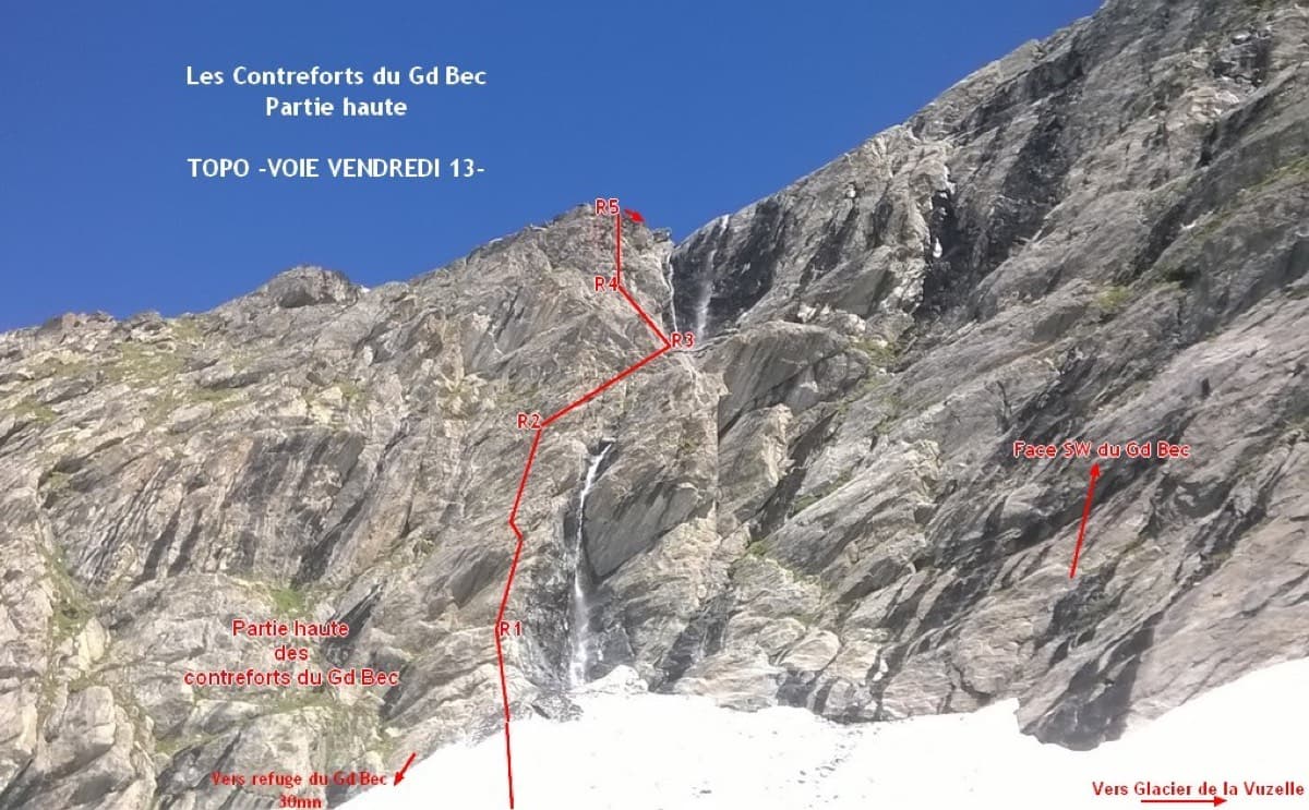
Photo-topo of Vendredi 13 on the upper Contreforts du Grand Bec, with belays R1 to R5

France · Vanoise (Grand Bec)

Vendredi 13

A short, sunny high-mountain route at 2800 m in the Vanoise: five 25 to 30 m pitches of 4b to 5b with one or two moves of 5c that can be pulled through, then an easy scramble. The bolting is generous enough that parties with little experience enjoy it. The setting, below the south-west face of the Grand Bec, is the reason to walk up.

5c6 pitches180 m
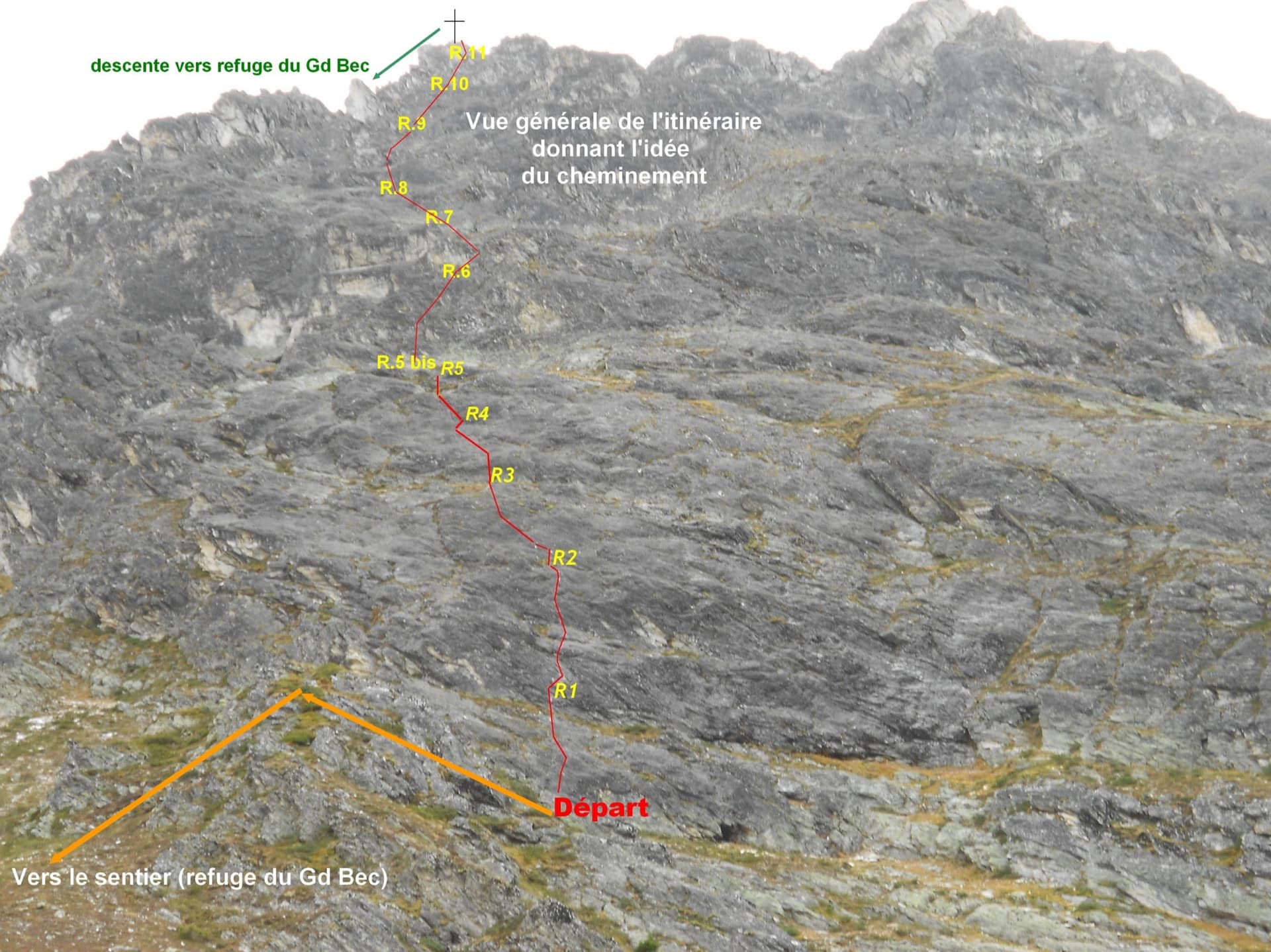
General view of Eau de mai on the north face of the Pointe de la Vuzelle, with the start and belays R1 to R11 marked

France · Vanoise (Grand Bec)

Eau de mai

A long, easy mountain route up the shady north face of the Pointe de la Vuzelle, finishing at a summit cross above the Refuge du Grand Bec. The climbing is in the first two pitches and the seventh; the rest is short steps of 3b to 5a linked by walking pitches over grass and unstable scree. Go for the outing and the summit, not for sustained rock.

5c12 pitches300 m

Read the cautions

The south face of the Petite Aiguille de l'Arcelin above the Cirque de l'Arcelin

France · Vanoise (Grand Bec)

Voie Vion

The classic hard line of the south face of the Petite Aiguille de l'Arcelin, in a high cirque above Pralognan. Nine varied pitches on good grey limestone: corners, slabs, short overhangs and a technical 6c crux pitch with at least one obligatory move of 6b. Every pitch climbs, and the descent is a small mountain trip of its own.

6c9 pitches220 m

Read the cautions

The Petite Aiguille de l'Arcelin from the approach through the Cirque de l'Arcelin

France · Vanoise (Grand Bec)

Stop ou Encore

A short, wild, modern route on the grey limestone of the Petite Aiguille de l'Arcelin, in two halves: thin, technical slab low down, including a sustained 6b+ with obligatory moves, then steep walls with a very sustained 7a pitch of two bouldery cruxes. Seldom climbed for its quality.

7a6 pitches190 m

Read the cautions

Around 6a · about 7 pitches

Similar elsewhere

The classic view of Riglos from the south-west: the slender pinnacle of El Puro on the left, the great dome of Mallo Pisón beside it, and the main wall running right to La Visera above the village.

Spain · Riglos & Agüero (Mallos)

Espolón del Adamelo

This is the gentlest way to sample Riglos. Polished pockets and two bulging 'panzas' lead to a 6a crux that can be pulled through on the bolts (A0). The upper spur is easy, and the Pisón towers loom close by.

6a7 pitches175 m

Read the cautions

A view of the region, not this route's wall. Slab climbing at the Ewige Jagdgründe crag near Ginzling in the Zillertal; the Wiegelwand is the wall above this sector and is not in the picture.

Austria · Zillertal

Alpiner Spätaufsteher

A granite slab route beside a washed-out stream bed and a small waterfall, described as the new slab classic of the Zillertal. Mostly around UIAA 5 on fine slabs, with short harder passages and a 6/6+ exit. Never very exposed, with a view of the 3000 m peaks.

6a7 pitches255 m

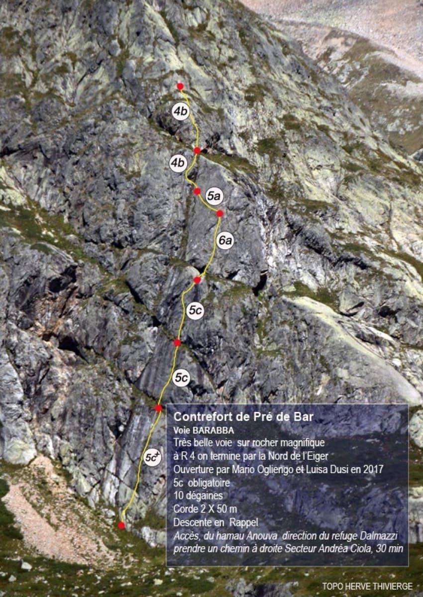
Topo of Barabba on the Contrefort de Pré de Bar, Val Ferret

Italy · Aosta Valley

Barabba

A pretty plaisir route on edgy, quartz-studded granite slabs beneath the Mont Blanc massif. The crux is a short bulge and steep juggy wall on P4. Camptocamp rates it 'great'.

6a7 pitches180 m

The multipitch wall of Le Ponteil above Champcella

France · Briançonnais

La diagonale de gauche

The gentlest way up the big limestone wall of Le Ponteil: short walls and slabs that slant leftwards across the south-west facet, with a ledge walk in the middle. Most of it is 4b to 5c on very featured rock; one well-bolted move round a block gives the 6a. It gets better as it goes, and pitches 4 and 6 are the ones people remember.

6a7 pitches200 m

Compiled from published sources and last verified October 2026. Bolts, anchors and access change. Climbing is dangerous and you are responsible for your own decisions: check a current topo and read the disclaimer.