Multipitch Atlas

Maye Friend

Tête de la Maye – south face · La Bérarde (Écrins) · France

Bail not documentedBolting confidence: high

Fifteen pitches up the steeper centre of the face: steep cracks and walls in the first third, then a long sequence of sometimes very thin friction slabs. Mostly 5c to 6a+ with one short 6b+ that goes at A0. Rated among the best on the wall and much quieter than its famous neighbour.

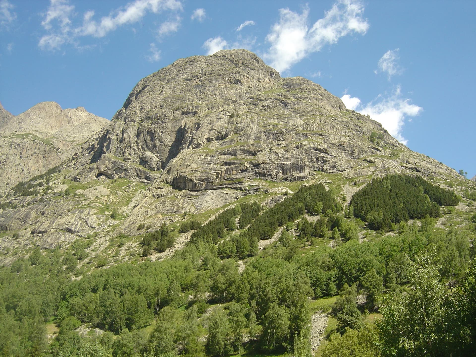
The south face of the Tête de la Maye above La BérardePhoto: Michmuch06 · CC BY-SA 3.0

Photo

The south face of the Tête de la Maye above La BérardePhoto: Michmuch06 · CC BY-SA 3.0
Hardest pitch
6b+
Pitches
15
Length
400 m
Approach
50 min
Aspect
S
South-facing
Rope
–

The route

Overview

Maye Friend starts between Du V à tire-larigot and Maye Oh Niaise, about 50 m right of the big cave, and finishes on the fore-summit. Camptocamp rates it among the great routes of the face and insists on precise footwork. The 2021 rebolt made the route more even at 5c to 6a, added bolts high up and broke three very long pitches into four. Some 6a slab moves remain obligatory but are never exposed. Parties take six to seven hours and report having the route almost to themselves while teams queue next door.

The climbing

Pitch by pitch

Pitches of Maye Friend
PitchGradeNotes
P15c+Start slanting left. A slightly thin mantel reaches the belay.
P2–A ledge: go straight up from it to a belay at the foot of a chimney on the left of a big white overhanging wall.
P35cNot sustained.
P45cA good finish.
P56b+6a, then a short 6b+ section that can be aided on three bolts.
P64bBlocks that can be avoided by grass, then a final slab rightwards.
P76aA fine black wall. Do not stop at the belay on top of the wall: continue up grass and a slab to the belay with a maillon.
P85bA lovely traverse left, back right and over an easy overhang on magnificent rock. Slightly re-routed in 2021.
P96a+A 6a+ friction start, easier above.
P105bA short pitch.
P115bOne friction move at the start.
P126a+The best pitch: a hard friction start, then a slab rightwards along a small dyke and a bulge.
P136aVaried: a thin start, a traverse left, then aim for an overhang on the right.
P144cEasy ground straight up, then left.
P154cStraight up with a few easy moves to the top.

Getting there

Approach

To the parking

La Bérarde is the last hamlet of the Vénéon valley, at the end of the D530 from Bourg d'Oisans (Grenoble side). A flood on 21 June 2024 wrecked much of the hamlet and swept away the car park in the riverbed, and road access has been restricted since. In summer 2025 the road was closed to general traffic beyond Saint-Christophe-en-Oisans, with shuttles from Bourg d'Oisans. In 2026 a June party found the road still closed with a shuttle promised for July; a party on 18 August took the first shuttle from Bourg d'Oisans at 06:20 and was in La Bérarde at 07:25; and a report dated 9 September 2026 says the hamlet can be reached by car again, with parking beside the reception chalet out of respect for residents. Check the current rules before you travel: the Maison du Département de l'Isère in Bourg d'Oisans (04 76 80 03 48) and the Saint-Christophe-en-Oisans town hall publish them. Do not count on the pre-flood shops and lodging; confirm what is open.

On foot · about 50 min

From La Bérarde follow the path up to the spur of Pujolidal, pass left of the spur and continue up towards a large cave. The start is about 50 m right of the cave. There are three starts side by side: Du V à tire-larigot on the left; Maye Friend in the centre, immediately left of Maye Oh Niaise, slanting left at first and then straight up; and Maye Oh Niaise on the right, a clear line of hangers straight up black streaks where a depression bars the way. A 2023 party took 50 minutes from the car.

Map of the walk-in

  • Crag
  • Parking

Loading map

The point marks the crag, not the exact start of the route.

Coordinates · crag

44.94392, 6.28912

Parking

44.93268, 6.29186

La Bérarde road end and trailhead (camptocamp waypoint 106909). The riverbed car park was destroyed in 2024; check current access and where parking is allowed

Point from camptocamp waypoint 39728 (Tête de la Maye summit; the routes start on the south face several hundred metres to the south)

For your phone or watch

Download GPX

Contains the route point and parking. Opens in most mapping apps and GPS watches.

Points are compiled from published sources, with the precision stated above. They were not surveyed on the ground: check them against a current topo.

Getting down

Descent

From the top walk up for about 10 minutes to join the Tête de la Maye footpath. Walk off by the waymarked Tête de la Maye footpath, which has cables and metal steps on its steeper sections, back to La Bérarde. Camptocamp allows 1 h 30; a 2023 party took the same from summit to car.

Retreat

Bailing off the route

Bail not documented

Retreat is not documented. Camptocamp mentions one belay 'with a maillon' at the top of pitch 7, which suggests some stations can be abseiled from, but no source says the route is equipped for descent or describes anyone going down.

Retreat from
Not documented.
Point of no return
Not documented. The route traverses on pitches 8 and 13 and crosses grass ledges that are not described as escapes.
Carry
A second rope and maillons to leave if you want the option; this is inferred.
Basis
Inferred from the route factsSources give only the walk-off from the top.

Partly inferred from the route facts

Safety

Hazards

  • Road access to La Bérarde has changed every season since the 2024 flood (closure, shuttles, reopening in September 2026). Confirm it before leaving.
  • In August 2023 a dead, uprooted pine was hanging by a few roots just left of a belay on the ninth pitch (the 6a+ friction pitch). Check whether it is still there.
  • Obligatory 6a friction moves on the upper slabs, notably the last 6a+; never exposed, but there is no pulling through.
  • A long route at altitude with a cabled descent: start early and watch the weather.

Sun and weather

Conditions

Full south-facing granite between about 1,900 and 2,500 m. Camptocamp gives May to October depending on snow, and warns that it is very hot in midsummer; the wall takes the sun early. Slabs with drainage streaks can stay wet after rain. This is a mountain setting: watch for afternoon storms, and note a June 2026 report of no phone signal on the face. A party in August 2023 met a violent, icy wind from the fifth pitch up, enough to unbalance them on the thin slabs.

Usual season · Jun to Sep

Sun on the wall · S-facing

Working out the sunlit hours for this month.

  • January: not yet worked out
  • February: not yet worked out
  • March: not yet worked out
  • April: not yet worked out
  • May: not yet worked out
  • June (usual season): not yet worked out
  • July (usual season): not yet worked out
  • August (usual season): not yet worked out
  • September (usual season): not yet worked out
  • October: not yet worked out
  • November: not yet worked out
  • December: not yet worked out

Sun on the wallDaylight, wall in shade● Usual season

Estimated from the wall's aspect only. Ignores surrounding terrain, gullies and the wall's exact shape. Clock times are local to the wall (Central European time), for the 15th of each month.

Climate figures for La Bérarde (Écrins) are not available yet

What to carry

Gear

14 quickdraws plus material for the belays. Rope length is not stated in any source and pitch lengths are unpublished; the descent is on foot. Helmet.

Checklist

Quickdraws
14
Rope
Length not given in the sources
Helmet
One each
Maillons or spare karabiners
To leave behind if you retreat

Derived from the route data; check it against a current topo

From climbers

Reader reports

Reader reports are not being collected yet. Until they are, check a current topo and the local club or guidebook publisher for recent changes to Maye Friend.

Worth knowing

Tips

  • Works well swinging leads for an evenly matched pair.
  • Agree rope signals in advance; wind makes shouting useless on the upper pitches.
  • Reported times: 6 to 7 hours of climbing, 8 to 9 h 30 car to car.

Open questions

Where sources disagree

  • First ascent: camptocamp says Cambon and Corréard, 1992. The ONOS log prints 'Sylvain and J.-M. Cambon, Pierre Chapoutot and Olivier Mansiot, 1994', the same credit it gives the neighbouring Li Maye Laya, which looks like a copying slip.
  • Pitch count: camptocamp lists 15 lines including the ledge; a June 2023 party speaks of 14 pitches.
  • Approach time is not given by camptocamp; 50 minutes comes from one 2023 report.
  • Rope length and pitch lengths are not published.

Provenance

Sources

Same area

More in La Bérarde (Écrins)

All routes in La Bérarde (Écrins)
The granite slabs of the south face of the Tête de la Maye above the larches of La Bérarde; Pujolidal climbs this face, the exact line is not marked.

France · La Bérarde (Écrins)

Pujolidal

The great classic of the Tête de la Maye: 13 pitches of rounded granite slab above La Bérarde with nothing athletic until the last hard pitch, a flake and wide crack of 5c+ that everyone remembers. Recently rebolted and very closely protected. It is camptocamp's reference route for the overall grade D.

5c+13 pitches350 m
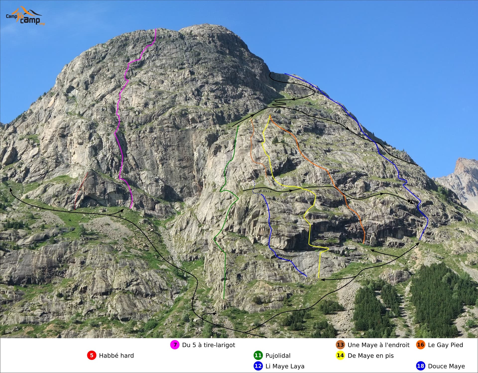
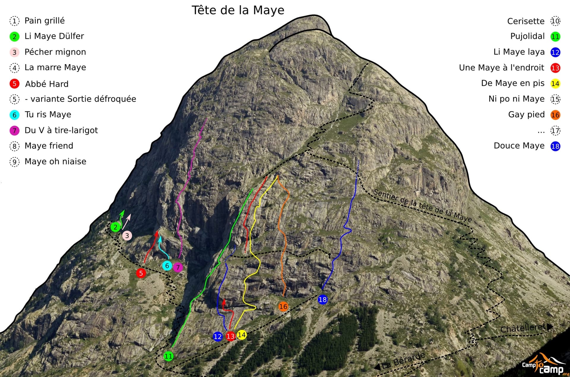
South face of the Tête de la Maye with route lines: Gay Pied is the orange line (16), Douce Maye the blue line on the right (18)

France · La Bérarde (Écrins)

Gay Pied

One of the easiest long routes on the Tête de la Maye: thirteen short pitches of low-angle granite slab, mostly grade 3 to 4, broken by a few steeper steps. The exception is the first pitch, a steep 5a/5b wall that is clearly the hardest and best climbing on the route.

5b13 pitches300 m

Topo photo of the Tête de la Maye; Douce Maye is line 18 on the right, crossing the hikers' path

France · La Bérarde (Écrins)

Douce Maye

A long, gentle introduction to multipitch: about fifteen pitches of easy-angled granite slab and short cracked steps, almost all at 4b, with one 5b move. The hikers' path crosses the route, giving easy escapes after pitches 6, 7, 8 and 13. Sunny from early morning.

5b15 pitches400 m

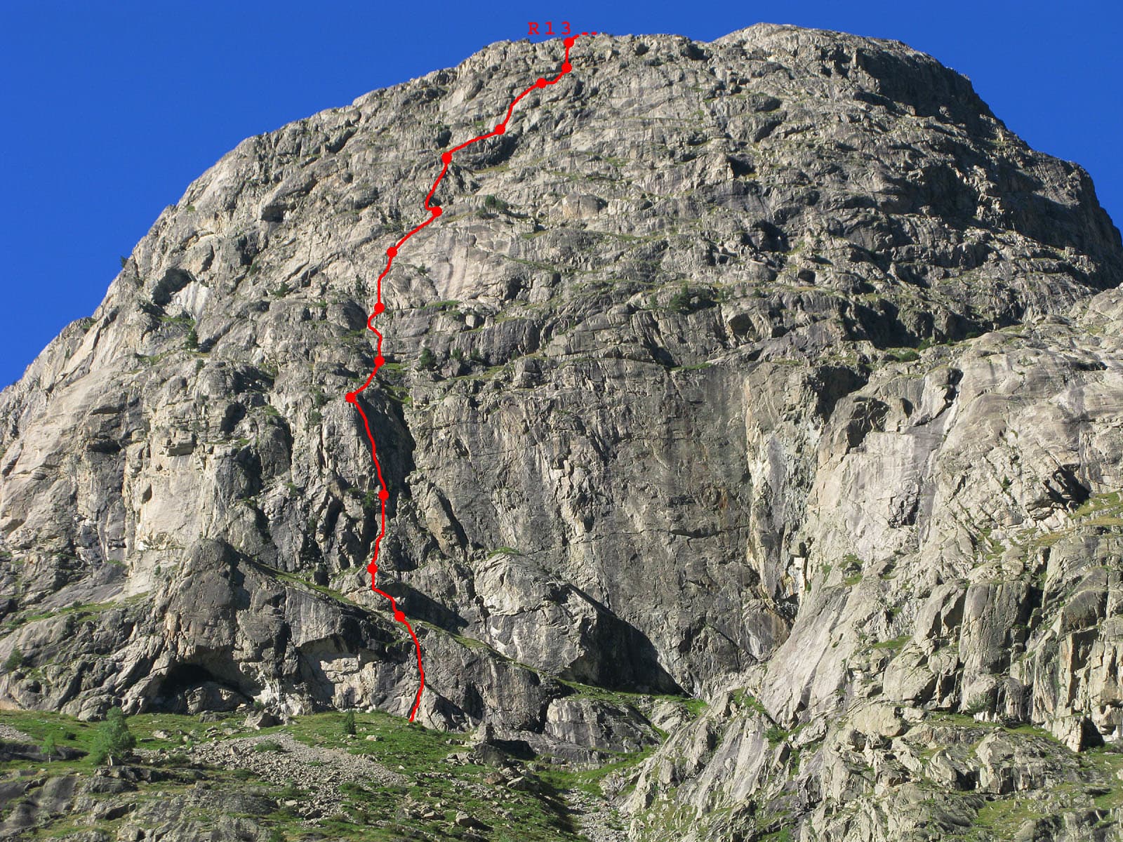
Du V à tire-larigot marked in red on the south face of the Tête de la Maye

France · La Bérarde (Écrins)

Du V à tire-larigot

The longest route on the Tête de la Maye at this grade and by far the most popular: fourteen pitches, sustained at 5b with three pitches of 5c. Steep steps, slabs, a roof, a layback crack on a pillar and a few grass ledges. The fives feel honest and only one 5b move is obligatory.

5c14 pitches400 m

Around 6b+ · about 15 pitches

Similar elsewhere

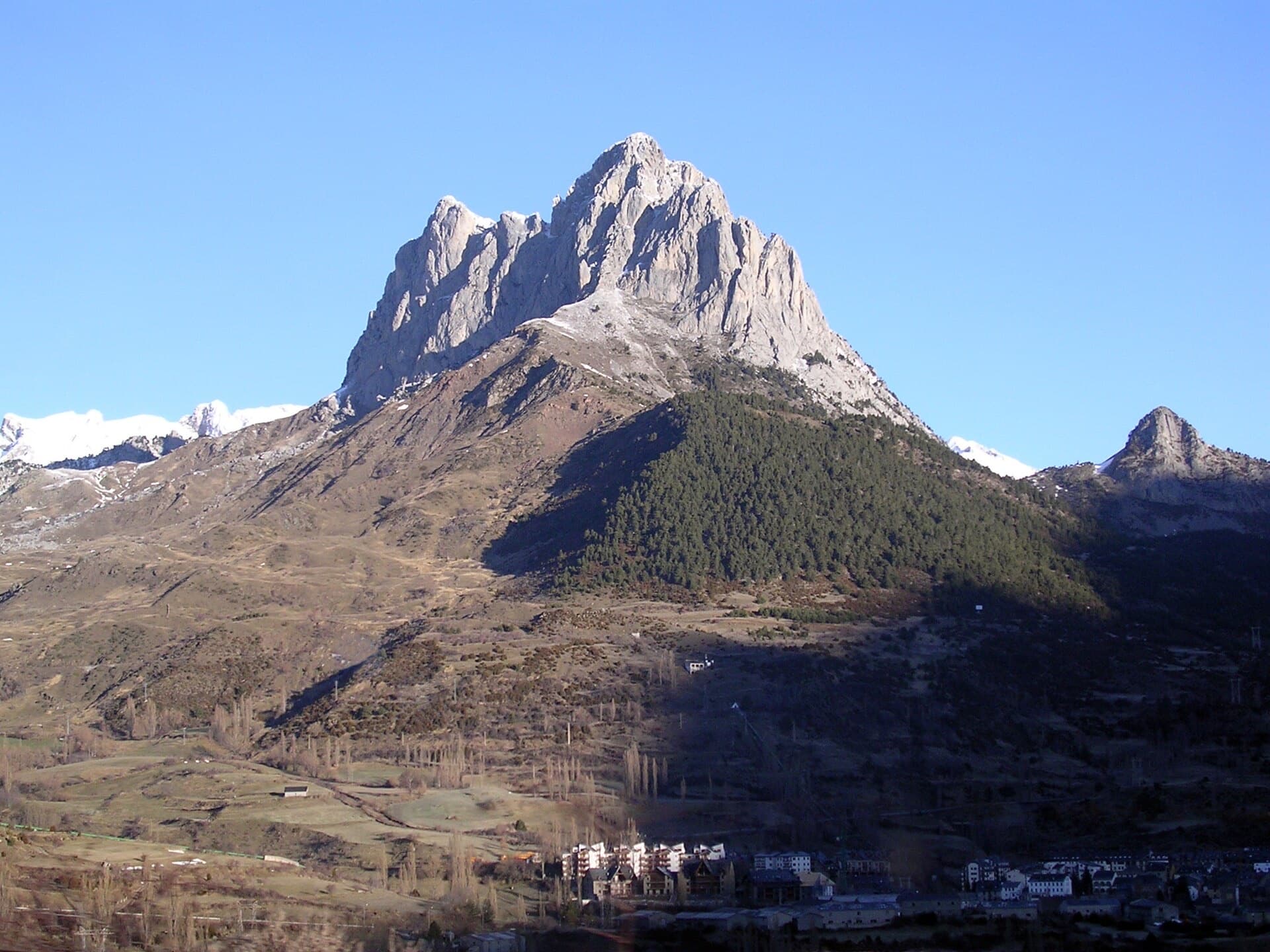
The limestone south face of the Peña Foratata rising above Sallent de Gállego in the Tena valley. Vía Anzas climbs this side of the peak; the exact line cannot be picked out here.

Spain · Aragonese Pyrenees (Tena & Canfranc valleys)

Vía Anzas

A big, fully bolted mountain route straight up the middle of a wall of the Peña Foratata to its summit. Three technical corner pitches at 6b+ low down and a 6b and a 6a above the grass terrace, separated by easy transition pitches. Short pitches by design, a long descent, and a seasonal closure for bearded vultures until the end of July.

6b+14 pitches420 m

Read the cautions

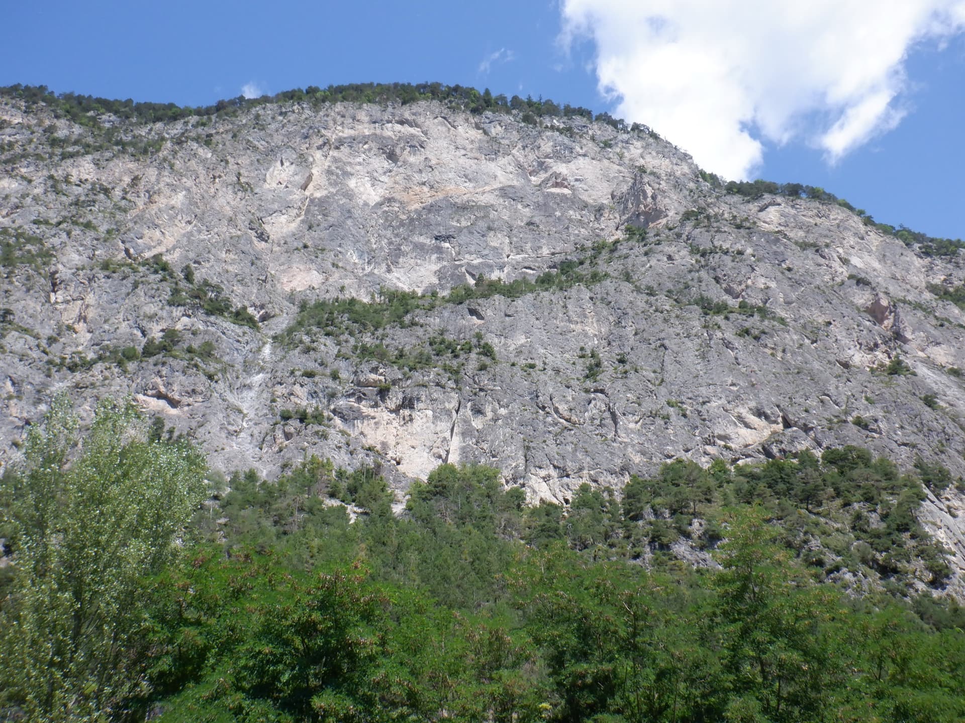
The Geierwand above Haiming seen from the car park; Nebraska takes the left side of the wall from bottom to top

Austria · Inntal (Haiming Geierwand)

Nebraska

bergsteigen.com calls this the best route on the Geierwand: steep, almost always vertical pocket climbing on the left side of the wall. The hardest move comes on pitch 2, but the upper half stacks several 6b pitches one after another and tires the forearms. Recommended to climbers who are comfortable at 6b.

6b+13 pitches355 m

The rock towers of the Ratengrat on the Röthelstein above Mixnitz, where the first half of the route climbs

Austria · Grazer Bergland

Don Kamille und Pepperone

Possibly the longest route in the Grazer Bergland: sixteen pitches that start up the Ratengrat (Don Kamille) and continue up the Breite Wand (Pepperone). The lower half is among the best climbing on the Ratengrat; the upper half begins gently over slabby steps in the forest and then steepens. Two passages of UIAA 7- and several of 6+.

6b16 pitches440 m

A view of the region, not this route's wall. The Maggia gorge at Ponte Brolla, sculpted gneiss and green pools below the Speroni.

Switzerland · Ticino

Alhambra

The long classic of Monte Garzo: eighteen pitches from the valley floor. The first ten are compact slabs that punish the feet, then a 40 m walk leads to a steeper upper wall with athletic pitches up to 6b+. Sustained, obligatory and long; allow six to eight hours.

6b+18 pitches600 m

Read the cautions

Compiled from published sources and last verified October 2026. Bolts, anchors and access change. Climbing is dangerous and you are responsible for your own decisions: check a current topo and read the disclaimer.