Multipitch Atlas

Rucola

Martinswand – Vorbau (Zirl) · Karwendel (Innsbruck Nordkette) · Austria

Bail with caveatsBolting confidence: high

A popular plaisir route up the slabs of the Martinswand plinth: seven pitches, mostly UIAA 4, with only about three harder metres in a short steep corner on pitch 5. Often combined with a route on the wall above.

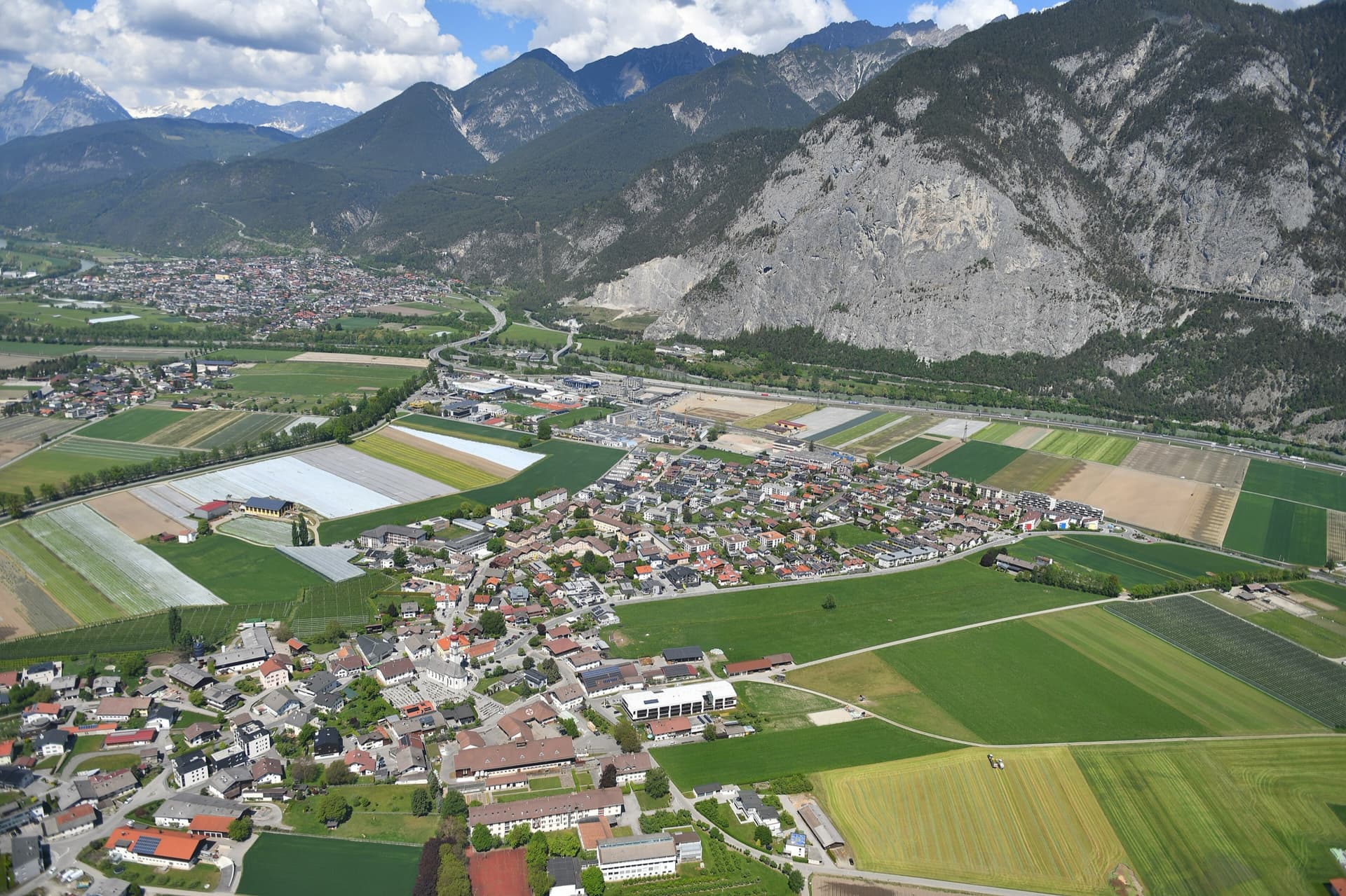
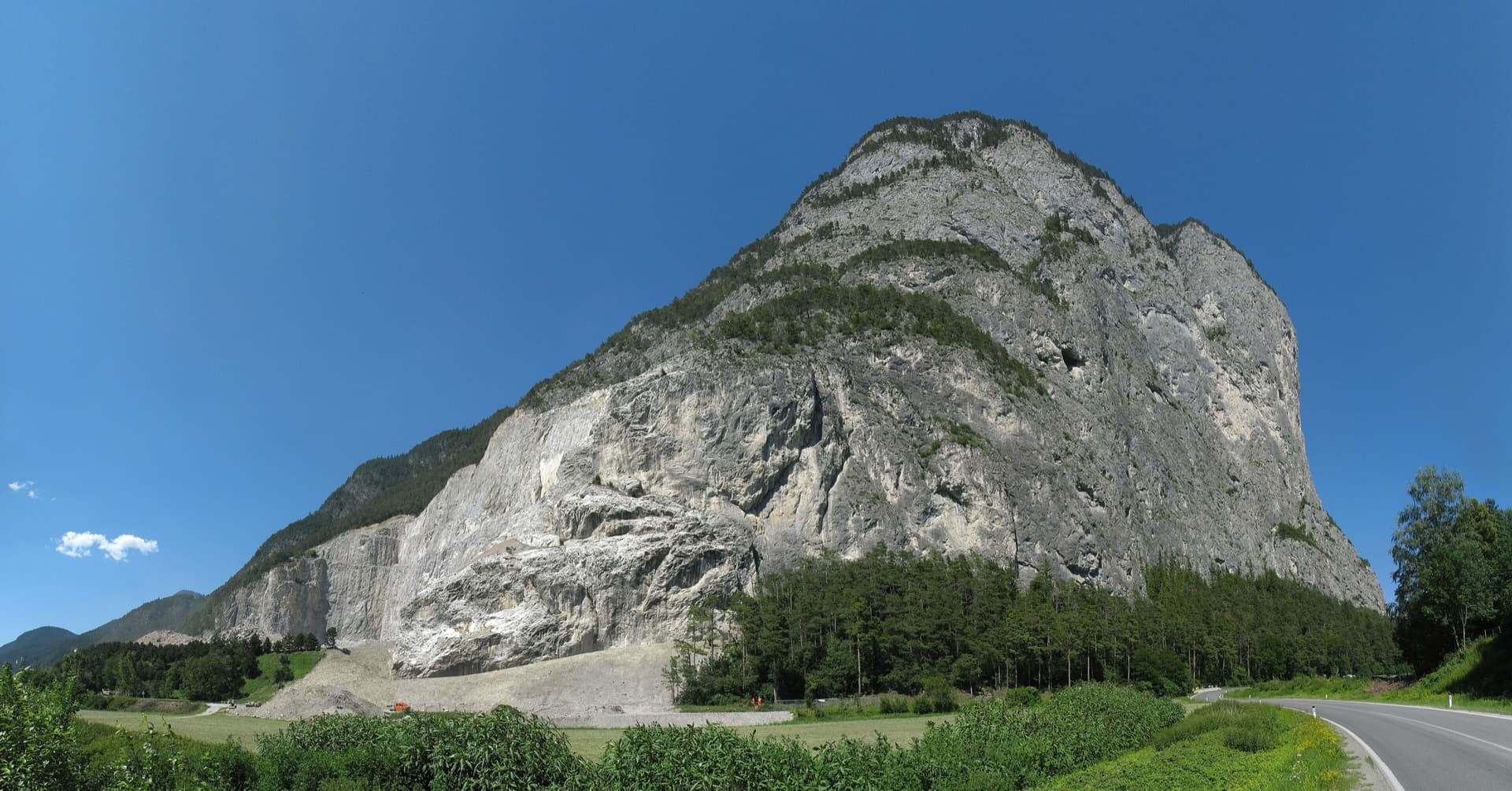
The Martinswand above the Inn valley near Zirl, seen from the south-west. The Vorbau routes climb the slabby plinth at the right-hand (eastern) end of the wall; the line is not marked.Photo: KlausFoehl · CC BY-SA 3.0

Photo

The Martinswand above the Inn valley near Zirl, seen from the south-west. The Vorbau routes climb the slabby plinth at the right-hand (eastern) end of the wall; the line is not marked.Photo: KlausFoehl · CC BY-SA 3.0
Hardest pitch
5c
Pitches
7
Length
225 m
Approach
20 min
Aspect
S
South-facing
Rope
2×50 m

The route

Overview

The easiest long outing on the Martinswand plinth with reliably close bolts. Seven pitches of cleaned limestone slab lead to the ledge system below the main wall, with one short, steep corner as the crux and a pillar to finish. It is south-facing, close to the road and very popular. bergsteigen.com notes that the hard climbing amounts to roughly three metres.

The climbing

Pitch by pitch

Pitches of Rucola
PitchGradeLengthNotes
P14a35 mWell-cleaned slab.
P24b30 mNo pitch description in the free sources; the grade and length are from the Climbers Paradise table.
P33+30 mEasy broken ground with some rubble, according to a bergsteigen.com photo caption (pitch position inferred from the grade).
P44c40 mNo pitch description in the free sources; the grade and length are from the Climbers Paradise table.
P55b/5c30 mThe crux: a short, steep corner. 5b on Climbers Paradise, UIAA 5+/6- on bergsteigen.com.
P64b25 mPleasant slab climbing.
P74a30 mUp a pillar. The signed turn-off to the abseil line is on the left in the middle of this pitch.

Getting there

Approach

To the parking

Leave the A12 Inn valley motorway at Zirl-Ost and follow the road to the Kematen (Sellrain) turn-off. After the exit, pass the quarry and drive back towards Innsbruck along the foot of the Martinswand to the parking by a ramp, signed P1 (Alpenverein climbing garden, 615 m). By public transport, take the train to Innsbruck and a bus to the Martinswand/Zirl stop.

On foot · about 20 min

From P1 walk towards the Alpenverein climbing garden as far as the toilet block, pass it heading towards Zirl and follow the path gently uphill until you are close to the wall. Take the track to a scree gully, cross it (passing the start of Flying Grass) and continue along the wall. Where the track touches the slab wall before dropping away again, Kaiser Max Spätlese starts on the plinth; Rucola begins about 50 m further left and lower. About 20 minutes.

Map of the walk-in

  • Route base
  • Parking

Loading map

The point marks the base of the route.

Coordinates · route base

47.26789, 11.27636

Parking

47.26670, 11.28090

P1, Alpenverein climbing garden car park below the Martinswand (bergsteigen.com map marker)

Point from bergsteigen.com map marker (route start, approximate)

For your phone or watch

Download GPX

Contains the route point and parking. Opens in most mapping apps and GPS watches.

Points are compiled from published sources, with the precision stated above. They were not surveyed on the ground: check them against a current topo.

Getting down

Descent

Two options. The quick one is the walk-off: from the top go right along ledges, lightly marked, with a fixed steel cable on the steepest bits and short passages of grade 1 to 2 scrambling, to the Martinswand descent path (about 45 minutes). The alternative is the abseil line just left of the route, 4 × 50 m, reached by traversing left in the middle of the last pitch. Do not abseil if parties are climbing below because of stonefall.

Retreat

Bailing off the route

Bail with caveats

An equipped abseil line runs just left of the route (4 × 50 m), normally joined from the middle of the last pitch. Whether the route's own belays are rigged for abseiling is not stated. Abseiling is discouraged when others are climbing below because of loose stones.

Retreat from
From the middle of pitch 7 via the signed traverse left to the abseil line. Lower down, not documented.
Point of no return
None documented.
Carry
Two 50 m ropes for the abseil line.
Basis
Part stated, part inferredThe abseil line and its 4 × 50 m length are stated by bergsteigen.com and Climbers Paradise; retreat from lower belays is inferred.

Partly inferred from the route facts

Safety

Hazards

  • Stonefall. There is a lot of scree above the plinth, chamois knock stones down, and in strong Föhn wind stones fall without any help. Wear a helmet from the approach onwards.
  • The walk-off crosses exposed ledges with grade 1 to 2 scrambling; it needs some alpine experience and is delicate when wet.
  • The Vorbau is popular and other parties are often above and below you.

Sun and weather

Conditions

South-facing, with the start at about 800 m. bergsteigen.com says the Vorbau routes can be climbed all year except when there is snow. The low altitude and full sun make midsummer days hot (inferred from aspect and altitude, not stated by the sources).

Usual season · Mar to Jun, Sep to Nov

Sun on the wall · S-facing

Working out the sunlit hours for this month.

  • January: not yet worked out
  • February: not yet worked out
  • March (usual season): not yet worked out
  • April (usual season): not yet worked out
  • May (usual season): not yet worked out
  • June (usual season): not yet worked out
  • July: not yet worked out
  • August: not yet worked out
  • September (usual season): not yet worked out
  • October (usual season): not yet worked out
  • November (usual season): not yet worked out
  • December: not yet worked out

Sun on the wallDaylight, wall in shade● Usual season

Estimated from the wall's aspect only. Ignores surrounding terrain, gullies and the wall's exact shape. Clock times are local to the wall (Central European time), for the 15th of each month.

Monthly climate averages for Karwendel (Innsbruck Nordkette), 1991-2020
MeasureJanFebMar (usual season)Apr (usual season)May (usual season)Jun (usual season)JulAugSep (usual season)Oct (usual season)Nov (usual season)Dec
Mean daily high °C−7−5−22711131395−2−6
Mean daily low °C−17−15−11−8−3133−1−5−11−15
Rain days 1 mm or more131315162121212016141313

● marks the usual climbing season. Averages for 1991-2020 at about 2267 m. Area climate from Open-Meteo reanalysis. Temperatures are adjusted to the height of the crag; rain comes from a grid cell of about 10 to 25 km, and summer highs on sea cliffs can read a few degrees low. The wall and valley can differ. Data: Open-Meteo, CC BY 4.0.

What to carry

Gear

11 quickdraws, helmet. Two 50 m ropes if you plan to abseil; a single rope is enough for the walk-off (pitches are up to 40 m). Take approach shoes for the walk-off.

Checklist

Quickdraws
11
Rope
2×50 m
Helmet
One each
Abseil device and prusik
The descent or the retreat involves abseiling

Derived from the route data; check it against a current topo

From climbers

Reader reports

Reader reports are not being collected yet. Until they are, check a current topo and the local club or guidebook publisher for recent changes to Rucola.

Worth knowing

Tips

  • Kaiser Max Spätlese starts 50 m to the right and is the natural next step up in grade.
  • The access path to the upper wall (which is also the walk-off) runs above the route across scree, so parties above can send stones down.
  • Allow about 2.5 hours for the climbing.

Open questions

Where sources disagree

  • Grade: 5b on Climbers Paradise, UIAA 5+/6- (5 obligatory) on bergsteigen.com. 5c is used for the card.
  • Length: 225 m on bergsteigen.com, 220 m on Climbers Paradise.
  • Protection: bergsteigen.com says very well bolted, Climbers Paradise says well bolted.

Provenance

Sources

Same area

More in Karwendel (Innsbruck Nordkette)

All routes in Karwendel (Innsbruck Nordkette)
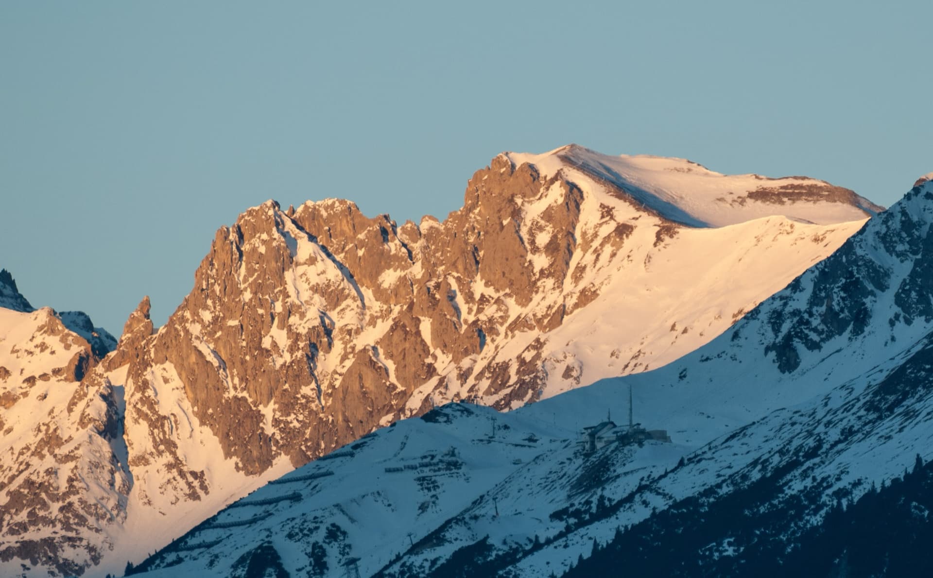
Evening light on Frau Hitt and the Westliche and Östliche Sattelspitze on the Innsbruck Nordkette, seen from the east above the Seegrube; the exact line is not marked.

Austria · Karwendel (Innsbruck Nordkette)

Mit Vergnügen – avec plaisir

A plaisir line straight above Innsbruck, reached by cable car. Two pitches are UIAA 6-/6 (5+/A0) and the rest is mostly grade 4–5. The upper pitches are grassy, so avoid it when wet.

6a9 pitches300 m
The Martinswand above the Inn valley near Zirl, seen from the south-west. The Vorbau routes climb the slabby plinth at the right-hand (eastern) end of the wall; the line is not marked.

Austria · Karwendel (Innsbruck Nordkette)

Flotter Dreier

One of the most popular routes on the Martinswand plinth: five short pitches of limestone slab that get better with height. The crux is a traverse right on pitch 3, hard from the first move, followed by a friction slab on pitch 4.

5b5 pitches135 m

The Martinswand above the Inn valley near Zirl, seen from the south-west. The Vorbau routes climb the slabby plinth at the right-hand (eastern) end of the wall; the line is not marked.

Austria · Karwendel (Innsbruck Nordkette)

Kaiser Max Spätlese

Easy slab climbing straight up the plate zone below the 'Ostrisswald' on the Martinswand plinth, broken by a few ledges. Mostly UIAA 4 to 5, with an overhang on pitch 2 and the 6a crux on the long last pitch.

6a6 pitches200 m

Aerial view over Kematen to the south face of the Martinswand, with Zirl on the left. The Vorbau routes are on the lower slabs at the right-hand (eastern) end of the wall; the line is not marked.

Austria · Karwendel (Innsbruck Nordkette)

Flying Grass

The original Martinswand plinth classic: six pitches of limestone slab, well bolted but polished by traffic, so the grade feels stiff. The crux comes on pitch 3 and a fine 45 m slab finishes the route.

6a+6 pitches150 m

Around 5c · about 7 pitches

Similar elsewhere

No photo yet

Italy · Bolzano & South Tyrol

Dirty Flirty

A friendly, well-bolted line up the red porphyry below the Gasthof Noafer, just above Bolzano. Three pitches of steep slab and corner lead to a long shoulder, two easy pitches cross it, and two more fine slab pitches finish at the cliff top. Mostly grade 5 with one 5c pitch, the third, which is the best of the route.

5c7 pitches250 m

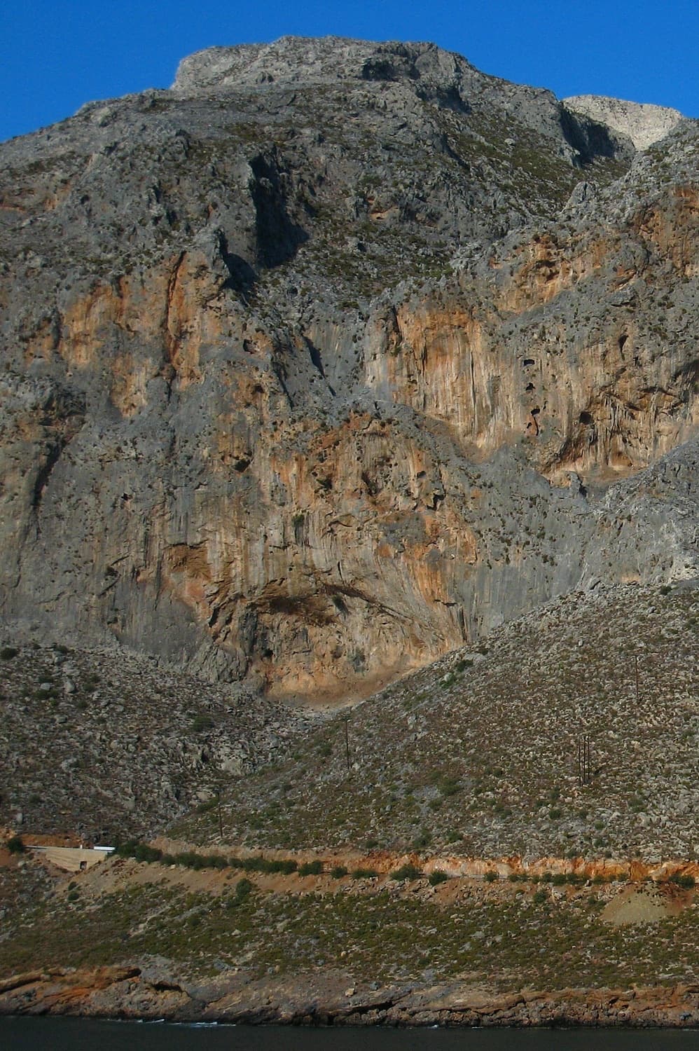
The Arhi cliffs above Arginonta bay on Kalymnos; Regensburg is at the far right-hand end of the sector

Greece · Kalymnos & Telendos

Regensburg

The friendly long route of Kalymnos: seven short pitches that spiral up the face and slabs right of the crest of a buttress above Arginonta bay, never harder than 5c. A good first pitch, an easy second and a scramble lead to three better pitches on the upper wall. Some parties find the rock scrappy in places, so wear a helmet.

5c7 pitches150 m

Read the cautions

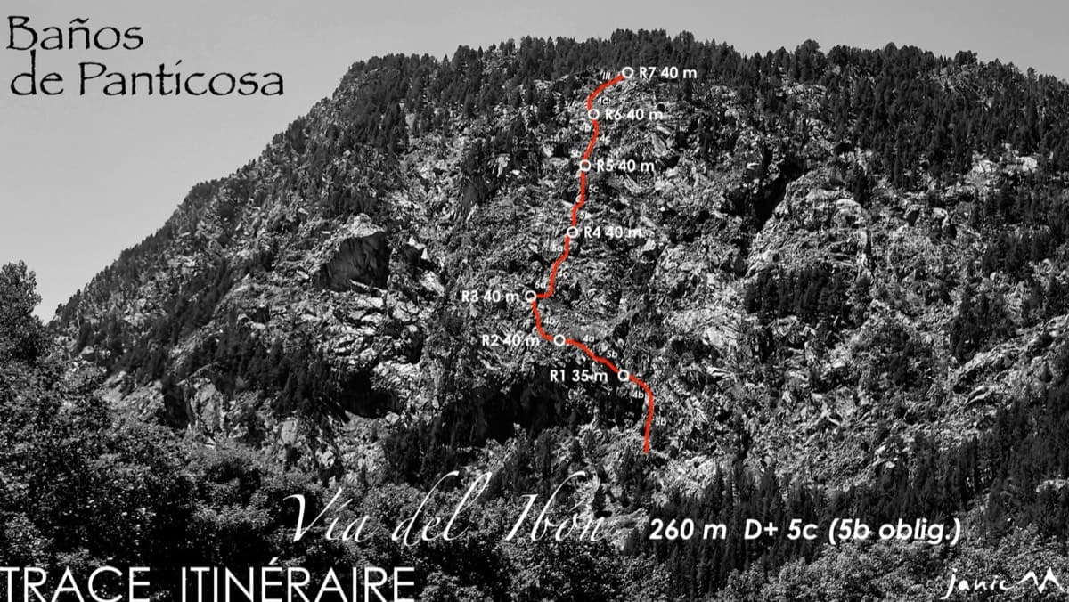
The Pared del Ibón above Baños de Panticosa with the line and belays of Vía del Ibón

Spain · Aragonese Pyrenees (Tena & Canfranc valleys)

Vía del Ibón

A mountain-style line on dark, weathered granite twenty-five minutes above the spa of Baños de Panticosa. It links ramps, a short overhanging break, slabs and a rounded boulder, with one well-bolted 5c move and the rest 4b to 5b. The rock between the good sections is earthy and lichenous, but the friction is excellent and the bolting generous.

5c7 pitches260 m

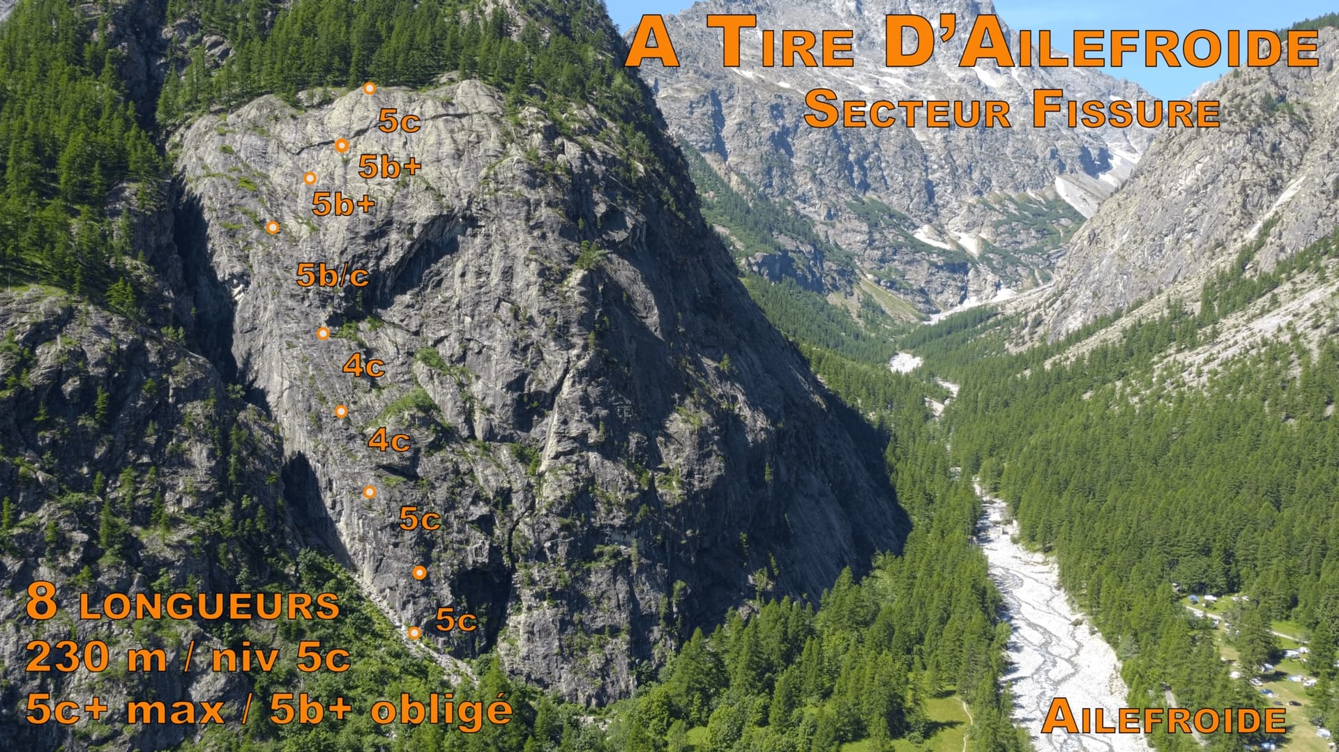
Photo-topo of À tire d'ailefroide on the Paroi de la Fissure, with belays and pitch grades marked; Ailefroide is in the valley below

France · Ailefroide

À tire d'ailefroide

An even 5c on the big wall directly behind the Ailefroide campsite: a steep corner to start, slabs in the middle and a fine layback near the top. It takes the left side of the face that holds the famous Fissure, and is a little quieter than the other classics of the grade.

5c8 pitches230 m

Compiled from published sources and last verified October 2026. Bolts, anchors and access change. Climbing is dangerous and you are responsible for your own decisions: check a current topo and read the disclaimer.