Multipitch Atlas

Sendero Límite

Peña Rueba south face (Mallo Estrella), Murillo de Gállego · Riglos & Agüero (Mallos) · Spain

Bail with caveatsBolting confidence: high

A long beginner's big route on good conglomerate at a moderate angle. Pitches can be linked in pairs with a 60 m rope. A four-pitch headwall with a couple of panzas finishes high above the Gállego valley.

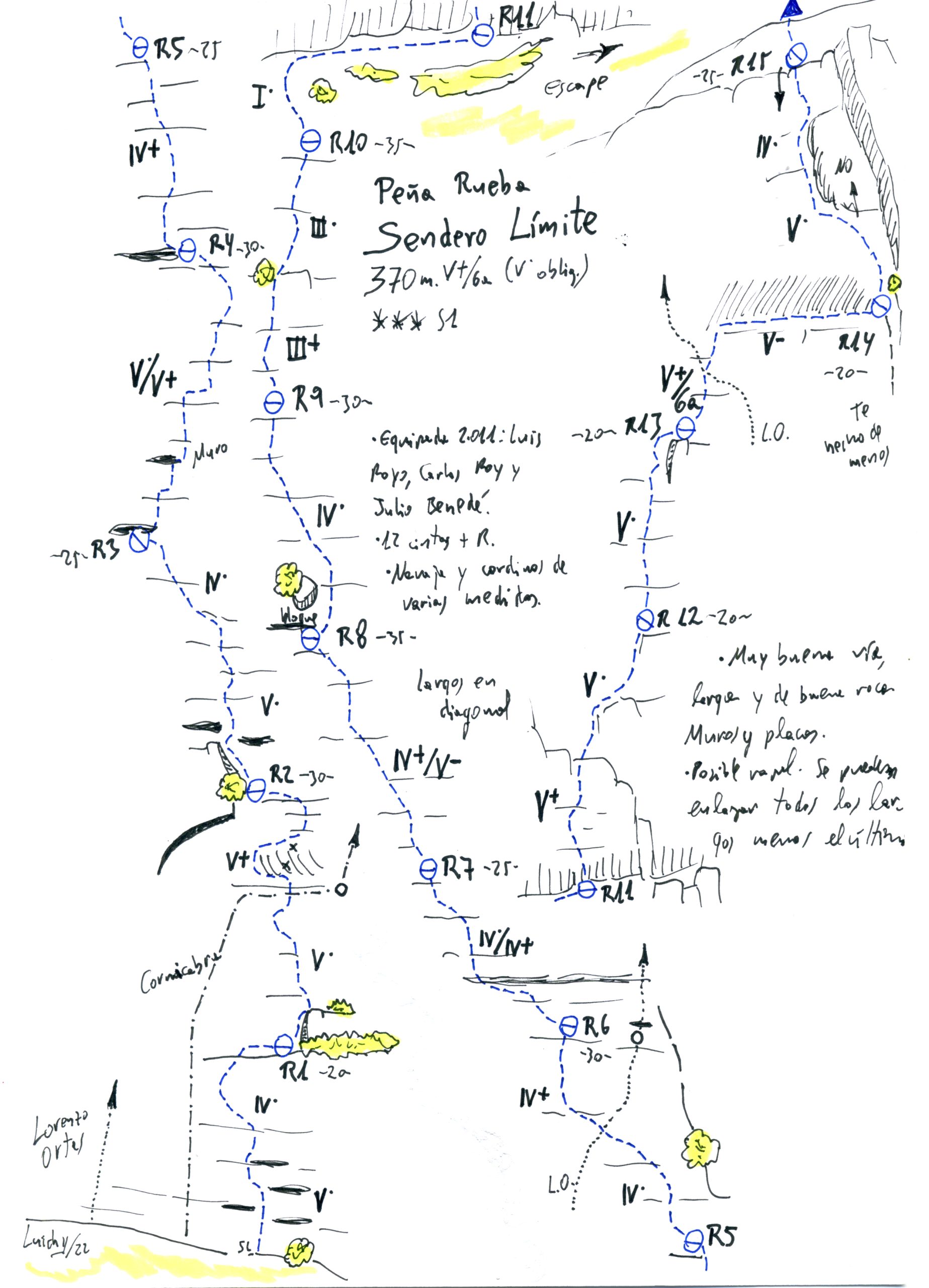
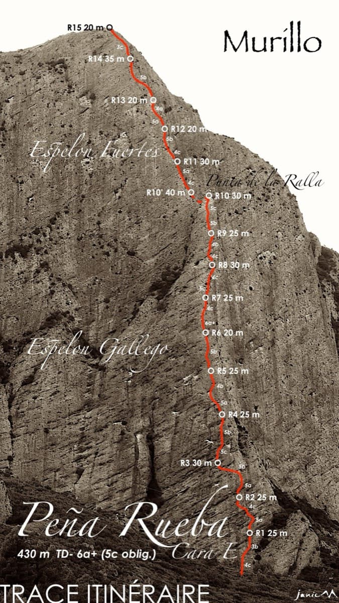
Topo of Sendero Límite on the south face of Peña Rueba (Mallo Común)Photo: janic · CC BY-SA 3.0

Topo

Topo of Sendero Límite on the south face of Peña Rueba (Mallo Común)Photo: janic · CC BY-SA 3.0
Hardest pitch
5c
Pitches
14
Length
375 m
Approach
30 min
Aspect
S
South-facing
Rope
1×60 m

The route

Overview

A long, friendly bolted route up the south face of Peña Rueba above Murillo de Gállego: ten pitches of slabs and walls at a moderate angle to a big grass ledge, then a steeper four-pitch headwall with two panzas and an airy traverse. The rock is good conglomerate and the climbing is mostly IV to V with short harder steps. It is the best-known route of the 'Sendero Límite' team, well marked, and you can stop at the ledge after ten pitches. It is long rather than serious, but bolts are spaced on the easy ground and the walk-off needs care.

The climbing

Pitch by pitch

Pitches of Sendero Límite
PitchGradeLengthBoltsNotes
P15a30 m5 bolts5a then 4c over easy bulges (V then IV on the Luichy topo, which puts R1 at about 20 m).
P25b30 m7 bolts4b, then a 5b bulge with a small solid hold a long way up; awkward for shorter climbers. Bolts are close here so it can be pulled through. Belay on the left at a juniper. Several parties rate the bulge 5c to nearly 6a (V+ on the Luichy topo).
P35a30 m7 bolts4b then 5a, starting beside a poorer slab on the left and finishing further left.
P45c30 m8 boltsThe hardest pitch of the lower part: a thin, sustained wall straight off the belay (V/V+ to V+). Some find it 6a; A0 is possible.
P54c30 m7 boltsThe angle starts to ease (IV+).
P64c30 m6 bolts4c, 3b, then 4c, moving diagonally left across the route 'Lorenzo Ortas'. Keep left and follow the 'S.L.' arrow; do not follow the green-painted hangers straight ahead.
P75a30 m7 bolts4c then 5a on a steeper wall.
P84c30 m6 boltsStraightforward (IV).
P94b30 m6 boltsEasy. Shorter than 30 m according to one party, and can be linked with pitch 10.
P103c30 m4 boltsEasy ground to the belay on the big ledge (Mallo Común/Estrella). Then walk right along the ledge for about 30 m, following yellow paint, to the first line of bolts, marked by a tape with the route name. This is also the escape.
P115c20 m6 boltsStraight up two panzas, steep at first, then rising rightwards (V+).
P125b20 m6 boltsRising rightwards up a faint rib to a belay below a very steep step, shared with 'Lorenzo Ortas'.
P135c20 m7 boltsStraight up to the second bolt (5c; V+/6a on the Luichy topo), then right on a fine, exposed horizontal traverse at 4c. 'Lorenzo Ortas' goes straight up on green hangers. An old vulture nest sits about 1 m above the line.
P144c20 m6 boltsContinue the traverse for 3 m, climb straight up past one bolt, then trend left through a squeeze with a big undercut for a good metre. The slab then lies back to the top.

Getting there

Approach

To the parking

Base is Murillo de Gállego on the A-132, across the river from Riglos. Arriving from the north (Jaca), take the first street uphill on the right at the entrance to the village; at the first hairpin take the second track on the right and follow the main track along the Barranco del Barello for about 3 km, past two water tanks, to a wider flat area used for parking (Los Ballatíes). The track is rutted with two steep sections and needs good ground clearance. Komando Kroketa says to park at the tanks (balsas) because driving further is no longer allowed, and gives an alternative from the Agüero road if the track is in bad shape. The car park was full by mid-afternoon on a spring Sunday.

On foot · about 30 min

25–45 min. From the parking a signed, cairned path climbs towards the walls and the huge roof of 'Make', first on the right flank of a rounded ridge and then on its crest. Just before the foot of the walls take the cairned path right, which runs about 20 m below the cliff. Cross a gully; the route starts at the top of this gully, where it ends in a slab that you climb. 'SL' is painted in white on the rock at the base and at the first two belays; start right of the mark.

Finding the route · 1 photo

Approach photo

Map of the walk-in

  • Crag
  • Parking
  • GPS line

Loading map

The point marks the crag, not the exact start of the route.

GPS line: a line of the whole day, including the climb and the descent drawn by its source, not a recorded track. Line drawn on the camptocamp route page, not a GPS recording: a loop from the Los Ballatíes parking up to the wall, the climb, and the descent back to the car. Do not follow it blindly.

GPS line: camptocamp contributors · CC BY-SA 3.0

Coordinates · crag

42.35985, -0.76216

Parking

42.35191, -0.76694

Los Ballatíes (camptocamp access point)

Point from camptocamp waypoint 752248

For your phone or watch

Download GPX

Contains the route point, parking and a GPS line. Opens in most mapping apps and GPS watches.

Points are compiled from published sources, with the precision stated above. They were not surveyed on the ground: check them against a current topo.

Getting down

Descent

Walk-off, about 1 h 30. From the top go up towards the summit of Peña Rueba, following cairns, then cut right to the east ridge and the Vía Ferrata Sur. At a large cairn do not turn right; continue straight to find the steel cables. Descend the ferrata (easy: walking, scrambling and holding the cable) to a col, then a sloping path with more cables back to the foot of the wall and the approach path. A shorter variant follows yellow paint from the ledge system towards the col of the Mallo La Mora (a 25 m abseil from two rings, or a fixed rope installed beside it), then a steep gully with a chain and an exposed cabled passage that joins the ferrata halfway down. From the ledge after pitch 10 you can also abseil from a two-bolt station to the left, down the line of the Toño Ubieto and Inazio Cinto routes.

Retreat

Bailing off the route

Bail with caveats

Partly. The one documented way off is the big ledge at the top of pitch 10, which Camptocamp gives as an escape on foot. Below that, abseiling the route is not described, but the belays are numbered and chained and the pitches are 20 to 30 m, so retreating belay to belay on a 60 m rope should work. On the four headwall pitches the line rises rightwards and then traverses, which would make abseiling awkward.

Retreat from
The ledge after pitch 10: follow it right, horizontal then rising, behind the Mallo Estrella, then go up the rounded ridge to the north (not across the flank, to avoid stonefall on parties below) to the ridge and the via ferrata. A 2025 party found this somewhat exposed. From the same ledge there is also a two-bolt abseil station to the left, down the line of the Toño Ubieto and Inazio Cinto routes. Below the ledge, any chained belay by inference; pitch 6 goes diagonally left across another route, so expect a sideways abseil there.
Point of no return
After the horizontal traverse on pitch 13, finishing the last pitch is the practical way off. This is an inference from the line; no source says so.
Carry
1×60 m. Camptocamp lists the pitches at a uniform 30 m, so a 60 m rope only just reaches; knot the ends. A 70 m gives margin.
Basis
Part stated, part inferredCamptocamp states the ledge escape and the Luichy topo and trip reports the chained, numbered belays; abseiling the lower ten pitches and the difficulty of retreating from the headwall are inferred from pitch lengths and the line.

Partly inferred from the route facts

Safety

Hazards

  • Bolts are spaced on the easy ground and closer on the harder moves, which is typical of the area.
  • The upper pitches pass right beside griffon vulture nests; a 2025 party climbed within 1 m of an old nest on pitch 13. Climb quietly and check locally for any nesting restrictions; none was stated in the sources read.
  • The escape from the ledge after pitch 10 looked somewhat exposed to a 2025 party. Camptocamp advises going up the rounded ridge to the north rather than traversing the flank, to avoid knocking stones onto parties below.
  • The route crosses 'Lorenzo Ortas' on pitch 6 and shares a belay with it at R12; green hangers are the other route.
  • The Mallo La Mora descent has steep, exposed sections, and the rock on the spur at the col is poor.
  • The access track is rough and needs a high-clearance vehicle.

Sun and weather

Conditions

South-facing and hot: one source was very thirsty even in winter. Best from autumn to spring. An early start puts the first three pitches in shade in March. Wind and cold make the lower cruxes feel harder. Very popular: on fine holiday weekends there are queues, and parties arriving at 09:00 found others right behind them.

Usual season · Feb to May, Oct to Dec

Sun on the wall · S-facing

Working out the sunlit hours for this month.

  • January: not yet worked out
  • February (usual season): not yet worked out
  • March (usual season): not yet worked out
  • April (usual season): not yet worked out
  • May (usual season): not yet worked out
  • June: not yet worked out
  • July: not yet worked out
  • August: not yet worked out
  • September: not yet worked out
  • October (usual season): not yet worked out
  • November (usual season): not yet worked out
  • December (usual season): not yet worked out

Sun on the wallDaylight, wall in shade● Usual season

Estimated from the wall's aspect only. Ignores surrounding terrain, gullies and the wall's exact shape. Clock times are local to the wall (Central European time), for the 15th of each month.

Climate figures for Riglos & Agüero (Mallos) are not available yet

What to carry

Gear

10 quickdraws if you pitch it as described, 15 or more to link pitches (one party took 19); a few extra are useful because there are some intermediate threads. Single 60 m rope to link pitches in pairs (30 m is enough otherwise; one party used a 70 m). The Luichy topo suggests a knife and spare cord for the threads. A lanyard for the ferrata is optional. Helmet and plenty of water.

Checklist

Quickdraws
15
Rope
1×60 m
Helmet
One each
Abseil device and prusik
The descent or the retreat involves abseiling

Derived from the route data; check it against a current topo

From climbers

Reader reports

Reader reports are not being collected yet. Until they are, check a current topo and the local club or guidebook publisher for recent changes to Sendero Límite.

Worth knowing

Tips

  • Pitches link in pairs with a 60 m rope and 15 quickdraws; the Luichy topo says all can be linked except the last, though Komando Kroketa warns of rope drag because the line wanders. Linking brought one party's time down to 3 h 40.
  • All belays are numbered on the rock (R1, R2…), with chains.
  • Do not skip the top four pitches if you have time: several parties call them the best rock and atmosphere on the route.
  • Stopping at the ledge gives a 10-pitch, 270 m route of about 3 h 30 to 4 h 30. From there, pitches 8–10 of 'Vía del 75' offer an easier way to the summit.
  • Allow 5–8 hours car to car for the full route.
  • Stay at the campsite in Murillo de Gállego (one party recommends Camping Armalygal, whose host knows the sectors) or at the refuge in Riglos.

Open questions

Where sources disagree

  • Hardest grade: 5c on Camptocamp and V+ on Komando Kroketa and Txastimendiak; the 2022 Luichy topo gives V+/6a (V obligatory) with the 6a on pitch 13, and a 2024 Camptocamp party felt pitches 2 and 4 were close to 6a.
  • Pitch count and length: Camptocamp counts 14 pitches and 375 m; the Luichy topo draws 15 belays (it counts the ledge traverse as a pitch) and 370 m, with pitch lengths of 20–35 m rather than a uniform 30 m.
  • Quickdraws: 10 (15 to link) on Camptocamp, 12 plus belay on the Luichy topo, 12 'but bring more' on Komando Kroketa, 19 on Txastimendiak.
  • Approach time: 25 min (Txastimendiak), 30 min (2025 outing), 45 min (2024 outing).
  • Crag name: Camptocamp files it under Mallo Estrella; the Spanish sources call the formation Mallo Común or Mallo La Calva.
  • Parking: Camptocamp describes parking about 3 km up the track; Komando Kroketa says vehicles must now stop at the water tanks.

Provenance

Sources

Same area

More in Riglos & Agüero (Mallos)

All routes in Riglos & Agüero (Mallos)
The Adamelo spur on Mallo Pisón, Riglos

Spain · Riglos & Agüero (Mallos)

Espolón del Adamelo

This is the gentlest way to sample Riglos. Polished pockets and two bulging 'panzas' lead to a 6a crux that can be pulled through on the bolts (A0). The upper spur is easy, and the Pisón towers loom close by.

6a7 pitches175 m

Read the cautions
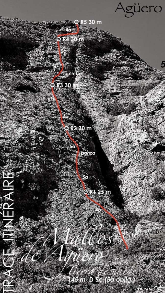
Topo of Tierra de Naide, Mallos de Agüero

Spain · Riglos & Agüero (Mallos)

Tierra de Naide

A morning-sun route at the quieter Agüero mallos. Easy slabs separate two fine steep walls, including a superb vertical 5c plaque on pitch 4. Take care with some loose cobbles on the last traverse.

5c5 pitches145 m

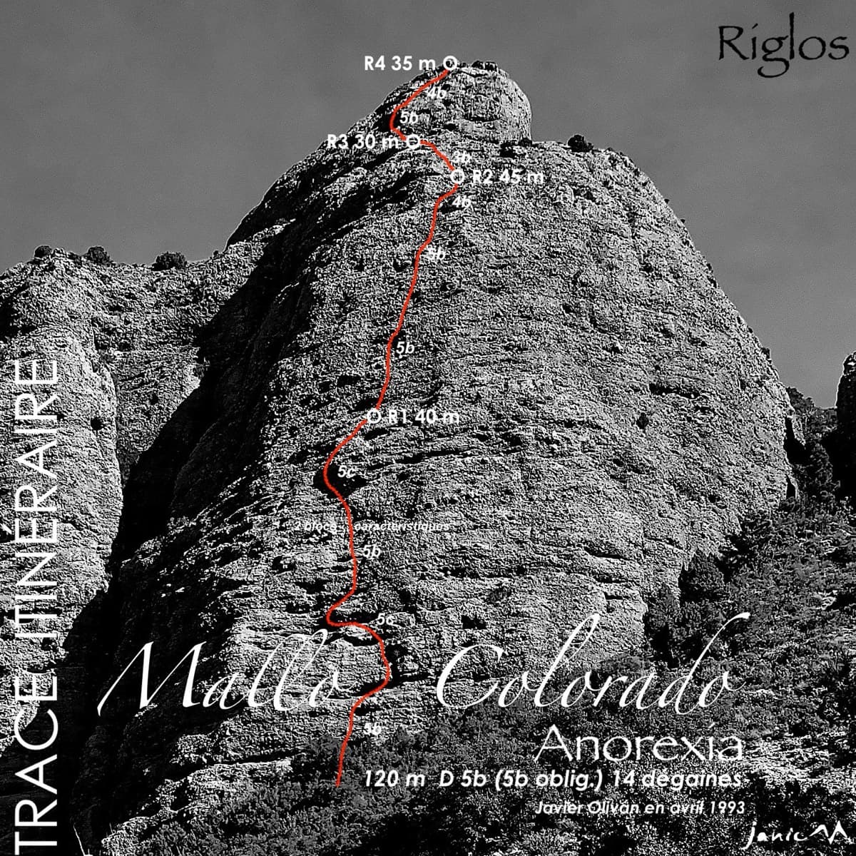
Topo of Anorexia on Mallo Colorado, Riglos

Spain · Riglos & Agüero (Mallos)

Anorexia

The best-known route on the Mallo Colorado. Two steep, juggy panza pitches have a well-protected boulder move, giving a short taste of real Riglos steepness at a friendly grade.

5c4 pitches150 m

Around 5c · about 14 pitches

Similar elsewhere

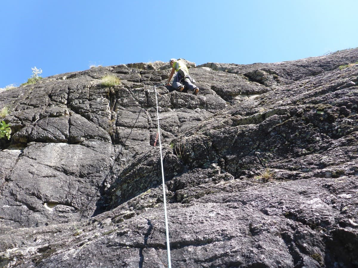
Climber on pitch 3 or 4 of Les Pets des Rupricaprins, La Draye, Ailefroide

France · Ailefroide

Les Pets des Rupricaprins

A long, sunny outing up a series of granite steps, consistently in the 5th grade, finishing with a great view over La Draye. Grassy ramps separate the tiers, so the climbing never feels exposed.

5c14 pitches450 m

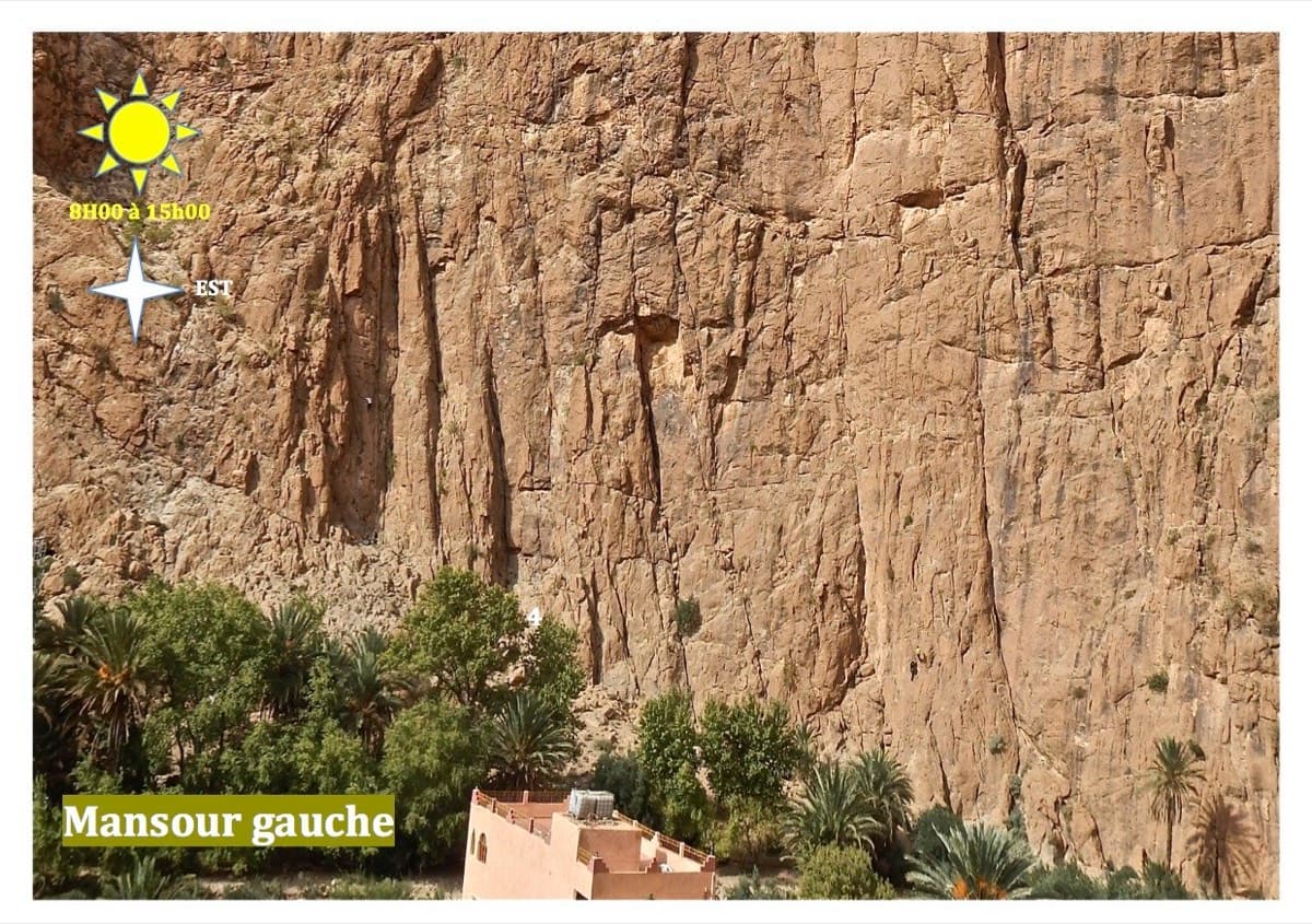
Mansour Gauche sector, Todra Gorge

Morocco · Todra Gorge (Todgha)

Berbertraum

Thirteen short pitches, mostly grade 4, with two 5c steps. The longest pitch is 45 m. A big day of easy mileage in the sun above the palm grove.

5c13 pitches340 m

Topo of Lo Dzerby (line 1) and Mitico Vento on the Corma di Machaby, Arnad

Italy · Aosta Valley

Lo Dzerby

A long, easy-angled outing up the full height of the Paretone. A steeper lower half with an exposed pillar on P5 leads to sculpted slabs and broken steps higher up. It's a good first big multipitch.

5c13 pitches400 m

The Miroir d'Argentine seen from Solalex

Switzerland · Vaud Alps

Remix

The bolted way up the Miroir d'Argentine: fourteen pitches of compact limestone slab, with the difficulties in the first four pitches and long, easy, run-out friction above. A big day out at a modest grade with a mountain walk-off. Do not underestimate it.

5c+14 pitches400 m

Read the cautions

Compiled from published sources and last verified October 2026. Bolts, anchors and access change. Climbing is dangerous and you are responsible for your own decisions: check a current topo and read the disclaimer.