Multipitch Atlas

Supersommer

Au Süd (above Gasthof in der Au), Zillergrund · Zillertal · Austria

Bail not documentedBolting confidence: medium

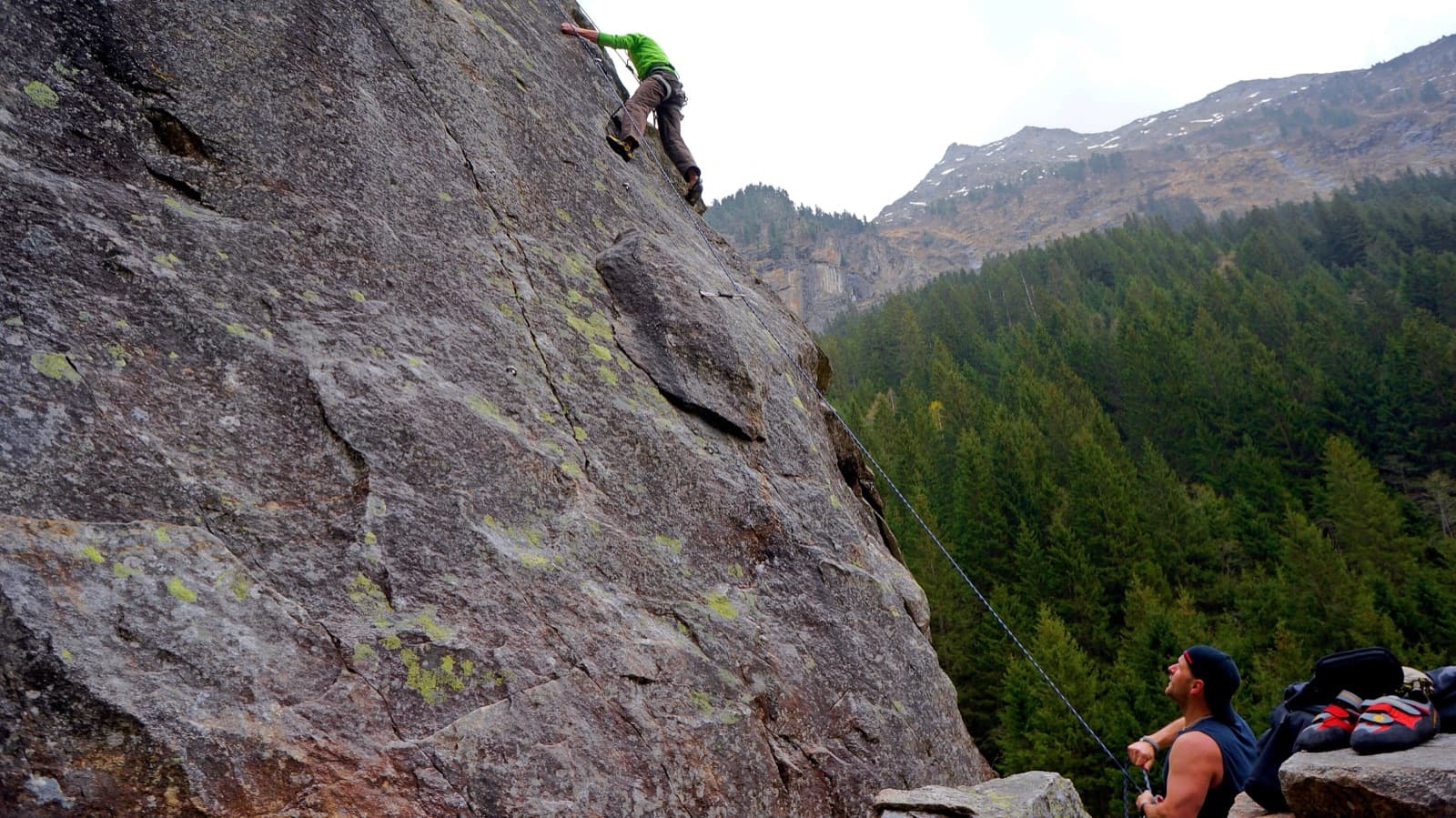
Eleven pitches that cover everything a granite climber needs, in a mild and well prepared form: slabs, steps, arêtes, corners (one of them awkward), small overhangs and a fist crack. Two pitches of 7-, much of the rest around 6 and 6+. Views of the glaciated 3000 m peaks.

Gasthaus Au in the Zillergrund, where the approach starts; granite walls rise directly above the innPhoto: Whgler · CC BY-SA 3.0

Photo

Gasthaus Au in the Zillergrund, where the approach starts; granite walls rise directly above the innPhoto: Whgler · CC BY-SA 3.0
Hardest pitch
6b
Pitches
11
Length
265 m
Approach
30 min
Aspect
S
South-facing
Rope
1×60 m
walk-off

The route

Overview

Supersommer climbs the south-facing wall of old crystalline rock above Gasthof in der Au in the Zillergrund, which you can see from the inn. Thomas Bauer, Bernhard Johannes, Hilde Thanbichler, Marion Wittmann and Fritz Amann bolted it in the summer of 2018. It is the longer moderate line of the right-hand sector: easier at the bottom, then often UIAA 6 and 6+ with two pitches of 7-. The climbing changes constantly between slabs, flakes, corners and cracks. The rock carries lichen, soil and moss in places, so it has to be completely dry.

The climbing

Pitch by pitch

Pitches of Supersommer
PitchGradeNotes
P1–Steep, with plenty of jugs.
P2–Straight up after the second bolt; a good pitch for getting used to standing on granite.
P3–A fine slab.
P4–Not described in open sources.
P5–Steep flakes straight above the belay.
P6–Relaxed climbing.
P7–A corner system.
P8–Includes a hard corner graded 6+.
P9–Steep and slabby.
P10–A strong fist crack.
P11–Wall climbing where you have to look carefully for the holds, to the route book at the end.

Getting there

Approach

To the parking

Leave the A12 at the Zillertal exit and follow the B169 towards Mayrhofen. Just before the town turn left towards Brandberg; after the tunnel turn left onto the toll road into the Zillergrund. By public transport take the train to Mayrhofen and the bus into the Zillergrund. Follow the toll road to Gasthof in der Au (1265 m), where there is a car park.

On foot · about 30 min

From Gasthof in der Au walk up the tarmac road to the second hairpin, about 10 minutes. There go up left of the concrete road wall along the edge of the meadow to the forest. Follow the small yellow dots on the rocks: faint paths lead straight to the starts of the left-hand sector. For the right-hand sector and this route traverse right about 200 m below the rocks; after a spring you reach the start, where the name is on a small plaque. Allow 30 minutes.

Map of the walk-in

  • Route base
  • Parking

Loading map

The point marks the base of the route.

Coordinates · route base

47.12393, 12.01542

Parking

47.12189, 12.01018

Car park at Gasthof in der Au, Zillergrund (toll road)

Point from bergsteigen.com map marker (route base)

For your phone or watch

Download GPX

Contains the route point and parking. Opens in most mapping apps and GPS watches.

Points are compiled from published sources, with the precision stated above. They were not surveyed on the ground: check them against a current topo.

Getting down

Descent

Go right on faint paths, following the yellow dots, through steep forest with one slight rise, to a hunters' path. Follow it down to a steep meadow. Descend about 70 m of height on the meadow or in the forest on its right to a raised hide on your right. About 10 m of height below it, at a salt lick, turn right into the forest and go to the rock wall, then follow its foot back to the start.

Retreat

Bailing off the route

Bail not documented

Retreat is not documented. The route is climbed on a single 60 m rope and left by a walk-off, and abseiling is not mentioned. The belays are bolted, but with one rope you can only abseil 30 m at a time.

Retreat from
Not known.
Point of no return
Not documented.
Carry
A second rope or a tag line if you want the option of abseiling, plus maillons and cord, since abseil hardware at the belays is not confirmed.
Basis
Inferred from the route factsbergsteigen.com gives only the single rope and the descent on foot.

Partly inferred from the route facts

Safety

Hazards

  • Damp rock is slippery here because of lichen and moss.
  • Bolts are occasionally further apart than on a pure plaisir route.
  • The descent crosses steep forest and a steep meadow; follow the yellow dots.

Sun and weather

Conditions

South and south-west facing, with the inn at 1265 m and 360 m of height to the top. Do not start when it is wet or damp: bergsteigen.com says the rock should ideally be bone dry because of lichen, soil and moss. No season is published; June to October is an estimate from the altitude and aspect.

Usual season · Jun to Oct

Sun on the wall · S-facing

Working out the sunlit hours for this month.

  • January: not yet worked out
  • February: not yet worked out
  • March: not yet worked out
  • April: not yet worked out
  • May: not yet worked out
  • June (usual season): not yet worked out
  • July (usual season): not yet worked out
  • August (usual season): not yet worked out
  • September (usual season): not yet worked out
  • October (usual season): not yet worked out
  • November: not yet worked out
  • December: not yet worked out

Sun on the wallDaylight, wall in shade● Usual season

Estimated from the wall's aspect only. Ignores surrounding terrain, gullies and the wall's exact shape. Clock times are local to the wall (Central European time), for the 15th of each month.

Monthly climate averages for Zillertal, 1991-2020
MeasureJanFebMarAprMayJun (usual season)Jul (usual season)Aug (usual season)Sep (usual season)Oct (usual season)NovDec
Mean daily high °C−11471217191915104−0
Mean daily low °C−9−8−5−2279951−4−8
Rain days 1 mm or more121215162021201814121313

● marks the usual climbing season. Averages for 1991-2020 at about 1432 m. Area climate from Open-Meteo reanalysis. Temperatures are adjusted to the height of the crag; rain comes from a grid cell of about 10 to 25 km, and summer highs on sea cliffs can read a few degrees low. The wall and valley can differ. Data: Open-Meteo, CC BY 4.0.

What to carry

Gear

A single 60 m rope, 10 quickdraws and a helmet. Nuts are not needed.

Checklist

Quickdraws
10
Rope
1×60 m (walk-off)
Helmet
One each
Maillons or spare karabiners
To leave behind if you retreat
Cord
Mentioned for retreat

Derived from the route data; check it against a current topo

From climbers

Reader reports

Reader reports are not being collected yet. Until they are, check a current topo and the local club or guidebook publisher for recent changes to Supersommer.

Worth knowing

Tips

  • The two 7- passages are a flake at the start of the first hard pitch and a small layback overhang.
  • Monsterbolts (7/7+, 370 m), Chickenheads-Plaisir and Bodybuilding und Ballett (both 7-, 150 m) are on the same wall.
  • bergsteigen.com allows 3 h 45 for the climb.

Open questions

Where sources disagree

  • Single source; no second site describing the route could be opened.
  • The pitch count of 11 is inferred from the bergsteigen.com photo captions, which number pitches 1 to 11 and end at the route book. The topo is behind a login, so per-pitch grades and lengths are not published openly; which pitches carry the two 7- passages is not stated.
  • Protection: 'very good' in the header against 'good to very good, with the odd wider gap' in the remark.
  • The mountain is given as the Rotkopf (2819 m), which is the summit far above; the route ends well below it.

Provenance

Sources

Same area

More in Zillertal

All routes in Zillertal
Slab climbing at the Ewige Jagdgründe crag near Ginzling in the Zillertal; the Wiegelwand is the wall above this sector and is not in the picture.

Austria · Zillertal

Schwarzer Teufel

A slab route on the left side of the Wiegelwand with steep passages on small edges; UIAA 7/7+ at the crux on pitch 3, 6 to 6+ obligatory. The easier pitches are a bit grassy. Often wet, so look from below first.

6b+5 pitches110 m
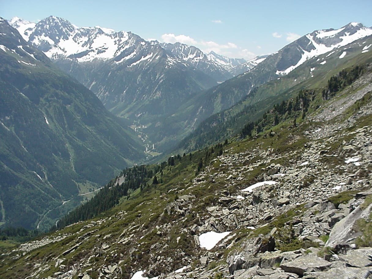
The upper Zemmtal with Gasthof Breitlahner on the valley floor, the starting point for the Karlkopf routes

Austria · Zillertal

Herzblut

bergsteigen.com counts it among the best easier multipitch routes in the Zillertal and one of the few true plaisir lines there. Six pitches of featured slabs, steep walls studded with quartz crystals and fine flakes, with very little smooth rock. Three pitches reach UIAA 6-.

5c6 pitches200 m

A view of the region, not this route's wall. Slab climbing at the Ewige Jagdgründe crag near Ginzling in the Zillertal; the Wiegelwand is the wall above this sector and is not in the picture.

Austria · Zillertal

Blutwurst

The second plaisir route on the Karlkopf, ending at the same point as Herzblut. It starts on grippy slabs, then follows a cleft in the mountain that closes into a chimney: you climb two short pitches inside the rock. One pitch of UIAA 6+ lower down is the crux.

6a+8 pitches205 m

A view of the region, not this route's wall. Slab climbing at the Ewige Jagdgründe crag near Ginzling in the Zillertal; the Wiegelwand is the wall above this sector and is not in the picture.

Austria · Zillertal

Jakobsweg

Twelve long pitches of slab climbing up an unremarkable-looking wall near the Klausenalm, getting harder towards the top. The length, the bolting and the short approach are rare in the Eastern Alps. The price is the descent: a steep, rough scramble and four abseils that the sources call delicate.

5c+12 pitches570 m

Read the cautions

Around 6b · about 11 pitches

Similar elsewhere

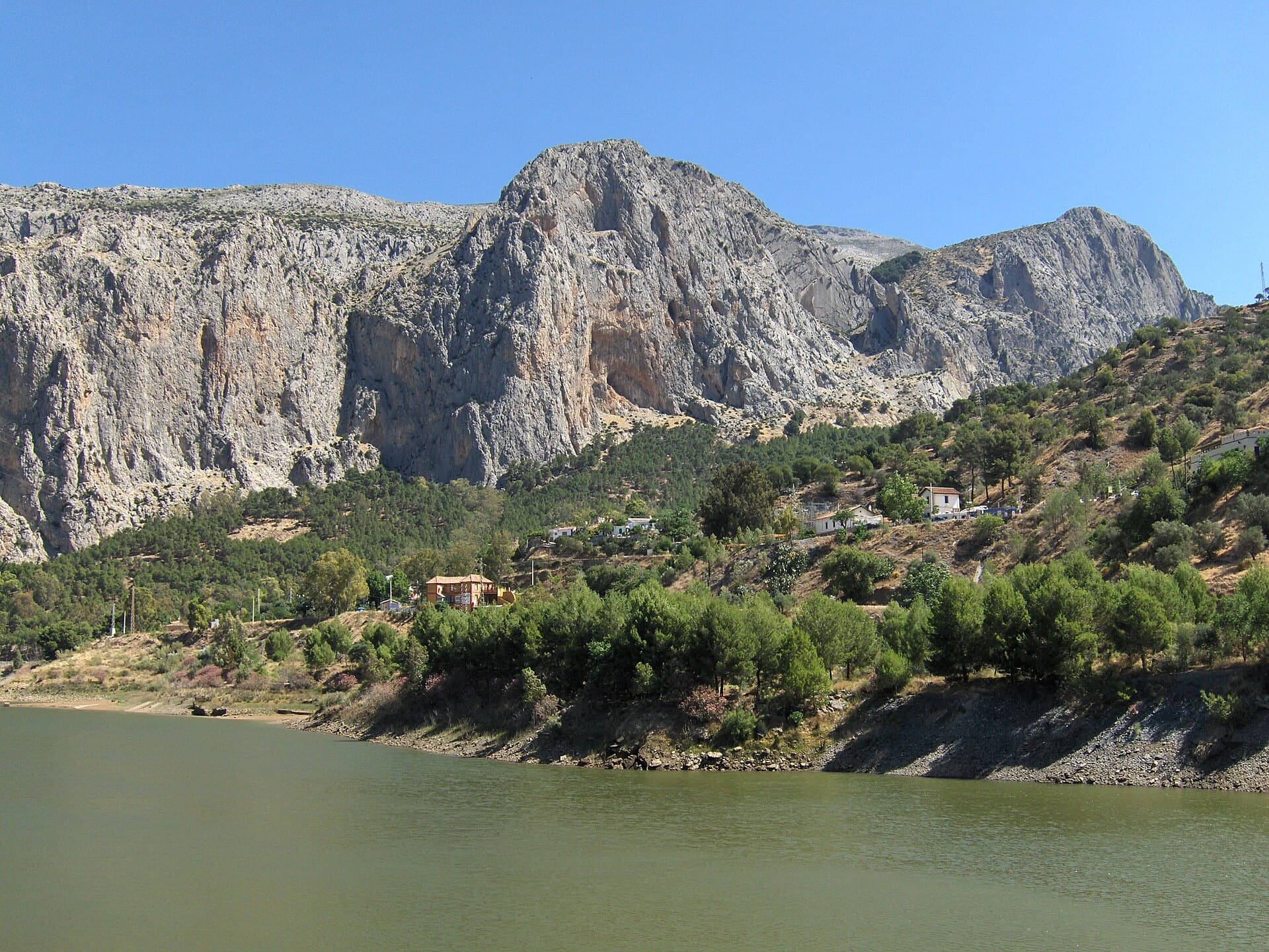
The Frontales cliffs above El Chorro seen across the Tajo de la Encantada reservoir, with the big Poema de Roca cave at the foot of the central dome. The Solarium sector is towards the right-hand end of the cliff; the line is not marked.

Spain · El Chorro

Estrella Polar

Ten varied pitches on good rock in a superb position: a roof, slabs, a tenuous traverse by a cave and a steep corner. Several pitches feel stiff for the grade, especially the P2 crux.

6b10 pitches279 m

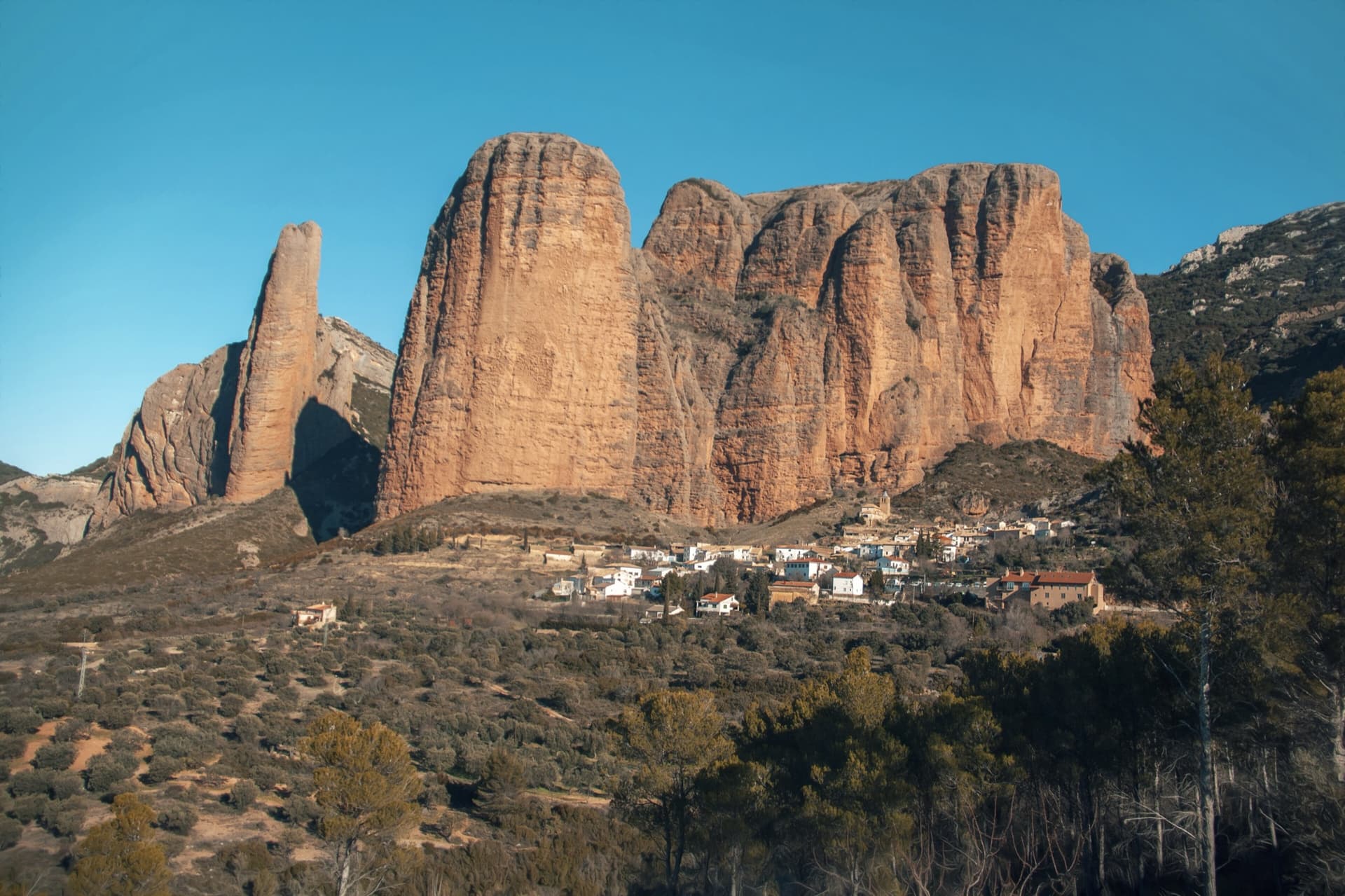
The classic view of Riglos from the south-west: the slender pinnacle of El Puro on the left, the great dome of Mallo Pisón beside it, and the main wall running right to La Visera above the village.

Spain · Riglos & Agüero (Mallos)

Normal al Puro

The way up the detached cigar that is the symbol of Riglos, first climbed in 1953. A polished corner, then the chimney between the Puro and the Pisón, then three short pitches on the outside of the needle to a tiny summit. Very polished in the chimney and on the boulder moves. In shade most of the day.

6b10 pitches180 m

Read the cautions

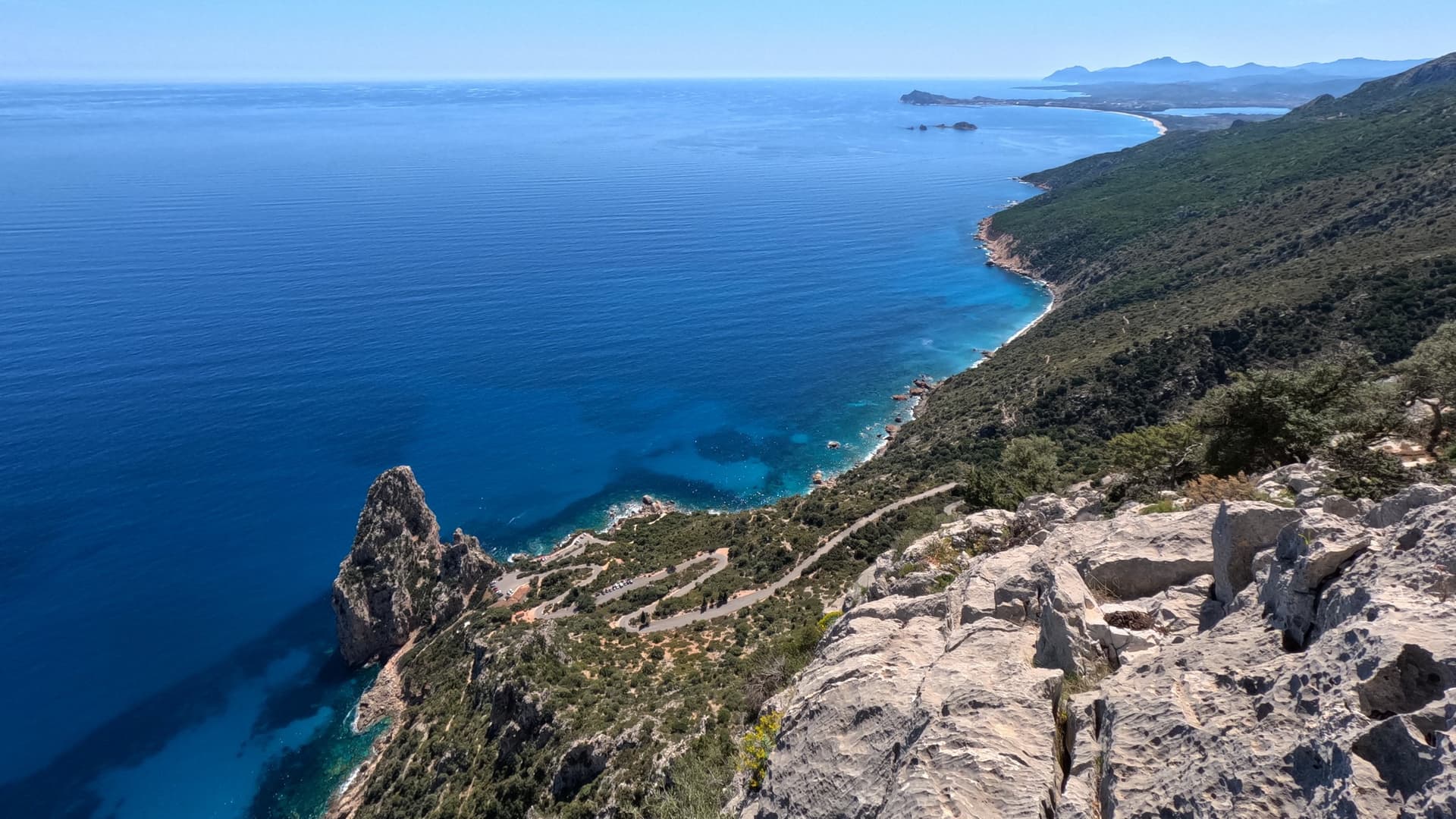
Looking down on the Pedra Longa stack and the coast from high on Atlantide

Italy · Sardinia

Atlantide

A 400 m plaisir route above Pedra Longa with the sea behind you all day. Eight easy, vegetated pitches lead to a steep finish: the last three or four pitches, up to 6b, are the real climbing. Closely bolted throughout; the long abseil descent through bushes needs care.

6b12 pitches400 m

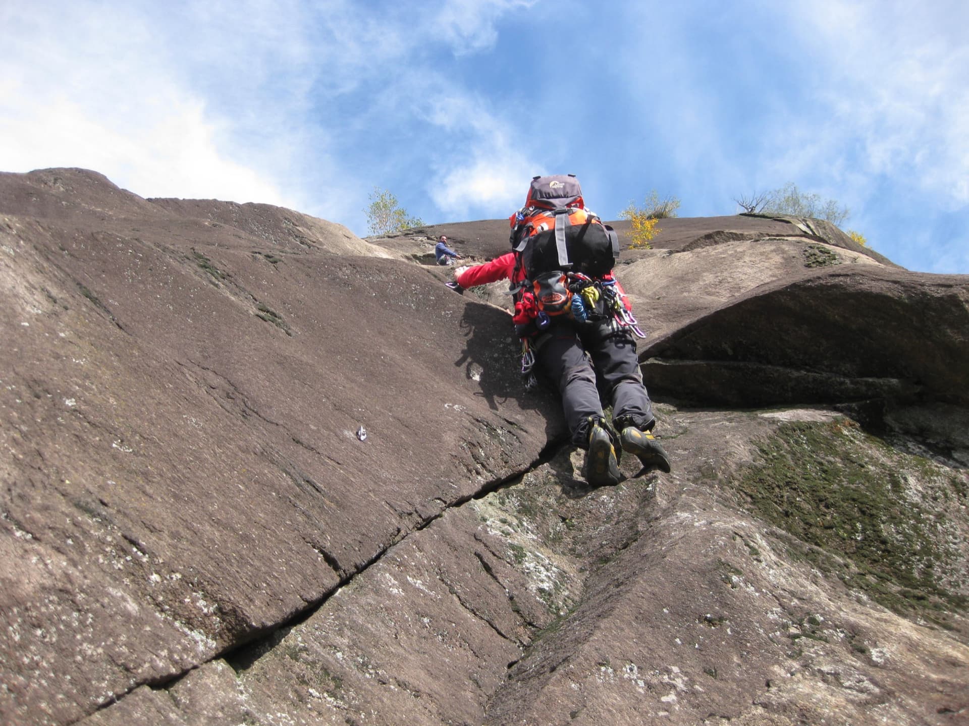
On the gneiss slabs of Bionde Trecce above Pontemaglio

Italy · Val d'Ossola

Bionde Trecce

Ten pitches of pure friction on a low-altitude gneiss pillar in the Valle Antigorio. Four easy slab pitches warm you up, then a delicate water-polished corner (6a), a balance move on quartz (6a) and a thin slab traverse (6b, partly aidable) provide the interest. A spring and autumn route.

6b10 pitches300 m

Compiled from published sources and last verified October 2026. Bolts, anchors and access change. Climbing is dangerous and you are responsible for your own decisions: check a current topo and read the disclaimer.